Kansas & Kentucky & More 01

1st map of the general Byng area, featuring both Kansas and Kentucky (flat platform area on ridge above Byng).

Byng Stream — starts high up on Wealthy Mtn. as a multitude of various forks which combine just before The Impasse (see below). Byng Stream basically runs through these areas:

– Upper Byng (forks just mentioned, in open, walkable woods);
– Impasse or The Impasse (rhododendron clogged region where forks unite as one stream — Byng — which then flows more rapidly as it forms several, long cascades;
– Kansas (general area between lower extent of Impasse and Lion’s Roar that has a navigable path running through it [in contrast to Impasse], forming more of a gorge-like region with steep sides);
– Lower Byng (from Lion’s Roar to mouth of creek at Flanigan’s Fork next to the nearest road — runs through a more open area here with, as in Upper Byng, many options for traversing)

Individual sites on Byng Stream:

Lion’s Roar — near lower end of Kansas that Byng flows all the way through; is a large, overhanging rock, the largest in the mapped area, it seems, and perhaps by a considerable margin. The overhang is extended enough so that I could stay here in the rain and be comfortable without getting wet, a notable plus in future considerations about developing this area. Lion’s Roar already shelters 50 objects (jars, pots, etc.) coming from the side of neighboring Yards Mtn., pieces of a future art happening in this area, no doubt.

Kansas Path — traceable path running all the way through the Kansas region of Byng, starting at the upper reach of Lower Byng and ending at the start of Impasse.

Periwinkle Falls — small cascades just upstream from Lion’s Roar. Split in paths just before, with left hand path (Kansas Path still) taking you upstream and right hand path forming basic beginning of Mystery Path connecting Kansas and Upper Byng in passing around the eastern side of Impasse.

Four Minutes — area recently cleared of dead rhododendron just above Periwinkle Falls. Represents possible future site of Temple of TIDE and more. Mystery Path runs through here; Kansas Path on other side of Byng from here. Named for a Roger Waters song.

Rock Island — small isle of rocks upstream from Four Minutes, near the center of Kansas. Debate in past whether this is part of Kansas or older defined yet vague regions of both Illinois and Iowa, perhaps stemming from the existence of a city called Rock Island (named for an island located between these 2 states) in the “real world”.

http://en.wikipedia.org/wiki/Rock_Island,_Illinois

This also seems to imply an assoc. between Byng Creek and the Mighty Mississippi River. Iowa and Illinois, seen as one, are also 2 states bridging Kansas to the west (bordering Iowa) with Kentucky to the east (bordering Illinois). Some say our Rock Island floated downstream from somewhere within The Impasse, losing its Illinois/Iowa ties in the process (deeply debatable).

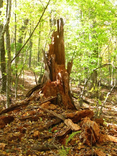
6 Mile Hill — as yet undeveloped region surrounding a large, dead tree (Rot Tree) in upper Kansas. Could be a center of that already mentioned future art happening. Perhaps. The name 6 Mile Hill relates to 4 Minutes also found in Kansas, and also a 6 Minute Hill on the Jeogeot continent of Second Life located in a sim of the same name. Shrine of Second Life here, then? (Jeogeot?)

Impasse Trees/”SF”/Mine — composing a single area in extreme upper Kansas, on the edge of Impasse and where you can’t keep making your way upstream on Byng directly because of clogging rhododendron, falling trees, briars, and more. The Mine in question is rumoured to be owned by Lisa the Vegetarian, and thus is perhaps an old quartz mine. “SF” just below it (“Suspiciously Flat”) may also be a hopeful reference to gold town San Francisco. Kansas Path end can connect to Mystery Path here, but the way up the embankment is quite steep, with falls and possible loss of limbs forewarned.

Kansas & Kentucky & More 02

3 Comments

Filed under Byng, Herman Park, Wealthy Mountain

Kentucky

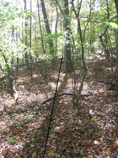
Revisited Kentucky yesterday and produced the following pictures. First up is of a string I set up running all along the Bee Line of Kentucky, which I was surprised to find out runs about 60-70 yards across the ridge. Amazingly long, straight line, then, and I’m starting to strongly suspect a direct affinity with DSotR2, another amazing alignment of considerable length. If these two line-ups are essentially one underneath it all, or directly related to each other, then this casts the Tin S. Man/Wallace3 relationship in nearby Green Oz Valley in a new light, perhaps one of renewed cooperation.

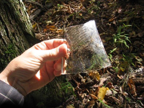
First up in our stringed line pictures comes the glass shard left in the ground just up from what I consider now the two central maple trees of our Kentucky story — more on those trees just below. As you can see, the string representing the Bee Line almost directly crosses over this buried segment of glass.

Bee Line running past the tree with the hole at the bottom pictured in this earlier post, and also Split Log just behind it, mentioned in the same post.

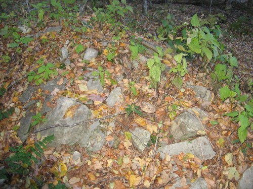
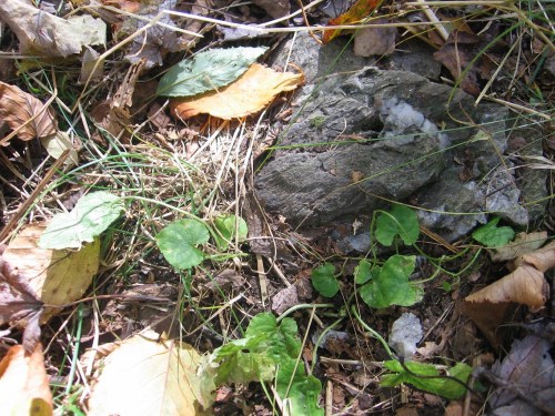
I’m calling these 3 rocks projecting from the leaf covered ground here Tie Rocks, not because they wear ties, har, but because these are what I tied the upper end of my string to, and so also marking this as the probable, upper reach of Bee Line itself. Might also be called “End Rocks”, then.

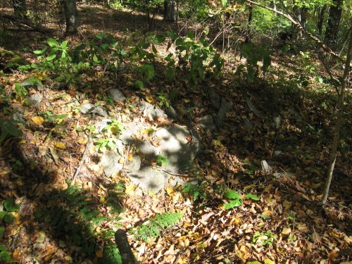
Another picture of that mysterious, rock covered mound just on the opposite side of Bee Line from these rocks.

So back to the 2 maple trees where the glass shards came from, here we have pictured the considerably smaller of the two, called Tiny Tree for now. Contrast this to the description of Poe’s skull bedecked, very tall tulip tree in “The Gold Bug”, already discussed in this earlier post. Since writing that text, I’ve also noticed that the Bee Line runs right through the two maple trees in question, basically bisecting an imaginary line running between them. I believe Tiny Tree relates directly to Poe’s aforementioned, huge tulip tree, then (inversion or reversal), and is doubled by the larger maple right on the opposite side of Bee Line.

Another very interesting thing to mention is that Tiny Tree’s bark has been worn off toward its base, as seen below. Have deer been rubbing against it? Or is this possibly additional handiwork by humans from previous times? It seems like more the actions of a knife did this. Could be wrong, but that makes for a lot of rubbing if not.

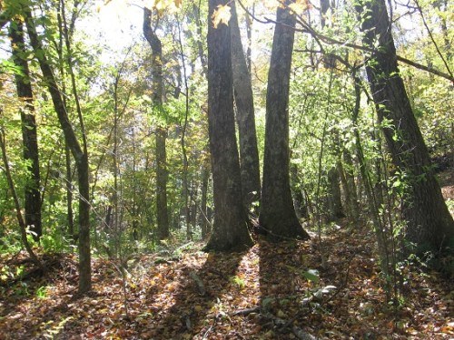
2 tall beech trees, which bend toward each other at their tops to intertwine in the leafy parts, seem to dramatically mark the lower end of Bee Line, which might start in the gap between them or in the immediate vicinity. The higher merger of the trees way up in the air here seems to mirror the unifying energy of the Bee Line between them on the ground. Yes, seems significant.

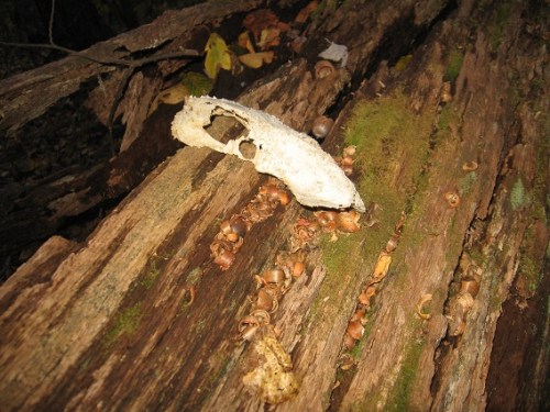
Lastly and probably not leastly we have the presence of an actual skull in Kentucky, of unknown animal origin. This comes from the southeast corner of the platform region. Is it a fox, perhaps? Doesn’t look like a calf’s but could be wrong, once more. Also significant is that only one of the two eyes sockets remain on the skull (the right one), and Poe’s “Gold Bug” story prominently features eyes of a skull. Specifically, Legrand’s servant Jupiter had to drop the gold bug and attached line through the *left* eye of the skull, and not the right eye. Only the left eye drop of the bug determines the correct position of the treasure subsequently uncovered, although the right eye was mistakenly tried first because of Jupiter’s inability to tell his left from his right.

Maybe the skull is that of a domestic dog instead?? (at least it’s not human!)


fox skull

1 Comment

Filed under Byng, Herman Park, Wealthy Mountain

“Must…

… admit I miss Byng, Hucka D.”

Hucka D.:

Go back tomorrow. Measure the Bee Line. You have time.

bb:

‘Bout 2 weeks until daylight savings time ends. Gonna be sad, then. Winter for sure. Weekends are tied up for the next several. Great expansion, however, of Frank/Herman Park mythologies. Much more to be thought about.

Hucka D.:

You have time. Take string. Get the pieces of the bottle and bring them home. Bring the rr home. Or set it up — whatever. Tue Wed Thu and maybe Fri. Sun. morning. You’re not finished with Byng yet.

Leave a comment

Filed under **VIRTUAL SL

Hiking Day 5

Not as big a hiking day as some of the others in this vacation period, but returned to Byng as usual. Some renames first (prelim): the stretch from Lion’s Roar to 6 Mile Hill or Impasse Tree along Byng Creek (or just Byng) is now called Kansas. The nearby flat platform on the ridge that holds the secrets of the broken bottle is named Kentucky for now. This partially comes from Hucka D. saying he wanted to fly away to Kentucky and visit his dad (when, earlier, we were talking about the problems assoc. with Tinsity at that time), where he was happy. A “bee’s line” is also found on this ridge directly connected with the broken bottle. In the post just below, I attempt to parallel the process and events surrounding this bee’s line with E.A. Poe’s famous story “The Gold Bug”, perhaps the one he made the most money off of in his lifetime. I attempted to take some string and trace the whole of this line, but I didn’t have nearly enough to complete the task as it turned out — must return very soon and unroll a new, longer line, then. Also retrieve the pieces of the bottle itself, perhaps.

Hucka D.:

The bottle contained a message, which you didn’t find. Cryptogram, just like in Poe’s story. The flat platform you mention is indeed my Kentucky with its bee’s line. This is what I wanted you to find. Return. There’s more to it.

bb:

Hucka D., the events or processes involved in finding this line on Kentucky seem to reverse, in part, those of Poe’s story.

Hucka D. (repeating):

The message was in the bottle, which had to be broken in order to retrieve. Who retrieved?

bb:

Obviously not me. What was on the message?

Hucka D.:

The location of a treasure, just like in Poe’s story.

bb:

Is it connected to the hole being dug by Tin S. Man in Tinsity, now part of the 3333 protectorate according to you?

Hucka D.:

Yes. The process was split in two along those lines. The birth of Cpt. James T. Kirk. In Tinsity. 2233. You.

bb:

So… let’s see… the revelation of the Gold Bug parallels in Kentucky caused my rebirth in Tinsity as Kirk?

Hucka D.:

Yes. You are an infant, just as the Gold Bug-Kentucky parallels are just beginning. It’s a party.

bb:

But obviously this is not a physical treasure. A psychological treasure, then. Like alchemy.

Hucka D.:

You have more.

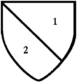
http://www.winslowtree.com/heraldry/heraldry-blazon.htm

Leave a comment

Filed under **VIRTUAL SL

Gold Bug

Comparisons between the discovery of the Bee’s Line of the Kentucky Flat (another type of “natural platform”, as mentioned in Poe’s excerpt here) with primary events in Poe’s “Gold Bug” short story.

The natural platform to which we had clambered was thickly overgrown with brambles, through which we soon discovered that it would have been impossible to force our way but for the scythe; and Jupiter, by direction of his master, proceeded to clear for us a path to the foot of an enormously tall tulip-tree, which stood, with some eight or ten oaks, upon the level, and far surpassed them all, and all other trees which I had then ever seen, in the beauty of its foliage and form, in the wide spread of its branches, and in the general majesty of its appearance. When we reached this tree, Legrand turned to Jupiter, and asked him if he thought he could climb it.

There are no tulip trees in my Kentucky, but instead beech and maple trees, it appears. There is a central tree of maple variety, however, probably as tall as any on this flat or platform, and it is in front this tree I found my own version of a gold bug, about 2 feet from the circumference of the trunk.

During this colloquy no portion of Jupiter’s person could be seen; but the beetle, which he had suffered to descend, was now visible at the end of the string, and glistened, like a globe of burnished gold, in the last rays of the setting sun, some of which still faintly illumined the eminence upon which we stood. The scarabaeus hung quite clear of any branches, and, if allowed to fall, would have fallen at our feet. Legrand immediately took the scythe, and cleared with it a circular space, three or four yards in diameter, just beneath the insect, and, having accomplished this, ordered Jupiter to let go the string and come down from the tree.

I cleared a space of about 3 or 4 yards in front of aforementioned maple tree, to find the bits and pieces of an old, shattered bottle. In the clearing process I stumbled upon the gold bug. Legrand in Poe’s story clears the ground *for* the dropping gold bug, which landed in its approx. center.

Driving a peg, with great nicety, into the ground, at the precise spot where the beetle fell, my friend now produced from his pocket a tape-measure. Fastening one end of this at that point of the trunk of the tree which was nearest the peg, he unrolled it till it reached the peg, and thence farther unrolled it, in the direction already established by the two points of the tree and the peg, for the distance of fifty feet –Jupiter clearing away the brambles with the scythe. At the spot thus attained a second peg was driven, and about this, as a centre, a rude circle, about four feet in diameter, described. Taking now a spade himself, and giving one to Jupiter and one to me, Legrand begged us to set about one to digging as quickly as possible.

For me, the Bee’s Line, straight as if laid out with a tape measure, extended from the center of this cleared space about 30 yards up to the crest of the hill separating Kentucky from the rest of Herman Park. The line in my case was found first, then the space cleared when I followed the line to the maple tree to reveal the broken pieces of the bottle, then the gold bug uncovered. It was basically backwards from Legrand’s process…
We now worked in earnest, and never did I pass ten minutes of more intense excitement. During this interval we had fairly unearthed an oblong chest of wood, which, from its perfect preservation, and wonderful hardness, had plainly been subjected to some mineralizing process –perhaps that of the Bi-chloride of Mercury. This box was three feet and a half long, three feet broad, and two and a half feet deep. It was firmly secured by bands of wrought iron, riveted, and forming a kind of trellis-work over the whole. On each side of the chest, near the top, were three rings of iron –six in all –by means of which a firm hold could be obtained by six persons. Our utmost united endeavors served only to disturb the coffer very slightly in its bed. We at once saw the impossibility of removing so great a weight. Luckily, the sole fastenings of the lid consisted of two sliding bolts. These we drew back –trembling and panting with anxiety. In an instant, a treasure of incalculable value lay gleaming before us. As the rays of the lanterns fell within the pit, there flashed upwards, from a confused heap of gold and of jewels, a glow and a glare that absolutely dazzled our eyes.

… except I didn’t discover any skeletons or treasure at the crest of the hill to start the whole thing. There *was* a rock pile that seemed artifical. Should I dig there? (probably not).

There appears to be no parallel to Legrand’s cryptic parchment either, created by Cpt. Kidd. NOTE: Perhaps the *bottle* itself is the parchement in this case, and not the treasure itself? Pieced back together, does it create some type of similar message? What of the bottom piece of the bottle, found away from the rest and acting like a miniature terranium now? NOTE: Connected to the expression “message in a bottle”, like in The Police song of the same title? One might also have to break such a bottle to retrieve the message. So the message could be the equivalent to Poe’s cryptic parchment here, except there’s no parchment of course. Is there?

NOTE: I skipped the part in Poe’s story about missing the treasure on an original dig by Legrand and co. because the golden bug was dropped from the wrong eye by the dyslexic Jupiter.

NOTE: There is a slight possibility that the crest of the hill with the rock piling can act as a sighting spot, much in the manner of the Devil’s Seat in Poe’s story.

1 Comment

Filed under Byng, Herman Park, Wealthy Mountain

Hiking Day 4 Pics 03

Close up of the split log discussed in the last blog entry, with Kentucky’s Bee Line passing almost directly through this separation.

3 grouped trees (species?) near the uphill end of the Bee Line. The mysterious rock piling is to their left, just on the other side of the line running next to them.

The rock piling itself. Difficult to take a great picture of, but I’ll try again soon. It looks like it could be the dirt covered roots of an overturned tree, but although there’s an old tree trunk nearby and pointed in the right direction, there’s still a separation between it and this mound. Plus we have all those rocks on top of the dirt mound, if that’s what it is. Could it be rock all the way through instead? It still could be that a dig is in order here. Am I scared? Certainly!

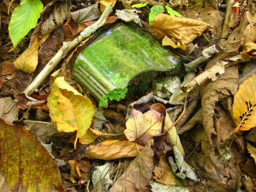
What appears to be the base to the bottle that was shattered at an unknown date in Kentucky. It has turned into quite the miniature terrarium in the meantime, and I hated to move it because of this and disturb the still quite green and alive moss and plants growing within. Its position is a couple of yards off and perhaps also below the Bee Line a bit, behind the gap between two trees that may mark its true beginning.

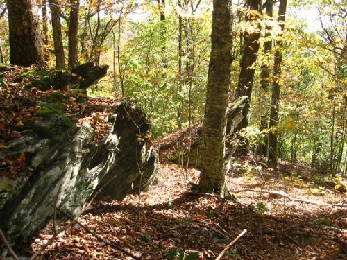
Moving away from Kentucky, then, I continued to hike clockwise around the west side of Wealthy Mtn., soon coming across this rock outcropping with its own small cave or enclosure…

… but *nothing* like what was only about 20 to 30 yards beyond this: one of the very few, legitimate caves I’ve found in the Blue Mountain area on my many, many hikes. The sucker is about 20 feet deep, and prism shaped — that is, its front entrance and back wall both make pretty even and symmetrical triangles, with straight side walls and a level floor connecting them. The cave is also fairly wet inside, and I didn’t feel comfortable entering even on a bright, sunny day like this. Perhaps it was the foreboding poison ivy growing all around the top and sides of the enclosing rocks that put me off, when no other examples of that species were found anywhere in the immediate area that I saw. Upon returning home, I was also *quite shocked* to also find an “orb” in one of my two pictures of the cave itself, and shaped, for all the world, like a *coin*, similar in dimensions to a Roosevelt dime but whose “face” appears more like Eisenhower on his commemorate 70s dollar piece. Hucka D. and I talk about these and other possible significances of the “Prism Cave” or “Coin Cave” in a post just below.

A picture of the blowing poison ivy adorning the top of the cave. Quite dense and a seeming warning of danger.

Keeping on in a clockwise direction around Wealthy Mtn., a distance of several football fields brings us to another ridge of rocks, which appears to be just above the upper end of Green Oz Creek and on the edge of a long and basically impenetrable rhododendron bramble separating me from it.

Sadly having exhausted my days off this particular week, I left Sue in charge of all the loot at Lion’s Roar, and promised to return and reunite him with exploring companions Stan, Spit, and Sid. I dare not back out on this vow for fear of consequences.

Leave a comment

Filed under Byng, Herman Park, Toy Avatars, Wealthy Mountain

Hiking Day 4 Pics 02

More Kentucky pics, and now we are at the heart of the matter: the finding of a *”bee line”* running all the way across this ridge totaling a distance of about 35 yards or so. Below is a log split almost on this bee line, which gave me one of the first, large clues that the obviously mystical and occult line was present in the first place.

This photo represents a basically failed attempt to show this Bee Line running through the woods up to the ridge marking a western limit of Kentucky. So in a doctored up version beside it I highlight where the line is.

Just after discovering the line, I started to find bits and pieces of a broken bottle right in the path of it, and beside a prominent maple tree of the ridge. I cleared out an area of several yards around in the process…

… finding, for example, a small glass bit underneath a rock…

… and then this *gold bug* clinging to the side of another rock in sweeping away more leaves, which I instantly knew to be important. I think I had already made the link with Edgar Allen Poe’s famous detective short story “The Gold Bug” when taking this picture, since I vaguely remembered some kind of “bee’s line ” or plumb line also being mentioned in that tale.

The gold bug turned over to show off more of its defining color.

The bits of found glass shards kept piling up at the base of the maple tree as I continued to uncover them in the immediate area.

Another shot of the smaller tree in the middle of the grass clumps, the same as pictured at the beginning of this particular blog post. The shards were mainly found between it and the maple tree, which would be behind me-the-shooter here.

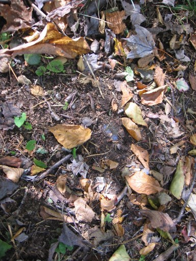
Yet another piece of glass uncovered, right on the Bee Line. I decided not to remove this particular shard. Despite the volume of glass found, I still think it all came from a single shattered bottle.

Another section of the Bee Line. Does that tree to the left form some kind of avatar home, complete with a front door? The thought had to cross my mind. Similar “doors in trees” exist in the immediate area as well, and perhaps one or two more quite close to the Bee Line, even. Hafta check that upon a return here.

2 Comments

Filed under Byng, Herman Park, Wealthy Mountain

Hiking Day 4 Pics 01

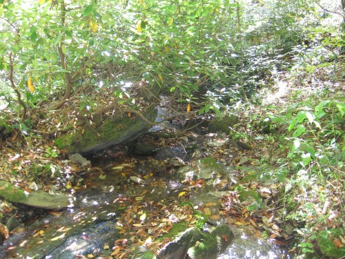
Photo of Byng (Creek) as it passes the flat, cleared area now known as Four Minutes (just left, offshot). The large rock in the center of the photo, as yet unnamed, lies between the creek and this flat spot. Four Minutes is now also the place where, technically, the Mystery Path connecting Kansas/lower Byng and upper Byng starts. More elements of fate, then, that the space was cleared by me of dead rhododendron plants several days ago, as it allows one to move freely up the embankment now where this path then leads.

Further upstream, we have an interesting isle of rocks, also unnamed. Is this another site for a potential temple of some kind, perhaps of a rock variety itself?

Upper extreme of Kansas, where it almost looks like someone has dug into a bank behind an uprooted tree. At least Sue thinks so; more on Sue soon.

A section of the Mystery Path, depicting one of many small white rocks seeming to mark the trail along the way. I cannot doubt that these are signature stones of Lisa the Vegetarian, who appears to now communicate to me (and potentially others) through *quartz*.

We then move to Kentucky, a larger flat spot on the ridge just west of Byng. Below is pictured a small yet central tree found in the middle of an area with several patches of grass. Kentucky has become very important to a correct, synchronistic interpretation of Byng and also Wealthy Mtn. as a whole, it seems. Obviously we have more workings of Lisa V. to take into account here.

Two Kentucky trees that seem to have a path running between them.

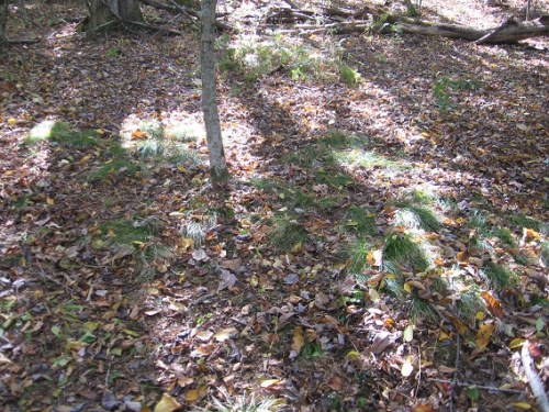
More isolated clump of grass on this ridge quite near the above trees.

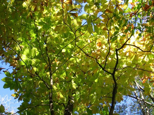
Looking up into a buckeye tree, I believe. The leaves are peaking now around this elevation.

Rotting log creating a colorful Kentucky landmark via its intense redness.

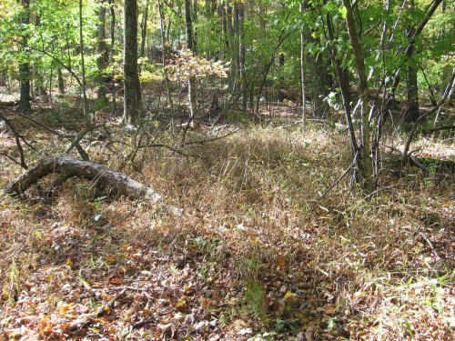
More grass, but of a different, taller species that the types pictured above.

Leave a comment

Filed under Byng, Herman Park, Wealthy Mountain

“Just a moment, Hucka D.”

“Just a moment, Hucka D.”

Hucka D.:

Prism Cave refracted Herman Park back into Frank Park. And visa versa. It is True Man, a combination of Franklin Delano Roosevelt’s dime and Eisenhower’s dollar. It is also 10 as 1, then. But Truman is between the two. That’s the meaning — it’s a portal. Marked with poison ivy, true, but not necessarily an evil or bad place. Just a loss of identity if you’re identified with either park, as some are. Herman is Herman and True Man is beyond. It’s Frank but more. It’s “outside”. It’s another Trek.

bb:

Thanks for that. Cpt. James T. Kirk was born 2233, which means he was born in Tinsity. Resolution.

Hucka D.:

Lion. Lion’s Roar.

bb:

There are 2 “3rd lion roars” in Messiaen Trek, Hucka D. A 3rd cue is Spock creating his own lion roar apart from Kirk, which leads to almost unrepairable disaster as he mind melds with V-jer. Afterwards he learns friendship trumps search or quest for knowledge. A hard lesson.

Hucka D.:

The bigger the harder, etc.

bb:

That it?

Hucka D.:

Go back to Prism Cave but not soon. Go back to Bee’s Line Ridge soon. Tomorrow. Take measurements. Read “Gold Bug”. Thank you.

Leave a comment

Filed under **VIRTUAL SL

Hiking Day 4

Another fantastic day of hiking, with almost perfect weather. Only complaint was that it was just a touch cold when I became more stationary.

Went back to Lion’s Roar and (lower) Byng to begin, took the Mystery Path to upper Byng, trying to think like a person who lived in the woods would — what would I be doing later on when I retired and might have a chance to camp here, for example. Well, I think I’d be gathering stuff in the woods to study back at Lion’s Roar, that’s what I think. Like rocks, obviously. In this way I am thinking like Michael Too, who actually “lived” on this mountain, on the other side — at the Michael Too compound recently revisited. Michael Too similarly collected rocks from the neighborhood and brought them back to his compound. And Lion’s Roar is turning into a kind of compound in and of itself, what with the import of 50 outside “objects” recently (all relocated from another part of Herman Park, however: SEE Rules of Billfork).

The Mystery Path most directly connects upper and lower Byng, allowing me to rather easily bypass the Impasse on this creek (rhododendron clogged stretch above Impasse Tree). The upper part of Byng, where it separates into several source streams, has no such problems — it is basically open woods. Once I get pass the Impasse then I don’t have much problem with rhododendron and similar exploring obstacles after that in continuing to head up and also around the mountain. The rhododendron stays closer to Flannigan’s Fork, and the downhill parts of the 4 Valley region explored the day before.

I also believe the Mystery Path had to be created by Lisa the Vegetarian, supposed — no *real* owner of Wealthy Mountain and whose signature can be found in quartz rocks; white quartz rocks. A good number of such rocks are found up and down Mystery Path, so that’s why I believe she created it, in some form or fashion. Michael Too also probably “knew” Lisa V., and perhaps strengthened her presence on the mountain. Michael Too may have even known of Byng, although it’s a pretty hidden stream as opposed to, say, Green Oz Creek. Not that easy to reach. So my guess is that Byng remained relatively free of Michael’s influence (although I could be wrong).

Several other places need to be named now, including a flatter part of a ridge just south of Byng. I think I’ll call it Bottle for now, or *The* Bottle. A number of mystery things about The Bottle: there appears to be a Bee Line of a path that extends diagonally all the way across this ridge, a distance of perhaps 30 yards or so (guesstimation). It runs through a perceived center there (Bottle Center), where an actual, broken bottle was found, but only after the Bee Line had been uncovered. The bottle merely heightened or accented the already discovered line, that is. I’ll show pictures of this bottle from Bottle in the next pictorial post here, hopefully. I also found a golden bug, which may also factor into the new weirdness since Poe’s “Gold Bug” story describes such a bug and also has an attached bee’s line or plumb line itself. I’m currently re-reading this famous short story, set in the Charleston SC area (also brought up today as a beach destination for my visiting niece and nephew from Colorado!).

Legend might have it that The Bottle was destroyed in 1933, and Franklin Delano Roosevelt and perhaps Dwight D. Eisenhower visited. Or perhaps DELANOR Roosevelt, half man president half woman 1st lady. Or perhaps they stayed the f— away from this haunted site(!) Near the upper end of the Bee Line is a rock pile that may be a grave of some sort (?) Whose grave, then? Or is it just another pile of rocks in the woods as often found in these parks. Whatever, obviously Man has visited this lonely ridge in the past. I’ll have more to say about the bottle in question soon, as stated.

Next up is The Cave, which also needs a name. It lies a bit around the mountain from The Bottle even, heading clockwise from Byng. It’s certainly another mystery, and I’ll get to a photo taken there soon that seems to show a “spirit”, who chooses to take the form of what looks like a coin, perhaps a dime or commemorative dollar…*

I think I’ll call this cave, then, *Coin* Cave — that’s my coined name for the place, hehe. Poison Ivy grows on its upper side and top, which appears rare in the immediate area. Bad sign? Probably. The cave itself is quite big for a local one, and one of only 2 or 3 that I can think of I’d call a sort of cave proper and not just a rock overhang. The cave is triangular shaped front to back, like a kind of prism. Prism Cave might become an alternate name, then.

It’s probably about 20 feet deep, and wet inside. I didn’t go in — scared (and probably for good reason). Coin Cave or Prism Cave might lie directly uphill from the other, smaller cave I found in the 4 Valley region pictured in this earlier F&HE post. I might now call this Other Cave, then, since it is the smaller of the two and not really inclosed.

—–

* or this commemorative Eisenhower dollar shrunk down to the size of a dime.

1 Comment

Filed under **VIRTUAL SL