
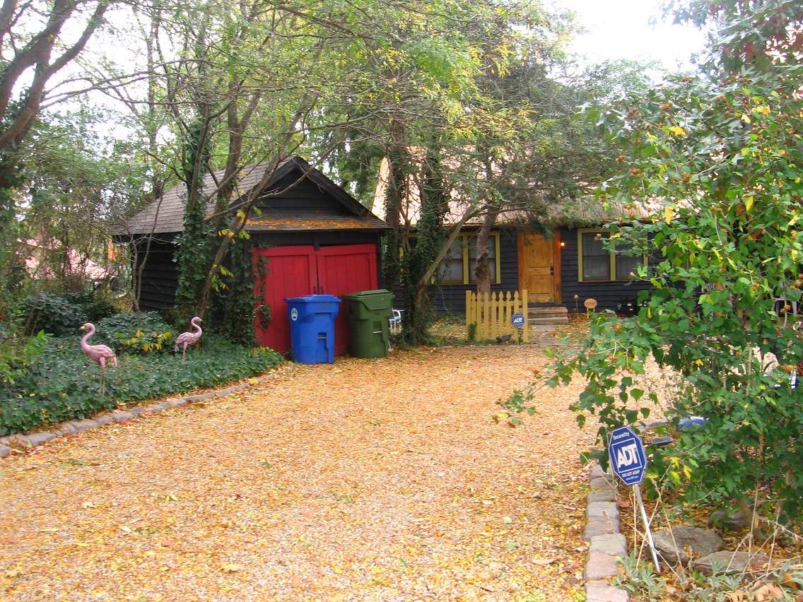
TEXT SOON.


We now come to what appears to be a fall hiking focus: Sharieland, an area of Herman Park tagged with that label mid-May of this year. Basically speaking, this area consists of the immediate environs of Herman’s Mansion and then the whole valley extending below it to the southwest all the way to Head Lake, a distance of a bit less than 1 mile as the fly crows. All the peaks and ridges immediately rising up from this valley on its sides are also considered part of Sharieland. An initial map of the area where each part is identified with a particular planet, per a palmistry association implied by its central Heart Line or Heart Path, is found at the end of this follow-up May post. This map will most likely be updated and re-created in considerably more detail before October is over.
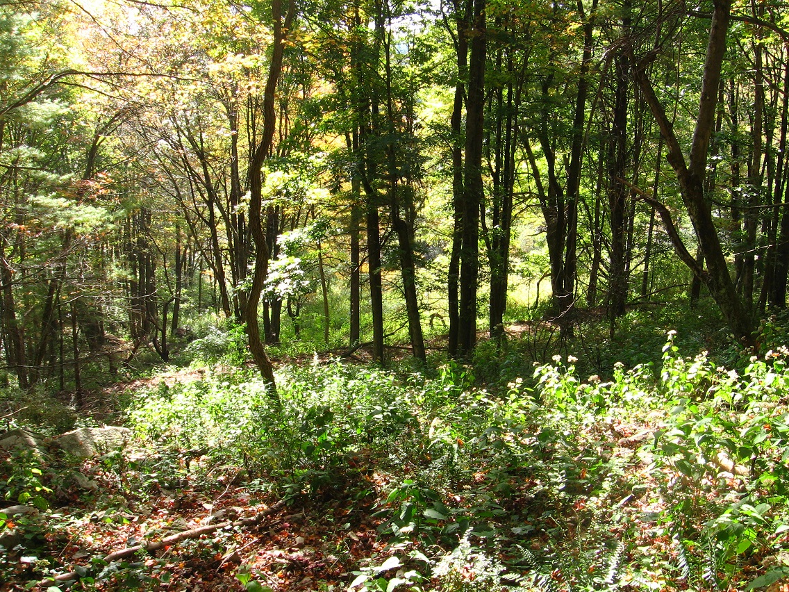
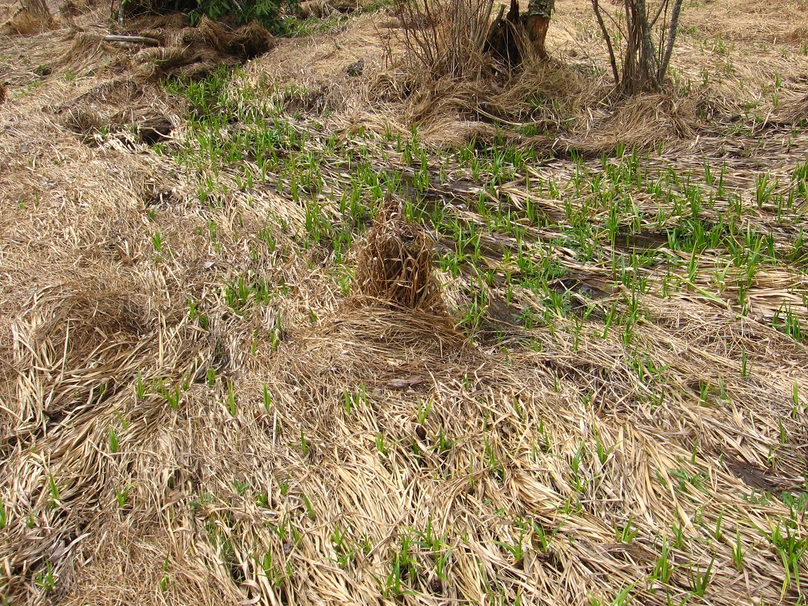
The meadow pictured below is the site of a newly discovered and very important path, which, after studying palmistry related images online, I’ve decided to call the *true* Heart Line, at the same time transforming the old Heart Line into Head Line. I think.
—–
There’s no doubt in my mind that Sharieland is directly connected to palmistry and its various lines and mounds, but I think the association can be flexed to make, for example, different lines attach to different Herman Park paths. After studying the matter for about 1/2 an hour presently, I’m going to call the new path the *Head* Path and keep the Heart Path as is (as I designated it this past May). The actual *shape* and *relationship* between Head Path and Heart Path more resembles that between *Heart* and *Life* lines of palmistry, as I’m examining the various pictures of hands and lines found in a Google image search on the subject. But keep in mind… well, let’s just leave it at that for now to continue moving the text forward. I’ll have more to say about all that soon enough in future posts here. NOTE: Head, Heart and Life are generally regarded as the 3 major hand lines of palmistry.
So the eastern edge of the meadow below represents the beginning of *Head* Path, which extends itself about a third to a fourth of a mile directly downhill from Herman’s Mansion, and runs in a general northeast direction from this meadow. Despite being situated on a steep slope, the path itself is basically level throughout its course, apparently following the line of an old road. The mansion would lie directly uphill from about its center.

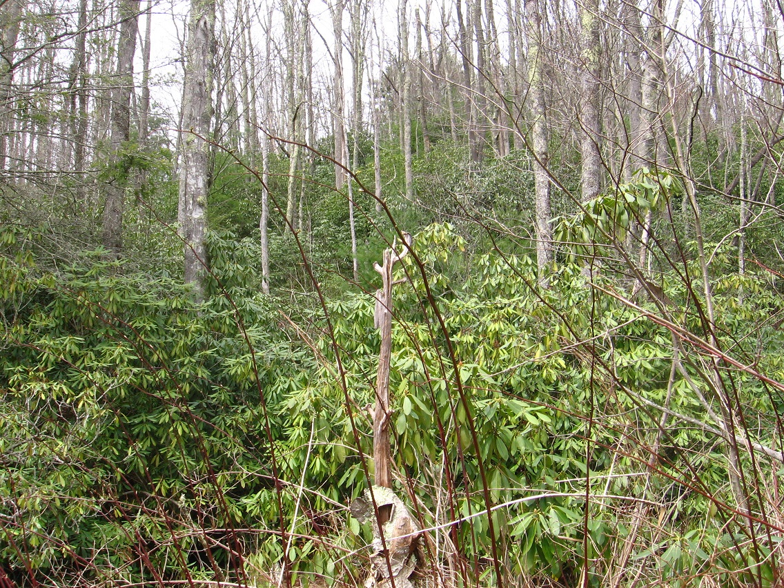
This is a view down from a point on Head Path to Heart Path below, at about this central point of the former. In the middle of the picture one can make out the very interesting arching branch that seems to act as a gateway to the meadow beyond. I believe this particular effect to be fairy induced.
Clash of red berry spotted bramble bush and fern. I think this particular thorn is a barberry variety, perhaps Japanese Barberry. If so, it seems to also be considered an invasive plant, avoided by deer and prone to ticks. Pretty, though. There are a considerable number of these bushes around Head Path, but not so much as to impede progress along it in any way.

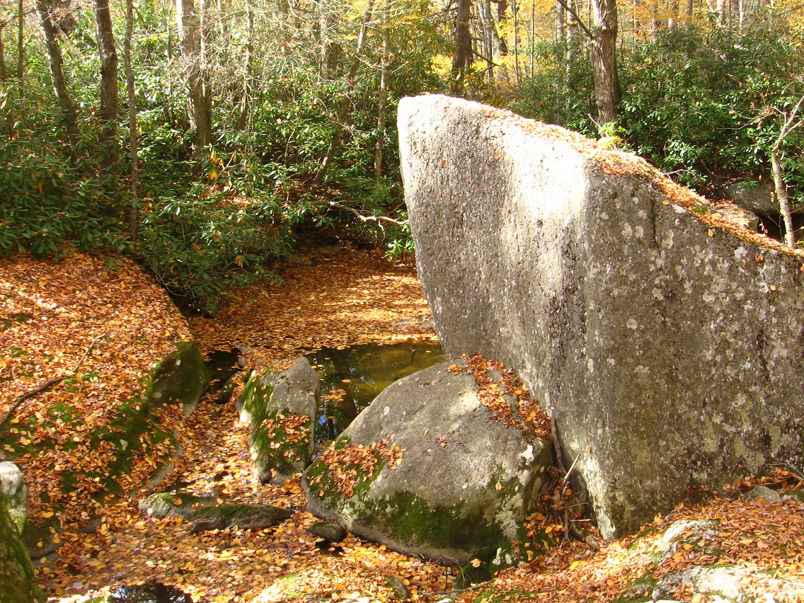
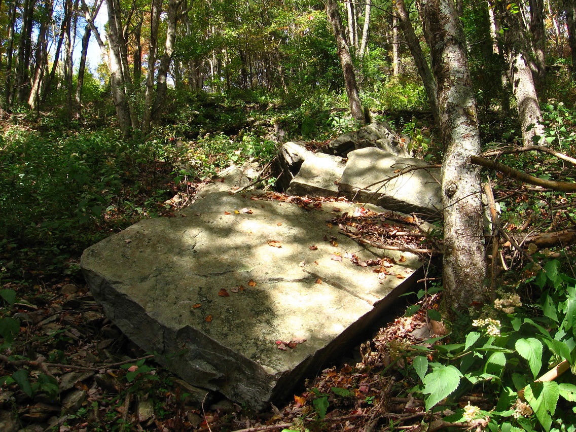
Briar choked end of a trail splitting off from Head Path nearer its western terminus. I had a desire today to get to that rock pictured here but it was hard going, not only because of the briars but I also ran into a bit of poison ivy along the way. I made it, however (probably shouldn’t have tried?).

A rockier section of Head Path, in moving toward the center now. Again, this is not any officially recognized Herman Park path, but a traceable trail nonetheless, probably used by both deer and cows on occasion.

There are obvious signs of human activity from the past near the trail, like the remains of a rock wall here. But no humans besides me hang around here any more in all likelihood. It’s just Baker, cows, deer and other wildlife. 🙂 I will say that you can frequently hear the voices and sounds of walkers from a nearby, fairly heavily used path, however — just uphill.

A more impressive tree/bush that sprouts near the center of Head Path. I’m not sure what type it is yet, but the plant appears to be identical to the one found in Yellow Down (last photo from this September post). In my opinion the plant actually defines the center as much as any other object.

I thought I’d include this photo in the blog because of a somewhat interesting illusion caused by a yellow and green plant directly in front of one of the central trees, giving the appearance of a skeleton outfit almost.


Another shot of the fairy arch…

… and nearby fairy rock stacking. There is obviously considerable psychic energy in the area.
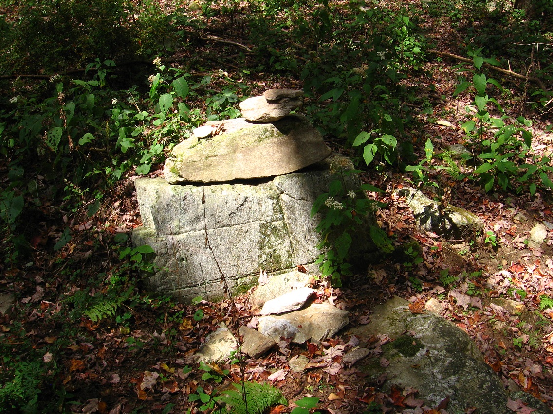
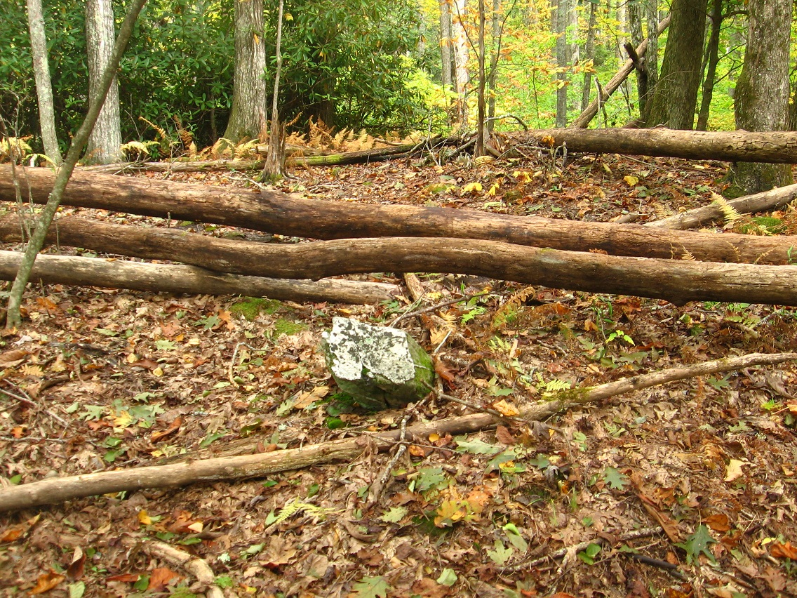
Larger, squarish rock of what I’m now perhaps calling Vale of Null or some approximation thereof.
Amazing moss and lichen microcosm found in another valley leading to Heart Lake further down the hill. But the picture didn’t turn out too well. I’ll try again soon.

Nearby pile of rocks with a piece of plastic underneath the topmost one. Trying to take yet another cue from The Woods, I then wrapped this rock up in the plastic underneath it (perfectly covering it) and took it home for further examination. The wife said it gave the appearance of a piece of bread, or a scone-like pastry. Scone Rock is the name, then, since scones are often wrapped in plastic when bought.

On the same day of hiking, I visited Methril in Frank Park and found this end of a projecting log, which looks like a barking or snarling dog, just before hearing a group of wolves or coyotes eerily howling in unison nearby. I high tailed it out of there before dusk proceeded any further!

Filed under Frank Park, Herman Park, Sharieland, Thrill

“Korean Channel is perhaps the original audiovisual tiling, Hucka D. Zebra and Damsel Island are clues — black and white. Head trip.”
Hucka D.:
Yes.
bb:
Obviously a gold plated football helmet that is also an army helmet, like the one used to name Monkey City when I was a boy. Land of Reds and Yellows must play a role as well. Perhaps everyone is bushed there all the time. This is a way beyond Billfork. This is the Korean Channel.
Hucka D.:
Yes. Where is the Land of Reds and Yellows? Would that be Whitehead Crossing?
bb:
Unsure Hucka D. Let’s see, the Land of Blue and Purple would be entered through that log bridge, but the actual significance of that bridge is that it points to The Totem in Silverberg on the other side of the channel. I think a battle between Silverberg and Purpleland took place in the past. Purpleland grouped around the smaller of the 2 Silverberg streams, and Silverberg proper around the larger of the two, perhaps centered by Silver Pool.
Hucka D.:
Yes.
bb:
(after a pause) Maybe Green Stream itself was originally known as the Silver Stream. Now this applies to Spoon Fork perhaps.
Hucka D.:
Maybe. Yes.
—–
(continued from The Land of Blue and Purple 01)
The following day I returned to the same area, first taking this shot between straight rows of pine trees in the Square Forest not far from Concreek (and below Thrill with its Ilthril, Methrill and Myselthril). Hucka D. has claimed that Square Forest is actually a super intelligent computer disguised as a forest — hence its unnatural “straightness”. Maybe a comparison can be made to a similarly square shaped computer chip, say.

Stacked breeze blocks on the east side of the Square Forest: Hucka D. again says these are not what they seem, and represent the nucleus of the computer, a sort of mini-computer in itself that use to exist on Damsel Island and acted as the controlling intelligence for Concreek. That Bee has some imagination! I’ll have to ask him how the core got up to Square Forest when I see him next. But I guess the Square Forest could have been “built” or manufactured around this relocated core. Now *I’m* starting to think like Hucka! Zebra could represent black and white, or the on and off state of a computer bit.

And then we have Damsel Island itself, where I once again crossed Green Stream after subsequently walked down the whole of Concreek from Jacob I. Road. I took this picture of a suspicious looking piece of wood which seems to act as one of those fairy bridges once more, allowing passage to Damsel Island from the “mainland”. Impractical for humans, see, due to its smallness. But just right for a fairy?

I might have decided to call the vast open area surrounding Green Stream as it passes through this region *Korea*, and the passage itself the Korean Channel. I’m obviously attempting to import more Second Life mythology into Frank and Herman Parks if this decision stands. Second Life has perhaps crawled into its death bed, with last rites not far behind. The top of this Korean Channel (again, if the name stands) would be at Whitehead Crossing. The bottom or lower part would also be the lower part of Green Stream itself, where it meets Spoon Fork. I’ll go into more detail about all this soon.
Rotting trees in the Korean Channel, not far upstream from Damsel Island.

The Bridge of Blue and Purple again, discovered the previous day.

But what I didn’t know the day before is that the most important aspect of this log might not to be as a functional bridge, although it serves that purpose as well (entrance to the Land of Blue and Purple), but a *pointer*, because in the opposite direction from LBP it points *directly* at the silvery hued, very mysterious Totem, standing tall in a briar choked peninsula at the meeting of two small stream flows on the opposite side of the Korean Channel from here.

Now I understand this is just “mere” remains of a dead birch tree, but it’s so unusually shaped that I think it *has* to mean something, especially given the alignment with this log (in turn, midway between the blue and purple soda cans). Does it somehow describe the history of this location and its “people” (assumably avatars)?
Totem from the other side. I think I’ll create a drawing for this particular mystery feature of Frank Park. Another mysterious part is the presence of a piece of disattached bark way up in the tree behind the totem. From this angle, the two seem to merge into one symbol of some sort. Does the totem tell the story of sky people?

The totem is also surrounded by a thicket of briars, perhaps for protection and preservation. Nowhere else in the immediate area are the briars this thick. You can’t get up next to it, even — that’s why my photos are all taken from a certain distance away.

Filed under Blue and Purple Land, Concreek, Frank Park, Thrill

“WIS”, pronounced like “wiz” (center center), is the 3rd, hidden element of the triangle whose 2 known points are Health [Lake] (right center) and Wealthy [Mtn.] (top center). We do not even know what kind of element WIS is presently. It is a black hole I believe Hucka D. wants to say here. WIS exists in the gap between Herman Park, seen as north in the above map, and Frank Park, south on the map. I am not unconvinced that Whitehead Crossing (SW of WIS) won’t be the main station for these parks in future times, as I move more out in the woods at retirement (8 years if all goes well; *I* will be the Whitehead in the Woods (!)). WIS is close to Whitehead Crossing but not the same. WIS is close to Wealthy Mtn. but not the same. Close to Health Lake but… not the same. It is in a gap in a map which does not logically make sense topographically but does psychologically. It is a hole that everything folds around, like flower petals.
All I can do is move from Frank/Herman Park focus to Frank/Herman Park focus. A new focus is Falmouth Creek (lower right corner of map). I’ve now determined that the original village on this creek was called Old Baker Settlement. I have a rough picture for now; it exists in the basic center of Falmouth Creek, about equidistant from both source and mouth. Old Baker Settlement, or what remains of it (ruins) is white-ish rocks in a moss bank below a clump of trees.


We’ll get to more of the story behind Old Baker Settlement (OBS) shortly. Hopefully I’ll be able to take more pictures of Falmouth this weekend, despite the continued cold weather, PHEH. On the bright side, I’m definitely going to England once more. I had a panic attack in the middle of the night, and started thinking negatively about the trip. Now I’ve turned around again. Analysis of Falmouth collages is helping. Falmouth is centering — in Avebury. Might Avebury have something to do with Old Baker Settlement?
Falmouth, Indiana which lies on the line between Rush County (west) and Fayette County (east) was originally called Old Baker Settlement. That’s obviously where I got the name. The synchronicity to this, ‘coz there’s always synchronicities when it comes to Frank and Herman Park names it seems, is that the ridge separating Falmouth and Second Life Pond (named later) acts as a peculiarly extended *block* between more public land around that pond and Falmouth Creek, essentially and effectively isolating the creek while allowing it to be quite proximate to tourist attractions in Frank Park, Second Life Pond basically. So I decided to name this ridge Block Ridge, then remembering Old Baker Settlement as an original name for a US Falmouth, decided to change this to Bloch Ridge, after my main Second Life avatar Baker Bloch. Second Life Pond, lying on the other side of this ridge from Falmouth Creek, is named immediately after this, then. Second Life Pond is the origin place for not only Baker Bloch but also Baker Blinker, who was my original, dominant Second Life avatar during my first half year or so of involvement in that virtual reality. When I moved to mainland SL from Azure Islands in Fall 2008, Bloch, the male, took over as the dominant one. The story of my avatars is found in the Where Are We On That art exhibit I still have up in my flickr site. Accompanying the first two stories about Baker Blinker and Baker Bloch in that exhibit is a 3rd story about Hucka Doobie, in case you’ve ever wondered about *his* origins (this is the same as Hucka D.), and then Esbum Michigan and Wilsonia Foxclaw, my final two avatars I was using at the time. After the exhibit was created, I made 2 more Second Life avatars: Karoz Blogger (formed right after the exhibit) and, about a year later, my last one called Bracket Jupiter.
Hucka D.:
I heard my name and woke up. Howdy baker b. Heard you talked to Headburro Antfarm for the first time in a long time.
bb:
Yes. I just asked him if there’s a virtual reality out there to rival Second Life yet, at least as far as making pictures and galleries go. He suggested Minecraft, but I’m not sure it is a rival yet to SL, or will be in the future. The best hope is to attach something directly to a web browser, with a first person viewpoint and simply getting rid of the avatar.
Hucka D.:
But that wouldn’t be any fun.
bb:
Maybe not for me, but it would make things easier for people to see your work.
Hucka D.:
Oh you can’t do that. You have to have Second Life. What about the Pietmonds??
bb:
Yeah. Not sure. But back to Falmouth, if you want to talk about them. Second Life Pond, a logical name for reasons I can’t go into here involving the *actual* name of the pond. Another virtual reality.
Hucka D.:
Maybe that should be your new virtual reality. Is it still around?
bb:
Check the link I just made with your last sentence.
Hucka D.:
I’ll check it later. It was just a rhetorical question anyway. Second Life began in that pond in Frank and Herman Parks. Bloch Ridge blocked Baker Blinker from proceeding over the hill to Falmouth. Only Baker Bloch exists in the attached collage series[ Falmouth 02 and Falmouth 04]. Falmouth 01 02 03 04 is Old Baker Settlement. So, yeah, it *is* the same as Avebury, if you will. Falmouth is Avebury.
bb:
There’s Lean Rock in the creek just below OBS.

There was the mysterious writing “Fi” in a rhododendron leaf at OBS as well.

Hucka D. (guessing):
Hifi. Or High Five.
bb:
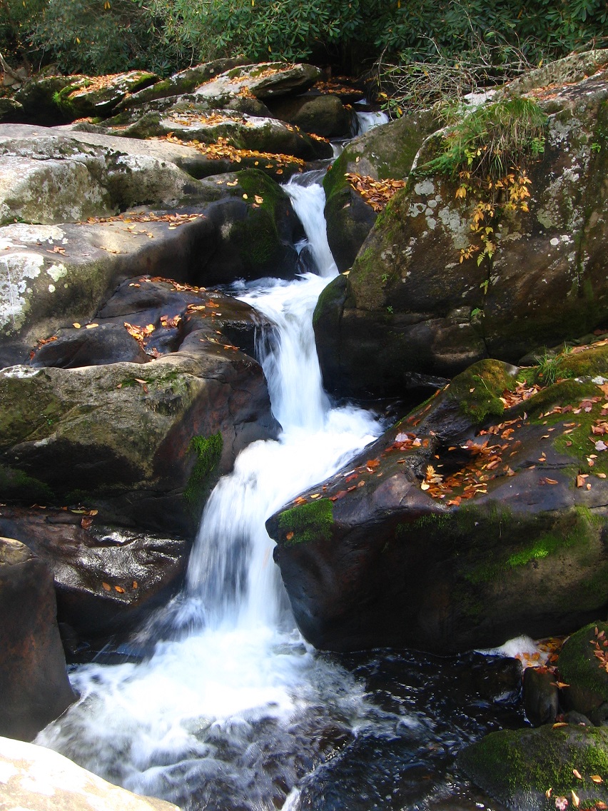
This is a picture of a cascade on a creek just north of Falmouth, just over another ridge, or I gues it is an extension of the same ridge [Bloch Ridge]. This creek lies between Falmouth and Gnirps.

Hucka D.:
That’s a pretty cascade. A popular vacation spot for toy avatars, much like Gnirps nearby. They stay away from Second Life Pond and Second Life Creek, however, because of the humans. Humans and toy avatars as yet do not mix.
bb:
I can imagine. So there are toy avatars at Falmouth?
Hucka D.:
Oh yes. Mouse and Shark. Bart and Lisa. Baker Bloch and Baker Bloch. Red Lion man/woman and Man/Woman. Hand. Non-President R. Booger Hayes. Sunfish. Patrick Star and his friends. Lots of toy avatars.
bb:
So it’s the same as the characters in the Falmouth collage series. The 2 Baker Blochs which are actually different Baker Blochs, for example.
Hucka D.:
Yes. Non-President Booger Hayes wants to speak with us again soon. He has some ideas about Falmouth.
bb:
What of the other parts of Falmouth presently? — Visible I., Stream’s End, the unnamed spring which contains the mossy bank with *no* rocks, unlike OBS.
Hucka D.:
That’s a black hole. And the spring is a black hole. Rush.
bb:
How about X-Ray. Or Ray-dium, the follow-up?

When people ask me about the spacial relationships between Frank and Herman Park locations I mention in this and the Baker Blinker Blog, I usually tell them to f— off.
Hucka D.:
Wise decisions. But this time you’re showing a map. Why? Is it because you’ve found *the center*? Have you found the heart of the heart of Frank and Herman Parks, baker b.?
bb:
Not sure about that, Hucka D. But I think I’ve found Diamond. The legendary Diamond. Priceless indeed. We know from long ago that Frank Park has a set price, a very high price but a figure can be named, given enough time. Herman Park is in contrast priceless. Now I’ve found the priceless Diamond, but inside Frank Park. It should have been in Epsi but instead there I find a piece of ordinary glass with the word “Epsi” on it — “P” removed.
Hucka D.:
That’s then also Pepsin, baker b.
bb:
I get that. With an extra letter instead of a letter removed.
Hucka D.:
Dirty Dozen.
bb:
So instead of Coke, Virginia next to Ordinary and Glass, it should have been Pepsin. But the words were switched, and Pepsin moved to Missouri and positioned near Diamond, close enough for me to make the association. But The Diamond is that special special rock in Methril, Hucka D. Obvious now that I’ve revisted the place and taken blog pictures. Next might be a marble race event.
Hucka D.:
I think you have to. Interact with the energies of the hill in that way.
bb:
And I think there may even be some kind of Bee’s Line up there, Hucka D. Can you tell me more as of now? Since I probably won’t be able to get up there for about 2 weeks at least.
Hucka D.:
Methril will throw open doors. Make you forget about the aliens on Bill Mountain. That’s the main purpose, or a main purpose. The Diamond was held in reserve. You knew about it but you didn’t really *know* about it.


Welcome Back!
http://en.wikipedia.org/wiki/Mithril#Abundance
In Tolkien’s Middle-earth, mithril is extremely rare by the end of the Third Age, as it was now found only in Khazad-dûm. Once the Balrog destroyed the kingdom of the Dwarves at Khazad-dûm, the only source of new mithril ore was cut off. Before Moria was abandoned by the Dwarves, while it was still being actively mined, mithril was worth ten times its weight in gold.[2] After the Dwarves abandoned Moria and production of new mithril stopped entirely, it became priceless.
Filed under Allen Knob, Bill Mountain, collages 2d, Concreek, Frank Park, Gnirps, Norris Brook, Spoon Fork, Thrill, Wiltshire
3 hills of Thrill:
Ilthril
Methril*
Mysethril
The supposed portal into the heart of the middle ridge known as Methril. Compare to a similar two tree “portal” at Billfork, at the old Pluto core of that civic unit.

One of the two column trees of the portal, in this case, contains a peculiar, truncated second tree projecting from its base. Perhaps it has been lopped off in this shape, and perhaps not. At any rate, it looks a bit too much like a pine cone at the top or perhaps even a pineapple to be an accident for me.

Looking from the basic position of the portal into Methril’s heart. In the background there’s an unusually varied array of colored objects for such a winter’s scene.

Closeup of the objects in the above photo. On either side you have the two most sacred rocks in all of Methril, or Parry (left, greyish-white) and Gary (right, dark green). Between them from this angle are three different colored mossy rocks, and the rotted trunk of a small tree.

3/5/13 Correction: Parry has been renamed The Diamond. Plain and simple. It appears to be a most sacred rock, and apparently balanced and grounded, as it were, by the larger, moss covered rock formerly called Gary (rename not complete at the time of this writing). The Diamond now appears in 2 collages of the new Lis series, and “Gary” appears in one of the two with it. The Diamond in Lis 00 to begin the series, (“Welcome Back”), accompanies the Confederacy of Diamonds welcoming me back to Wiltshire and collages based thereon after I thought I’d exited that process at the end of Gilatona. It may even be a (7th?) member of this confederacy. In order to defeat the aberrant collage system arising at the same time, I had to return. And also to make me understand that I simply *have* to go to Wiltshire and England this summer. I can’t wimp out, as much as my negative self wishes to and stay home with the kitties and do my standard and safe local hiking instead. No I must head to the equivalent of Mars, nay, outside the Solar System for me. For this is beyond the comfort zone of Sol (that probably doesn’t make sense; work on it later).
So to return to my comfort zone… below we have pictured a line of small rocks that may mean something in the larger scheme of developing Methril mythologies. But maybe not as well… worth a picture, I thought, at any rate.

“Gary”, featured in Lis 03 (“Gargoyles Cometh”). The rock seems to come to the rescue of his partner The Diamond, which has been sat upon (captured? de-energized or made redundant?) by the foremost gargoyle of the collage. “Gary” seems to be swinging on a tree branch from the left to attack the advancing gargoyles, and keep the scene of the twinned collage “Meating Meet Shake” (right half of overall diptych) a safe harbor free of monsters.

The Diamond, projecting fifth dimensionally from the Methril forest floor. This is the photo of the rock used in Lis 00…

… and this is the photo used for both it and “Gary” in Lis 03, along with a couple of accompanying tree limbs or branches. Methril is already remotely wielding its powerful magic in England. The seemingly defeated gargoyles in this case are most likely my fears of travel and leaving the comfort of my safety zone here in the Appalachian Mountains. These fears must be embraced and conquered, a Lis 06 theme most likely (bearing in mind especially that one of the advancing gargoyles in Lis 03 bears a strong resemblance to Bart Smipson, as pointed out by Brian Robert Marshall).


The Diamond viewed from the north — can’t see the trademark diamond shaped quartz face from this direction.

The only manmade object I could find in Methril, or an old pot with the bottom rotted away. This would be west of the “Gary”/Diamond central complex, or near the overall west end of Methril proper.

Looking east over top of this pot back toward the core of Methril.


Mouse & Cheese
—–
* compare to Tolkein’s mithril
Filed under Frank Park, Thrill
