Monthly Archives: January 2015

No Where 02

swannanoa02

“Bunk”, har har.

Click to access l200104.pdf

—–

http://www.svpvril.com/Cosmology/cos8.html

envelope
Figure 8.7- Colors Represent Relative Frequencies
Red = C = Thermal Rays
Yellow = E = Light Rays
Blue = G = Chemical Rays

….

8.5 – Dynaspheric Shells – This faster vortex will be the inner most envelope which will be enclosed by the second spinning vortex and the third vortex will enclose the first two. Imagine an orange with three peels each one covering a band or width of the equator sealing the area not covered by another enclosed band. The poles of each spinning equator will be open. In Figure 26 the black areas of each shell are the spinning sealing areas of motion. The colored areas are the open polar zones. The three concentric peels will effectively seal the entire surface area of the orange according to its velocity of rotation which translates directly into force of compression and density. The end result is a highly compressed “solid” sphere of matter. These dynaspheric shells correspond to Russell’s “caps” that seal and hold an atom together. See “Atomic Suicide?” for more details.

sealedpoles
Figure 8.9 – Dynaspheric Shells and Attractive Poles

animatrip

1 Comment

Filed under Middletown^

Yet another woodland area near Ashville threatened…

… similar to this one briefly described in October.

https://bakerbloch.wordpress.com/2014/10/11/major-collison-taking-place-in-an-important-area/

The endangered trees this time lie on Richmond Hill northwest of downtown Middletown.

Prepare for changes at Richmond Hill

richmond-hill-communities

Hi,

Please give your best efforts to create a Richmond Hill Park preserving unique land near downtown Asheville.

Thank you,

richmond-hill-final-map

70619a2dcf12446cbd6d8a0950100a70

Leave a comment

Filed under **VIRTUAL SL

Orange

“It’s easy to see that the *Orange* River drew the much, much, much younger The Way and Interstate 30 to Center County. It has a much more powerful influence that the last 2. Actually it doesn’t, because *all 3 are 1*. It is the 4th that again holds the key. Does it travel at zero time? Or does it travel the speed of light?”

bb:

At any rate, it’s the Orange again.

Hucka D.:

Right.

http://tmbw.net/wiki/asheville

Trivia/Info

Also known as The Orange Peel (in the original concert setlist).
The Orange Peel is in Asheville, NC and somewhat close to the French Broad River mentioned in the song.
Besides the venue (and the fruit), a possible source of inspiration for the theme of the song could be playwright Arthur Miller’s Death of a Salesman, in which Willy Loman pleads with his boss, “You can’t eat the orange and throw the peel away—a man is not a piece of fruit!”
Twenty days prior to the TMBG show at the Orange Peel where this song premiered, the French Broad River flooded horrifically, doing terrible damage to the city’s art district.
Unlike all of the other regularly performed venue songs, this track doesn’t have a studio version. The rendition on the DVD/CD is from the soundcheck.
Colourmovie designed and animated the video for this song.

Asheville

See also here:

https://bakerbloch.wordpress.com/2014/12/19/21412/

Leave a comment

Filed under Middletown^

No Where

swannanoa01

All of the 3 seem significant. Obviously the first (near Middletown in NC), 1/2 of the source of the name Otanoa, home of Woodrow Wilson College and Future Home (western edge).

Apex_04

The 2nd (NJ) is near Newfoundland, where acclaimed movie Station Agent was primarily filmed. Swannanoa NC sometimes nicknamed Swanna Nowhere, and in film Newfoundland was similarly described as being in the middle of nowhere. Resonance.

the-station-agent

Station Agent is a primary movie in Carrcass+6.

And then the only other one, in VA, was home to coupled mystics Walter and Lao Russell during the last half of the 20th Century. This is where they lived and worked.

http://en.wikipedia.org/wiki/Swannanoa_%28mansion%29

Swannanoa_LVA001131284

photo_18
W. Russell’s periodic table of octaves

—–

I just stumbled upon mention of the band They Might Be Giants this morning when looking up the etymology of the phrase “here there be giants”, used in a previous post. Now I find, through research into the French Broad, that they wrote a song about Ashville. Hmmm…

Asheville
By: They Might Be Giants
Year: 2004

Please allow me to introduce myself I’m the orange peel You don’t remember But I was once part of your orange

I’m the peel that you left on the floor You took the good part and walked out the door And I hate you for that I hate you for that I’m the orange peel

When the flood waters reach where I lay French Broad River will float me away And I hate you for that I hate you for that I’m the orange peel I’m the orange peel I’m the orange peel

Leave a comment

Filed under Middletown^

Hand, Heart

245e07a19f6f98868a4a4e1edc76efe2612b6f07c4026bafd874f8eb2ed13043

French (1 of 4) and Heart (1 of 1) in Fulton County, AR along with Elizabeth and nearby Hand, inundated by Norfolk Reservoir. Obviously points to above caption meme: Fred Sanford’s trademark fake heart attack where he puts his hand over his heart and calls to deceased wife Elizabeth that he’s coming to join her. But the just discovered presence of French adds a new twist. It seems it has something to do with Center County and its Middletown and Heart Circle and centering river which still doesn’t possess a mythological name. Part of the real name, however, includes the word French, and since French is so near Heart in already highlighted Fulton County, I think this points to middle/center/heart again in full. Is the mythological name, then, the Heart River? Or is this just another indication of middle, as in Middletown and Center County? Many Islands is also in Fulton County, and the “Heart River” contains many islands as it runs past the heart of Alexfin and the old dump area there.

I also recall that in August Baker Block “died” of a heart attack when Head of Perch merged with a painting in his room composed of many eyes, or many “i’s”.

https://bakerbloch.wordpress.com/2014/07/26/baker-bloch-is-dead/

Check out who owns the Elizabeth post office.

http://en.wikipedia.org/wiki/Elizabeth,_Arkansas

Elizabeth is an unincorporated community in Fulton County, Arkansas, United States. Elizabeth is located along Arkansas Highway 87, 8 miles (13 km) southwest of Viola. Elizabeth has a post office with ZIP code 72531, owned by Jackie and Stephen Hart.[2]

Leave a comment

Filed under **VIRTUAL SL, Arkansas, Jeogeot, MAPS, Middletown^, Noru^

Bentmore & Alexfin 02

One of a number of interesting rocks along the riverside road leading to the old dump site. This one appears to have hieroglyphic patterns on its underside (seen clearer in the enlargement), but close up they turn into “mere” spider webs of a circular design.

IMG_0129smaller

At this island location the road veers away from the river and starts uphill to the old dump plateau. In reviewing early 90’s notebooks, I see I call this place Dumpport, because this was where I was planning to carry junk from the landfill and create a kind of art happening, perhaps even including “ships” or floating devices that can move (up and?) down the river. I only very vaguely recalled the island when I saw it, however. I didn’t appreciate what I had at the time, obviously, since the same kind of vagueness shrouded my memories of the Woodrow Wilson trails revisited this fall. When we return to A-ville I’ll not make the same mistake, hopefully. I’ll appreciate.

IMG_0134smaller

Beyond the end of the road and Dumpport lies these rocks that I recall a bit better. You can also see them on GoogleEarth, I’ve found out, and this is just a segment of them. At some point I’d definitely like to hike the whole central Alexfin penninsula beyond this to where a main road rejoins the river. That’s perhaps the defining aspect of the peninsula — no road along the river except for, in part, basically unused and overgrown ones.

IMG_0136smaller

More details from the Dumpport island. It’s maybe 15 yards by 5 yards.

IMG_0142smaller

A fallen, ivy colored tree trunk creates a kind of bridge to the mainland.

IMG_0146smaller

The dump road follows a brook up the hill to the old landfill site. This is one of the places where it runs under this road. Nice ice effects. You can also see that the stream is still discolored from dump leachate. More on this type of drainage here:

http://en.wikipedia.org/wiki/Leachate#Landfill_leachate

IMG_0153smaller

Back on the river: footprint effect in a rock; bigger than an ordinary man’s. Here there be giants?

IMG_0160smaller

The river raging below a rock outcropping.

IMG_0168smaller

I called this Fist Rock. Right on!

IMG_0175smaller

Leave a comment

Filed under Middletown^

Bentmore & Alexfin 01

More spectacular and meaningful hikes in the Middletown/Ashville area last Saturday. Temperatures were near freezing when I got to A-ville around noon, but reached perhaps 40 in the afternoon. The first hike involved attempting to find a possible pond corresponding to the Bentmore base point of the A-ville pyramid (Bentmore-Future Home-Alexfin). I parked on The Way at place I thought would be about as close as possible to the pond, and also give me a quick, stealthy way into the open woods, which turned out to be quite passable and filled to the brim with these little white pine trees. Beautiful. After a couple of hundred yards going like this I ran into a system of what I recognized as equestrian trails that soon led me to the pond in question. It was larger and more tamed than expected, as seen in the below photos.

IMG_0088smaller

Great place to take a book and read (or notebook and write). But unfortunately it is on private land, which I feared roaming much. I think I could get away with being here, however, as long as I don’t fish or swim. 🙂 More details on that loophole soon. “The Bentmore Exception”?

IMG_0089smaller

Camouflaged pvc pipe outlet for the pond. Nice touch.

IMG_0091smaller

Looks like I might not be the only one practicing the Bentmore Exception in past/present/future. Looks like a pretty well constructed and perhaps recently or even presently used stick hooch to me. I was slightly worried I’d run into this possible woods dweller when exploring the pond area. I was more worried about running into the people who worked for the people who owned the land, however. No one spotted in either case. It was a pretty cold day, and off season.

IMG_0097smaller

Another interesting structure found nearby. This is a little downstream from the pond, in another open area. Turns out to be an old bathroom. It made me wonder if the pond was more popular destination in the past, perhaps before a blocking interstate had been constructed to its west and the dammed site was easier to reach.

IMG_0098smaller

IMG_0100smaller

Another nearby structure. Looks like a large trash container, perhaps, now empty and rusting.

I attempted to reach Central River by continuing to follow the stream leading into and from the Bentmore pond down the hill. I decided to turn around at a no trespassing sign that had a pretty detailed warning. I had found enough in this area for now. Food for thought fer sure!

IMG_0101smallest

My second hike this sunny but cold day involving moving up the river about 10 miles to Alexfin, highlighted by the second base point of the Alexfin-Future Home-Bentmore pyramid. In this case, my destination wasn’t the actual point of the pyramid, a location inside an A-ville area prison and certainly off limits. Instead it represents a hypothetical but still quite logical spot, and I say this because the Alexfin and Bentmore points are located 8.68 miles from Future Home *and*, in addition to this, 5.57 miles from where Central River enters (Bentmore) and exits (Alexfin) Center County itself. One could put it this way: The pinpointed center of Alexfin is defined by the relationship with other pyramid attached spots of a more tangible nature.

I was extremely happy to find that the old way to the former Alexfin landfill area I had used in the past was still accessible. The central area of Alexfin is still relevant! Hopefully it will remain that way during at least some of our tenure in A-ville. Very valuable real estate we’re talking about here, and a lot of it. If the land is to remain somewhat pristine and undeveloped, I’ll have to have some help from the Gods that govern such things. Perhaps the meaning of the pyramid is primarily one of preservation, then. In contrast, even though the Bentmore pond (central point of Bentmore, in turn) is on private land, I’m confident that it will continued to remain in a natural state and not be butchered to make room for housing projects. Again, more on that aspect soon enough.

So to the pictures — below we have the amazing Center River (Centeriver) swiftly flowing north past rocky islets, with the bald plateau of the old A-ville landfill rising above the treeline in the background. We are looking into the heart of Alexfin.

IMG_0113smaller

I believe these are sumac berries.

IMG_0120smaller

Before passing to the south of the old dump, the river calms. We are drawing nearer to the Alexfin centerpoint, a place as I’ve stated we do not and in fact cannot visit.

IMG_0125smaller

Leave a comment

Filed under Middletown^

Middle: River + Way + 40 + Weak

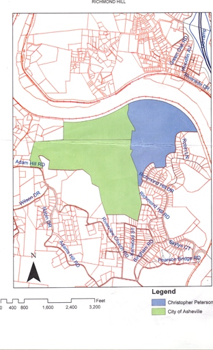
Of course the main thing connecting Blue Mountain mythos and Middletown mythos (formerly Ashville mythos) is The Way. Perhaps spelled The Wey, but I think the former now. It’s another, er, way to define Centre County as a whole along with the Central River (official name still pending). Art River? (like Art Bears?), since the road runs ne to sw and defines a nice, full diagonal in the process. Although The Way also passes through the county Blue Mountain is the seat of, there it’s along the southern boundary. That’s actually another plus about the location of Future Home: very close proximity to this Way, and the ability to travel up and down it easily to hiking possibilities — such as Bentmore, the center of which is bisected by it, in essence. So I believe The Way is how toy avatars or whatever travel from Blue Mountain to Middletown and visa versa. In this way they can act as a kind of balance to each other. And of course The Way also bisects contiguous Frank and Herman Park, splitting them both in two, to the initial protest of Herman[ Munster]’s widow Lilly in the the 1940’s.

Speaking of 40’s, Superhighway 40 also bisects Centre County, running basically east to west across the county and also lying quite close to Future Home. In fact, The Way and SH 40 intersect only about 1 1/2 miles from FH. Another way to get to places quick, then. Blue Mountain has no superhighways, in contrast. Travel must be slower there in general. And yet another way Ashville is truly Middletown.

To summarize:

Central River: bisects Centre County north to south.
The Way: bisects Centre County northeast to southwest.
Superhigh 40 (?): bisects Centre County east to west.

The Pyramid is probably another way to link all of these together. We can also assume a 2nd diagonal running nw to se across the county, which would represent the weakest, 4th line defining the county. We might also be able to assign some color qualities.:

River: Blue
Way: Green
Superhigh: Red
Weak: Yellow

middletown01

The Pyramid is based on exact measurements directly assoc. with the n-s passage of River through the county. The other defining lines of the county — Way, Superhigh, Weak, are not exactly defined as yet, and perhaps never will be.

So a focus for my remaining (?) time in Blue Mountain is to understand The Way, seemingly the only thing connecting the two mythologies, or most closely connecting them.

All of these line pass into other counties in both directions. So their story extends in the same essential directions on either side.

Here’s some further thoughts:

River is Number 1, and colored the highest value hue of blue. Way is Number 2, and colored green. Superhigh(way) is actually Interstate 30 now, and represents Number 3, then (30 = 3+0 = 3) and the color red. The weak line becomes the 4th line, which seems to have no physical attachment to a particular highway or road or stream or anything else. Appropriately it is then assigned the lowest value color of yellow.

middletown02

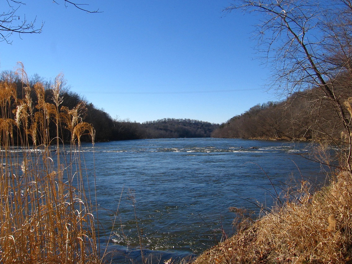
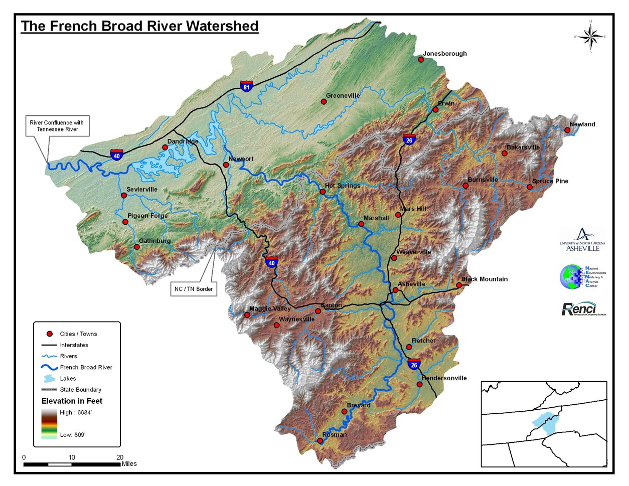
(1) is defined mainly by The Pyramid now composed of points Alexfin (north), Bentmore (south) and Future Home (east or top or apex), and also its two 5.85 mile long arms connecting Alexfin to the place where The River crosses the northern county line and Bentmore to the place where The River intersects the *southern* county line. As stated, the line of The River across Centre County is the one most defined now. So let’s look at the larger picture of The River. Where does it start and where does it end? We’ll be asking this question for all bisecting county lines except the Weak Line, which doesn’t correspond with a physical object.

http://en.wikipedia.org/wiki/French_Broad_River

French_Broad_Watershed1254
213 miles

http://en.wikipedia.org/wiki/Blue_Ridge_Parkway

22tgbluejpg-eeed4b9a7e74b5d1
469 miles

http://en.wikipedia.org/wiki/Interstate_40

usa-interstate40-map
2555 miles

Leave a comment

Filed under Blue Mountain, MAPS, Middletown^, North Carolina

This weekend…

… should be able to visit the center of Bentmore, a newly minted Ashville, er, Middletown mythological zone. Don’t know exactly how to tag it yet. Country? I have a feeling Bentmore will become very important in the new Middletown mythology. Perhaps Alexfin again. Need to read early 90’s notebooks again for clues.

Hucka D.:

Alexfin was another place for toy avatars, but you obviously couldn’t focus on that. (pause)

bb:

Yes, I see that. Can’t believe I did stuff like that now. Toy avatars can be acquired much easier at yard sales (!).

Hucka D.:

You must erase that karma. A prison is now the center[ of Alexfin]. You can do this through Bentmore. You have most of the ingredients already. Bends on The River are important. Is it Central River? Heart River? You don’t have a committed name for it yet.

bb:

Hucka D., Winesap was just laying on the table at my mom’s house at Xmas. Turned out my nephew had lent my sister-in-law the book to read on a plane trip. Obviously this is a true synchronicity and not accident. Focus on Winesap, eh.

Hucka D.:

Yes.

bb:

Blue Mountain doesn’t have that type of central river.

Leave a comment

Filed under Blue Mountain, Middletown^

Present

“It’s why you’ve never understood Ashville completely. Sorry: *Middletown*. Good name. In middle of Centre County, but not the one in Pennsylvania. Okay, kind of that too. Half and half. Or 3/4 and 1/4.”

bb:

Thanks Hucka D. Hyghmythos was an invention necessary at the time, directly connecting Blue Mountain and Mythopolis in a powerful up and down way. The Synching Creek Designated Mystery area does not go *beyond* it but merely extends it, acting as a type of 3rd eye or substitute Anti-Mythos planet that didn’t manifest, perhaps.

Hucka D.:

Middletown and Centre County are centered by a pyramid[ to come to current terms again]. 666 between Future Home and another home that will play a small role in the proceedings. This is an Anti-Home. But not an Anti-Christ.

bb:

That much power, eh?

Hucka D.:

The maps have slightly changed in the meantime — since your relative youth. (smiles) I told you summer of 2010 that where we become 3 dimensional truly[ is Middletown]. You carry your Falmouth series, your Gilatona-Lis series forward there. But much more needs to be done in Blue Mountain in the meantime. Preparation. Cleansing. Can you pull it off?

bb:

That’s why I’m feeling offcentered now. 2014 was rough (!)

Hucka D.:

Everything offkilter except toward the end. Now you are moved. Now you can relax *just* a bit. Ashville reaches from the future as aid. Helping hand. You in future, kind of. But more. You need a future goal. Beyond work work. And that is what has been provided in the present.

Leave a comment

Filed under Blue Mountain, Middletown^