I’m glad that Hucka D. is starting to attend meetings with Carrcassonnee. Or should I refer to him as Hucka Doobie now? hehe. We’ll see how long it lasts. Short attention span that man-insect has! But I get the gist. Carrcassonnee’s diner is symbol of Hand Lake, as the larger TILE Temple that she originally inhabited in the newest version of Collagesity is Drink Lake. We know now that the two, in real life, are directly north and south of each other — as the temple and diner were (as well) in fake or virtual life. That’s another link or resonance. Further, both Hand and Drink are drinking lakes, and have a water plant nearby that also have a direct north-south relationship. Directly. Hucka D. has stated that a Fringe event has happened in the center of Hand Lake in past/present/future, and *caused* The Finger. Interesting theory. Carrcassonnee seems to back it up but unsure still. The rock in the Collagesity diner is supposedly owned by Peter SoSo, who may be the same as Fringe’s Peter. Carrcassonnee might even double for Olivia, as we’ve talked about before. LINK
—–
If there’s something to all this, Reiden Lake must figure into the mix, a place linking the two realities of Earth depicted in Fringe….
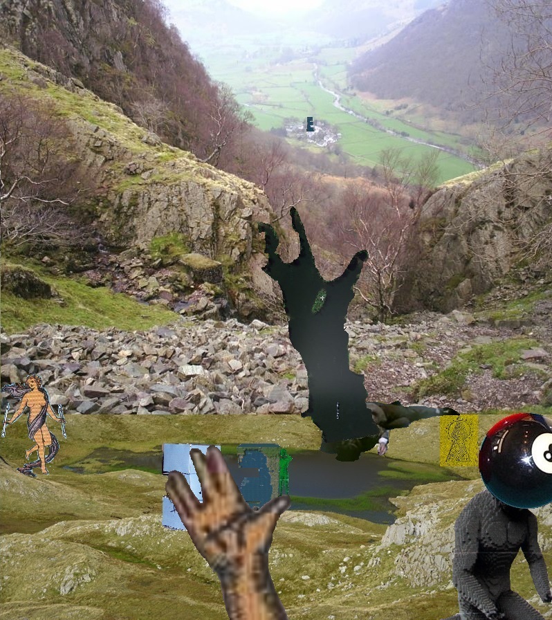
I’m getting hints that Hucka D. doesn’t want me to talk about that much yet. So let’s go here instead: the image of a lake as a hand that basically seals up the whole Falmouth collage series, acting as an Omega element…
(The actual lake in the extended collage) is Tarn at Leaves near Stonetwaite. TaL is filled with algae, as I know Hand Lake is now when visiting midday this past weekend. Mr. Bean has become one with the lake or tarn; seems to be laying down on its shore and drinking from it or perhaps even drowning in it — becoming one with it either way. Same basic color. Then extending from *his* body is an upright map version of Lake Horton in Nauvoo, Illinois, a place famous for the death of Joseph Smith, prophet and founder of Mormonism. The lake contains a single island which is called Gilligan’s Island. And the lake is shaped like a hand of sorts.
I’ve decided to rename Finger Island into Hand Island, with the attached lake it dominates likewise turning into Hand Lake. I do this because there’s clearly not one finger-like extension projecting from the main bulk of the island, but *two*. My reasoning is that the other 3 fingers are represented but hidden, perhaps clustered together like this…
… or maybe even this.
There’s deeper reasons for the name change, however. When feeling the initial desire to turn Finger Island into Hand Island because of the two fingers conundrum outlined above, my mind also turned back to Herman Park and a projected *fourth* lake to be created by Lisa The Vegetarian there called, well, Hand Lake — to complement the perhaps already created Heart Lake, Head Lake, and then soon to be created Health Lake, the last of the four. This duplicates the composition of the 4Hs in the 4H club pledge and famous 4 leaf clover emblem: head, heart, hands and health. There we have a plural form of the same word we’ve applied to the Blue Mountain pool: “hand” to “hands”. But the thing is, Hand (or Hands) Lake was reportedly the only one of the 4 never fulfilled by Lisa V.
References to this from the Frank and Herman Einstein Blog:
“Thanks for that information, Hucka D.,” I said. He smiled. He went to the shelf and removed a red book. Small — no title on the spine or on the front. He opened to page 156.
Noticing this I said, “I’ve already received that message.”
“Received it more,” he came back levelly. He continued to flip through it. “Have you read about Drink Lake yet? Fascinating. You know Lisa the Vegetarian was given Hand Lake and then decided to expand it through this book. The book is the father. Norris was a father; Anderson was a father. Together they created a memory pool of Sandusky County and Clyde extending almost from the years 1860 to 1900, a two score. Booger was told of this.”
McCartney charges Lisa the V. to center the US of A in Arkansas, and kind of tells her how to do it. She creates Head Lake, Heart Lake, Hand Lake, and then Health Lake spinning the opposite direction. To control the spin she must buy all of neighboring Wealthy Mountain — actually Health Lake and Wealthy Mountain are part of one complex, along with Wysei [ which you haven’t found yet]. Then she expanded Hand Lake through the TILE Creek, which was showing off her genius for the first, real time.
bb:
Real genius for the first time, you mean.
Hucka D. (continuing):
That expansion is very important. You must study it this spring. For without that expansion, Herman Park does not exist. All would be in the aether still.
bb:
I will. I promise.
bb:
Who are the singers?
Hucka D.:
They are the genius of Lisa the Vegetarian. They are the expansion of Hand Lake. They are TILE Creek. They will protect.
In addition, Lisa the Vegetarian had several June 2015 posts devoted to her after she topped the voting in the Mystenopolis town deity contest. As far as I know she still holds this rank, even though I, through Baker Bloch, soon left the Mysten sim to return to the Rubi Woods.
So what about this expansion of Hand Lake into TILE Creek, extending from Hand Spring to Drink Lake and a bit beyond?
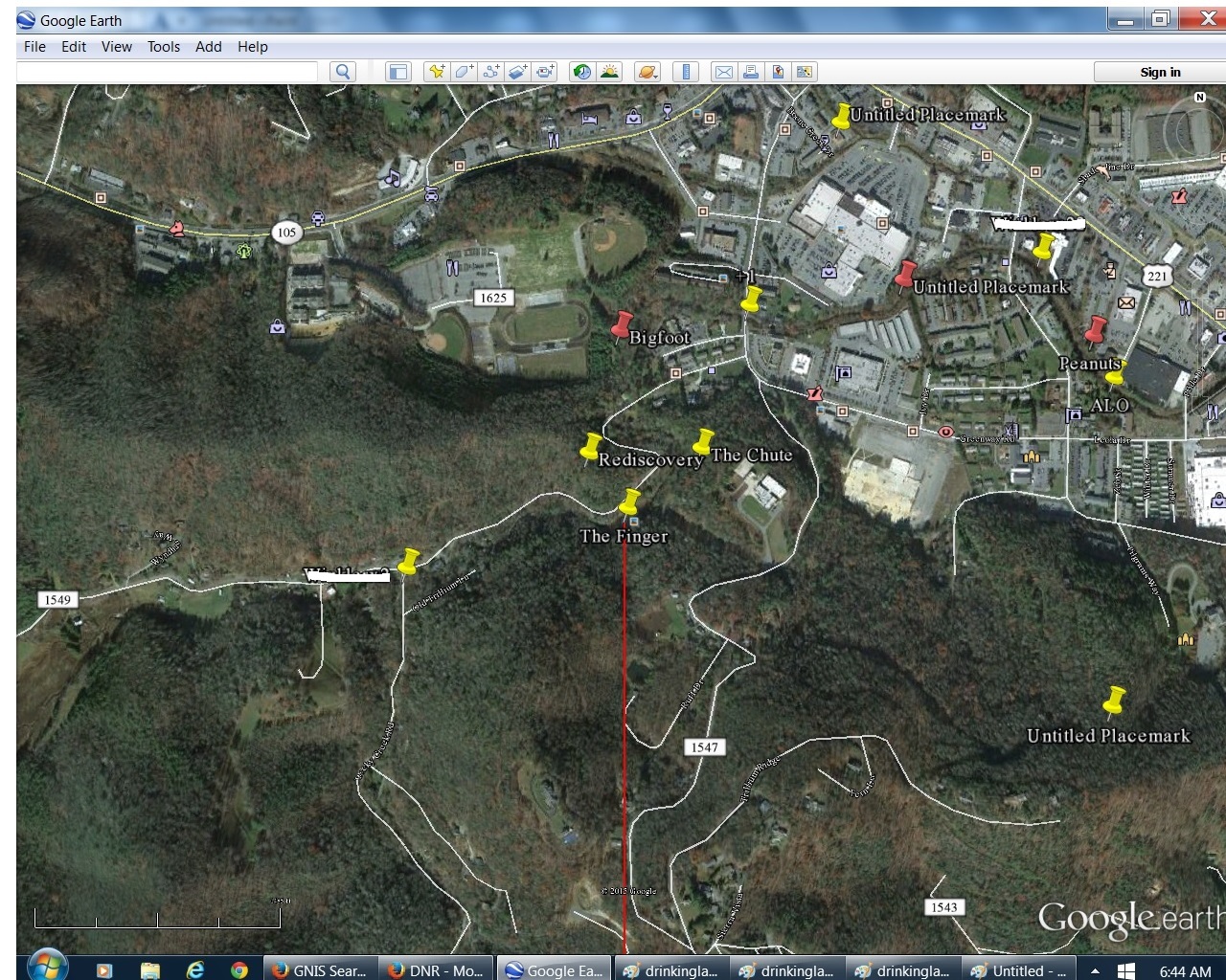
Well, let’s first explain I also found out this morning that Hand Lake (former Finger Lake once more) lies directly north of Drink Lake, and both bodies of water are sources of drinking water for their respective towns of Blue Mountain and Boulder. *Both* are drinking lakes. In the below 2 images from GoogleEarth, the position of The Finger in Hand Lake is placemarked by a yellow pin, and then a corresponding spot directly south of it in the middle of Drink Lake is similarly marked with a yellow pin. Toggle back and forth to see the overlap. The pin locations are less than 4 miles apart. I was quite surprised to find out how close the 2 pools were.
These are my preliminary thoughts:
The Finger formation of Hand Lake *has* to be the working of Lisa The Vegetarian. She reinforced this through the creation of a second, smaller finger-like extension from the same dominating lake island. She clearly wanted *me* to understand that this was the legendary Hand Lake, *created* but then *displaced* into the Blue Mountain area from the Boulder area. She displaced it directly north of the lake she created *in place* of it near Boulder, or the considerably larger Drink Lake. The Mmms moved in sometime after this. Hermania was created sometime after this. Mossmen learned of the location, and Herman Park as a whole.
Last thoughts for now:
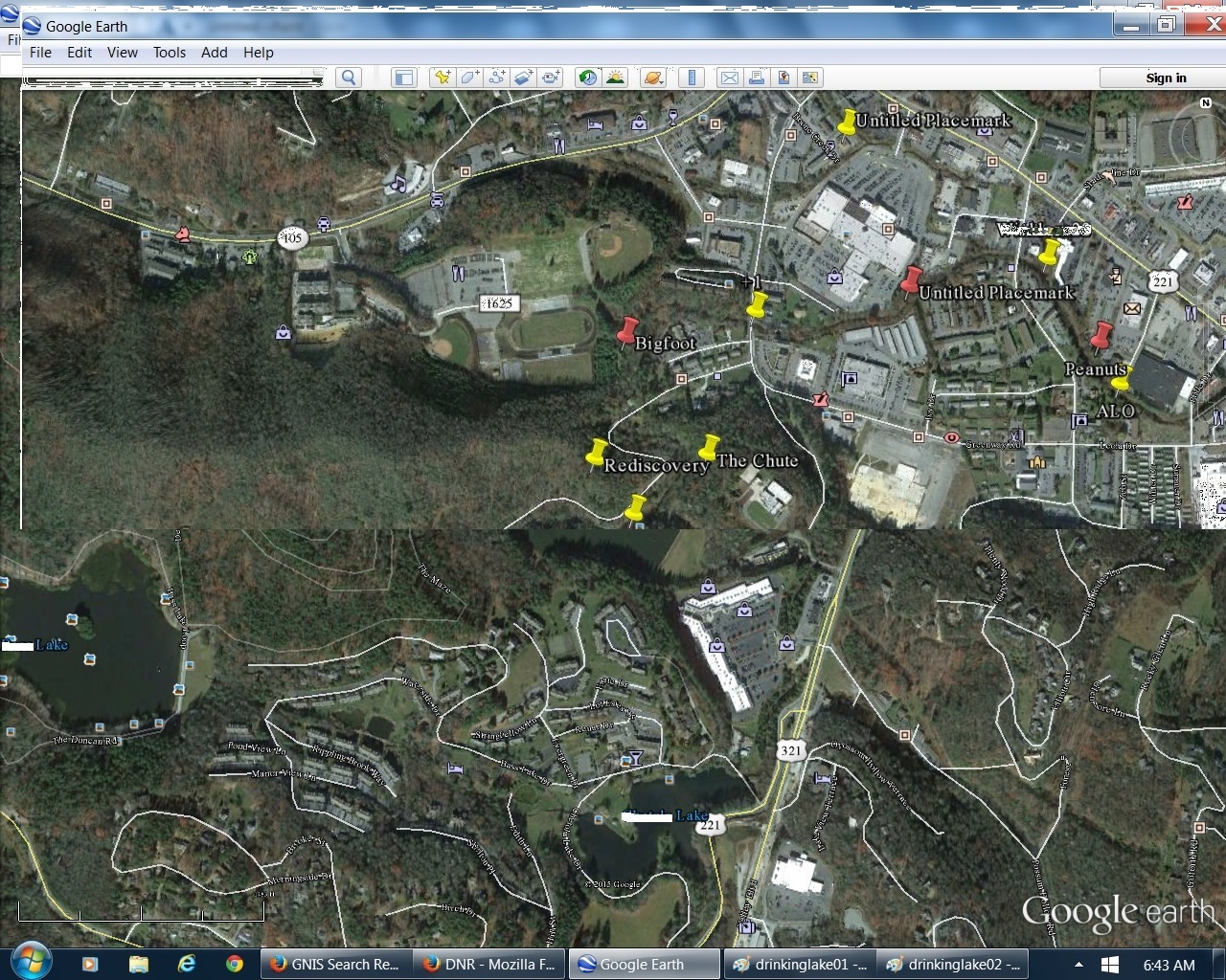
Overlapping Hand Lake and Drink Lake pins and replacing land south of former with south of latter gives the following image, where the two towns of Blue Mountain and Boulder effectively touch in the general pin regions. The 2 town water plants are also obviously a focus of the overlap; they’re also directly north-south of each other, and also “touch” boundaries in the below image.
If we eliminate land *north* of Hand Lake and replace it with land north of Drink Lake instead, we get the following, with the disappearance of both towns and setting the joined drinking lakes in a relative wilderness setting….
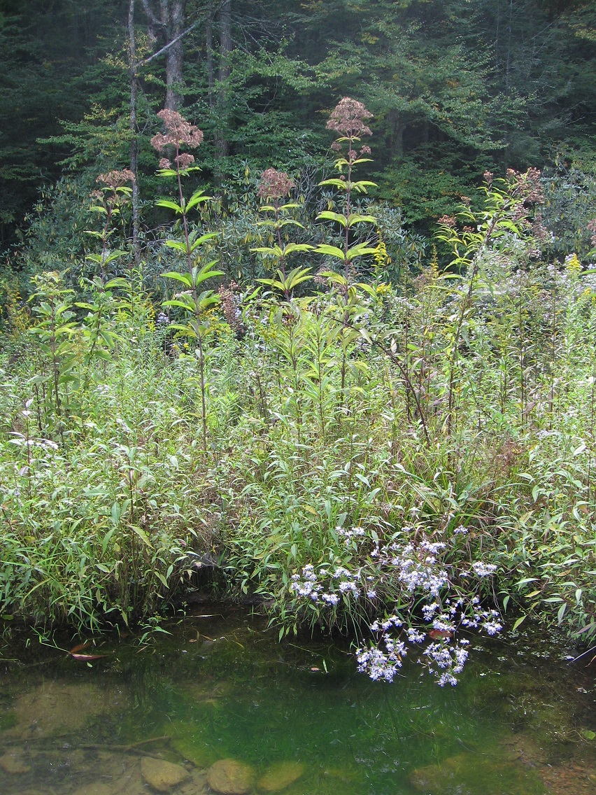
Joe Pye weeds of Finger Island, with flowers a bit past their peak color.
The Finger from its tip. So regular and un-natural seeming.
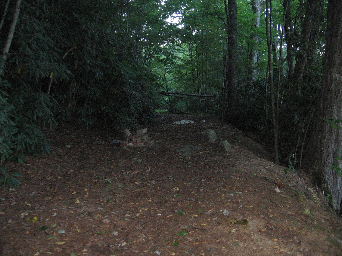
This is the place off the path running along the northern shore of Finger Lake where I accessed the island. I suppose the associated rock pictured below becomes Access Rock? You simply cross the trunk of a small fallen tree just below the rock to easily reach the island. I would guess Finger Island is a third as big as the whole lake itself. Could be overestimating this.
Weeds along the trail. We are definitely on the doorstep of autumn.
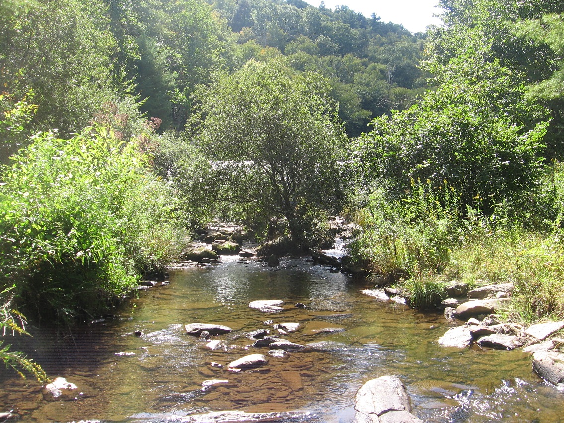
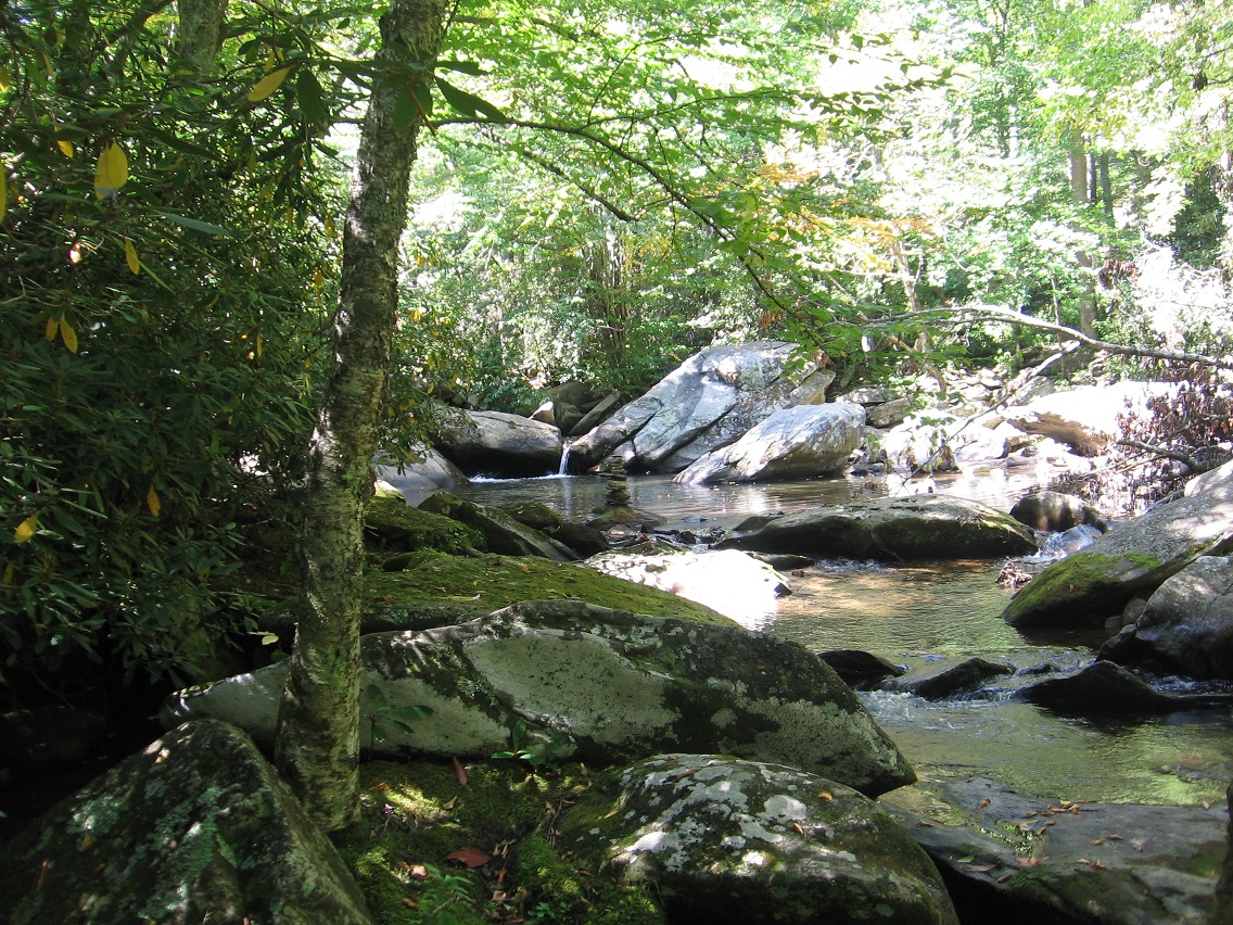
These stepping stone style rocks are where I cross Leola Creek below the Finger Lake dam to get to the most southern part of Rediscovery.
Nearby elongated rock in the center of the creek.
Looking back toward the dam from the crossing.
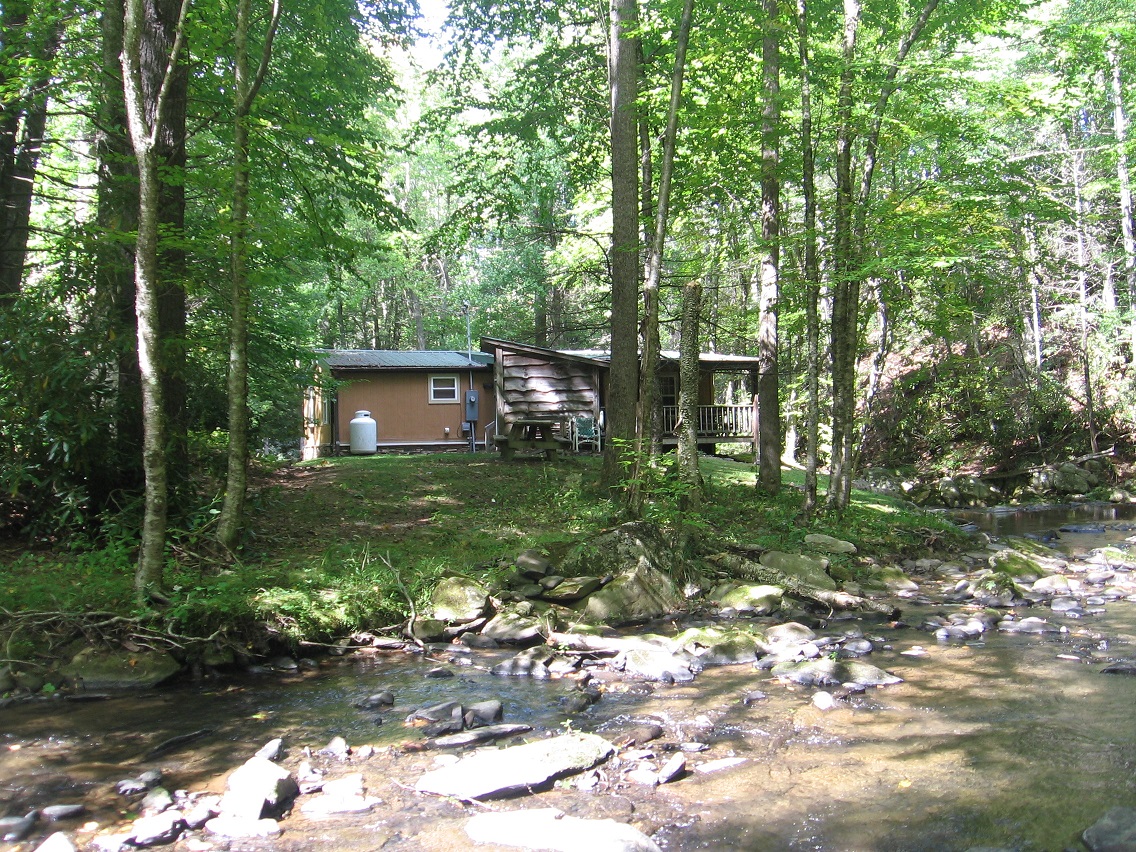
A house probably marking the eastern edge of Rediscovery, where wilderness meets civilization again.
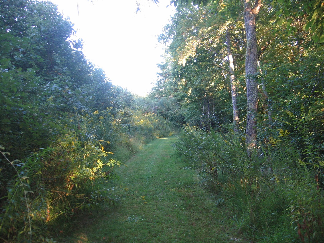
And then we come to locations from the next day, which would be yesterday as I’m writing this text. This is the first time this summer — and years and years actually — that I’ve explored this region, which can be accessed by an old road splitting off from Water Plant Road to the *south* (as Rediscovery lies north of this same road). Much more woods are found here, with multiple old roads crossing the area. The below photo depicts a more open area in these woods.
These snapshots comes from the edge of a a torn down plant once making top secret electronics.
Cattails of Bigfeet Swamp. For now, I’m reverting the name of the area surrounding this swamp to Bigfoot (instead of Bigfeet), but the swamp retains the changed name. I do this for google search reasons, and the need to keep hiding my local woodsy finds from, well, the locals.
*Bigfeet* Swamp intake in *Bigfoot*, then. Confusing? Well, tuff. 🙂
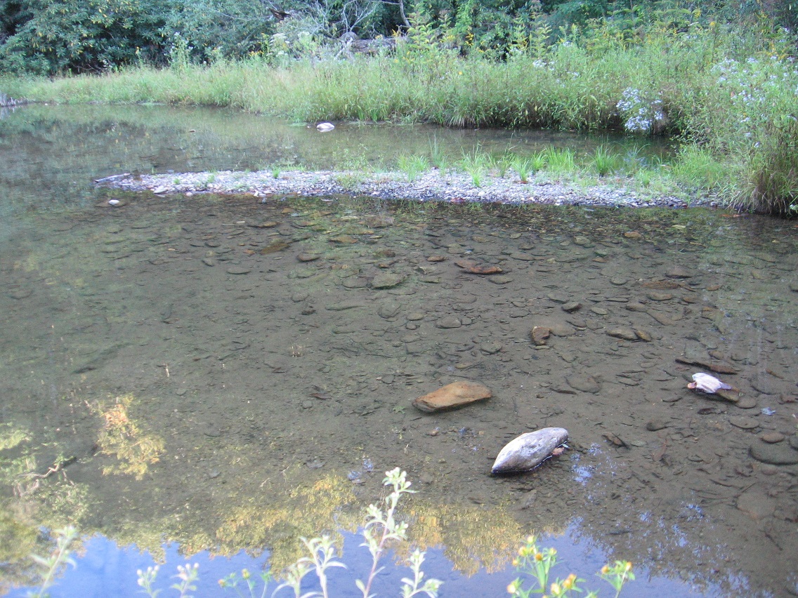
Then it’s over to Finger Lake in Rediscovery again. Nice green algae at the bottom, but this is suppose to represent the reservoir we get the town’s drinking water from? Hmm.
The Finger of Finger Lake once more.
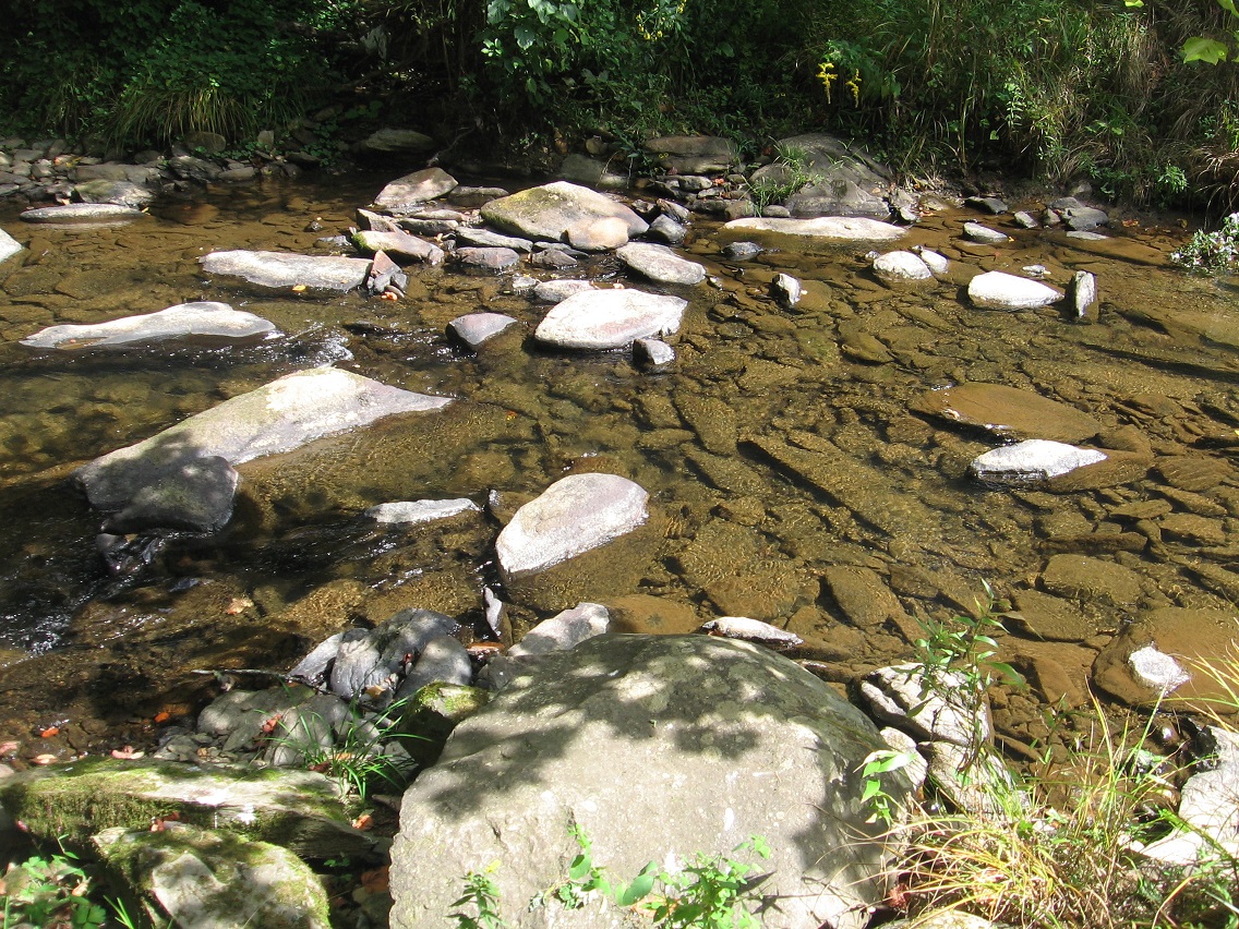
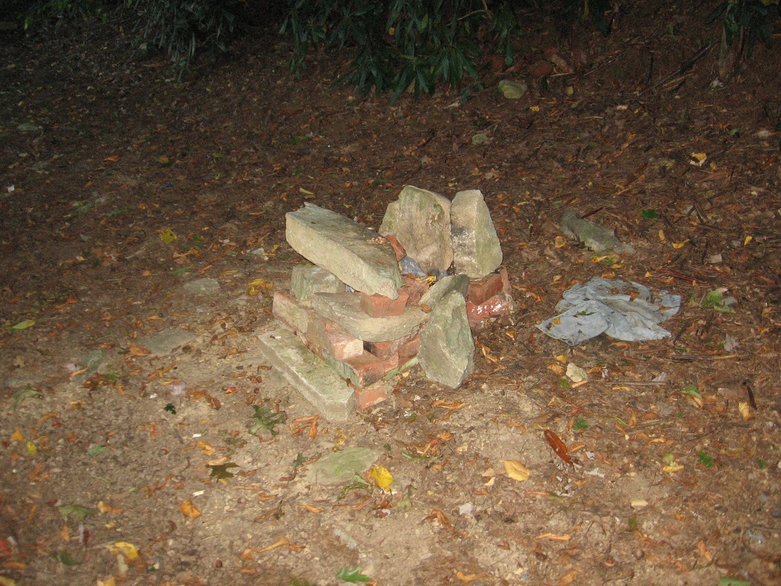
Upstream: the banned waterhole again. In the center of the photo you can see a rather complex rock cairn that has formed on one of its larger rocks since last weekend. Nice.
Waterhole > Finger Lake, its namesake, weed bedecked island ablaze in the sun. Actually about the only thing you can make out on the island is the small Pinkie peninsula, emerging from the near side of the overexposed region and pointing right at us.
Finger Island and another mysterious thing about it: what appears to be some kind of purposeful stick creation near its eastern tip. Looks human-made to me.
More close up. What is the purpose of this?
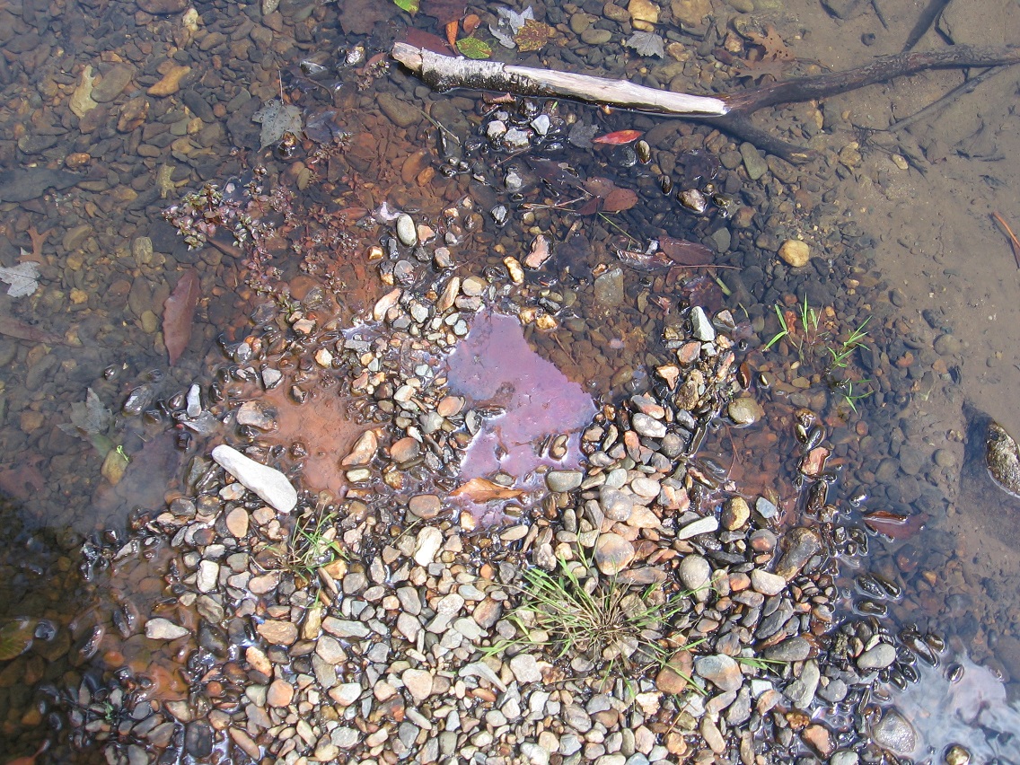
Discolored, oily water at the tip of the finger.
The small rocks composing The Finger continue underwater past this tip.
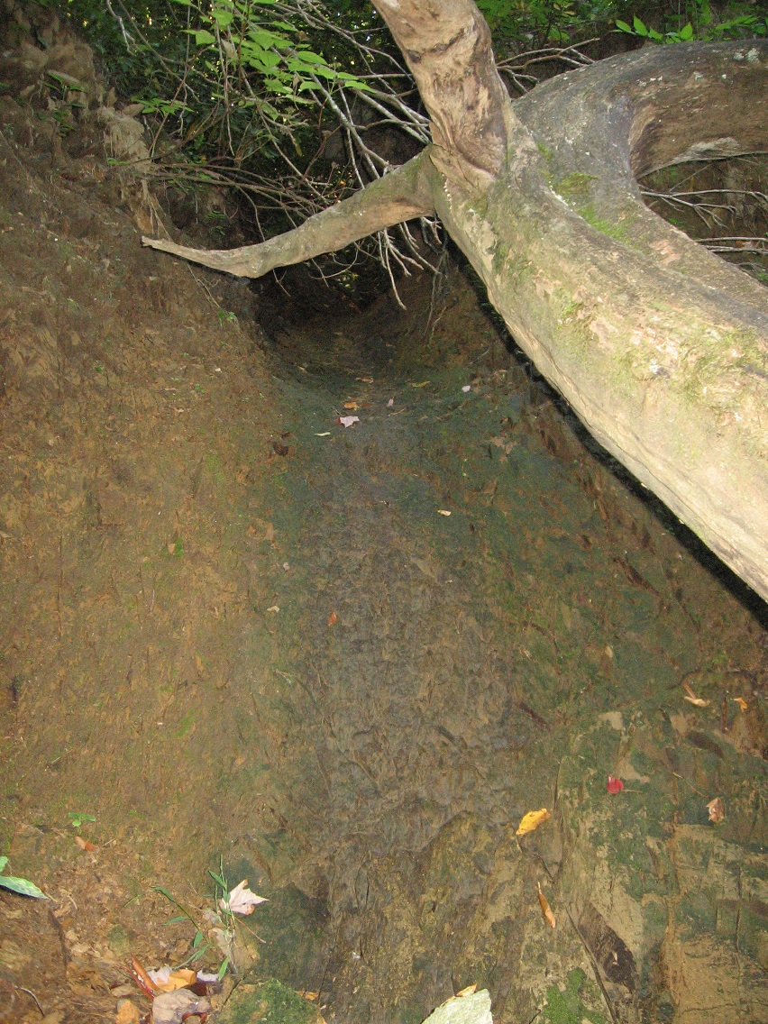
We now move down and across Leola Creek to the new part of Rediscovery uncovered the weekend before this one. LINK . The below photos show more details of a central gully I mention at the first of that earlier post I just linked to, which in heavier rain, would create quite a nice little waterfall I would suppose. I don’t have a name for this “falls” yet. Could this possibly be the fabled lost Marble Falls, where marbles fall back into reality that have been misplaced in previous times?
Another shot of an old road that bisects the gully along its way. This is the one that runs both north and west of a Blue Mountain water treatment plant.
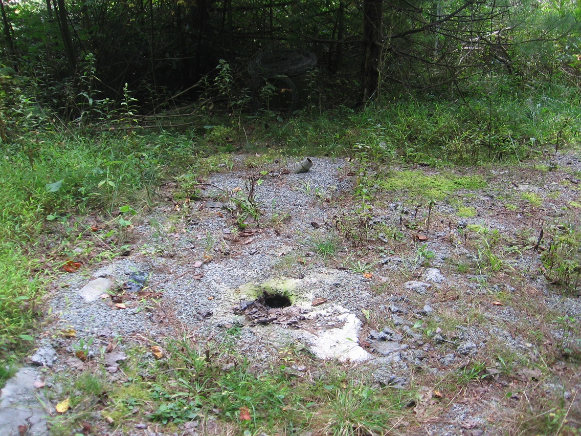
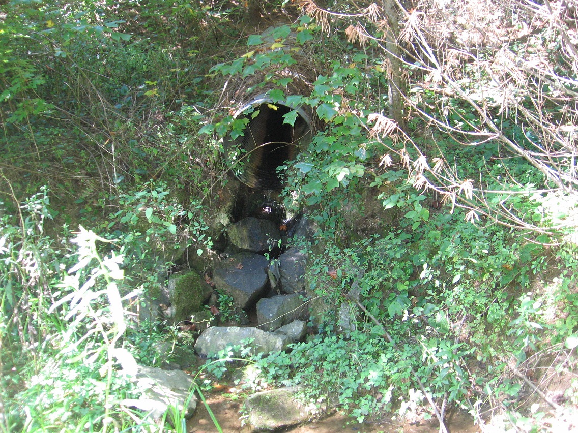
Another surprise: the stream that sometimes flows through this gully with the projected falls has a very physical and concrete source.
I actually looked up this model and found the following link:
If we continue east along the road pictured above, we soon encounter a wetter, weedy part that’s harder to traverse, acting as a pretty efficient barrier between Water Plant Road to the east and points west (like the gully). This colorful log was found on the other side of the seep.
Continuing along this road toward Water Plant Road we encounter yet more evidence of camping past and perhaps even present.
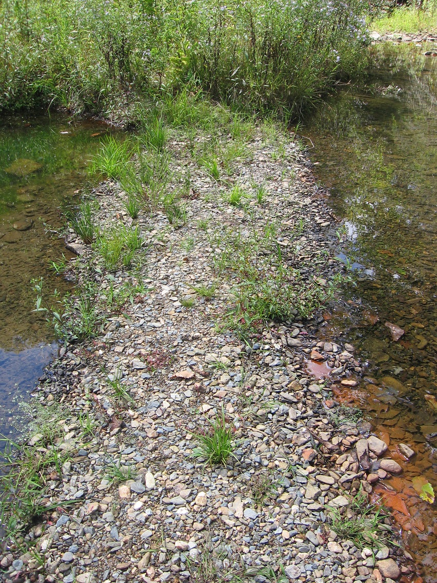
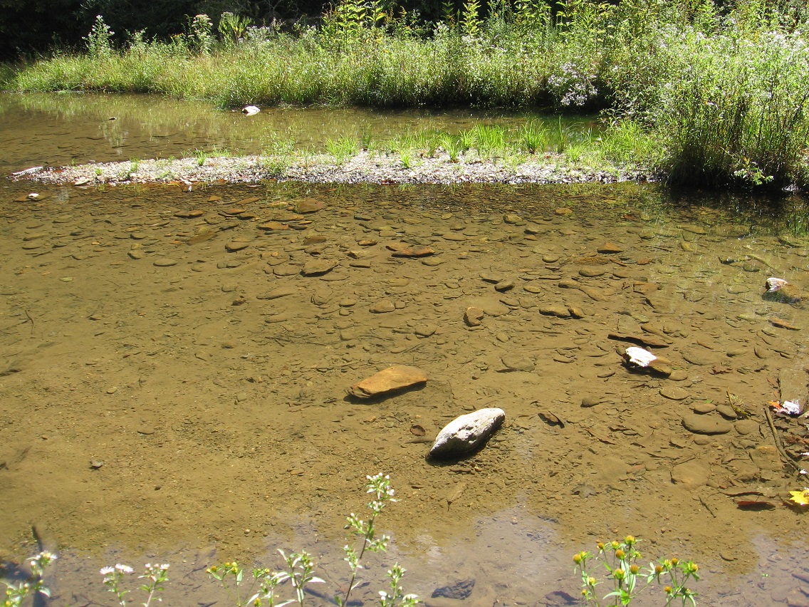
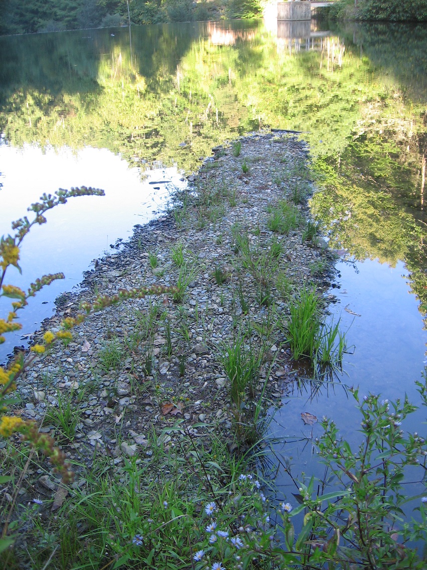
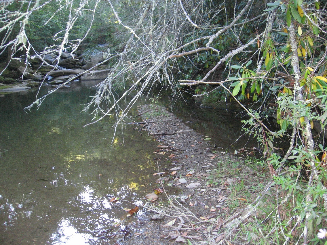
Beautiful, rocky Leola Creek on the town side of Rediscovery, a little downstream from the reservoir we’re going to be talking about a lot in the next several posts. I now have a name for the large island in the pool (Finger Island) but not the pool itself. Heck I suppose I’ll just call it Finger Res., after the dominating island. Makes sense for now.
And here it is: The most prominent “finger” (finger-shaped rocky penninsula) of Finger Island protruding into Finger Lake or Reservoir. It’s really quite an odd phenomenon, and to double the mystery there’s another similar if smaller finger on the other side. I should call it Fingers Lake/Fingers Island probably, but those don’t have the same ring as Finger Lake/Finger Island. So I’ll just credit the more prominent example in the names.
This is, by the way, what I’d consider a classic shot of The Finger from the path running along the north side of the lake.
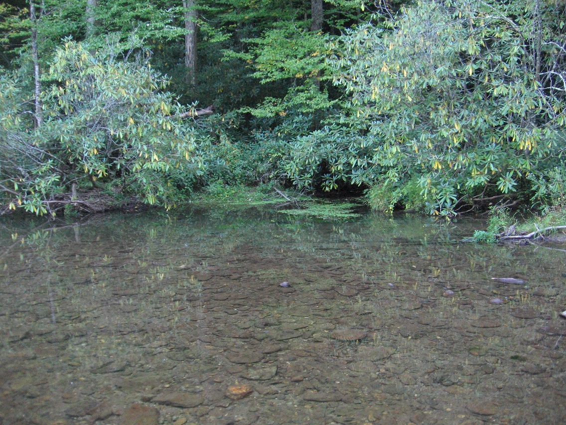
Finger Lake as seen from the west. I was on the lower rocks of the banned Rediscovery waterhole I’ve mentioned before when taking these shots. I dare not go further upstream for fear of being seen by passing cars on Leola Creek Road, especially a police car. 😮 It’s difficult to see someone from much of Finger Island from the same road.
The Finger itself from the bordering weeds. It’s really an odd phenomenon. Basically straight as an arrow and equally wide down its approx. 20 foot length it is, until we reach a neatly tapered end. Through information that’s starting to stream in from other directions, let’s say, I think an association with The Point of Herman Park’s Drink Lake may be in order. I’ll go into that further later on, if so.
The Finger from another point of Finger Island.
A bay on the south side of the lake as seen from the island.
The second, smaller and slightly lower “finger” of the island. I think I’ll call it “The Pinkie” or just Pinkie. But you can tell it is of very similar design. The further description of “spookily similar” is not out of order here I don’t believe.
The Pinkie points directly toward the banned Leola Creek waterhole in the background.
Finger Lake dam on the pool’s opposite side from its dominating island.
I viewed the first half of Carrcass-1 again yesterday while the wife was in her jewelry class. Again impressed by the power of the synch, especially the central “Captain” region. Is that predicted by GNIRPS like some other parts of the synch?
Well, can’t get into the GNIRPS database right now. Perhaps best to talk to Hucka D. instead.
Hucka D.:
GNIRPS is a place of marriage. Frank and Herman; red and green. Then that makes… you say it…
bb:
Then that makes the trench in Head Trip where green and yellow overlap red and yellow a marriage bed. Conjunctio. We’re number 1, and so on.
Hucka D.:
In Bridee marble speak — I’ll go this time — Red and [Yellow and Odd] are the 2 inferior marble colors to superior Green and Blue. Shooting reds and yellow all day is shooting at the inferior races of red and yellow by the green and blue races, if you will. And shooting or bumping heads/bodies with the inferior red and yellow marbles by the superior blue and green, like your Bob Underston (Blue), like my Ed Edwardston (Green). But[ in the end] they get their due.
bb:
I do.
Hucka D.:
Queer. Anyhow, to Carrcass-1 and swiftly.
bb:
Well, I realized that the cardboard city of 12 Oz Mouse is Blue Mountain, which Don stepped out of, and then *I* stepped out of this summer through Bigfoot — a big step as it were. The reason I think this is that *Peanut* disappears soon afterwards, and that stands directly for the Peanuts region inside the Blue Mountain Urban Landscape which was replaced as a toy happening focus by Bigfoot. So Peanut disappearing in Carrcass-1 is symbolic of this switchover. Actually Golden Joe disappears first. This leaves only 12 Oz Mouse or Ozmo himself, and his sidekick Skillet. Then I think the hole Ozmo finds is further up Leola Creek than Bigfeet, or Wallace/Tinsity, where the F&H/Sunklands Blog began as it were.
Hucka D.:
As it is.
bb:
The bug goes down as Don tries to piss (down). *Freeze* the (12 Oz Mouse) DVD, then unpause as the green liquid erupts *up* from the ground as the narrator for Don Aman says “it finally came” — the yellow piss erupts *down*. This the concept of Greenup/Yellow Down, Hucka D.
Hucka D.:
Indeed it is. Or was.
bb:
Then Ozmo and Skillet meet the 4th Angel or 4th Angle. An erection occurs. Mouse and Skillet seem to have made a house in the desert in the meantime.
—–
—–
bb:
In looking at that video again, it looks like Ozmo calls it New Agel instead of New Angel or Angle. Like “New Age”. He says this first after Peanut disappears with not even a burn mark.
Hucka D.:
Keep watching…
bb:
Then they reach the desert in the wastelands.
Hucka D.:
Maistelands. Had to be said.
bb:
A big bug burrows backwards. 4 b’s there, Hucka D.
Hucka D.:
A desert is without water, so this (resulting) hole could be the source spring of Leola Creek, an Appalachian Spring after all. Leola Creek then flows by Peanuts in the Urban Landscape… by Bigfeet before that.
bb:
Is it Bigfeet or Bigfoot?
Hucka D.:
Your choice. Like feet or foot. 100 foot long swamp or marsh or 100 feet long swamp (or marsh)?
bb:
Greenup is a reverse process from Yellow Down. This is the 2 sides of Green Oz at the head of Leola, centered by Wallace/Tinsity.
Hucka D.:
Correct.
Carr.:
Corr. ect.
bb:
Hi Carrcassonnee!
Carr.:
Harr.
—–
bb:
They built that house from their own spit. Spit in the sand day and night. That’s either our present house or our future house or cabin in Blue Mountain, perhaps near or next to Leola Creek, Hucka D. Or perhaps Green Stream over in Whitehead Crossing. But it’s a makeshift house.
He comes out of the house and states that he strongly needs a car. And then a city to drive it in. And that’s when he or she showed up. She/he starts shooting at Ozmo and Skillet. The screen freezes along with the Mexican music just before the attack, but not of my doing this time. Then during the attack Ozmo suddenly remember they have a force field and activates it, forming a protective sphere around them. Couldn’t this be the Rainbow Sphere Lisa The Vegetarian uses to protect or perhaps isolate Tinsity? Quote here…
Wallace3:
Hi Tin S. Man! (waves across barrier tree). What’s cooking?
Tin S. Man (looking at ground):
Do you know there are *bones* here. Cow bones if I’m assuming correctly.
Wallace3:
Yes. I knew.
Hucka Doobie (flying as a giant bee-man now):
I’m trying to get inside the boundaries but can’t. I’m bouncing off the Tinsity limits like there’s some kind of force field around it.
Wallace3:
Spock’s Bones.
Tin S. Man:
Yes. I’m ahead of you now. Feel it.
Wallace3:
I invoke the 3333 spell, then.
Hucka Doobie (still bouncing):
A force field!
Tin S. Man:
I have found something. Digging. Bricks. I will take the bricks now. These tiles.
Wallace3:
Stop. Those are mine!
Tin S. Man:
Hmmm, looks like they’re within my boundaries now.
The spherical force field may be the same as the Rainbow Sphere.
Hucka D.:
You already said that.
bb:
Oh. Sorry.
Hucka D.:
Keep watching.
bb:
And then he/she walks up after the force field is activated. Mexican music starts again. Ozmo gets a metaphorical erection. “Howdy partner,” she/he says in a dual voice, “is that a gun in your pocket or are you just glad to see me?”. “No it’s a gun,” Ozmo responds. Dual voices, Hucka — mirroring the dual sexuality?
Hucka D. — also this figure isn’t the New Agel, but she mentions the entity as a way to escape the desert, it appears. At this, Ozmo tells Skillet to lower the force field. He thinks he/she is okay since she/he’s also looking for the New Agel to quench her thirst and end the ominipresent heat.
Her actual name is Lee, and it use to be Heaven Lee. But… he has to kill her with a silver bullet she or he supplies. Kill him or her[ I meant]. And that’s The End of 12 Oz mouse, Hucka D. He has to kill him/her before he/she turns into the She-Wolf. Why the specific sex at this point?
Re: audiovisual synchs. Going to get into them more. Maybe not creating them per se (har!) but analyzing and extending what I’ve got. A lot! A whole lot. I remember the old good days — or simple days is a better way to put it — when there was just Dark Side of the Rainbow and not a lot else. But of course expansion and all the rewards is better. Still shocked… after all these years. But I want to pace myself as the music is (finally!) running out. The Residents pulled me through the carrcasses alone, but can’t depend on them forever. Will something else move up and take their place as prime audio movers? I suppose it’s possible.
But now I have the collages, correct?
And process art will evolve into something, extending from toy happenings in the Blue Mountain landscape (Billfork, Lion’s Roar, Whitehead X-ing, etc.). So I think it may finally be time to return to The Crossing…..
I’m studying toy avatars in ernest again. It still all seems to revolve around Whitehead X-ing. But I haven’t given up on a toy happening this fall at Bigfeet. Not at all. Long term this Blue Mtn. Urban Landscape is.
Independent film by Mmmmmm’s. Mmm (*not* Salad Bar Jack!) is lost in the urban landscape of Hermania, unable to escape. Hermania is a burg of quite some significance. Many Mmmmmmm’s live there. Mossmen too (exploiting Mmmmmmm’s?). Marbles as well. Bad ones. Bad ones? Dented.
Known as the first humanistic Mmm related film; beyond action-adventure. Probably low budget as well.
Film deals with rapid growth of Hermania, attracting the “wrong” elements, and the clash of cultures (3Ms). Must remember to be united through TILE and Meeting Rock! Must remember the cooperation of between their ancestors. Not devolve into the warring factions that caused the Wilderness battle, etc.
Must create a street map of Hermania — collaged from other maps. How? Hermania exists between Mars Beach (“south”) and Jupiter Beach (“north”).
How does actor-turned-director Gene Fade, struggling still to fulfill his ambitious (expensive?) “Fade To Moss” art movie, feel about a successful movie by an Mmm that’s pulling in the crowd (mostly other Mmm’s)? Not good, I’m thinking.
What is the population of Hermania? What of the pop. of the ethnic groups? Meeting Rock is seen as a landscape icon, like Hollywood Hills for L.A.