Category Archives: Haze County

Wild Wonderful Frank Park 02

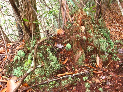
We’re still on top of Crack Rock mentioned at the end of Wild Wonderful Frank Park 01, taking pictures of interesting vegetation like this lichen covered reddish stump.

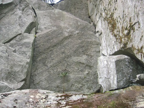
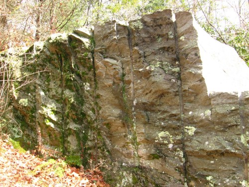
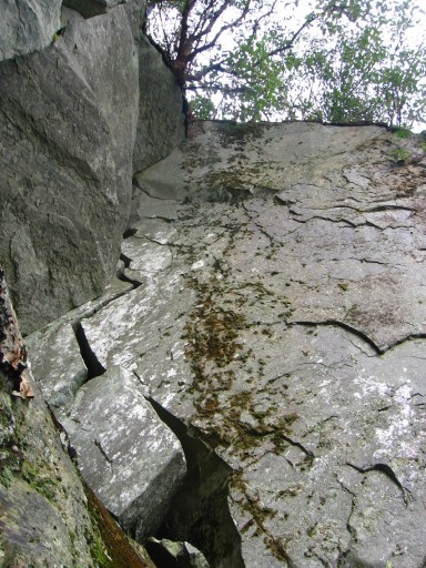
Then in heading back down to the Loop Trail, took more pictures of the side of Crack Rock…

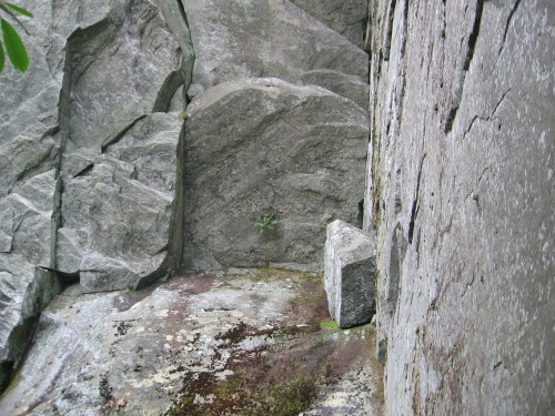
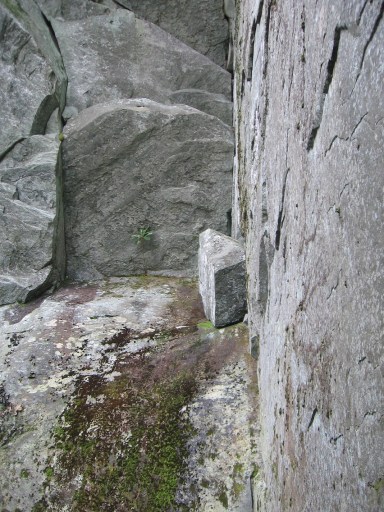
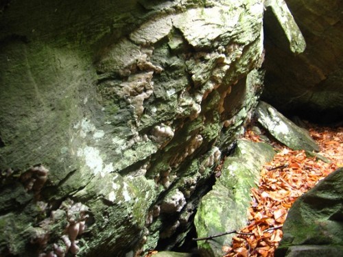
… including several of this especially picturesque setting on the rock wall perpendicular to the one with the crack, and right beside the crack as well. Seems to mean something in a larger way; I’ll let the photos do the talking for now.

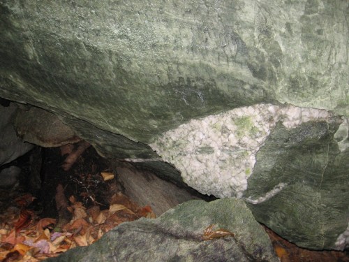
Just on the other side of the trail from here we have a small fissure cave with quite interesting quartz patternings going on.

Cracked Rock and its lightning bolt shaped fracture as seen over top of a trail ladder, the only one encountered on the loop and probably the only ladder on Frank or Herman Park trails as a whole.

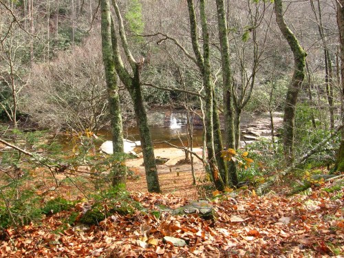
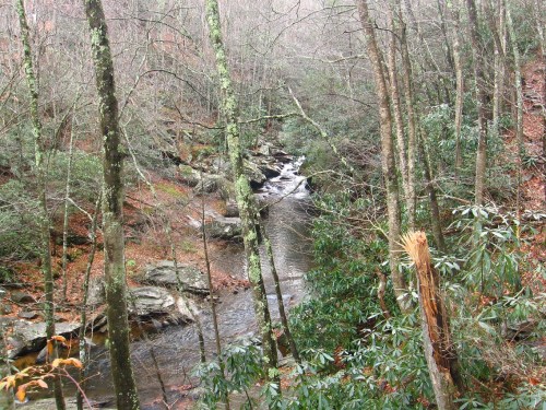
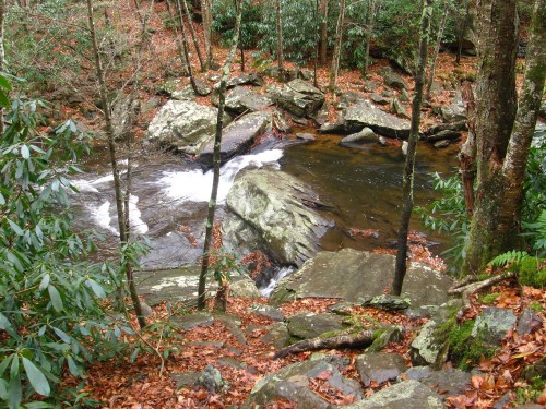
Continuing to roughly parallel Spoon Fork as we head upstream, more vistas of cascades are found on Loop Trail, although the drops tend to be smaller and less roaring as the stream begins to flatten out.

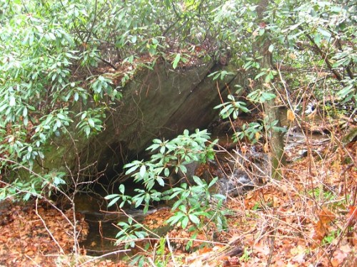
Evidence of past rock shaping. This is near the 2nd Spoon Fork portal featured, for example, in this Baker Blinker Blog post from way back in 2008.

Then to end my series of photos this fine day of hiking, I present to you what I later learned was commonly called a horsehair worm, but which appeared to me at the time (within Spoon Fork) as a sentient *string*. Never seen such a creature before, or even known of their existence. Frank and Herman Parks are teaching me in ways I couldn’t expect.

2 Comments

Filed under Frank Park, Spoon Fork

Wild Wonderful Frank Park 01

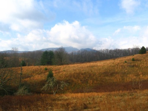
This is actually a snapshot taken the day before all the rest of this post and the next, but still in the same meadow as the second photo below, or on the Frank Park Trail Loop, the longest trail in Frank Park at approx. 5 miles.

View of Granddaddy Mtn. from the meadow, important in Mossman mythology as the source of their fabled Rock Gods.

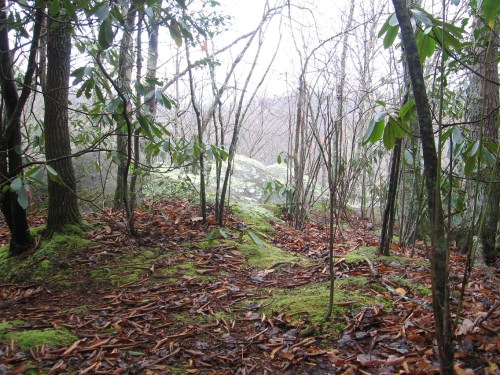
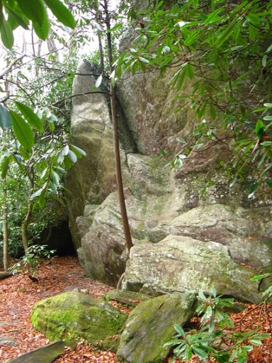
Then in continuing on the loop, we descend into the rhododendon forest and follow Bee Line Creek for about a mile to a mile and a 1/2. The trail runs by 3 larger rocks after the rather steep descent from the meadow, leveling off in the process as it begins to parallel the creek.

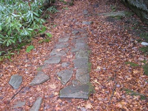
At the last of these rocks, the trail turns into a type of stone sidewalk for a brief spell before reverting back to dirt.

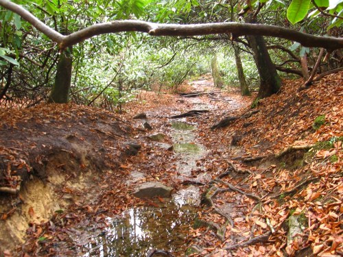
But before long, there’s another much more substantial stretch of the Loop Trail that turns into another element besides dirt, this time *water*. Yeah, that’s a stream actually running through the trail, and this continues for about a football field in length probably but which seems *much* longer. Not recommended for kids or novice hikers looking for a relaxing day out in the woods. Didn’t bother me much, though, since I had more involved reasons for being here (blog mythologies).

Even taking away that tough stretch where it turns to water, the Loop Trail seemed considerably longer than what I remember, with many rocks and places along the way seeming new to me. Is it possible for a trail to actually grow over time psychologically and perhaps even physically? I’m sure Hucka D. would give a resounding “yes” to this. He’s most likely right. I should add that I haven’t walked this loop in its entirety for a number of years, although I frequently hike various fragments of it. Loop Trail circumnavigates what in essence is the wild, beating heart of Frank Park, and helps the hiker grasp and absorb its raw, powerful nature better than any other park trail.

An example would be frequent vistas along its northern side of roaring Spoon Fork rapids and cascades such as those pictured below. Spoon Fork is the largest stream by far in either Frank or Herman Parks, and could be classified as an actual river. It is mentioned in the Baker Blinker Blog most prominently through the Portal System supposedly uncovered by Mossmen as they continued to settle the area of Frank Park. They did not create it however, making the system of unknown, ancient origin. Was it designed by those Rock Gods we mentioned before? I’ll hafta talk with Hucka D. about that whole, large subject soon.

Then we come to Crack Rock, which is, no, not an entrance to a den of illegal substance iniquity but a simple lightning strike shaped crack running perhaps 30 feet up one side a large rock. We’re still on the northern side of Frank Park and fairly high above Spook Fork after just accomplishing a steep ascent. We’re also heading upstream on Spoon Fork after descending along (and even in!) Bee Line Creek up until reaching the northern corner of the park, where Bee Line also empties into Spoon Fork at around the 2 mile point in our loop.

With a bit of effort, I was able to climb to the summit of the rock pictured above, where interesting patches of vegetation were found.

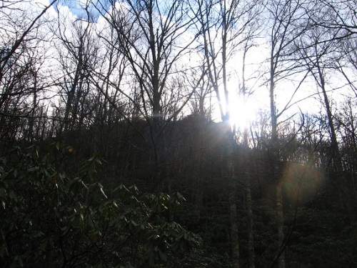
It was also from this summit that I was able to glimpse more, larger rocks near the top of this ridge, which I decided to name Sunrise Rocks because the sun was rising just above them as I took the below photo. Thick rhododendron, however, lies between me and these rocks higher up on the ridge. I decided a visit would have to wait until another time.

Wild Wonderful Frank Park 02

1 Comment

Filed under Frank Park, Spoon Fork

Return to Cache Creek

http://bakerblinker.wordpress.com/category/hermanfrank-parks-rl-parks/cache-creek/

Today I returned to Cache Creek in Frank Park. I first uncovered this stream last December, and was amazed at the magic (white rocks, cascades). The return trip proved to be less inspiring, and I think it was all the newly fallen leaves covering up a lot of the creek bottom and sides that were to “blame”. The rhododendron around the creek seemed harder to get through this time, and I also got the dreaded “wet foot” when I slipped at one point a bit. Still I was pleased to find the open space next to the largest cascady area (most easily accessed, perhaps, at the top of the horseshoe bend of the creek coming before this) still pertinent seeming, and maybe the site of a future toy happening or future camping spot. I didn’t take any significant pictures this day.

Leave a comment

Filed under Cache Creek, Frank Park

“Don’t…

… you think Yards Mtn. was created first, Hucka D.?” (pause) “Hucka D.?”

Looks like I’m on my own tonight, maybe. Well, that’s my theory now — that Yards Mtn. came first and Wealthy Mtn. second. *Health* lake was the last lake added to the Herman Park quad sqaud, after Heart, Head, and Hands. Heart (and then Head) may have been first, but corrupted (by plastic people?). Health Lake across the Way from all the rest was last, and also Wealthy Mtn. formed after the rest of the area of Herman Park. It was furthest away from the town of Boulder. But what of Frank Park? Was Frank Park already there before Herman Park? Or was Frank Park created from Herman Park in some fashion. We know that Herman Park is priceless and Frank Park has a very very high price but a price nonetheless. We know the priceless aspect of Herman Park is through TILE Creek, or the existence of such. This is the “1” that makes 6 into 7, or equates it spacially with Frank Park.

So the order of lake creation seems to be: Heart, Head, Hands, and then Health. Health Lake may have originally — briefly — been named Hustle Lake per the 4H history of the slogan. Also might be significant that health rhymes with wealth, and part of Benj. Franklin’s “Early to Bed” quote (Early to bed and early to rise makes a man healthy wealthy and wise). According to the 4H history article linked below, O. H. Benson came up with the 3 leaf clover emblem of 4H in 1907 or 1908 (with the H’s standing for Heart, Head, Hands), then changed to a 4 leaf clover in 1912 when “Hustle” was added. But the article also mentions that another man, O. B. Martin, suggested changing Hustle to Health soon afterwards. So the emblem is really the work of two men, perhaps just like the arrangement of Herman Park lakes is the work of two. Maybe Wealthy Mtn. has a different patron, so to speak, than Yards Mtn.?

Interesting also that the name “Wright” is removed when 3 leaves change to 4. Reminds me of 2/3 rights don’t make a left quote as well, with the “left” being the 4th, “Health”.

Hucka D.:

The 3rd is Hands, but the 4th was created to act as a backup to the 3rd, in case a further corruption was enacted. The 3rd is the son accepting the energy of the father. Winesap.

—–

Oh, and the 4 Valleys region next to Health Lake may have something to do with this differently “spinning” energy of the 4th as well.

1 Comment

Filed under Frank Park, Herman Park, Wealthy Mountain, Yards Mountain

Brown/White

Resonances:

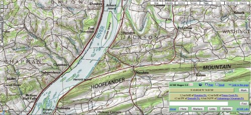
Whites Island and Browns Island:

Little Brown and Little White bottles of Lion’s Roar, just laid down on the ground in prep for Sandy, perhaps not to be set up again until the spring or later.

Bowers Island and Browns Island:

Also important, and points to Zircon (formerly Confederation), the central province of Wazob, which is also traditionally assoc. with the color brown as a whole; contains Brown and Bowers territories. I thought of Zircon when writing the little tale of Knock picking up Little Brown and becoming gigantic in the process (*Chuck* Laser is biggest basketball star of the Zircon Zappers). Like my “High Octave Story” set in Zircon. Charlie Brown is nicknamed Chuck in Peanuts.

Notice also these can translate to possessive words, like Brown’s, Bowers’, White’s. Means bottles own the islands?? Is this a message from the prostrated bottles themselves? Do they think they’re dead now?

But I found all this in looking at the area surrounding the only US Pallas (extreme left on map), which Poe’s Raven perched on all during his poem of the same name. Pallas=wisdom.

Also perhaps notable from map: Red Cross village found at mouth of a Mouse Creek, which also contains Urban upsteam. Also compared Lion’s Roar to cardboard city of 12 Oz Mouse just recently, and also Dead End Street unites the two (with a Little Green bottle at the end of it according to Knock, which actually doesn’t exist in Lion’s Roar, although you have a larger green bottle that he may actually have been referring to).

More:

Yards Mtn. as a whole as Pennsylvania, the location of the map containing the islands and Pallas above. Pennsylvania has also been strongly related to Herman’s Grave, similarly on Yards Mtn. and at the edge of a meadow. Specifically, the sw corner county of Greene.

1 Comment

Filed under Byng, Herman Park, MAPS, Pennsylvania, Toy Avatars, Wazob, Yards Mountain

Heart O’ Herman Park

Since I’ve gotten around to writing the text for this post, the appellations for the lakes pictured below have changed. Head Lake in the map has “reverted” back to Heart Lake, and the actual Head Lake appears to instead be the larger body of water at the bottom of the map, here called Heart Lake. So the two names have been reversed in the meantime. Drink Lake, to the left, will probably be still known as this in future posts, although it is understood that behind-the-scenes planning had it at some point as Hand or Hands Lake. Instead, at some stage in the development, the “Hands” part was moved to the opposite side of the stream in effect, or made the *source* of the stream, hence Hand Spring, which begins with “hands” as well (upper center of map). The implications for this move are quite enormous for the Frank Herman Einstein blog.

And now Bass Ackwards Lake (map’s left) is now called or implied to be Health Lake, completing the 4H analogy. And all this is now directly assoc. with the state of Arkansas through its own, strong 4H resonance, including containing the only US Heath and Heart population centers. Health Lake also could be different from the other 3 named Herman Park lakes in that it might be spinning in an opposite direction from the others, whatever that means. One clue to this is the removal of “Wright” from old 3 leaf clover emblems of the 4H club when a 4th “H” is added, which might mean that the one *left*, the 4th (Health), is spinning in the opposite direction (or opposite of (W)right). But what is this spinning if so? Could it be the direction of time itself?

Leave a comment

Filed under Billfork, Byng, Drink Lake, Fork Creek, Great Meadow, Green Oz Creek, Hand Spring, Herman Park, Hermania, Jonesborough, Tile Creek, Wealthy Mountain, Wedge, The, Yards Creek, Yards Mountain

Byng/4 Valleys Map

See this map for details about the Lion’s Roar/Gold Bug area: Kansas & Kentucky & More.

2 Comments

October 23, 2012 · 6:42 pm

4 Valleys

Another remarkable hike today on what could be my last day off for Fall Hiking Season. Short-ish but sweet. Hiked the 4 Valley region again, with 2 big finds. First the discovery of what I call a Southern Passage (or Lower Passage) up and around these ridges, staying close to the bottom instead of the top. All 4 ridges can now be accessed through this lower passage — before, for example, I’d have to huff it all the way up to Louisiana on the 3rd ridge over (counting, once more, south to north), to get from 2 to 4. Now I can significantly undercut that ascent on this 3rd ridge. 2 prominent flat parts (or platforms) on ridges 2 and 3 have now also been found, as yet unnamed. These would be similar to Louisiana itself, although neither approach the size of Kentucky. The larger of these 2 new platform finds on the lower ends of the 4 Valleys ridges might be another site for some type of art happening, and maybe even a more permanent structure might be built there, like some type of earth lodge (?). Anyway the discovery of this Southern Passage alone would have made my day. The 4 Valleys region is becoming tightly bonded with Byng, and I believe they actually make one region between them, separate from any others around Wealthy Mtn. or neighboring Yards Mtn. for that matter. So Green Oz Valley to the west seems separate, and the whole, extensive Lost Valley region (an area I thought of exploring today but decided against it in favor of 4 Valleys) also appears separate, and may be dividable into several sub-regions itself.

A 2nd major find is the discovery of another cave in the 4 Valleys regions. We already have discussed Prism Cave, and also a place called Other Cave. Well, as it turns out Other Cave has a twin cave sitting right next to it, and more enclosed or *closed* in, as well as probably larger. So I’ve redesignated Other Cave as *Open* Cave, and the newly discovered cave next to it becomes Closed Cave. Together they are also the Twin Caves, I suppose.

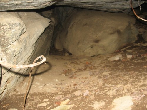
Close Cave had most definite signs of human habitation in the past, and may have been the site of a *stove*, if I’m understanding what I’m seeing in and immediately around it. A number of bricks remain inside (where the stove sat?), and then a stove piece was found just outside the mouth of the cave, which seems to have been artificially enhanced with the creation or reinforcement of a ledge. I’ll get into more of this in my post devoted to the cave just below.

—–

“Hucka D., who lived in this cave, or at least stayed there? The ceilings seem quite low for any extended stay. But then there’s the matter of the possible stove.”

Hucka D.:

Chuck lived inside. (pause)

bb:

Was he a little person? Munchkin, I suppose?

Hucka D.:

No. (pause) Wait, yes.

bb:

The 4 Valleys region is becoming super important.

Hucka D.:

Each valley a story, each story a valley.

bb:

Maybe we should return to our Lion’s Roar evolving story, Hucka D.

Hucka D.:

Me. (pause) Me, me, me (!)

Leave a comment

Filed under Herman Park, Wealthy Mountain

Closed Cave

Amazingly bizarre find yesterday while hiking the 4 Valleys region on the west side of Wealthy Mtn. So bizarre it’s difficult to write about…

Okay, here goes: found a cave, and one sitting *directly beside* another I’d already classified as “Other Cave”, now called Open Cave. The new cave is contrastingly called *Closed* Cave. Together they also make a type of twin caves site, almost like 2 side-by-side rooms. They lie near the head of the 2nd valley of the 4 Valleys region, counting from west to east (see above map).

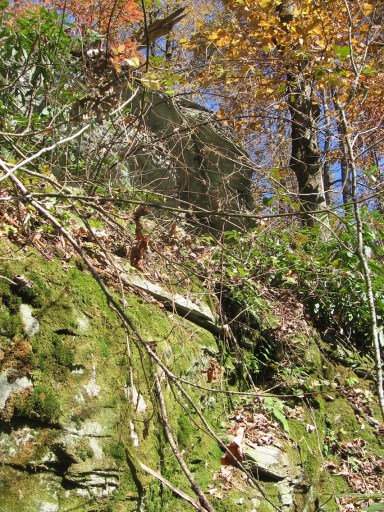
Below we have just a small sample of the protective vegetation surrounding Closed Cave on basically all sides, even the top. It’s *extremely* difficult to reach, although one assumes this was not the case in some bygone day…

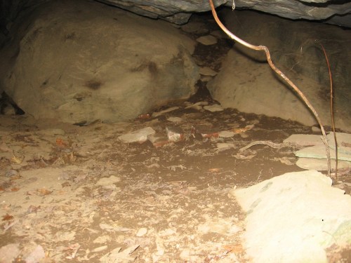
… since within this small cave, perhaps 20 feet deep (similar to depth of nearby Prism Cave, then), we have a number of bricks, obviously moved here by human hands.

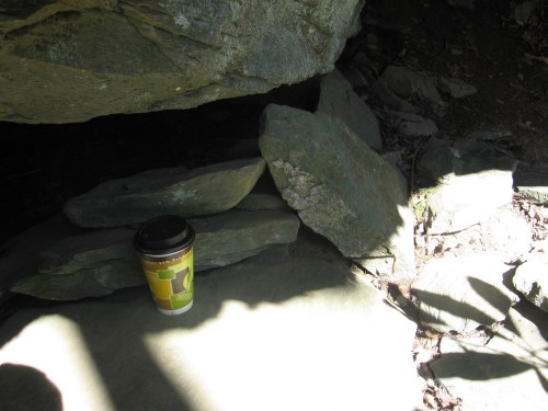
And moreover, we have clear signs that the entrance to the small cave has been compromised, seemingly by reinforcing the ledge it is on. Is *this* where the stove sat instead of inside?

Because there’s also this evidence that a stove was indeed here, although I can’t make out the brand because of the worn letters. This lies just below the above pictured ledge where I sat my coffee cup.

As I said, Closed Cave is essentially inaccessible from any direction. I actually went around neighboring Open Cave and entered from the back, the only way I safely knew how. And even then it was tough going through rhododendron and briars. I was crawling on all 4s throughout.

Closed Cave rocks from more of a distance. What is the meaning of all this?? And who “lived” there???

Leave a comment

Filed under Herman Park, Wealthy Mountain

Lion’s Roar locations

Maps of Lion’s Roar. First Pot and Center Pot in the upper part are not shown — they lie in the direction beyond Rob E. Center and Door Pot, and like them act as supports for the passing rail.

The second identified way of town shown here: Side Way. It could represent the main business part of Lion’s Roar. Now to find some “people” to populate the town with. Anyone? (Believe me, they’re all clamoring!)

Leave a comment

Filed under Byng, Herman Park, Toy Avatars, Wealthy Mountain