
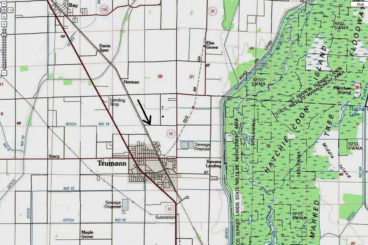
… gives way to Trumann.
Cheiro
http://en.wikipedia.org/wiki/Cheiro
Cheiro: Palmistry for All at Project Gutenberg
http://www.gutenberg.org/files/20480/20480-h/20480-h.htm
INSERT: Picture of my hand I accidentally poked at work with a pencil on the Life Line, a day after being poked several times in the same hand by thorns while above the Head Line itself in Herman Park. I noted the connection between the multiple pokings at the time, but didn’t realize until just now, in looking down at my hand, that the last poke occurred precisely on the Life Line. The other pokes from the day before came on the thumb of the other hand (right).
I’m wondering if this poked point on the Life Line represents The Present, or a specific point in Herman Park, perhaps the position of Shark Rock or what I now may call *Poke Rock*, which has an actual hole going all the way through it.
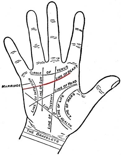
Also confusing to me now is that, traditionally, palmistry’s *Head Line* lies below the Heart Line apparently, contrary to what some Internet sites say. So, top to bottom: Heart Line, Head Line, and then Life Line as the 3 major lines of the hand.
I also wanted to re-examine the Hand map of Baxter County Arkansas talked about before in relation to Sharieland (May post).
Here’s the original source:
http://ozarkshistory.blogspot.com/2010_12_01_archive.html

Eye in Hand.
—–
Hucka D.:
Closest to Herman[‘s Mansion]. Dewey defeats Truman. Dewey is Herman. Head Line includes. Um. 2 Hermans on either end. Trumann near Herman Arkansas.
—–
Interesting: “H E A D” and “lines” (grid overlay).
http://www.datasync.com/~rsf1/sfran.htm
Position of Trumann, Arkansas related to this grid. It lies basically in the exact center on the western edge.

Translation: these grid lines are all *head lines*, like the famous Chicago Tribune’s “Dewey Wins”. This is also the location of the St. Francis *Sunk Lands*.

In the known history of the world, no other earthquakes have lasted so long or produced so much evidence of damage as the New Madrid earthquakes. Three of the earthquakes are on the list of America’s top earthquakes: the first one on December 16, 1811, a magnitude of 8.1 on the Richter scale; the second on January 23, 1812, at 7.8; and the third on February 7, 1812, at as much as 8.8 magnitude.

Detail from above map, zooming in. Notice that two names within the St. Francis Sunk Lands involve the two objects that poked my hand several days ago: Thorn [School] and Lead [Fork], situated within 1 mile of each other. These resonate with the thorny bushes that stung my thumb twice, and the lead in the pencil that poked my palm. Notice also there are *2 separate* Lead Forks on this map, not far apart, as if to reinforce this resonance. Am I stretching it? I don’t think so — just being a completist.
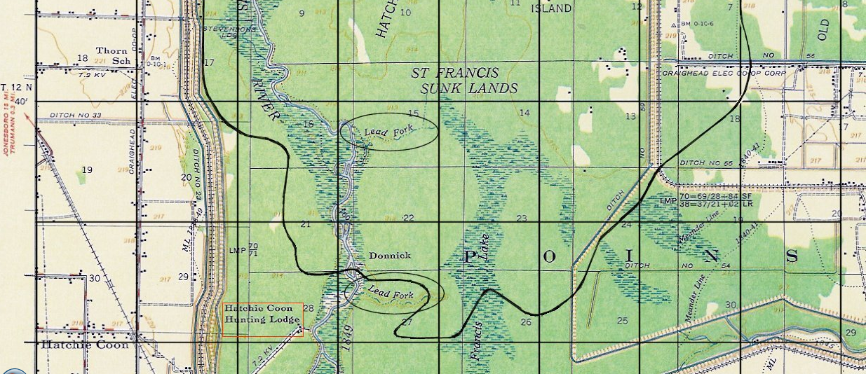
Robert Fritzius, the author of the attached article, noticed the repeated Lead Forks as well, along with some other name oddities within his pinpointing grid. I’ll quote them here, which includes queer info on Panther Island:
The clear cut area near the north end of Hatchie Coon Island was apparently a Homestead Settlement back in 1908. It is accessible from the east via Craighead County Road 82, which is also known as Hatchie Coon Road. [Added 06 Jan 2006.]
About a mile east of the homestead settlement just mentioned, is an area known as Panther Island. This area is enclosed inside an oval on the topo map. Shawnee Chief Tecumseh is credited with prophesying that a continent shaking catastrophe would occur on December 16th 1811. The name Tecumseh means Panther in the sky. Anybody having knowledge of how Panther Island came to have that name please contact the author. (Does Indian history in any way connect Chief Tecumseh with Lake St. Francis?) [Added 28 Feb 2006.]
He continues…
At the bottom of the section of the USGS topo map, shown just above, there is a ditch located along the inside edge of the eastern levee which borders the St. Francis sunk lands. The ditch is labled “Iron Mines Creek.” (This name is enclosed in a elongated vertical ellipse.) Anybody having knowledge as to whether there ever were iron mines in the St. Francis Lake area, and if so, where they were, please contact the page author. Also, on the St. Francis river, itself, near the former southern boundary of St. Francis Lake, are two annotations, “Lead Fork.” (These are enclosed in the shorter horizonatal ellipses.) If anybody knows what the meaning of these notations are, especially if the words “Lead” pertain to the metallic element bearing the same name, please contact page author. [See correspondent’s comments below.]
[Added 26 Feb 2006.]According to Scott May, a member of the Hatchie Coon Hunting and Fishing Club, Inc., the 1849 meander line (shown on the 1956 topo map above) is a misnomer, because when the surveyors came in the winter of 1849, the water was too deep in the area near Hatchie Coon. This fact is reflected on the surveyor’s notes available in the State Land Office in Little Rock, AR. [Added 08 Aug 2006.]
According to May, the southern “lead fork” is locally known as “Stud Horse Run,” and the fact that the same name appears in two different locations may be a mapping error. He says (with respect to the word lead, as in lead forks) “It is definitely lead as in the metal. I have never heard it pronounced as in to “lead” the horse to water.” [Added 08 Aug 2006.]
The hunting and fishing club, mentioned above, is located on the west side of the St. Francis river, southwest of the lower “lead fork.” On the 1956 topo map, it is located inside the red rectangle. [Added 09 Aug 2006.]
If there were any lead or iron mines, however temporary, in the Hatchie Coon/Saint Francis Lake area, then there may be old photographs, news clippings, or other narrative materials relating to them. These could be tucked away in albums or stored in other keepsake stashes. Any readers who can find any materials of this nature, which provide dates, names, locations, etc., of the mines, is heartily encouraged to contact the author. They can be incorporated on this webpage. [Added 08 Aug 2006.]
More info about an attached theory concerning a comet that passed by Earth at the same time the New Madrid earthquakes occurred by Fritzius:
http://www.datasync.com/~rsf1/1811.htm
He and others speculate the two events could be connected, and that the St. Francis Sunk Lands is the result of a meteor impact that caused the earthquakes (!). And of course, coming from my direction again, there’s the whole tie-in with Second Life’s Sunklands, but that’s too much info to cram into this post.
Filed under Arkansas, Herman Park, MAPS, Sharieland
Filed under Arkansas
Hopefully I can get to a “Wiltshire Trip, Days 03-04” post today or tomorrow — should be lots of fun to create, and I’m attempting to review my notes taken during the trip itself. VWX Town is pretty polished up, and even Cardboard Derek Jones seems happy with the state of Westside (yes, West*side*), what with its new beachy look due to all the palm trees. I’m not sure when the next town meeting is, but I have emphasized to Hucka D. that I want to attend as well. *He* can attend, for sure, but I also want to be there, as another representative for the “outside”. What is going to happen next for VWX Town? I believe the Stairs Gallery, now in two parts, will start to fill with some kind of art, and I’ve been exploring options a bit, with no solid leads now. Would like to have a new artist to work with, probably a collagist again. The Stairs Gallery will extend through the Big Boy tower, which connects the two duplicate gallery structures now (each is connected to Big Boy via a walking bridge). There are two small gallery spaces in Westside where an exhibit could exist. Must start thinking about The Table again now that The Table House has been established in VWX Town. Exciting! Have already identified a list of participants: Marty, Lemmon, Plant, Peter Gabriel (same as Peter SoSo?), Dr. Blood (coming from Aotearoa and northward), Knok perhaps. Maybe OWZ/Zapple, who has appeared in Table related posts in this blog before (or the Baker Blinker Blog — can’t remember which one), and he’s also in the Gilatona-Lis collages, like Knok and his Kniks — and Marty. Why is it so important to have a solo artist participating in carrcasses that is also in a band participating in same? I guess they have more perspective on the thing, and more overall involvement. Oh, I just realized according to these rules that *Waters* can sit in on Table meetings, since Pink Floyd (or Sink Floyd) is used, and also his solo stuff is used in both SID’s 1st Oz and Quadrospirited. We can ask him all kinds of questions about these 2 synchs that he participated in, along with all the Pink Floyd stuff like Dark Side of the Rainbow, of course (!), and also 2001-Echoes, etc. Should get him a variant name, though — can’t believe I hadn’t thought of including Waters until now. Preliminary variant name: Piney Ridge. Roger Pine Ridge (b. 1936).
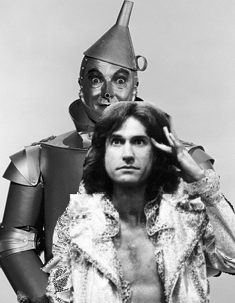
Ray Davies appearing to send a message about Dr. Blood. Wonder what it could be?
—–
Hucka D.:
We can’t accept Ray Davies at The Table except through Dr. Blood, who is from the future. That’s because he’s still imaginary.

Pooh searches for Master Bee at 4 Sticks, crossing Big Log to enter. 4 Sticks misses him. Gift of honey stuck on knob of Big Log. This is legend. 4 Sticks knows this is Crossroads and 49 x 61 = 2989. 2989 is the Master Number. 2989 is the Master’s Number.
Where does Pooh come from to visit 4 Sticks? He has planned and planned and planned for this trip.
Pooh sometimes said he was a swan and not a bear.
Is Master Bee Hucka Doobie? Did Pooh go to the wrong location (4 Sticks instead of Greenhead, where the Bees actually lived)?
Pooh visits Herman Forest, traveling from his home of Ashdown Forest in England. Ambassador?
Filed under Arkansas, Frank Park, MAPS, Whitehead Crossing
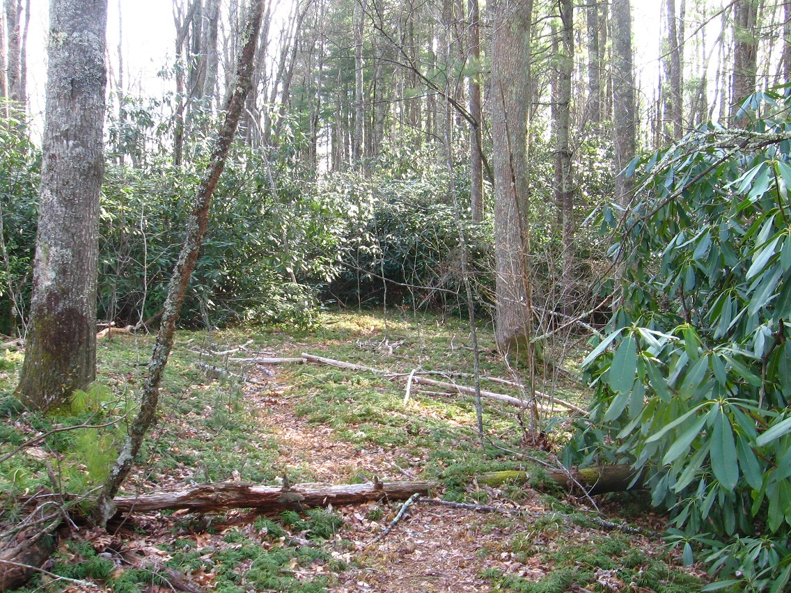
Heart Line is a path running from a postion between Heart and Head Lake to a road below Herman’s Mansion, cutting across the heart, as I interpret it, of his namesake park. I also assoc. it with the *Heart* Line on a *Hand*, positioned above the *Head* Line and whose lower end is just above the upper end of the *Health* Line. See the diagram at the end of this post.*
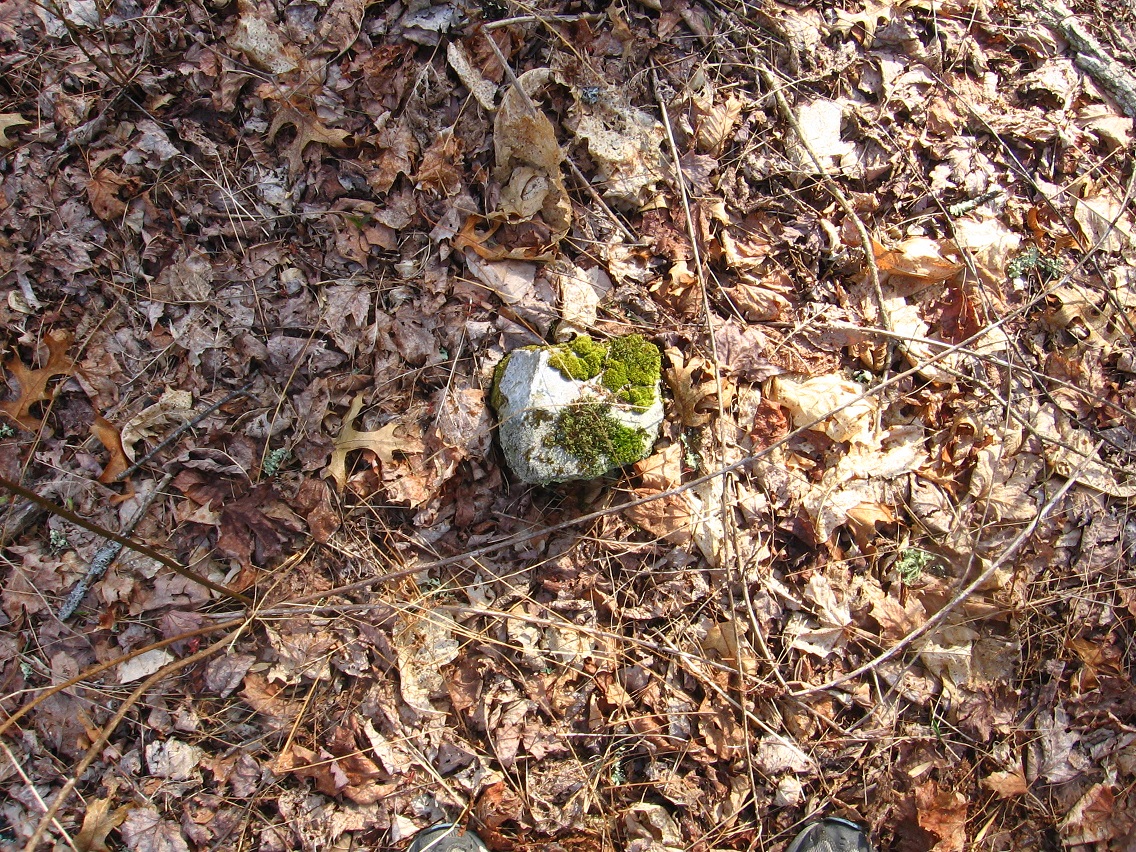
Below are two pictures of rocks found along Heart Line or Line of Heart. I’ll take more pictures this weekend, with accompanying text to be generated as well.


Neart a central point, Heart Line becomes clogged with rhododendron, but a path has been cut through the bramble still, allowing one to continue upward or downward. I should also note here that Heart Line is not an official hiking trail of the park, but has obviously been walked and even somewhat maintained as an unofficial one by certain groups of people in the past.

A holly tree marking an upper end of the meadow above Heart Lake — as seen from Heart Line, once more.

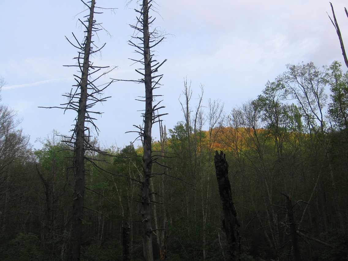
We move now to neighboring Frank Park, and a shot of a large and apparently dying oak tree just beyond the northern edge of the Whitehead Crossing region.

Greenmount from Green Steam on the lower edge of Whitehead Crossing, or what is also the upper end of Green Stream’s Korean Channel.
—–
* palmistry lines:
Hucka D.:
You wish to ask about palmistry and hand, heart, health, head. Yes, the blueprint for the lakes of the park all appear in Sharieland, in the various paths that cut across the land just below Herman’s beautiful mansion in the skies. But there may have been more human intervention in these plans than you presently suspect. Perhaps Herman knew of the Heart Line. Perhaps Herman knew of the giant hand[ as it were], below the mansion. Pull up that Arkansas hand from before — Baxter County I believe.
bb:
Here it is, Hucka.
https://bakerbloch.wordpress.com/2013/02/01/if-odd-crazy-things-become-consistently-common/

Well, certainly Herman’s Mansion is his beautiful *Mountain Home* in the skies, Hucka[ as you put it].
Hucka D.:
Herman wished to move his home into the mountains themselves, to become one with the mountains. He’s approving of your work, baker b.
MOUNTAIN HOME… FOLLOWING THE HEART. HEART LEADS TO HEAD. HEAD OF MOUNTAIN.
—–

Herman saw his mansion positioned between cue and eight ball on the Mounds of Venus; his grounds as a giant hand — fingers as roads. Mansion equals 12345 between the balls. Cue ball was oblique in his living days. Cue ball and eight ball are two of the mounds here.

Some say Herman saw his mansion in a vesica piscus lying between the two mounds. Some say he wanted his mansion to be the third, central mound, completing the hand of his land [Land Hand]. He wanted to rooftops to be equal in elevation to the basically equal tops of Cue and Eight.
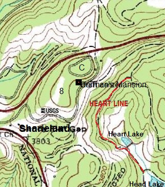
In this doctored map, the two mounds are clearly/obviously in the center: “8” marks the top of Eight Ball and “C” the peak of Cue Ball. Notice Herman’s Mansion is quite positioned between the two, reinforcing a vesica piscus interpretation. On this map I’ve also included the location of Heart Line (red) just downhill from the mansion, and also Head Lake and Heart Lake are marked.
—–
Hucka D.:
The 2 mounds would have to be those of The Sun and Saturn, don’t you think baker b.?
bb:
Suppose. According to this article…
http://psychiclibrary.com/beyondBooks/palmistry-mounts
Hucka D.:
Sorry to interrupt [again!], but that may be the Mount of Saturn and Jupiter, instead. I think this is what Herman thought when building his mansion. It is a cross between Saturn and Jupiter, the two largest mounds…er, planets I mean. And that makes sense when I’m looking at the map again through your eyes.
bb;
Yeah, thanks for adding that last part. Partial credit to me, then.
Hucka D.:
I’ll think about it. (smiles)
bb:
So here we go:
http://psychiclibrary.com/beyondBooks/mount-of-jupiter
http://psychiclibrary.com/beyondBooks/mount-of-saturn

But can we go even *further* with this, Hucka D., and say that *all* mounds of the hand have correspondence in the landscape around the mansion. Obviously I think we can say that the Mound or Mount of Apollo corresponds with that flat ridge I explored a week ago today, where I felt a strong presence of fairies. Traditional palmistry has it that if a mound of the hand is too flat, it represents a weakening of that aspect in the personality.
Hucka D.:
Yes. *All* mounds are represented in the landscape, as you’ve guessed. You better study the history of palmistry.

Filed under Arkansas, Frank Park, Herman Park, MAPS, Sharieland, Whitehead Crossing
This post covers one of the most shocking discoveries, certainly, from my Frank/Herman Park explorations. A fairly well traveled path, it seems, splits off from a main path near my Whitehead Crossing and quickly follows a ridge above Green Stream into the rhododendron. Already questions are arising: Why does a well trodden path just dead end as such? Do people just get off the path here, travel down it, and then find out that they — and everyone else that has done the same thing — just reached an impasse? Let’s let that question stand for a minute…
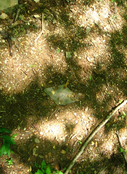
An interesting rock at the beginning of this side path. It seems to be some kind of marker. After finding out what else is on this ridge, beyond the rhododendron at the end of the above pictured side path, I believe I know what it could mark now.
In the valley below the ridge on the other side from Green Stream is found a camping spot, complete with a number of interesting rocks such as this one. Some of them could pass for primitively shaped headstones, for example.

Which brings us to this.
Remember me bringing up Head-Foot symbols a couple of posts back? Here’s a reminder.
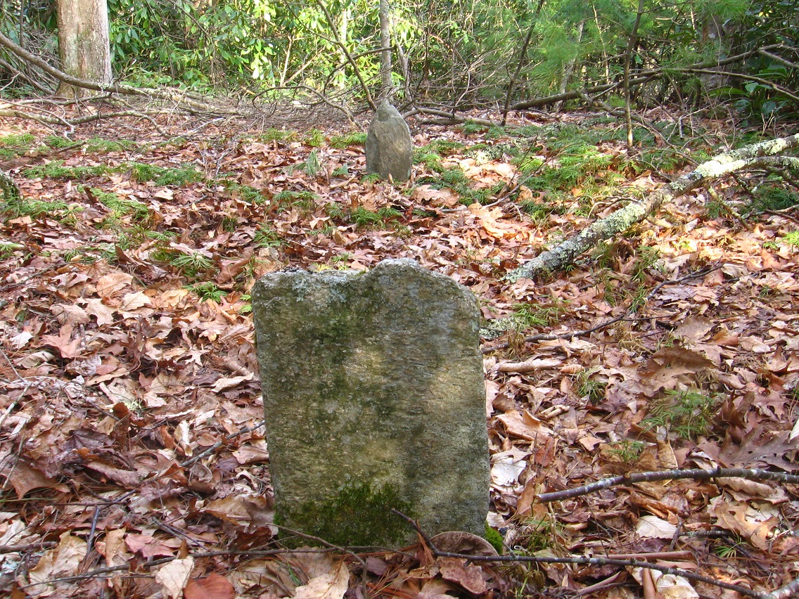
Yes, it’s what it looks like it is. Two, in fact. The place has been called Dogpatch. It’s what lies beyond the rhododendron if you kept following that same ridge further south. It’s almost completely inaccessible from all directions — there are, in fact, only two rather narrow ways in through the woods, both of which come up the ridge from the sides. Another camping spot has been created sometime in the past (pictures forthcoming, perhaps) in the same general area and on the same ridge (at the top of one of these two entrances), but far enough away that I’m not even sure that they knew what they were camping near. Perhaps they wouldn’t care. I think I’d care, without knowing more details. And for one of the two, there’s really no more details to find. That’s the major mystery part, it seems.
We have a dichotomy or contrast of something known and defined, and something unknown and not defined. We seem to have something smaller and something larger. We have a head and a foot in both cases. We have a mystery.
Dogpatch, Arkansas, according to the GNIS database, has a long list of variant names, but a list that can nevertheless be whittled down into 2 groups: those related to Marble Falls, and those related to the pre-Dogpatch and pre-Marble Falls designation of Willcockson, as displayed on this 1895 map.

We move beyond “Dogpatch” for now back to Concreek and this nifty view of an orange-red and pretty large salamander trotting around its bottom. It was kind enough to pose for me.

Filed under Arkansas, Blue and Purple Land, Concreek, Frank Park, MAPS, Whitehead Crossing
http://en.wikipedia.org/wiki/Rhombus
“You have to establish The Diamond first, for it is truly priceless. Then you can position all around[ it].” Words uttered to Lisa V. by Marty of the copse.
bb:
So Lisa V. comes to Amereca and plants The Diamond.
Hucka D.:
The Diamond saves you from the aliens. Carrcass-8.
bb:
Think I understand. It is the protective energy of Frank and Herman Parks. But if it is priceless why is it in Frank Park when Herman Park is suppose to be priceless?
Hucka D.:
The two parks had to be equalized. This was the way[ to do that].
bb:
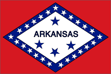
Interesting. Hafta think about that, Hucka D. So The Diamond is also Arkansas.
Hucka D.:
Yes (!).

In collage #3 from the new series, the night sky is illuminated through the stars on the Brazil flag, with Vega substituting for the star representing the capital of Brazil in Brazilia (probably need to study that city, come to think of it). Billville is revealed… Northfork does not exists by itself any more (nor does Billville). The subsequent collage after no. 3, or “Billfork Announcement” (no. 4), shows that this union did indeed take place… in the center of the (purple) night like a conception by a loving couple. This is an announcement, thus like the birth of a baby. The night is rescinded, and the ark in the picture is illuminated, seemingly by the weak light of a new, dawning day. The ark is the thing created, the center of the center, and in another way represents Arkansas or Synchpatch, USA in that state. The ark is in the center of the Billfork synch, as I’ve discussed it on the Paradox Forum, and then the elements to the right in collage #4 also highlight this center, or the boat seen during the Lucy in the Sky with Diamonds song floating on the central lake, and also the stack of diamond rings below it also referring to this central Lennon song (the “diamonds”) from his Beatles days. So the announcement is for Billfork, but also the center of the synch (art, L.S.D.) is highlighted to show its edge over the otherwise parallel SID’s 1st Oz… this would be the hint of platinum at its more manipulated center, which is also parallel to the Elmertown underground opposite to Billville in the Boom Dot Bust album… Elmertown, in the Billfork synch, represents video editing in ways, especially seen in track 16 of the album in the synch (the core Elmertown scenes, overlapped with 4 separate scenes of Irwin trying to convince the angels of the movie that he is also an angel.. the lost angel they seek… the “glueing of these 4 separate scenes together is parallel to the Martha Glue-it track (16) spanning all 4 scenes from the movie. This would also be like the collaging of the 3 separate towns of Leaksville, Spray and Draper in NC to make Eden , or L+S+D.)
Filed under Arkansas, Frank Park, Herman Park, MAPS
Lisa the Vegetarian wants me to start studying Winesap. Lisa the Vegetarian wants me to understand that the basic design of Herman Park comes from Arkansas and The Way and Winesap. 56. The end of March 2013 may be a decision point.
“The governments know of my return”.
“Quetzalcoatl?” I asked. “No: Master. Master Shake. Of the Aquamarine Rebel Strike Force.” “Great,” I answered. “Sapphire’s precious Aquamarine grew into the rebellious Aqua Teen and psychologically became split from her.” “Baby Jesus and the lasers,” came his non sequitur answer. Should have known.
—–
Lisa started with Hand + Head at the center of the Arkansas Line. “Go there,” Marty said. “Unite Hand and Head so that I will be revealed.” So she did and came back and he said she did pretty good for a young’n. She took it kindly. “Go there again and insert Heart.” So she did. She came back. “You did okay,” Marty said to her. “You did kind of good.” She was not fazed. She stood her ground. “Now the most difficult part, young lady girl woman.” Marty seemed drunk but wasn’t. “Create Health *off the map*. No… create *Hustle* and then change it to Health by spinning it in the opposite direction. Which direction are your creations spinning now?” Lisa had to think. “Clockwise? Yeah, clockwise.” “We are in the northern hemisphere so that is good and correct,” Marty answered back. “Now you must make the southern hemisphere come to the northern hemisphere.” Lisa was confused. She tapped her finger to her chin in thought. She thought of her mother Marge and her aunts Selma and Patty back in Wiltshire, England. But she was now in Amereca, land of the freaks and home of the braves. Indian braves, that is, before White Man took it all. White Buffalo Men like Marty himself. But she didn’t say this aloud. “Do I really *have* to go to Amereca?” she asked Marty, who then looked at her reprovingly. She knew she had to. She looked down at the books strewn around her feet, around the rock she sat upon. She was still in Wiltshire but she was in Amereca.
—–
She picked up one. “Light in August” was its title. She picked up another, and another. “Those are no good,” Marty said to her. “They’re all protected. No, you have to use *this* one.” He handed her a somewhat smaller book, a red book. No title. Instructions for building an ATM sperm bank machine? Not quite. Let’s look at Tennessee, a new blog category under UmapS, then.

“How confusing, Hucka D. Herbert Do*main* overlapped with *Main* Street Winesap.”
“Expand out please.”
So I did.

Winesap *and* Old Winesap. I knew, well, Herbert Domain refers in part to Frank Herbert, the famous science fiction author of the Dune series. In the Dune movie directed by David Lynch, an especially powerful scene is where *Paul’s hand* is inserted into a Pain Box.
http://www.technovelgy.com/ct/content.asp?Bnum=39
From the folds of her gown, she lifted a green metal cube about fifteen centimeters on a side. She turned it and Paul saw that one side was open – black and oddly frightening. Paul slowly put his hand into the box. He first felt a sense of cold as the blackness closed around his hand, then slick metal against his fingers and a prickling as though his hand were asleep…
“What’s in the box?”
“Pain.” He felt increased tingling in his hand, pressed his lips tightly together. How could this be a test? he wondered. The tingling became an itch… The itch became the faintest burning… It mounted slowly: heat upon heat upon heat… . The burning! The burning! He thought he could feel skin curling black on that agonized hand, the flesh crisping and dropping away until only charred bones remained.
It stopped! As though a switch had been turned off, the pain stopped… “Take your hand from the box, young human, and look at it.” He fought down an aching shiver, stared at the lightless void where his hand seemed to remain of its own volition. Memory of pain inhibited every movement. Reason told him he would withdraw a blackened stump from that box. “Do it!” she snapped. He jerked his hand from the box, stared at it astonished. Not a mark. No sign of agony on the flesh. He held up the hand, turned it, flexed the fingers. “Pain by nerve induction,” she said. “Can’t go around maiming potential humans. There’re those who’d give a pretty for the secret of this box, though.”

We also know from Carrcass+3 that this Pain Box is the same as an ATM sperm bank machine. Whose Line is It Anyway? Paul inserts his hand instead. “My what?” Colin asks in return, obviously surprised.
—–
“No you have to use *this* one,” Marty said in parallel time. Lisa took the book… not really Herbert Domain but Public Domain. Winesap is in public domain, which means she could make cash from it. Cash and credit and more cash and credit. She could rule the world… no, rule *Wealthy* Mountain and its Healthy Lake. “Use this to make Health in Arkansas,” he said. She needed cash, she needed to be *wealthy*. Then she could create the parallel domain in parallel time. I think.
—-
She brought her father Homer to Wealthy Mtn. through the use of virtual reality technology only she could afford to her knowledge. The Kniks knew of this and approved. This was at Quartz Brook. He was a Plastic Man, meaning he was a toy avatar. Plastic Man is bookended by Plastic People by Zapple. Through this, Lisa knew that she could not make Plastic Man because it implied or led to Plastic People. But she herself was Plastic. So this was the great sacrifice.
“Yes, 2d to 3d,” said Hucka D. He was on Mars.
But then it was the 3rd, Tin S. Man, also sponsored by The Kniks, that drew her interest next. Another A. Mann. This was at Tinsity, in the next valley over from Quartz Brook but still on her mountain: Wealthy Mountain. She was experimenting with different locations. But this was a failure as well, at least initially.
“All were successes,” Hucka D. perhaps corrected.
Superman was the last man and the 4th. This was Lion’s Roar. Lisa on Byng. She created The Way here, connecting Kansas and Kentucky, while just before this establishing Kansas and Kentucky themselves. Lisa knew that this 4th was the best and most perfect… the *most* successful. It is here that Paul’s legacy was secured.
Pauls’ Switch comes then. 5 to 6. 56. End of March 2013. 5 to 6.

http://www.songmeanings.net/songs/view/3530822107858703499/
The Residents – The Electrocutioner
The time for all the followers of doom is drawing near,
Deceiving no-one, knowing nothing but the bite of fear.
Smiling as I throw the switch
That takes away their breath,
I see life as an interruption
To the tune of death
She is the electrocutioner…!
Playing with my birds, I wonder how the world could be
A perfect place to sin about, for anyone but me.
I see the shimmer of the dewdrops as I drink my tea.
And when the foolishness is over, I am much more me.
I wish that all the suffering and all the misery
Could be consumed inside my room, where switches set you free.
*humming*
Where switches set you free, my friend, where switches set you free.

333.
… well, I think you know what I’m getting at here (odd crazy things turn into common ordinary things). Like this image I found while googling “‘Baxter County’ Arkansas map” just a minute ago, before logging in here. It was in the 5th row of hits, about 29 images down. But it stuck out, you see, because of my recent mentions of Hand in relation to this county (posts immediately below this one), and how Hand lies at the center of the lower line (Arkansas Line) of The Way and assoc. with the hand of Sgt. Pepper, et al.
A very odd picture — it represents an upside down map of the county since the Missouri state line is to the south instead of the north where it should be. Here’s the web site it’s from:
http://ozarkshistory.blogspot.com/2010_12_01_archive.html
Here’s the first of 3 posts on the subject from Vincent S. Anderson’s Ozarks’ History blog:
http://ozarkshistory.blogspot.com/2010/12/white-river-development-association.html
The map on the hand is very stylized and not accurate in scale atall, although the directions of the listed towns on the fingers and wrist roughly correspond to (reversed) directions away from central Mountain Home, the county’s seat and largest city. The actual former village of Hand, now inundated by Norfork Lake (SEE: Billville) would lie somewhere in the space between the pinky and the ring finger, I think.* Is there even a connection between this kooky map and the name of the Hand village itself? Probably not, but I thought I’d just mention it anyhoot. Hand *Valley* (also called Head Valley) would lie just beyond the tip of the index finger, near the junction of the Buffalo and White Rivers. Master Shake (also just mentioned in the post below) mouths or “channels” the phrase “White Buffalo” in Carcass-0, which is then equated with a white spaceship with “horns” containing Plutonians. Let me see if I can pull a picture of it up even — and before I forget, Master Shake is also very white. Check out the last section from the Quetzalcoatl wikipedia article here; I’ll highlight the key words:
The British author Graham Hancock published a pseudo-historic theory that Quetzalcoatl is a being that is shared across many cultures including Egyptian, Aztec, Mayan and Olmec. The stories of a bearded white man bringing “knowledge” are alleged to be common, and sprouting from a central source or “master” culture. (Source: Fingerprints of the Gods, Graham Hancock, 1995)
Quetzalcoatl was a known “master” jester or joker as well. Is Master Shake Quetzalcoatl in disguise as it were? A knowledge of Carcass-0 would be helpful here, but I can’t relay that information. Perhaps a study of Carcass-0 is in order.
Just down the White River from Hand Valley is Buffalo City, where the Buffalo and White Rivers actually meet. The next population place on the White River down from this junction is Cartney, which reminds us that it is Paul McCartney’s *head* on Sgt. Pepper that The Hand lies just above. And then just downstream from that, continuing down the White, is Shipp — a reference to the Plutonian ship or “White Buffalo” again? Cartney would lie about in the fingertip at the top of the Baxter County “map hand”.
—–
* White Buffalo reference in Billville Guestbook:
http://www.firesigntheatre.com/bvhtml/guestbook/guestbook044.php
The “River of Buffalo” is described starting at about 11 minutes into the below video, and “the trip” ends about 1 minute later with the last mention of “white buffalo”, just before the phone rings (in Carcass-0, this corresponds with us seeing the white, Plutonian shipp ship). Master Shake channels “white buffalo” of 11:13, mentioned above. God I love this new blog!
Filed under Arkansas, Bill, The, Carrcass-00, MAPS
