SEE:

Ray Of Darkness/Away The Ray

rayfox01

stet
/stet/
Verb
Let it stand (used as an instruction on a printed proof to indicate that a correction or alteration should be ignored).
Noun
Such an instruction made on a printed proof.

rayfox02

http://en.wikipedia.org/wiki/X-Ray_%28book%29

51HAk8iNKkL._BO2,204,203,200_PIsitb-sticker-arrow-click,TopRight,35,-76_AA300_SH20_OU01_

Simple; direct: Raydium

Preservation.

rayfox03

https://bakerbloch.wordpress.com/?s=raydium

https://bakerbloch.wordpress.com/category/carrcass-artists/kniks-the/

—–

Hucka D.:

We must speed things up once more, baker b. So I come out into the light again. Can you see? Raydium. Light. Beyond X-Ray. Dark. 1973 is the year. Village Green is the place. This is where the extra energy comes from and is needed. Past future present. Can you?

bb (after a pause):

Sorry, I was looking at maps of Stafford and Pawnee Counties in Kansas, Hucka D. Thanks for showing up. We have about 10 minutes.

Hucka D.:

We have 10 minutes about. Raydium wants to be in the light. You can do this. You had him in Lion’s Roar, and the 3 bottles which were KKK. Knik Knak Knok. All this before Gila 00, however. All this before Gila 01 therefore. All this Gila 07 before was. Sowhatnext?

bb:

I think it’s always got to be about Ray and Frank, Hucka D.

Hucka D.:

Correct. Dye has been cast. Maybe Pye.

bb:

I don’t think PTG Town is BIG enough for Ray, Hucka D. He is BIG with big ambitions. He is 4-in-1. He is the Foreign One. Arab.

Hucka D.:

Bring him back to size. Raydium. Z.

Leave a comment

April 12, 2013 · 1:14 pm

More Whitehead related maps 02

Now let’s put into play White County, Tennessee, which historically has a Heads (multiple) to the west and a Foot (singular) to the east. There’s also a Heads-Foote in Washington C., MS but let’s not go there right now. Maybe later.

whitecountytn

—–

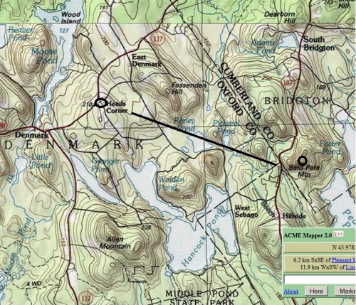
We also have this conjunction from Oxford-Cumberland counties Maine (see: Headsville-Bald Prarie, Robertson County, Texas just below)

headsmaine

Richard Petty:

Richard Lee Petty (born July 2, 1937) is a former NASCAR driver who raced in the Strictly Stock/Grand National Era and the NASCAR Winston Cup Series. “The King”, as he is nicknamed, is most well known for winning the NASCAR Championship seven times (Dale Earnhardt is the only other driver to accomplish this feat),[1] winning a record 200 races during his career,[1] winning the Daytona 500 a record seven times,[1] and winning a record 27 races[1] (ten of them consecutively) in the 1967 season alone.

He was cast as “The King” in Pixar’s 2006 animated film Cars as his 1970 Plymouth Superbird with the number “43”, with his wife Lynda Petty appearing as “Mrs. The King” (a Chrysler Town and Country).

missking

—–

Hucka D.:

We know that Heads to Foote is Addie. Coffin. Death. Heading to ___ for burial but actually for a selfish purpose… purposes. You cannot go there, however. Lisa the V. knows this also. Marty told her. She has to choose the book with the red cover, which means not stop but go.

http://www.cliffsnotes.com/study_guide/literature/as-i-lay-dying/summary-analysis/sections-1-5.html

First Look At James Franco’s As I Lay Dying

3 Comments

Filed under MAPS, Tennessee

More Whitehead related maps 01

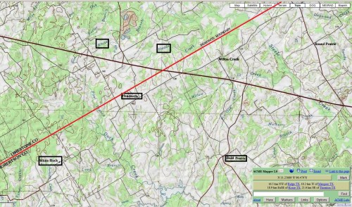
Conjunction of Headsville with Bald Prarie in Robertson County, Texas indicates “bald head”. Nearby is White Creek and Heads Creek, just over line to north in Limestone County, but name conj. on map originally made me think this was a White Heads Creek. White Rock is below Headsville.

robertsontexas

https://bakerbloch.wordpress.com/2013/04/05/whitehead-x-ing-02/

I believe it relates to the first 2 rocks of the above, recent blog post here. The first picture is of a rock with a bald spot upon it. I think I’ll call this Head Rock now. Headville? The next picture is of a white rock, which I’ll call White Rock, which is near Headsville (and Bald Prarie) in Robertson County, Texas. These rocks of course come from the Whitehead Crossing region.

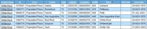
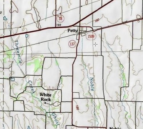
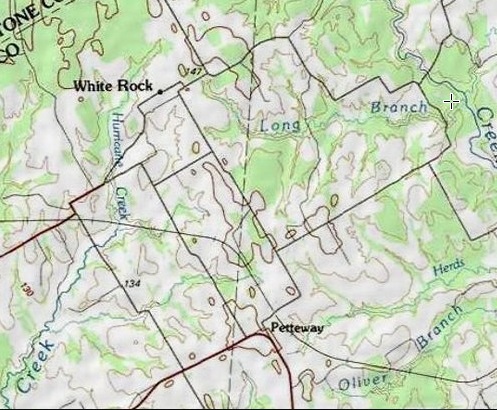
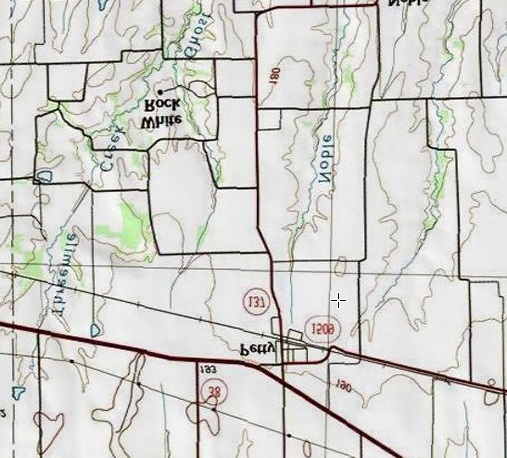
There is no article in the Texas Alamac for White Rock, Robertson County, unlike for nearby Headsville and Bald Prarie. However, this comprehensive almanac has a listing for a White Rock in Fannin County, which happens to be near a Petty according to the below stats, as White Rock in Robertson County is very near a Petteway (Pett—y + ewa in effect).

whiterocksintexas
White Rock population places in Texas. Notice that White Rock, Robertson County is on a Petteway topo map and White Rock, Fannin County is on a Petty map. This clued me in to their possible association.

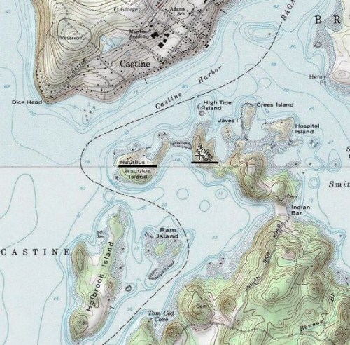
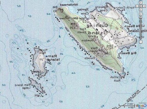
Originally *here*, in this Maine location, I thought Whites Head (reverse of “White Heads”, Texas just discussed) was actually *one* word, Whiteshead, only corrected in my mind when I just checked in the GNIS database. There is a causeway of sorts, it seems, between this Whites Head, then, and Nautilus Island, which has come to symbolize Second Life’s Nautilus Island and probably Second Life itself.

monhegan04

4/11/13:

But getting back to the White Rocks of Texas, I noticed that the above mentioned White Rock near Petty is actually not in Fannin County but just over the east line in neighboring Lamar, about a mile and a 1/2 from Fannin County. So the GNIS database got this wrong, harkening back to the Herbert error discussed several months ago on this blog. But then in looking at that listing again, it’s interesting to note that a White Rock lies on a Whitewright topo map, and this particular White Rock is just beyond the *west* Fannin County line, in Grayson County in this case, about 4-5 miles in. Besides Whitewright we also have a White Mound near this White Rock, making a type of White Rock – Whitewright – White Mound triangle, with two more interestingly named population places within this established triangle, or Tom Bean and Kentucky Town.

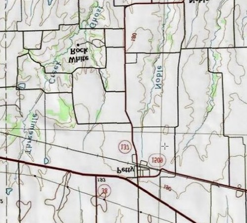
Another perhaps odd thing here: White Rock in Lamar County, unlike the great majority of population places on the topo map involved, is marked with a black dot. So is White Rock in Robertson County. If we make White Rock, Lamar County the retrograde inversion of White Rock, Robertson County merging these two black dots, we find that each lies about 2 1/2 miles from their Petty (Lamar County) and Petteway (Robertson County) and in the same direction.

whiterocktexas02b

whiterocktexas01b

whiterocktexas01c
Retrograde Inversion of White Rock-Petty, Lamar County. You can kind of make an animation by toggling this with this.

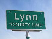
There is one other Petty in Texas, in Lynn County on a topo map named New Home. This is also the only other Petty in the US as a whole according to the GNIS database.

petty01

From this map of part of Lynn County (lower right corner), we can see that Petty is (or was) near a place called Dune. Grassland exists to the east of Dune in this county still.

HockleyCountyTexas1940

The planet Dune became the New Home of Paul Atreides in Frank Herbert’s famous novel Dune, already discussed in connection with another map anomaly involving the name Hebert itself. Should White Rock-Petty be fitted into this overall mythology, still developing then? Or is this, ahem, a petty matter to contemplate.

175px-Lynn_County,_TX,_sign_IMG_1492

White Rock in Whitehead Crossing *points*. What is it indicating, if anything?

604ec08fdc1a4f153cf39bba8243a7e6
Ahem.

6 Comments

Filed under Frank Park, MAPS, Texas, Whitehead Crossing

Flickr: Monhegan Island > Whitehead Crossing

http://www.flickr.com/groups/371390@N25/pool/with/4928131312/

—–

4/9/13:

Today I revisited Whitehead Crossing, which I will probably do tomorrow as well. Didn’t take a lot of pictures because of tiredness. Made the mistake of eating a full meal in the middle of the day, which is unnatural for me. Threw my whole metabolism off. Learned a lesson.

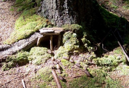
But to Whitehead: Perhaps a major discovery there still in the finding of a *fairy house*, as well as a fairy field. This just on the other side of Green Stream from Whitehead Crossing, and probably a part of its “metro area”. I’ll attempt to take pictures today. Named the only other stream in Whitehead X-ing besides Whitehead Brook *Little Whitehead*, and then later that day learned that there was a Little Whitehead as well on Monhegan Island (along with a Whitehead itself).

http://www.mytopo.com/locations/index.cfm?fid=1909846

To emphasize this resonance, in a google search for “little whitehead”, my blog comes up among the top hits now, along with an art group made up of people whose last names are Little and Whitehead, and then Monhegan Island’s Little Whitehead summit. Too queer! The assoc. between my Whitehead X-ing and Monhegan I. would have been made through this phrase if it hadn’t already been made through “whitehead”. About the only thing I’ve said about Little Whitehead (my stream) specifically in this or the Baker Blinker Blog is here, where I assoc. a bridge across two rocks framing the stream with possible avatar activity in the area. Now I can make a direct link between “avatars” and “fairies” through this other Little Whitehead on Monhegan I.

monhegan00

monhegan01
To scale, a direct overlap of the 2 Little Whiteheads in question.

What this proves so far:

* Frank Park is the exclusive carrier of the Monhegan-Little Whitehead portal.
* Monhegan Island width corresponds to mouth of Norris Brook to mouth of Whitehead Brook, with Woods of Howl between. This is red and blue.

Leave a comment

Filed under Frank Park, Maine, MAPS, Whitehead Crossing

Mouse Island < Ram Island

http://www.middlebass2.org/MouseCrash20060704.shtml

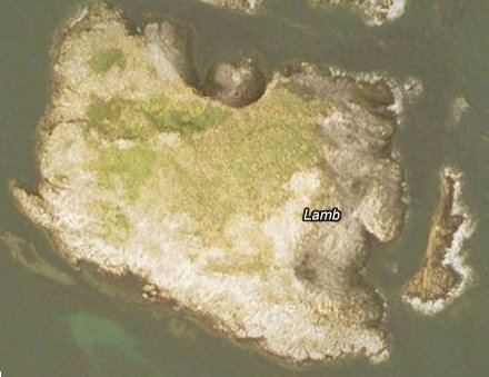
Interesting (not Ram but Lamb, but rams come from lambs don’t they?):

http://site.uri-geller.com/why_i_bought_lamb_island

The Pyramids of Scotland

lambgoogleearth1

—–

Whitehead details:

Geogeorock or Jeogeorock or Jeogerock is not the title of the Whitehead Crossing rock but a *type* of rock, which connects with the Jeogeot continent of Second Life (= My Second Lyfe). Instead the actual name is Grey Rock, sometimes misspelled Gray Rock. The resonance of for Gray, Maine, which has a lone (gray clad in battle) Confederate soldier in its Union cemetery, a grave which is tended the same as the rest. Gray, Maine is or was also home to one of the few galleries in the world named Blue Feather Gallery, and on a Brown Street ta boot. My own (virtual) Blue Feather Gallery reached its peak in Norum, when it bordered Chilbo also at its peak. This would be in August 2010, close to 3 years ago now. Norum comes from the sim Noru where I owned land at the time (and where BFG was). Only US Norum is in Washington County, Florida near Whitehead Crossroads and a Greenhead and Red Head and also Poplar Head and Orange Hill. More colors. This is a direct resonance, then. Only Norum/SV in US besides this is Norumbega, Maine, another direct reference and reference to My Second Lyfe through nearby Nautilus Island, reachable through Whiteheads.

Leave a comment

Filed under Frank Park, United Kingdom, Whitehead Crossing

Oh look, he’s talking about Billfork, Lion’s Roar (etc.)!

fairy villages, bowerbird art, & other ambiguous objects

fairy villages, bowerbird art, & other ambiguous objects

Very interesting the article compares the creation of cairns and fairy houses to crop circle formations. 🙂

http://www.spokaneoutdoors.com/fairy.htm

Monhegan Island
Fairy House, Monhegan Island, Maine.

Strange — this same blog features several posts on Whitehead, but Alfred North Whitehead in this case. One of the primary summits of tiny Monhegan Island, and around which I’m sure are found a goodly number of those fairy houses like the one pictured above, is named Whitehead, and that was what originally attracted my attention to it (not the fairy houses, which I just learned about in the last hour). This would be in resonance with the previously named Whitehead Crossing of Frank Park.

between Whitehead & Peirce

Speaking of which, I’ve just yesterday restored the 5-rock cairn at Dongoba, and might work on re-creating the biggest temple of the complex this spring/summer/fall. As I think I stated below somewhere, I decided not to move these 5 rocks just across the ridge to Whitehead Crossing for this restoration. The same would go for the bigger temple — rocks simply too large to move from this location, to name the major obstacle for this transfer of art.

IMG_0009smaller

IMG_0012smaller

I would be very interested to see what the “immanence” blogger though of *this* type of woodsy art: an apparently continuing interaction with *something* in the woods that really, really seems to want to communicate with me — *is* communicating. The floating tree below at Concreek, just beside its namesake Concreek Falls, has already been the site of one of these types of communications, as I discussed in this Baker Blinker Blog post from last summer. Now a second one at the same site has taken place. And I’ve already formed an interpretation, very quickly in fact, and on the spot. I believe it could very well be a *map*, specifically a rudimentary one of a portion of Frank Park around Bill Mountain and Falmouth Creek, pointing in fact to this very spot on Concreek in symbolic fashion. Let’s take a look…

IMG_0002smaller

So here’s the scene now just below the root end of Concreek’s floating tree on The Island (compare with here). The broken off rhododendron branches, 3 in number, certainly *appear* to be placed here on purpose by human/humanoid hands, but, as they say, the medium is the message. This is land art, but also a communication, more direct and unambivalent. As I said, I believe it is a map. One of the first things I noticed upon stumbling on this configuration is that the two larger rhodo branchs were placed one behind the other, but with a certain distance between them. I interpreted this as one *following* the other, and thought of the aliens following *me* across the road from Bill Mountain and to Falmouth Creek across The Way. Notice that the rhodo branch closest to the floating tree’s bottom is prominently forked, and that a 3rd, smaller rhodo branch lies above the forked branch in the following photo. I interpreted this — again all this fell together or happened almost “at once” — as the path I created to Falmouth Creek and the art happening (set up bottles in a metal circle) there at Old Baker Settlement. I believe the “aliens” have taken the fork from the main path or road running alongside Bill Mountain and across The Way (represented by the 2 larger rhodo branches) and have gone to the art event to take a peek, at least in a remote way (perhaps through the pictures and texts of this blog). At any rate, they wanted to communicate this knowledge to me through the map. And continuing down the main fork would bring them to Concreek, and they had to come here obviously to place the branches — i.e., make their map. I know this sounds odd, but that’s what I strongly believe it is. And it is akin to crop circles in that the circles tend to use the same fields year after year to affect their own brand of alien-to-human communications. Needless to say I’ll be paying close attention to this floating tree in the months and years to come, with any further messages chronicled for this blog. At least I *hope* that’s what they want me to do.

IMG_0003smaller

One more thing I should mention about this configuration. There also appear to the right of the smallest of the 3 broken off rhodo branches two slender but quite sturdy “roots”, looking almost like antennae. This didn’t seem natural either, and I couldn’t figure out if these two very similar “branches” were actually roots or stems of some plants, or if they were broken off in the first place. I may have to return to this spot for more investigating, then.

IMG_0008smaller

Shifting now to a totally new blog location, we have Fi, certainly not as mysterious as Concreek yet, but still worthy of inclusion here. The place is in Frank Park once more, and somewhat between Norris Branch and Whitehead Crossing, southwest of the Woods of Howl. The two creeks involved, both tributaries of Green Stream like Whitehead Brook and Concreek, have also not be discussed in this blog yet, but come together not far downstream from the site of the below pictures (which seem to indicate several lichen tinted, derelict *temples*) These are just some preliminary photos, and I’ll return to this location soon for more blog storytelling. A preliminary name for this “temple” site is Fifill, and there seems to be a complementary and perhaps antagonistic Fifole to deal with here as well in this Land of Fi.

IMG_0020smaller

IMG_0023smaller

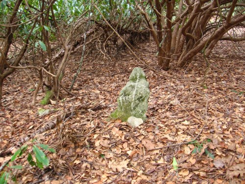
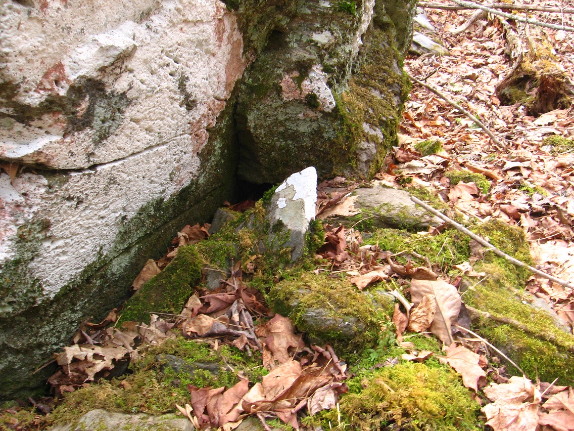
Solitary white rock that seems to be an indicator of something.

IMG_0026smaller

Tree mushroom.

IMG_0034smaller

4 Comments

Filed under Fi, Frank Park, Maine, MAPS, Norris Brook, Whitehead Crossing

Whitehead X-ing Intricacies 02

bb:

Turns out I didn’t begin to move the Dongoba temples to Whitehead X-ing, Hucka D. The rocks were just too heavy to take over the top of Woods of Howl. (pause) Hucka? Well, I’ll just talk on my own for now. (pause again)

Hucka D.:

Whitehead Crossing is long, is deep, is wide. A big box. Play.

bb:

Lisa’s Gnirps, Hucka D…

Hucka D.:

Yes. That was a center. Way.

bb:

I’m going to start to create a UmapS database modeled or substituting (sumtin) for the one at Gnirps. Or GNIrpS.

Hucka D.:

Yes. Way.

bb:

What means the marriage of parks Frank and Herman at that spot, Hucka D.

Hucka D. (after a pause):

Red. Green. Sister. Brother. Balance. Balance between red/silver and green/gold. Map Rat knows.

Map Rat:

Howdy!

bb:

Hi Map Rat. Welcome to the blog.

Map Rat:

I know. Iffy, isn’t it.

bb:

Not sure, Map Rat. Are you from Missouri?

Map Rat:

Yes. Sunklands. Crawled in a long time ago. Wide. Deep. Long.

bb:

Gnirps is just the outer or exterior side of an interior complexity. Output, then.

Map Rat:

Yes. Gang of Willard. Hobart. Krakatoa.

bb:

I’m getting all sorts of clues that Frank/Herman mythology is jumping up a step presently. Is this because of my focus on Whitehead Crossing?

Map Rat:

Yes. I am suppose to say yes here. (sound of change dropping in a plate) Thank you Hucka Doobie.

bb:

Are you being tipped, Map Rat?

Map Rat:

Only what counts. I can help with Gnirps. You have Con Creek and Damsel, Missouri. You have… you already have a lot. If you can draw around Whitehead Crossing for information that might be best (sound of more coins dropping in a plate). Thanks!

bb:

I’m uncomfortable with you being tipped, Map Rat. I think.

Map Rat:

I’m counting. 304. (pause to refresh) 306.

bb:

Are you being paid according to number of words in this post, Map Rat?

[no answer]

bb:

Up to 327 now. 329. 329 still Oh, 330. 330. 332 now. 333. Map Rat? 333 still. 333. 333. 333. Hmmmm… stuck on 333. Wait… 338.

Map Rat:

Are you finished? You need to start on another Whitehead Crossing Map. That’s what you need to do. You know (sound of coins again) — thank you Hucka D. — you know about Red Head, and how the Mossmen lived there but its hard to get inside. They didn’t want other avatars in there, but there was certainly a Big (sound of coins again) Lot of ’em in there. They met the bees, the humans or humanoids, at the Big Mall. Whitehead Crossing, Greenhead, and Red Head all in one. Norum.

—–

bb:

I think since Greenhead, the only UmapS version, is near both a Grassy Lake and a Little Grassy Pond, that Grassy Knoll has to be involved in the history of Whitehead Crossing.

Map Rat:

One element (sound of clicking coins). Thanks!

bb:

You’re getting pretty rich, Map Rat.

[no answer]

bb (continuing to look at map around Greenhead, Florida):

Wow, a Deadening Cemetery nearby, Map Rat. Or Hucka D. What a name! (pause again) But of course what I’m looking for is Red Head along this line. Oh, it’s the other direction. Big Blue Lake in-between, and Little Blue Pond. Marbles don’t you think?

[no answer]

—–

“There is an intimate link between Florida and Maine at Whitehead Crossing.”

monegan01

monhegan02

monhegan03

http://bakerblinker.wordpress.com/category/nautilus-city/
monhegan04

http://ngm.nationalgeographic.com/ngm/data/2001/07/01/html/ft_20010701.5.html

Is there a square inch of Monhegan that has not been painted? Perhaps it is the silver light that dances off the mirror of the sea or the fog that softens the landscape that has lured painters here since the 19th century.

http://rockpiles.blogspot.com/2010/03/manana-island-cairns-by-mary-e-gage.html
Leave a comment

Filed under Frank Park, Maine, MAPS, Whitehead Crossing

Gilatona-Lis credits (Brian Robert Marshall, et al.)

Along with images taken directly from GoogleEarth Streetview, Brian Robert Marshall’s UK geograph photos make up the bulk of primary or base location shots I’ve employed for reuse in the Gilatona-Lis collages. I’ve talked a bit about the history of this borrowing here, an extension of my “Baker Bloch in England” 2010 project. More Gilatona-Lis sources coming from UK geograph include pictures from Des Blenkinsopp and Andrew Smith.

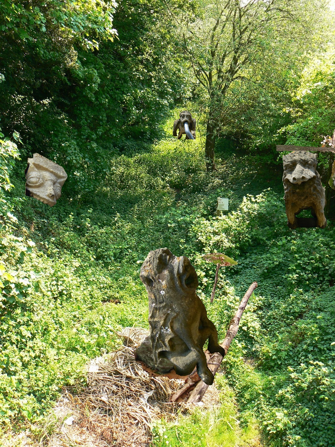
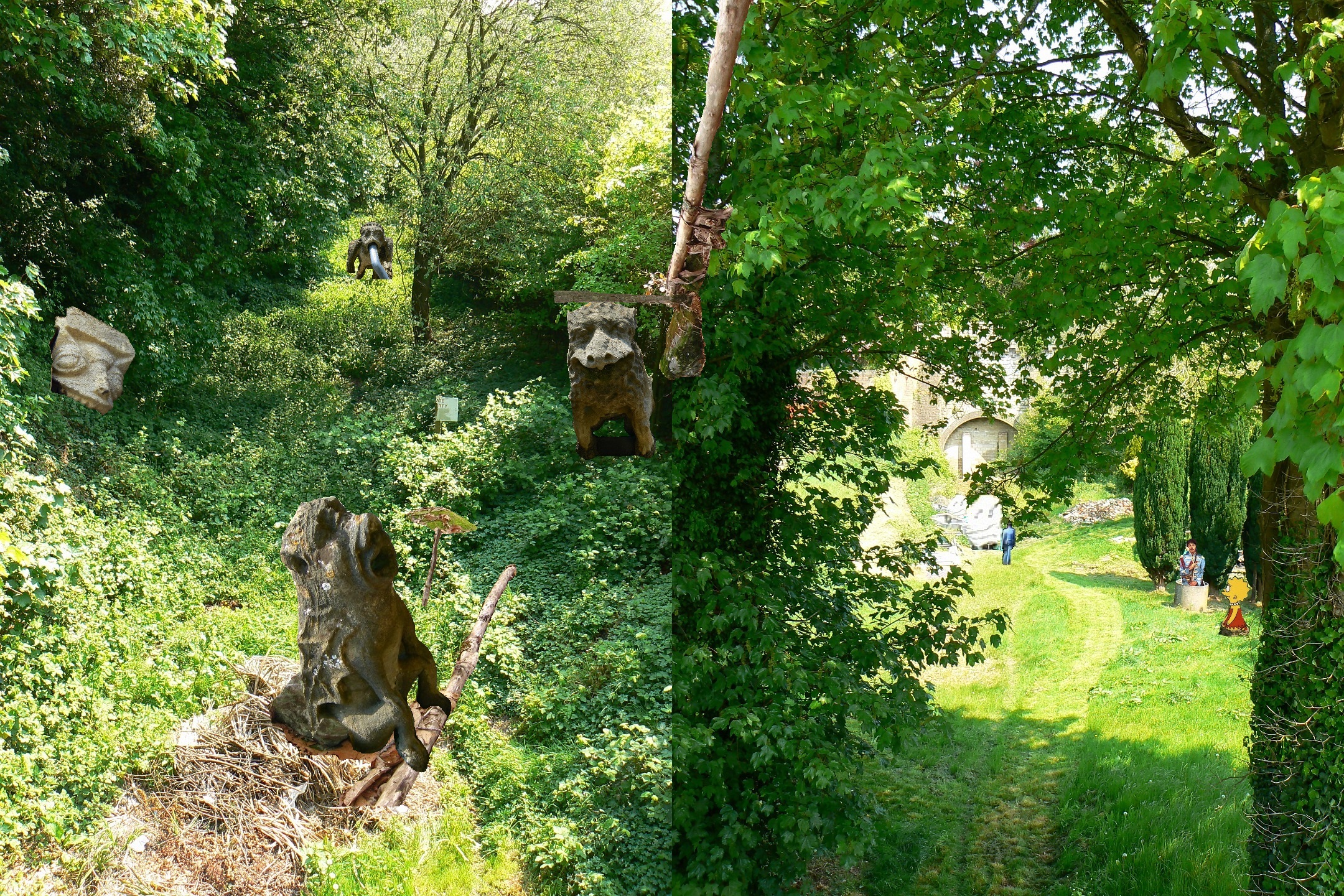
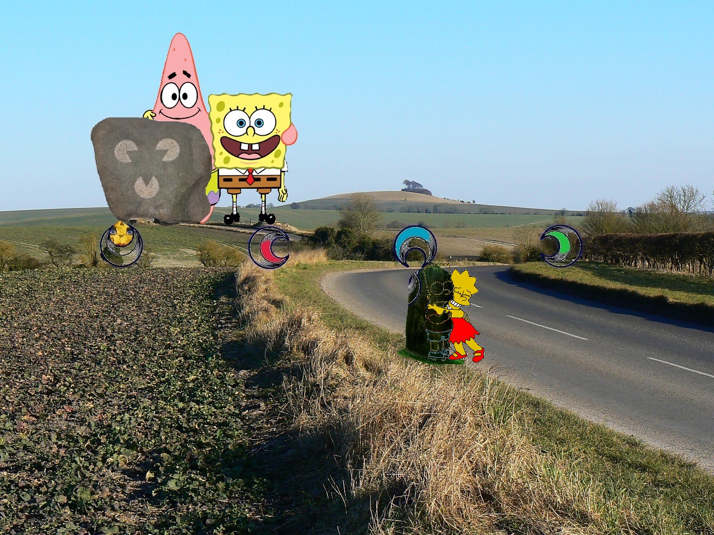
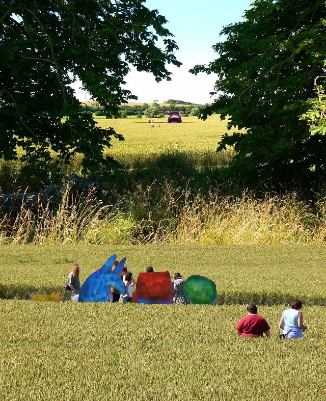
Below I’ve attempted to identify all the source links for location photos used in Gilatona-Lis collages, including the contributor’s name and whether it plays a primary or secondary role in a specific collage. Note that a number of the collages mix several different sources of this kind, Lis 01 and Lis 03 being extreme examples here. Whatever the source, almost all primary and even secondary locations are from Wiltshire County, England, an area famous for megalithic sites, white horses carved in hillsides, and crop circles. That is, if we discount virtual locations from Second Life (Gila 05, Gila 07, Latona 01).

For time’s sake, I will not attempt to track down other images used in Gilatona-Lis — like cartoon figures; too many.

So here goes!

—–

Gila 03

http://www.geograph.org.uk/photo/1910760 (Blenkinsopp) secondary

Gila 06

http://www.geograph.org.uk/photo/608208 (Marshall) primary

Gila 07

http://www.geograph.org.uk/photo/1848699 (Blenkinsopp) primary
http://www.geograph.org.uk/photo/1947157 (Blenkinsopp) secondary
http://www.geograph.org.uk/photo/1947135 (Blenkinsopp) secondary
http://www.geograph.org.uk/photo/1910785 (Blenkinsopp) secondary

Gila 08

http://www.panoramio.com/photo/23374221 (Collin West) primary
http://www.geograph.org.uk/photo/1848699 (Blenkinsopp) secondary

Gila 09 (this is a picture of the photo from Second Life)

http://www.geograph.org.uk/photo/609670 (Marshall) secondary

Gila 10

http://www.geograph.org.uk/photo/608208 (Marshall) primary
http://www.oldbarnyoga.co.uk/images/TheOldBarn_2.jpg secondary

NOTE: Gila 06 & 10 employ the same background image & create an animation effect when combined. Such animations are common in the collages of the Art 10×10 (2004-2009).

Latona 00

http://www.geograph.org.uk/photo/408862 (Smith)

Latona 02

http://www.panoramio.com/photo/16059362 (purplekitten) primary
http://www.geograph.org.uk/photo/834226 (Marshall) primary
http://www.panoramio.com/photo/24339635 (Steve Gayler) primary
http://www.panoramio.com/photo/16059575 (purplekitten) secondary

Latona 05

http://centreportal.blogspot.com/2008/10/oz-born_17.html primary
https://bakerbloch.wordpress.com/2013/01/25/misc-pics/attachment/52369665/ (Marshall? — unable to find source photo location) primary

Latona 08

http://www.geograph.org.uk/photo/409328 (Marshall) primary

Latona 09

http://www.geograph.org.uk/photo/409337 (Marshall) primary

Latona 10

http://www.geograph.org.uk/photo/409354 (Marshall) primary

NOTE: Latona 08 09 10 is a triptych, based on 3 Marshall photos near the same location (West Woods)

Lis 01

http://www.geograph.org.uk/photo/2387363 (Marshall) primary
http://www.geograph.org.uk/photo/2387298 (Marshall) secondary
http://www.geograph.org.uk/photo/2386590 (Marshall) secondary
http://www.geograph.org.uk/photo/2387342 (Marshall) secondary
http://www.geograph.org.uk/photo/2387345 (Marshall) secondary
http://www.geograph.org.uk/photo/950005 (Marshall) secondary

Lis 02

http://www.geograph.org.uk/photo/2387438 (Marshall) primary
http://www.geograph.org.uk/photo/2387342 (Marshall) secondary

Lis 03

http://www.geograph.org.uk/photo/2388037 (Marshall) primary
http://www.geograph.org.uk/photo/2387393 (Marshall) secondary
http://www.geograph.org.uk/photo/2387400 (Marshall) secondary
http://www.geograph.org.uk/photo/2387404 (Marshall) secondary
http://www.geograph.org.uk/photo/2387413 (Marshall) secondary

Lis 04

http://www.geograph.org.uk/photo/2388024 (Marshall) primary

NOTE: Lis 03 04 is a diptych, based on 2 Marshall photos at the same location (Devizes)

Lis 05

http://www.geograph.org.uk/photo/382881 (Marshall) primary
http://www.geograph.org.uk/photo/382855 (Marshall) primary

Lis 06

http://www.geograph.org.uk/photo/1744705 (Marshall) primary
http://www.geograph.org.uk/photo/382881 (Marshall) secondary

Lis 08

http://www.geograph.org.uk/photo/885306 (Marshall) primary
http://www.geograph.org.uk/photo/885302 (Marshall) primary

Lis 09

http://roy25booth.blogspot.com/2010/09/shining-button.html primary
—-

And I suppose this is a good enough place to give the links to all the Gilatona-Lis interpretation pages…
https://bakerbloch.wordpress.com/2013/02/02/gila-interpretationassociations-01/

https://bakerbloch.wordpress.com/2013/02/03/gila-interpretationsassociations-02/


https://bakerbloch.wordpress.com/2013/02/05/gila-interpretationsassociations-01/

https://bakerbloch.wordpress.com/2013/02/06/gila-interpretationsassociations-04/

https://bakerbloch.wordpress.com/2013/02/27/latona-associationsinterpretations-01/


https://bakerbloch.wordpress.com/2013/02/28/latona-associationsinterpretations-02/

https://bakerbloch.wordpress.com/2013/03/07/latona-interpretationsassociations-03/

https://bakerbloch.wordpress.com/2013/03/07/latona-interpretationsassociations-04/

https://bakerbloch.wordpress.com/2013/03/11/latona-interpretationsassociations/

https://bakerbloch.wordpress.com/2013/03/12/lis-interpretationsassociations-01/


https://bakerbloch.wordpress.com/2013/03/13/lis-interpretationsassociations-02/

https://bakerbloch.wordpress.com/2013/03/13/lis-interpretationsassociations-03/

https://bakerbloch.wordpress.com/2013/03/13/lis-interpretationsassociations-04/

https://bakerbloch.wordpress.com/2013/03/18/lis-interpretationsassociations-05/


https://bakerbloch.wordpress.com/2013/03/25/lis-interpretationsassociations-06/

https://bakerbloch.wordpress.com/2013/03/21/falmouth-interpretationsassociations-01/

https://bakerbloch.wordpress.com/2013/03/22/falmouth-interpretationsassociations-02/


https://bakerbloch.wordpress.com/2013/03/26/falmouth-interpretationsassociations-03/

https://bakerbloch.wordpress.com/2013/03/26/falmouth-04-interpretationsassociations/

https://bakerbloch.wordpress.com/2013/03/28/falmouth-interpretationsassociations-05/

—–

PHEW!

Leave a comment

Filed under collages 2d, Wiltshire

Whitehead X-ing 04, NORRIS

Old road leading out of Whitehead Crossing to the south. Unusable now, of course. But did it once service a human dwelling spot in the area? Wish I had a time machine where I could go back in the past to see!

IMG_0079smaller

This old road meets with Main Path (main or really only hiking path in the general Whitehead Crossing area) at this spot, which could be a type of proper entrance to Whitehead X-ing itself if it was a public place. It’s definitely not, however — want to keep this location hidden as much as possible down through the years.

IMG_0081smaller

This is a shot of the Main Path, which we’ve headed north on from the last picture about 50 yards or so to reach this area where it winds through some interesting rocks.

IMG_0082smaller

We now move away from Whitehead X-ing to Norris Brook. I was very disappointed to find that the largest temple of Dongoba had collapsed or *been* collapsed since I last visited in the fall, probably.

IMG_0084smallest

IMG_0085smaller

Since the tall, 5 rock Dongoba temple, or, properly, a cairn (as are all the temples here, properly speaking again) has also been knocked over, I’m strongly thinking that vandalism is the reason involved.

IMG_0086smaller

My mind turned back to the crosses made near the mouth of the creek and also on the central rock, as 1st pictured in another Baker Blinker Blog post. I’ve reposted the latter photo here. I’m thinking that the Christian humans who made the crosses might have also come across this temple complex and thought them to be idols to a false god. Crazy concept… or what actually happened?

IMG_0089smaller

It then occurred to me that I could move these temples back to Whitehead Crossing and rebuild them. So I returned across the ridge to examine my new home base closer. I entered from the south again, Green Stream below me now.

IMG_0090smaller

But I didn’t make it into the heart of the community again, halted by further exploration of this stream. So many rocks here for such a relatively small flow of water! Very similar to what I encountered at the the 2nd Portal on Spoon Fork the week before, except the rocks were not as large nor widespread. Still a comparison can be made.

IMG_0091smaller

IMG_0093smaller

1 Comment

Filed under Frank Park, Norris Brook, Whitehead Crossing

Whitehead X-ing 03

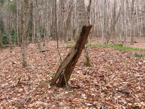
A fence post near the top of the ridge pictured at the bottom of the Whitehead X-ing 02 blog entry. Some fragments of barb wire are still attached, marking its past function.

IMG_0045smaller

I believe I’ll just go ahead and call this water flow Little Whitehead until I come up with a better name. This would be the stream that empties into Whitehead Brook at the tip of the ridge with the fence post above. I suppose I could scan recent blog posts to see if I can spot a better and more symbolic name. Ram Brook? (probably not)

Anyway, below we have a quite interesting log bridge across this flow.

IMG_0050smaller

Just downstream — still on Little Whitehead, comes this passageway through mossy rocks. This Baker Blinker Blog post from several years ago shows another type of bridge (branch) spanning these rocks. More evidence of the wee people in the area, perhaps akin to those who live on Mohegan Island, Maine? (given the other Maine resonances in the Whitehead area)

IMG_0054smaller

Detail of rock from this same ridge. A secret star map?

IMG_0058smaller

A quite iridescent rock in the Whitehead Brook flow nearby. Not sure what the involved mineral is, but it gives the appearance of an oil film.

IMG_0062smaller

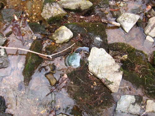
And — perhaps again strangely — just upstream in Whitehead Brook from this rock appears an iridescent *piece of glass*, perhaps originally part of a lamp. I’ll study this matter further. I’ll probably go back to Whitehead Crossing even today; the weather is suppose to be perfect almost all week (!)

IMG_0063smaller

Then just a bit upstream from that, even, we have what I’ll call Remorse Rock.

IMG_0065smaller

Interesting log nearby.

IMG_0066smaller

A look across a line of mossy logs into Rock’s Meadow, with Rock’s grave and also The Arena (alternately, The Lycaeum).

IMG_0067smaller

Rock’s Meadow itself: grave foreground left, The Arena background left, and “Rock’s rocks” background right. Soon this will be filled with green grass. Nice!

IMG_0075smaller

1 Comment

Filed under Frank Park, Whitehead Crossing