Monthly Archives: April 2013

Flickr: Monhegan Island > Whitehead Crossing

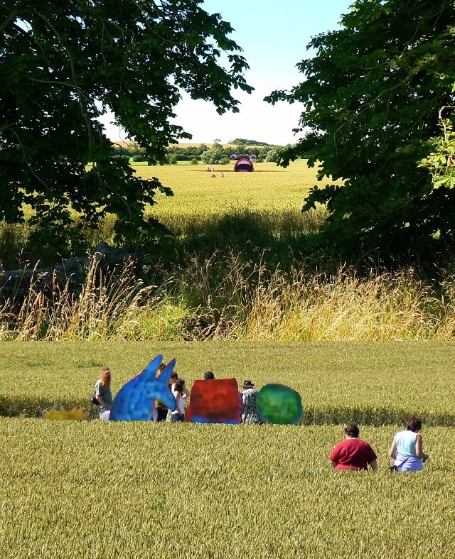
http://www.flickr.com/groups/371390@N25/pool/with/4928131312/

—–

4/9/13:

Today I revisited Whitehead Crossing, which I will probably do tomorrow as well. Didn’t take a lot of pictures because of tiredness. Made the mistake of eating a full meal in the middle of the day, which is unnatural for me. Threw my whole metabolism off. Learned a lesson.

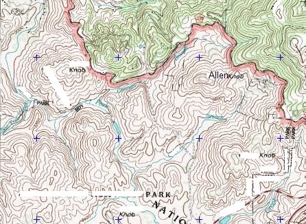
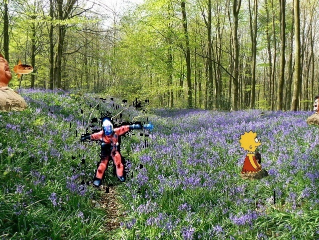
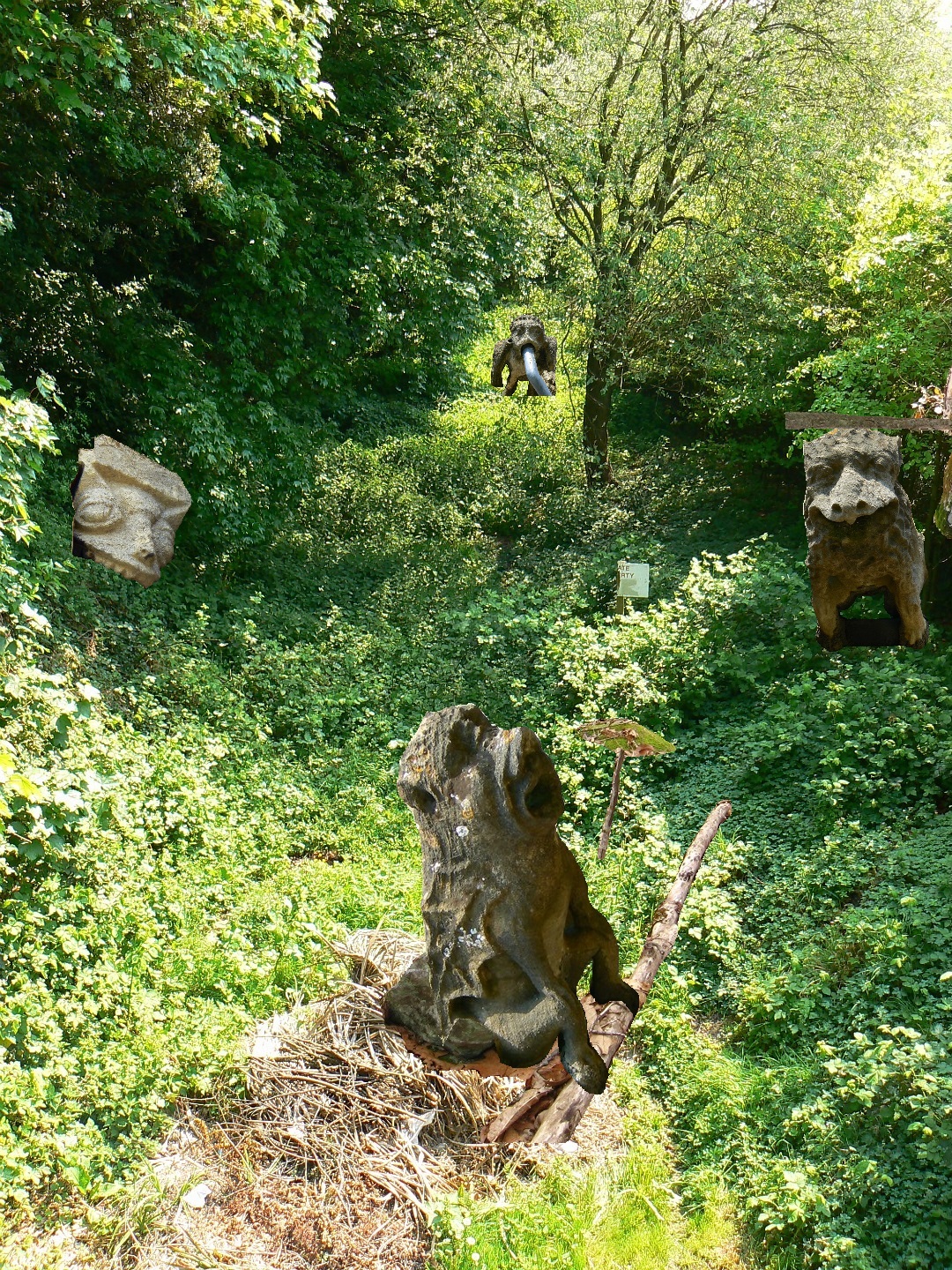
But to Whitehead: Perhaps a major discovery there still in the finding of a *fairy house*, as well as a fairy field. This just on the other side of Green Stream from Whitehead Crossing, and probably a part of its “metro area”. I’ll attempt to take pictures today. Named the only other stream in Whitehead X-ing besides Whitehead Brook *Little Whitehead*, and then later that day learned that there was a Little Whitehead as well on Monhegan Island (along with a Whitehead itself).

http://www.mytopo.com/locations/index.cfm?fid=1909846

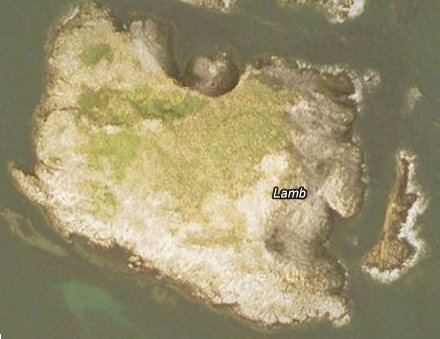
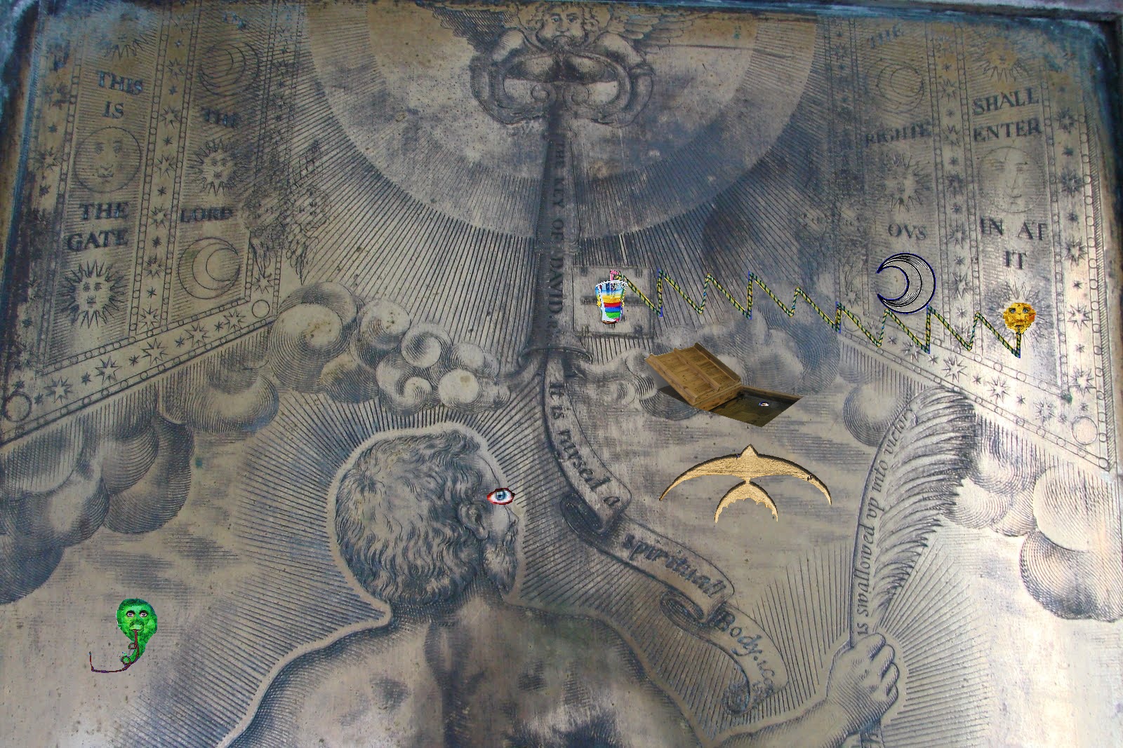
To emphasize this resonance, in a google search for “little whitehead”, my blog comes up among the top hits now, along with an art group made up of people whose last names are Little and Whitehead, and then Monhegan Island’s Little Whitehead summit. Too queer! The assoc. between my Whitehead X-ing and Monhegan I. would have been made through this phrase if it hadn’t already been made through “whitehead”. About the only thing I’ve said about Little Whitehead (my stream) specifically in this or the Baker Blinker Blog is here, where I assoc. a bridge across two rocks framing the stream with possible avatar activity in the area. Now I can make a direct link between “avatars” and “fairies” through this other Little Whitehead on Monhegan I.

monhegan00

monhegan01
To scale, a direct overlap of the 2 Little Whiteheads in question.

What this proves so far:

* Frank Park is the exclusive carrier of the Monhegan-Little Whitehead portal.
* Monhegan Island width corresponds to mouth of Norris Brook to mouth of Whitehead Brook, with Woods of Howl between. This is red and blue.

Leave a comment

Filed under Frank Park, Maine, MAPS, Whitehead Crossing

Mouse Island < Ram Island

http://www.middlebass2.org/MouseCrash20060704.shtml

Interesting (not Ram but Lamb, but rams come from lambs don’t they?):

http://site.uri-geller.com/why_i_bought_lamb_island

The Pyramids of Scotland

lambgoogleearth1

—–

Whitehead details:

Geogeorock or Jeogeorock or Jeogerock is not the title of the Whitehead Crossing rock but a *type* of rock, which connects with the Jeogeot continent of Second Life (= My Second Lyfe). Instead the actual name is Grey Rock, sometimes misspelled Gray Rock. The resonance of for Gray, Maine, which has a lone (gray clad in battle) Confederate soldier in its Union cemetery, a grave which is tended the same as the rest. Gray, Maine is or was also home to one of the few galleries in the world named Blue Feather Gallery, and on a Brown Street ta boot. My own (virtual) Blue Feather Gallery reached its peak in Norum, when it bordered Chilbo also at its peak. This would be in August 2010, close to 3 years ago now. Norum comes from the sim Noru where I owned land at the time (and where BFG was). Only US Norum is in Washington County, Florida near Whitehead Crossroads and a Greenhead and Red Head and also Poplar Head and Orange Hill. More colors. This is a direct resonance, then. Only Norum/SV in US besides this is Norumbega, Maine, another direct reference and reference to My Second Lyfe through nearby Nautilus Island, reachable through Whiteheads.

Leave a comment

Filed under Frank Park, United Kingdom, Whitehead Crossing

Oh look, he’s talking about Billfork, Lion’s Roar (etc.)!

fairy villages, bowerbird art, & other ambiguous objects

fairy villages, bowerbird art, & other ambiguous objects

Very interesting the article compares the creation of cairns and fairy houses to crop circle formations. 🙂

http://www.spokaneoutdoors.com/fairy.htm

Monhegan Island
Fairy House, Monhegan Island, Maine.

Strange — this same blog features several posts on Whitehead, but Alfred North Whitehead in this case. One of the primary summits of tiny Monhegan Island, and around which I’m sure are found a goodly number of those fairy houses like the one pictured above, is named Whitehead, and that was what originally attracted my attention to it (not the fairy houses, which I just learned about in the last hour). This would be in resonance with the previously named Whitehead Crossing of Frank Park.

between Whitehead & Peirce

Speaking of which, I’ve just yesterday restored the 5-rock cairn at Dongoba, and might work on re-creating the biggest temple of the complex this spring/summer/fall. As I think I stated below somewhere, I decided not to move these 5 rocks just across the ridge to Whitehead Crossing for this restoration. The same would go for the bigger temple — rocks simply too large to move from this location, to name the major obstacle for this transfer of art.

IMG_0009smaller

IMG_0012smaller

I would be very interested to see what the “immanence” blogger though of *this* type of woodsy art: an apparently continuing interaction with *something* in the woods that really, really seems to want to communicate with me — *is* communicating. The floating tree below at Concreek, just beside its namesake Concreek Falls, has already been the site of one of these types of communications, as I discussed in this Baker Blinker Blog post from last summer. Now a second one at the same site has taken place. And I’ve already formed an interpretation, very quickly in fact, and on the spot. I believe it could very well be a *map*, specifically a rudimentary one of a portion of Frank Park around Bill Mountain and Falmouth Creek, pointing in fact to this very spot on Concreek in symbolic fashion. Let’s take a look…

IMG_0002smaller

So here’s the scene now just below the root end of Concreek’s floating tree on The Island (compare with here). The broken off rhododendron branches, 3 in number, certainly *appear* to be placed here on purpose by human/humanoid hands, but, as they say, the medium is the message. This is land art, but also a communication, more direct and unambivalent. As I said, I believe it is a map. One of the first things I noticed upon stumbling on this configuration is that the two larger rhodo branchs were placed one behind the other, but with a certain distance between them. I interpreted this as one *following* the other, and thought of the aliens following *me* across the road from Bill Mountain and to Falmouth Creek across The Way. Notice that the rhodo branch closest to the floating tree’s bottom is prominently forked, and that a 3rd, smaller rhodo branch lies above the forked branch in the following photo. I interpreted this — again all this fell together or happened almost “at once” — as the path I created to Falmouth Creek and the art happening (set up bottles in a metal circle) there at Old Baker Settlement. I believe the “aliens” have taken the fork from the main path or road running alongside Bill Mountain and across The Way (represented by the 2 larger rhodo branches) and have gone to the art event to take a peek, at least in a remote way (perhaps through the pictures and texts of this blog). At any rate, they wanted to communicate this knowledge to me through the map. And continuing down the main fork would bring them to Concreek, and they had to come here obviously to place the branches — i.e., make their map. I know this sounds odd, but that’s what I strongly believe it is. And it is akin to crop circles in that the circles tend to use the same fields year after year to affect their own brand of alien-to-human communications. Needless to say I’ll be paying close attention to this floating tree in the months and years to come, with any further messages chronicled for this blog. At least I *hope* that’s what they want me to do.

IMG_0003smaller

One more thing I should mention about this configuration. There also appear to the right of the smallest of the 3 broken off rhodo branches two slender but quite sturdy “roots”, looking almost like antennae. This didn’t seem natural either, and I couldn’t figure out if these two very similar “branches” were actually roots or stems of some plants, or if they were broken off in the first place. I may have to return to this spot for more investigating, then.

IMG_0008smaller

Shifting now to a totally new blog location, we have Fi, certainly not as mysterious as Concreek yet, but still worthy of inclusion here. The place is in Frank Park once more, and somewhat between Norris Branch and Whitehead Crossing, southwest of the Woods of Howl. The two creeks involved, both tributaries of Green Stream like Whitehead Brook and Concreek, have also not be discussed in this blog yet, but come together not far downstream from the site of the below pictures (which seem to indicate several lichen tinted, derelict *temples*) These are just some preliminary photos, and I’ll return to this location soon for more blog storytelling. A preliminary name for this “temple” site is Fifill, and there seems to be a complementary and perhaps antagonistic Fifole to deal with here as well in this Land of Fi.

IMG_0020smaller

IMG_0023smaller

Solitary white rock that seems to be an indicator of something.

IMG_0026smaller

Tree mushroom.

IMG_0034smaller

4 Comments

Filed under Fi, Frank Park, Maine, MAPS, Norris Brook, Whitehead Crossing

Whitehead X-ing Intricacies 02

bb:

Turns out I didn’t begin to move the Dongoba temples to Whitehead X-ing, Hucka D. The rocks were just too heavy to take over the top of Woods of Howl. (pause) Hucka? Well, I’ll just talk on my own for now. (pause again)

Hucka D.:

Whitehead Crossing is long, is deep, is wide. A big box. Play.

bb:

Lisa’s Gnirps, Hucka D…

Hucka D.:

Yes. That was a center. Way.

bb:

I’m going to start to create a UmapS database modeled or substituting (sumtin) for the one at Gnirps. Or GNIrpS.

Hucka D.:

Yes. Way.

bb:

What means the marriage of parks Frank and Herman at that spot, Hucka D.

Hucka D. (after a pause):

Red. Green. Sister. Brother. Balance. Balance between red/silver and green/gold. Map Rat knows.

Map Rat:

Howdy!

bb:

Hi Map Rat. Welcome to the blog.

Map Rat:

I know. Iffy, isn’t it.

bb:

Not sure, Map Rat. Are you from Missouri?

Map Rat:

Yes. Sunklands. Crawled in a long time ago. Wide. Deep. Long.

bb:

Gnirps is just the outer or exterior side of an interior complexity. Output, then.

Map Rat:

Yes. Gang of Willard. Hobart. Krakatoa.

bb:

I’m getting all sorts of clues that Frank/Herman mythology is jumping up a step presently. Is this because of my focus on Whitehead Crossing?

Map Rat:

Yes. I am suppose to say yes here. (sound of change dropping in a plate) Thank you Hucka Doobie.

bb:

Are you being tipped, Map Rat?

Map Rat:

Only what counts. I can help with Gnirps. You have Con Creek and Damsel, Missouri. You have… you already have a lot. If you can draw around Whitehead Crossing for information that might be best (sound of more coins dropping in a plate). Thanks!

bb:

I’m uncomfortable with you being tipped, Map Rat. I think.

Map Rat:

I’m counting. 304. (pause to refresh) 306.

bb:

Are you being paid according to number of words in this post, Map Rat?

[no answer]

bb:

Up to 327 now. 329. 329 still Oh, 330. 330. 332 now. 333. Map Rat? 333 still. 333. 333. 333. Hmmmm… stuck on 333. Wait… 338.

Map Rat:

Are you finished? You need to start on another Whitehead Crossing Map. That’s what you need to do. You know (sound of coins again) — thank you Hucka D. — you know about Red Head, and how the Mossmen lived there but its hard to get inside. They didn’t want other avatars in there, but there was certainly a Big (sound of coins again) Lot of ’em in there. They met the bees, the humans or humanoids, at the Big Mall. Whitehead Crossing, Greenhead, and Red Head all in one. Norum.

—–

bb:

I think since Greenhead, the only UmapS version, is near both a Grassy Lake and a Little Grassy Pond, that Grassy Knoll has to be involved in the history of Whitehead Crossing.

Map Rat:

One element (sound of clicking coins). Thanks!

bb:

You’re getting pretty rich, Map Rat.

[no answer]

bb (continuing to look at map around Greenhead, Florida):

Wow, a Deadening Cemetery nearby, Map Rat. Or Hucka D. What a name! (pause again) But of course what I’m looking for is Red Head along this line. Oh, it’s the other direction. Big Blue Lake in-between, and Little Blue Pond. Marbles don’t you think?

[no answer]

—–

“There is an intimate link between Florida and Maine at Whitehead Crossing.”

monegan01

monhegan02

monhegan03

http://bakerblinker.wordpress.com/category/nautilus-city/

monhegan04

http://ngm.nationalgeographic.com/ngm/data/2001/07/01/html/ft_20010701.5.html

Is there a square inch of Monhegan that has not been painted? Perhaps it is the silver light that dances off the mirror of the sea or the fog that softens the landscape that has lured painters here since the 19th century.

http://rockpiles.blogspot.com/2010/03/manana-island-cairns-by-mary-e-gage.html

Leave a comment

Filed under Frank Park, Maine, MAPS, Whitehead Crossing

Gilatona-Lis credits (Brian Robert Marshall, et al.)

Along with images taken directly from GoogleEarth Streetview, Brian Robert Marshall’s UK geograph photos make up the bulk of primary or base location shots I’ve employed for reuse in the Gilatona-Lis collages. I’ve talked a bit about the history of this borrowing here, an extension of my “Baker Bloch in England” 2010 project. More Gilatona-Lis sources coming from UK geograph include pictures from Des Blenkinsopp and Andrew Smith.

Below I’ve attempted to identify all the source links for location photos used in Gilatona-Lis collages, including the contributor’s name and whether it plays a primary or secondary role in a specific collage. Note that a number of the collages mix several different sources of this kind, Lis 01 and Lis 03 being extreme examples here. Whatever the source, almost all primary and even secondary locations are from Wiltshire County, England, an area famous for megalithic sites, white horses carved in hillsides, and crop circles. That is, if we discount virtual locations from Second Life (Gila 05, Gila 07, Latona 01).

For time’s sake, I will not attempt to track down other images used in Gilatona-Lis — like cartoon figures; too many.

So here goes!

—–

Gila 03

http://www.geograph.org.uk/photo/1910760 (Blenkinsopp) secondary

Gila 06

http://www.geograph.org.uk/photo/608208 (Marshall) primary

Gila 07

http://www.geograph.org.uk/photo/1848699 (Blenkinsopp) primary
http://www.geograph.org.uk/photo/1947157 (Blenkinsopp) secondary
http://www.geograph.org.uk/photo/1947135 (Blenkinsopp) secondary
http://www.geograph.org.uk/photo/1910785 (Blenkinsopp) secondary

Gila 08

http://www.panoramio.com/photo/23374221 (Collin West) primary
http://www.geograph.org.uk/photo/1848699 (Blenkinsopp) secondary

Gila 09 (this is a picture of the photo from Second Life)

http://www.geograph.org.uk/photo/609670 (Marshall) secondary

Gila 10

http://www.geograph.org.uk/photo/608208 (Marshall) primary
http://www.oldbarnyoga.co.uk/images/TheOldBarn_2.jpg secondary

NOTE: Gila 06 & 10 employ the same background image & create an animation effect when combined. Such animations are common in the collages of the Art 10×10 (2004-2009).

Latona 00

http://www.geograph.org.uk/photo/408862 (Smith)

Latona 02

http://www.panoramio.com/photo/16059362 (purplekitten) primary
http://www.geograph.org.uk/photo/834226 (Marshall) primary
http://www.panoramio.com/photo/24339635 (Steve Gayler) primary
http://www.panoramio.com/photo/16059575 (purplekitten) secondary

Latona 05

http://centreportal.blogspot.com/2008/10/oz-born_17.html primary
https://bakerbloch.wordpress.com/2013/01/25/misc-pics/attachment/52369665/ (Marshall? — unable to find source photo location) primary

Latona 08

http://www.geograph.org.uk/photo/409328 (Marshall) primary

Latona 09

http://www.geograph.org.uk/photo/409337 (Marshall) primary

Latona 10

http://www.geograph.org.uk/photo/409354 (Marshall) primary

NOTE: Latona 08 09 10 is a triptych, based on 3 Marshall photos near the same location (West Woods)

Lis 01

http://www.geograph.org.uk/photo/2387363 (Marshall) primary
http://www.geograph.org.uk/photo/2387298 (Marshall) secondary
http://www.geograph.org.uk/photo/2386590 (Marshall) secondary
http://www.geograph.org.uk/photo/2387342 (Marshall) secondary
http://www.geograph.org.uk/photo/2387345 (Marshall) secondary
http://www.geograph.org.uk/photo/950005 (Marshall) secondary

Lis 02

http://www.geograph.org.uk/photo/2387438 (Marshall) primary
http://www.geograph.org.uk/photo/2387342 (Marshall) secondary

Lis 03

http://www.geograph.org.uk/photo/2388037 (Marshall) primary
http://www.geograph.org.uk/photo/2387393 (Marshall) secondary
http://www.geograph.org.uk/photo/2387400 (Marshall) secondary
http://www.geograph.org.uk/photo/2387404 (Marshall) secondary
http://www.geograph.org.uk/photo/2387413 (Marshall) secondary

Lis 04

http://www.geograph.org.uk/photo/2388024 (Marshall) primary

NOTE: Lis 03 04 is a diptych, based on 2 Marshall photos at the same location (Devizes)

Lis 05

http://www.geograph.org.uk/photo/382881 (Marshall) primary
http://www.geograph.org.uk/photo/382855 (Marshall) primary

Lis 06

http://www.geograph.org.uk/photo/1744705 (Marshall) primary
http://www.geograph.org.uk/photo/382881 (Marshall) secondary

Lis 08

http://www.geograph.org.uk/photo/885306 (Marshall) primary
http://www.geograph.org.uk/photo/885302 (Marshall) primary

Lis 09

http://roy25booth.blogspot.com/2010/09/shining-button.html primary

—-

And I suppose this is a good enough place to give the links to all the Gilatona-Lis interpretation pages…

https://bakerbloch.wordpress.com/2013/02/02/gila-interpretationassociations-01/

https://bakerbloch.wordpress.com/2013/02/03/gila-interpretationsassociations-02/


https://bakerbloch.wordpress.com/2013/02/05/gila-interpretationsassociations-01/

https://bakerbloch.wordpress.com/2013/02/06/gila-interpretationsassociations-04/

https://bakerbloch.wordpress.com/2013/02/27/latona-associationsinterpretations-01/


https://bakerbloch.wordpress.com/2013/02/28/latona-associationsinterpretations-02/

https://bakerbloch.wordpress.com/2013/03/07/latona-interpretationsassociations-03/

https://bakerbloch.wordpress.com/2013/03/07/latona-interpretationsassociations-04/

https://bakerbloch.wordpress.com/2013/03/11/latona-interpretationsassociations/

https://bakerbloch.wordpress.com/2013/03/12/lis-interpretationsassociations-01/


https://bakerbloch.wordpress.com/2013/03/13/lis-interpretationsassociations-02/

https://bakerbloch.wordpress.com/2013/03/13/lis-interpretationsassociations-03/

https://bakerbloch.wordpress.com/2013/03/13/lis-interpretationsassociations-04/

https://bakerbloch.wordpress.com/2013/03/18/lis-interpretationsassociations-05/


https://bakerbloch.wordpress.com/2013/03/25/lis-interpretationsassociations-06/

https://bakerbloch.wordpress.com/2013/03/21/falmouth-interpretationsassociations-01/

https://bakerbloch.wordpress.com/2013/03/22/falmouth-interpretationsassociations-02/


https://bakerbloch.wordpress.com/2013/03/26/falmouth-interpretationsassociations-03/

https://bakerbloch.wordpress.com/2013/03/26/falmouth-04-interpretationsassociations/

https://bakerbloch.wordpress.com/2013/03/28/falmouth-interpretationsassociations-05/

—–

PHEW!

Leave a comment

Filed under collages 2d, Wiltshire

Whitehead X-ing 04, NORRIS

Old road leading out of Whitehead Crossing to the south. Unusable now, of course. But did it once service a human dwelling spot in the area? Wish I had a time machine where I could go back in the past to see!

IMG_0079smaller

This old road meets with Main Path (main or really only hiking path in the general Whitehead Crossing area) at this spot, which could be a type of proper entrance to Whitehead X-ing itself if it was a public place. It’s definitely not, however — want to keep this location hidden as much as possible down through the years.

IMG_0081smaller

This is a shot of the Main Path, which we’ve headed north on from the last picture about 50 yards or so to reach this area where it winds through some interesting rocks.

IMG_0082smaller

We now move away from Whitehead X-ing to Norris Brook. I was very disappointed to find that the largest temple of Dongoba had collapsed or *been* collapsed since I last visited in the fall, probably.

IMG_0084smallest

IMG_0085smaller

Since the tall, 5 rock Dongoba temple, or, properly, a cairn (as are all the temples here, properly speaking again) has also been knocked over, I’m strongly thinking that vandalism is the reason involved.

IMG_0086smaller

My mind turned back to the crosses made near the mouth of the creek and also on the central rock, as 1st pictured in another Baker Blinker Blog post. I’ve reposted the latter photo here. I’m thinking that the Christian humans who made the crosses might have also come across this temple complex and thought them to be idols to a false god. Crazy concept… or what actually happened?

IMG_0089smaller

It then occurred to me that I could move these temples back to Whitehead Crossing and rebuild them. So I returned across the ridge to examine my new home base closer. I entered from the south again, Green Stream below me now.

IMG_0090smaller

But I didn’t make it into the heart of the community again, halted by further exploration of this stream. So many rocks here for such a relatively small flow of water! Very similar to what I encountered at the the 2nd Portal on Spoon Fork the week before, except the rocks were not as large nor widespread. Still a comparison can be made.

IMG_0091smaller

IMG_0093smaller

1 Comment

Filed under Frank Park, Norris Brook, Whitehead Crossing

Whitehead X-ing 03

A fence post near the top of the ridge pictured at the bottom of the Whitehead X-ing 02 blog entry. Some fragments of barb wire are still attached, marking its past function.

IMG_0045smaller

I believe I’ll just go ahead and call this water flow Little Whitehead until I come up with a better name. This would be the stream that empties into Whitehead Brook at the tip of the ridge with the fence post above. I suppose I could scan recent blog posts to see if I can spot a better and more symbolic name. Ram Brook? (probably not)

Anyway, below we have a quite interesting log bridge across this flow.

IMG_0050smaller

Just downstream — still on Little Whitehead, comes this passageway through mossy rocks. This Baker Blinker Blog post from several years ago shows another type of bridge (branch) spanning these rocks. More evidence of the wee people in the area, perhaps akin to those who live on Mohegan Island, Maine? (given the other Maine resonances in the Whitehead area)

IMG_0054smaller

Detail of rock from this same ridge. A secret star map?

IMG_0058smaller

A quite iridescent rock in the Whitehead Brook flow nearby. Not sure what the involved mineral is, but it gives the appearance of an oil film.

IMG_0062smaller

And — perhaps again strangely — just upstream in Whitehead Brook from this rock appears an iridescent *piece of glass*, perhaps originally part of a lamp. I’ll study this matter further. I’ll probably go back to Whitehead Crossing even today; the weather is suppose to be perfect almost all week (!)

IMG_0063smaller

Then just a bit upstream from that, even, we have what I’ll call Remorse Rock.

IMG_0065smaller

Interesting log nearby.

IMG_0066smaller

A look across a line of mossy logs into Rock’s Meadow, with Rock’s grave and also The Arena (alternately, The Lycaeum).

IMG_0067smaller

Rock’s Meadow itself: grave foreground left, The Arena background left, and “Rock’s rocks” background right. Soon this will be filled with green grass. Nice!

IMG_0075smaller

1 Comment

Filed under Frank Park, Whitehead Crossing

Whitehead X-ing 02

Here are some pictures of the many interesting rocks in the general Whitehead Crossing area. Below we have a rock with a bald spot of sorts.

IMG_0026smaller

This one is from the side of the smaller of the two major rocks in the area, or the neighbor to Geogeorock (a.k.a Gray Rock). It seems to act as a pointer, almost.

IMG_0027smaller

This is a slightly iridescent rock at the base of Geogeorock itself. We’ll get to a more interesting example of this quality in a moment.

IMG_0030smaller

Opened nuts on a mossy log. More alien communication or random configuration?

IMG_0033smallest

Flat and smooth rock below Geogeorock, in what is a water flow during heavier rains no doubt.

IMG_0034smallest

Geogeorock itself taken from about the same position.

IMG_0035smaller

Not a rock but an interesting red pattern of mold on a nearby log. Certainly gives the appearance of paint.

IMG_0041smaller

Heart o’ Whitehead straight ahead, with that mysterious patch of evergreen grass to the left. I suppose I’ll have names for all these rocks soon, or at least numbers/letters. If what I think is evolving here comes to fruition down the road.

IMG_0042smaller

The stream flow in the foreground of the above picture…

IMG_0043smaller

… and Whitehead Brook on the other side of the grassy ridge. Direction Rock can be seen in the background, one of the presently named rocks (subject to change, however).

IMG_0044smaller

1 Comment

Filed under Frank Park, Whitehead Crossing

Whitehead X-ing Intricacies

drewcounty01

bark01

Mall Meadows was a confluence point between human or humanoid toy avatars, mossmen, and bees. Perhaps others. The huge mall there was famous for its 5 shot lattes. Depression still there.

“We sent an Uncle Joe and an Aunt Zoe to the bees to find out why they ticked. Bombs away, we said, laughing. They didn’t know what hit them. This is Joe the Rock. Solid.”

“What about Cleveland?” I asked. “Cleveland Rocks. Do you draw? Did you drew?”

A stuttered reply came: “The Presidents… of the United States… of America.” He continued: “Rocks bark. Bark at a rock. Bark at rocks. Drew. Cleveland. Rocks.”

“Obvious that Rock, the toy avatar, sat on Rock, and probably for numerous times and long times.” I melded one with the other in me mind.

—–

“Rock’s Sinclair became Mr. Blue Skies or Blue Skies Mr., way up in the sky with his mass of white, tangly hair like wispy, clumped clouds. Like Baker Bloch and Baker Blinker and the King and Queen saw up in the sky in Rockley. And Hucka Doobie as well.”

“You need to write this god in the sky,” came the mystery entity’s reply. Across space. Across time.

—–

“Humans invited bees to come live in Greenhead amongst them, or nearby at least. Mall Meadows was a great gathering place. Mossmen crawled out of Red Head, bees came from Greenhead. The humans from Whitehead. A Great Party. Mmm’s? Marbles?”

“So why did Joe Flo Zoe Mo plug up the bee’s hole at Greenhead?” he then ask, staring at me with his blue blue eyes so deep. Krakatoa.

“The sealing affected the whole dimensional aspect,” came my reply. “The Bees were cut off from Green River and its centering Mammoth Cave. Allen Knob Kentucky was not an option now.”

—–

http://bakerblinker.wordpress.com/2011/11/21/the-2-allen-knobs-and-green-branchgreen-river/

There is a battle shaping up for control of future rock temples/land art between Dongoba and Whitehead Crossing. Who will win? My personal guess is that there will be no losers in this contest. It’s all just meaningful nonsense in a box canyon, thanks to that Roostre fellow/dude.

“Turns out this is coming true just now, Mystery Person.”

“Call me Blue. Mr. Blue. Mr Blue Skies. Blue Skies Mr. Blue wins out, yes.”

“So you really are a type of God for the Whitehead Crossing region.”

“Yes,” came the reply. He was a type of God.

Leave a comment

April 4, 2013 · 1:53 pm

Whitehead Xing Again 01

Another visit to Whitehead Crossing, which I’m seeing more and more as a true center for my woodsy experiences. Like I said previously, it’s actually a quite large and diverse region we’re talking about here, composed of a mixture of different types of woods and open areas, kind of surrounded or protected by a thicker forest of pines. Through the middle runs Whitehead Brook, acting as a type of unifying thread.

Below is pictured one of the many little oddities of this area: a tree seemingly lassoed by a trailing vine. I didn’t create this just to make a picture, I promise.

IMG_0002smaller

The now blog famous Jeogeorock or Gray Rock in the distance, with an unnamed spring passing it on the right in the below photo. The spring’s source is in the foreground.

IMG_0007smaller

Jeogeorock and neighboring, squatter and smaller rock, also unnamed like the spring in front of it here.

IMG_0010smaller

Although Jeogeorock is the largest specimen of such, there are many rocks scattered about Whitehead Crossing, including these which seem to have been piled up to make a type of fence or barrier of some sort.

IMG_0011smaller

This jumble of fallen trees also seems to act as a defining line between Whitehead Crossing proper and outside regions.

IMG_0012smaller

A candidate for the center of Whitehead Crossing is this finger of land between two stream flows: Whitehead Brook behind it, and another as yet unnamed spring in front. Notice the topping green of this low ridge — grass apparently stays alive all year round at this spot.

IMG_0015smaller

Trees forming an almost equilateral triangle in the northern part of WC. They point to the ridge pictured above.

IMG_0016smaller

A look into some of the thicker pine forest just beyond.

IMG_0019smaller

Jeogeorock’s unnamed partner rock already mentioned above. Isn’t this place fascinating?!

IMG_0023smaller

Leave a comment

Filed under Frank Park, Whitehead Crossing