Category Archives: Frank Park

Charon 01

Of course this will commonly be mispelled Sharon.

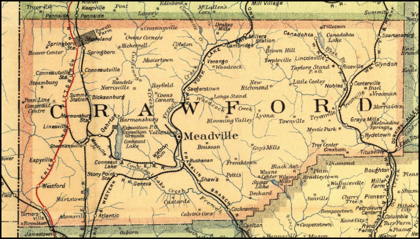
Sharon, Georgia (Taliaferro County; grayed circle):

650px-Taliaferro_County_Georgia_Incorporated_and_Unincorporated_areas_Crawfordville_Highlighted

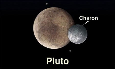
Charon, moon of Pluto:

Plutao-e-Caronte

Conclusion: Sharon is likewise The Moon of Crawfordsville.

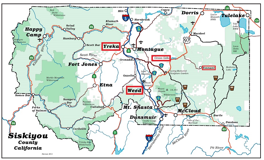
Taliaferro County /ˈtɒlɪvər/ is a county located in the U.S. state of Georgia. As of the 2010 census, the population was 1,717,[2] making it the second-least populous county east of the Mississippi River (after Issaquena County, Mississippi). The county seat is Crawfordville.

I wonder if Hucka D. has anything to say about this? (pause) Apparently not. This is my space. Space.

—–

Oh, and there happens to be a second Sharon in Georgia, in *Telfair* County, which looks a lot like Taliferro in spelling and contains all the same letters minus the “o” (no other relationship I can spot, however). Unlike the first, the Telfair County Sharon is not incorporated. Parts of Telfair lie directly south of Taliferro.*

Pluto-Charon_System

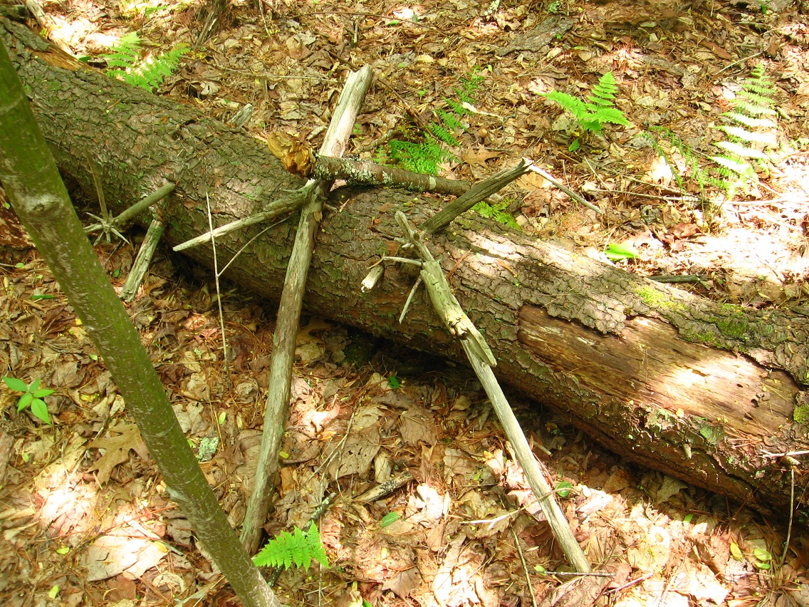
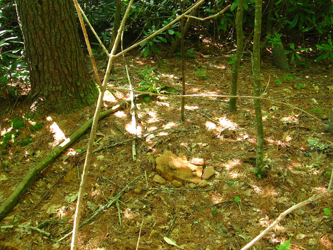
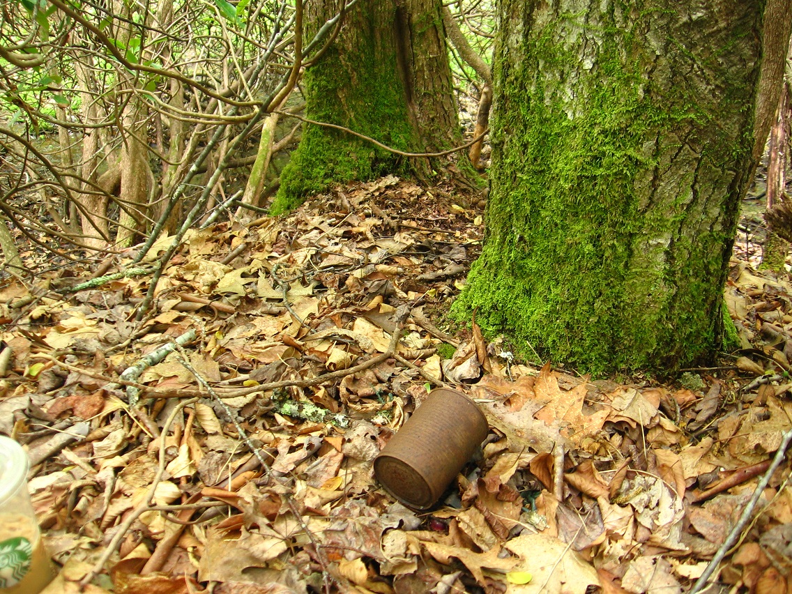
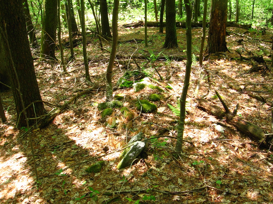
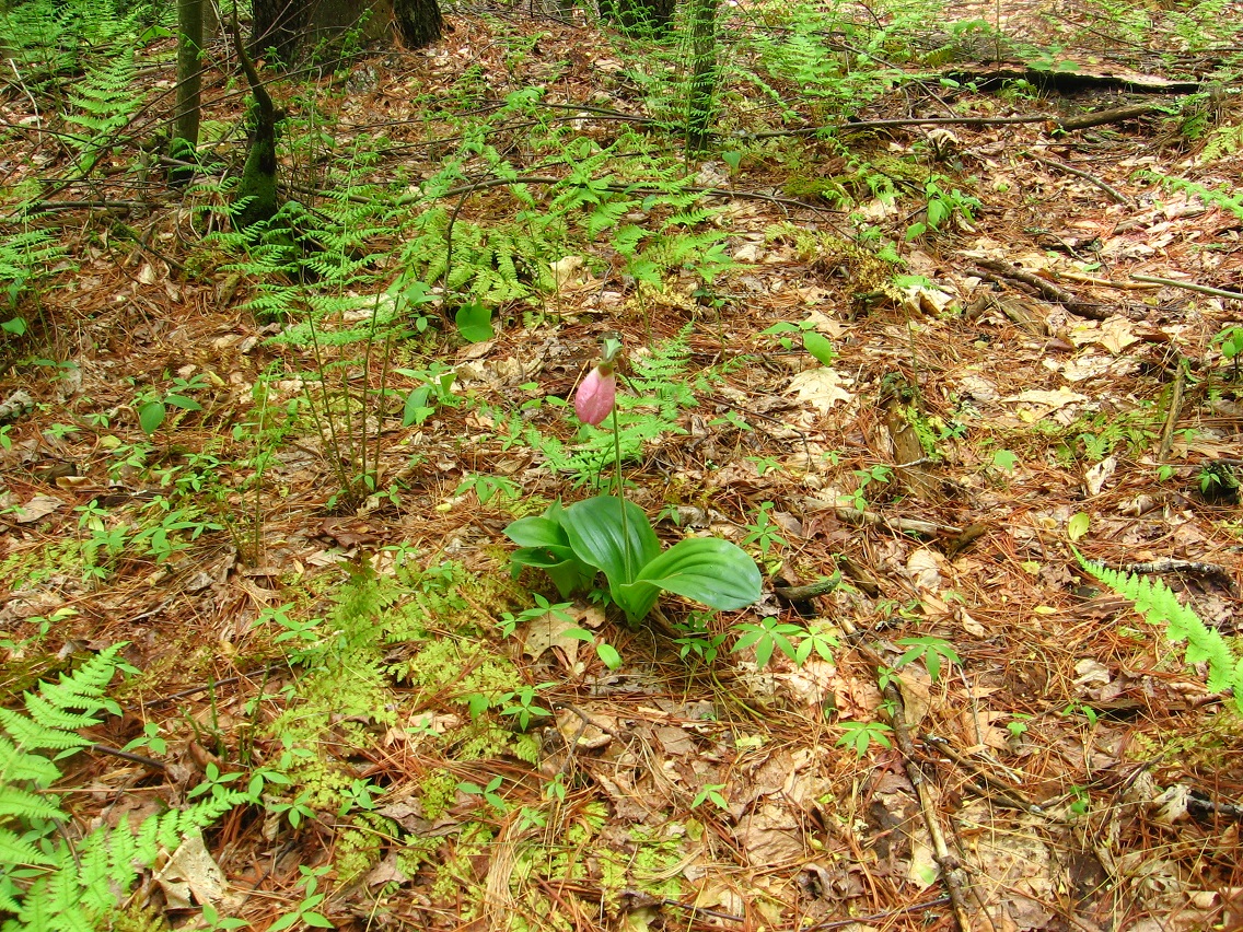
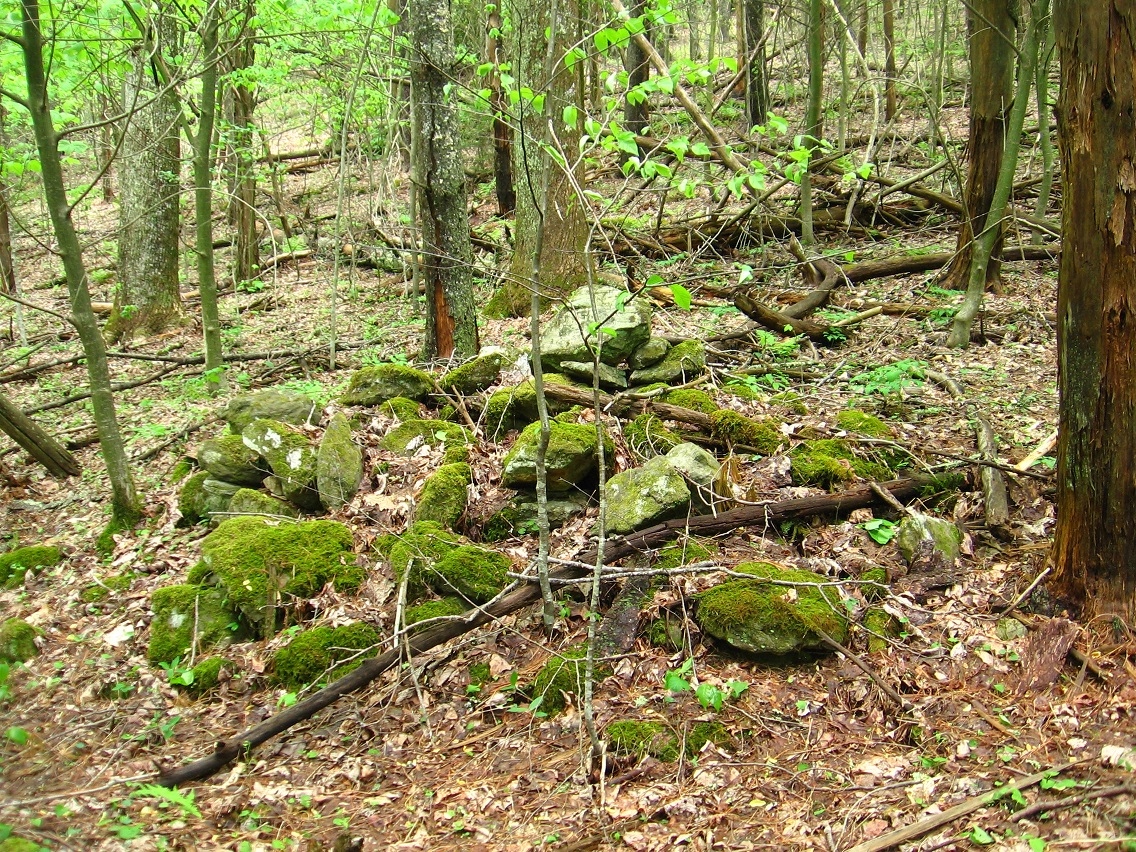
Now the immediate reason I name this place Sharon, or the area Sharon (centered by New Monkey City) is because of the presence of not one but multiple ladyslippers. Ladyslipper (town) was the capital of Mythos’ Sharon.

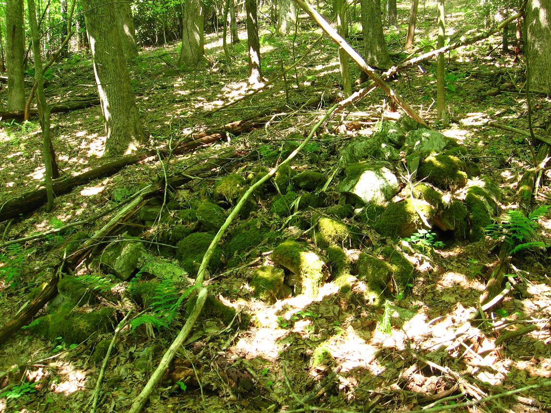
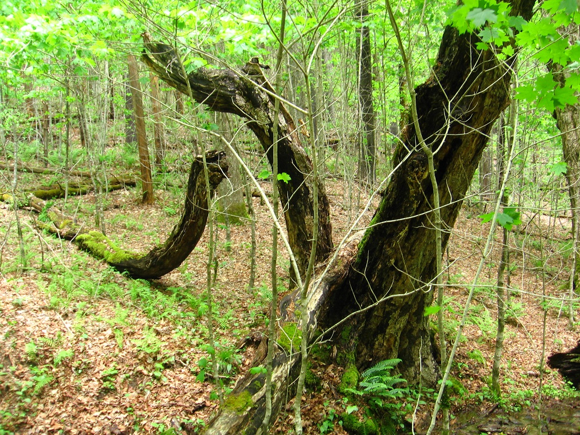
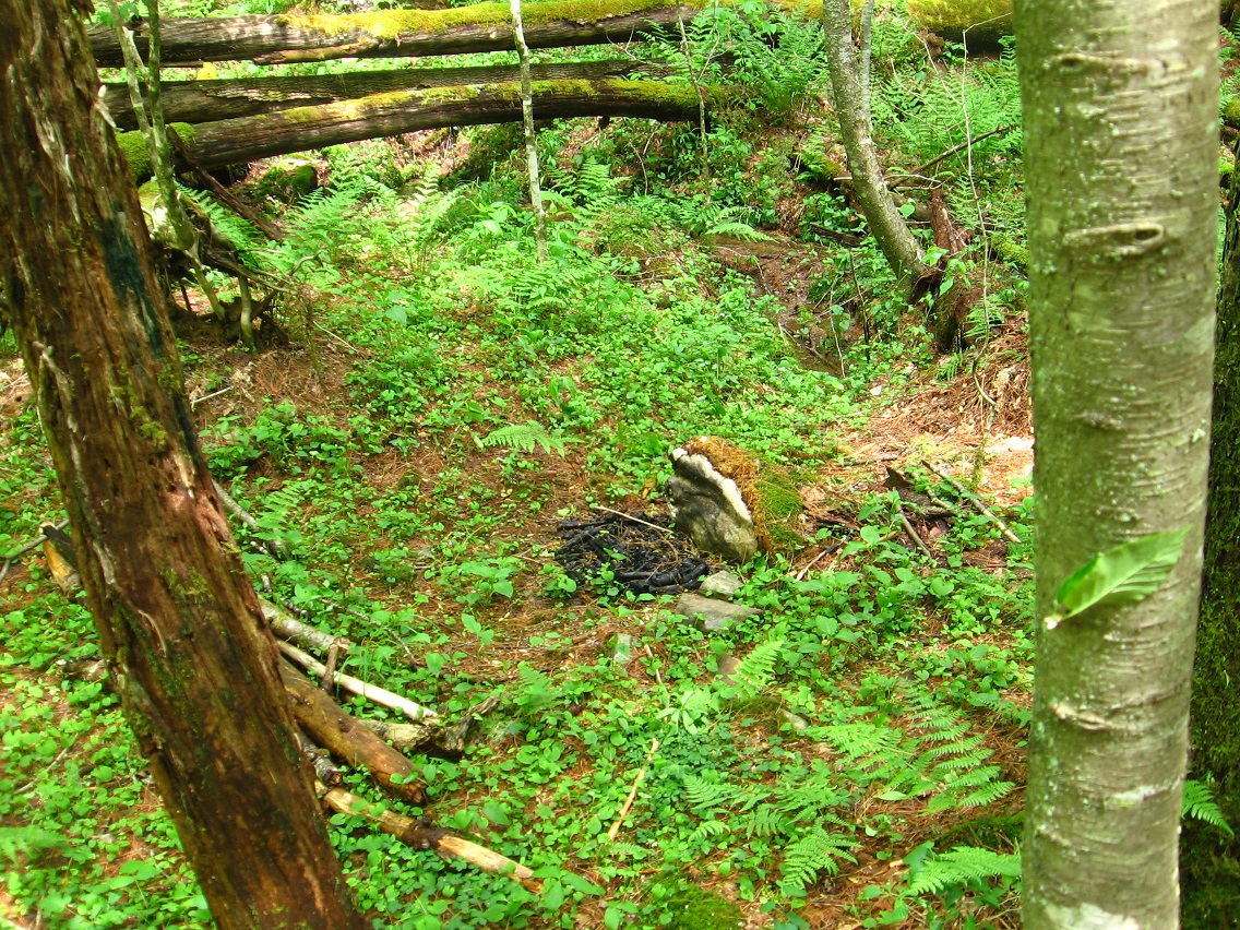
Charon may have been an ancient ampitheatre because of its shape. That’s perhaps at least part of the mythology of the place now.

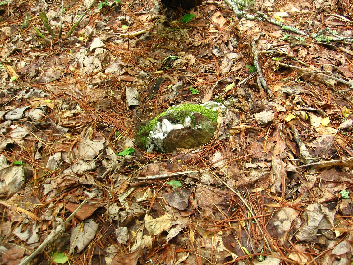
A stone was at its center. Perhaps these are the rounded stones from Mythopolis, that traveled on the last bit of maple from Monkey City. Mom asked me for rounded stones at the end of the day today — my last “task” — and I looked around the old Monkey City area among other places for them. Very tired and also cranky by that time. Something to remember her by.

Tronesis’ Colony of Slippermen could relate to Ladyslipper concept. Colony of Slippermen could also = Sharon.

When New Monkey City was established my guess is that the inhabitants named it Sharon for the Mythos province — perhaps Sharon had just been renamed Chrysoberyl and incorporated into Wazob, and the New Monkey Cy. people identified their own independence with that of Sharon before this reluctant incorporation.

—–

http://en.wikipedia.org/wiki/Charon_%28moon%29

Charon was originally known by the temporary designation S/1978 P 1, according to the then recently instituted convention. On June 24, 1978, Christy first suggested the name Charon as a scientific-sounding version of his wife Charlene’s nickname, “Char.”[19]
Charon discovery image with description

Although colleagues at the Naval Observatory proposed Persephone, Christy stuck with Charon after discovering it coincidentally refers to a Greek mythological figure:[19] Charon is the ferryman of the dead, closely associated in myth with the god Hades, whom the Romans identified with their god Pluto. Official adoption of the name by the IAU waited until late 1985 and was announced on January 3, 1986.[20]

There is minor debate over the preferred pronunciation of the name. The practice of following the classical pronunciation established for the mythological ferryman Charon is used by major English-language dictionaries such as the Merriam-Webster and Oxford English Dictionary.[21][22] These indicate only one pronunciation of “Charon” when referring specifically to Pluto’s moon: with an initial “k” sound. Speakers of many languages other than English, and many English-speaking astronomers as well, follow this pronunciation.[23]

However, Christy himself pronounced the ch in the moon’s name as sh (IPA [ʃ]), after his wife Charlene. Because of this, as an acknowledgement of Christy and sometimes as an in-joke or shibboleth, the initial sh pronunciation is common among astronomers when speaking English,[24][23][25][26] and this is the prescribed pronunciation at NASA and of the New Horizons Pluto mission team.[27][28]

—–

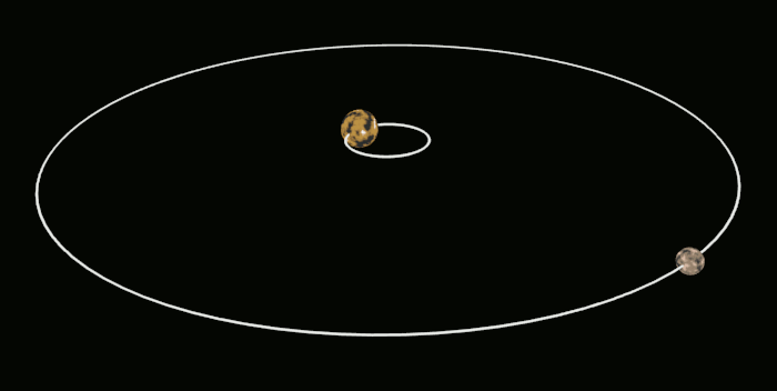
Sharon understood itself as having a 1:8 relationship with neighboring Whitehead X-ing. Separate but making one system, just like Charon and Pluto, another 1:8 volume relationship.

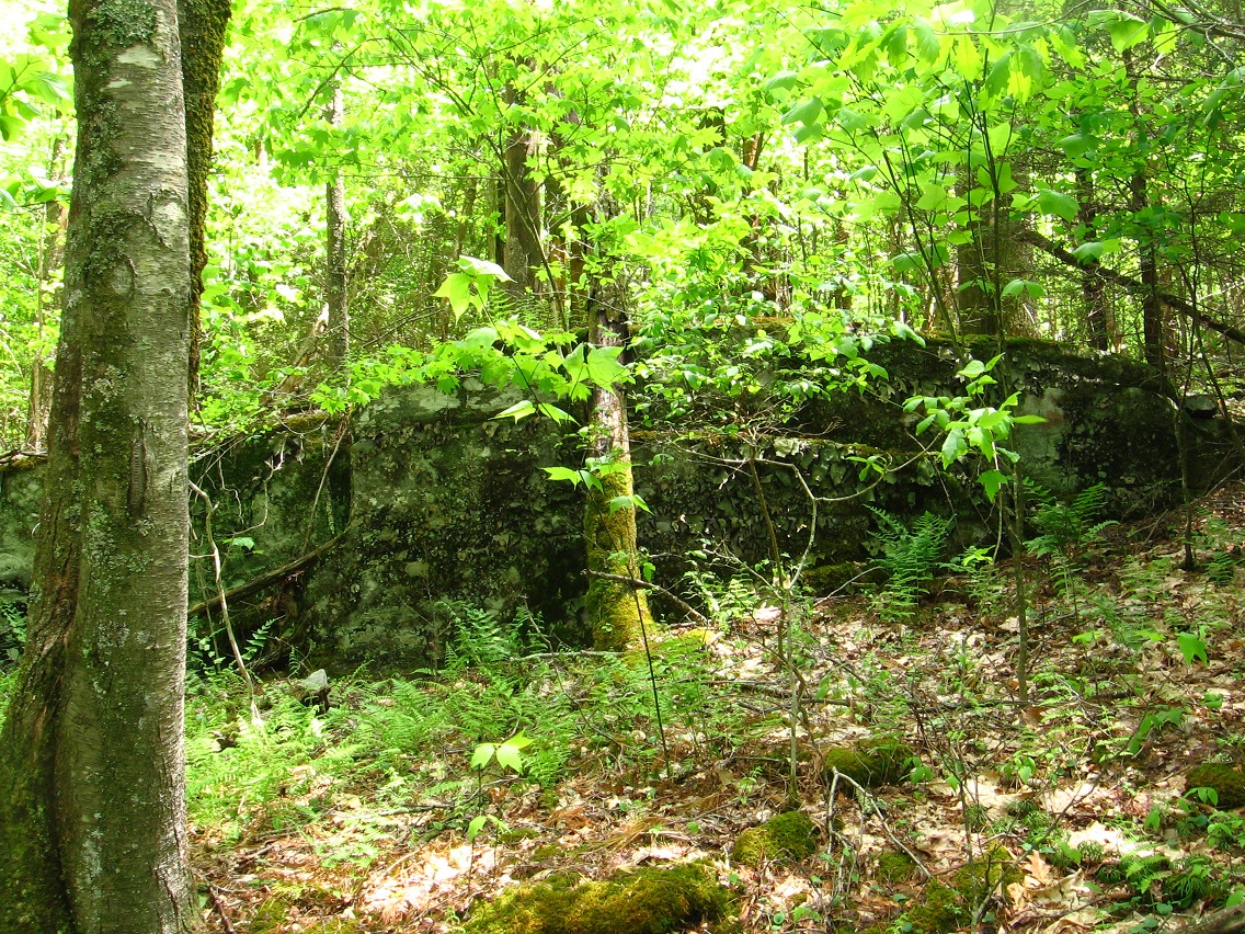
Sharon’s inhabitants originally landed in the equivalent of the Temple of TILE or cubic version of Edwardston Sta. Gallery. 30×30 meters, then. This original ship hovered over the central ground town for some years. I believe it may have even contained the entire “Art 10×10”, since Robinson is on the edge of Taliferro County with county seat Crawfordsville.

un608
Crawford County, Illinois

This may also have been the original Chromacube, which is 12×12 instead of 10×10 if so. However, there are 6 floors to the Edwardston Sta. Gallery, or half of 12.

It was very important for the people of Sharon to remain independent from WH X-ing. They saw this as Sharon remaining ind. of Wazob — directly. It makes sense that the people of Sharon are directly *from* Mythos’ Sharon, launching their rocket just before their home country’s merger with Wazob. Sharon, Blue Mtn. represents the bit of Sharon, Mythopolis that is unique and independent from Wazob. Did Wazob also outlaw toy avatars at this time?

crawfordpa1895
Shade is shaded.

—–

(cont.): These people of Sharon who didn’t identify with the unification of Wazob may have gone to Edwardston to secure a rocketship that could fly them to Blue Mtn. and Frank Park. Did the rocketship basically have only one possible destination? Was Edwardston the only place or one of the very few places in Wazob where rocketships were located and could be launched from? Or did they take their own chromacube(s)?

Sharron or Sharon was the last star forward of the Emerald Elephants college basketball team, last of a quite long list of star players there which also included Moss, Meade, and Greenburg. Costello and Whitehead were stars over at neighboring STI.

More ideas: these people took a “piece” of Carrcassonne in order to rejuvenate her at Blue Mountain and New Sharon. Carrcassonnee = the alien “glop” form of Mythos’ Sharon. She is Sharon. At Blue Mtn., however, she took a different form.

The ladyslippers are now wilting at New Sharon.

—–

* The first 7 letters of Taliferro, in fact, make a direct anagram of Telfair. Peculiar!

1 Comment

Filed under Allen Knob, Frank Park, Georgia, MAPS, Pennsylvania

2130

Blog’s lost a little energy since I made it private. Hucka? Must decide whether to rent or perhaps even buy land in Second Lyfe again. Thinking of renting an 8192 from Lama Estates. Land just west of Rubi is up for sale, but too big a plot and also too expensive. Should I have given up the Rubi land? Well, I had to scale down that’s for sure. And I’ve saved probably 100 bucks already by not holding on to even the scaled down model of VWX Town. So — no, I don’t think so. Would I buy it back now at the same price I purchased it for? Probably!

I’m not ready to let go developing Frank and Herman Parks mythologies, however. Interior woods are basically closed up, however. New Monkey City was kind of an endpoint in spring hiking in that way. New Monkey City, Hucka D.? Not there. Hucka doesn’t seem to want to talk about NMC. Blank and I are bonding over the database. Good, eh? New carrcass will come along sometime — maybe up my Netflix account to 8 DVDs at once in prep. No really firm ideas on what to use yet. Don’t know how I can top the last 3, which also act as 1.

Crop circles should be developing in full soon. Excitement! Always a fun thing to watch in summer months. July and August are the hottest months (sorry).

Must start to organize — everything. MapS keep developing, now in tandem, most times, with Frank/Herman mythology development. Who lives or lived in that house at the end of the 4th Way (into WH X-ing)? Aliens?

Compare impossible or at least highly highly unlikely 4th Way of Frank Park to the 4th and likewise improbable piece of the old Norum Blue Feather Gallery — The Tube. Like The Tube, The 4th Way or just The Fourth represents a steep descent from top to bottom. Who cut the Frank Park one? Why? Just as a shortcut to the park paths like the Maine Trail? Did they know of the centrality of Whitehead X-ing to the parks? Why does the path, if it kept going straight through the rhododendron, lead directly to the Dogpatch Cemetery? Why does it skirt Crushed Man Rock? What is the meaning of The Totem of Silverburg? Joined headstones? (probably) I know Selby lives or lived in that house at the end of the 4th, Hucka D. Selby may have cut that path.

Leave a comment

Filed under Allen Knob, Frank Park

Allen Knob Surroundings 02

Another alien looking tree remain near the one pictured at the end of “Allen Knob Surroundings 01”.

IMG_0027smaller

Still in New Sharon or New Monkey City, I came across this sun splashed array of interesting trees and limbs and thought it worthy of a picture.

IMG_0032smaller

Arrangement of sticks at the end of what I’m perhaps calling The Avenue, framed by a line of trees.

IMG_0033smaller

Interestingly positioned, uniquely marked and colored leaf in the same location.

IMG_0038smaller

The Avenue, pointing directly to 1st Tree.

IMG_0040smaller

The imported remains of Monkey City, which include an intact slice of its central maple and also a number of mainly rounded rocks found around this tree. I’ll re-tell the story of Monkey City soon enough. It’s *old*.

IMG_0052smaller

Root forming the appearance of a handle on the main trail through New Sharon, found where it passes between 1st Tree and The Avenue.

IMG_0055smaller

One of the three prominent rock piles found in New Sharon. I’ll have to make a map of the area soon.

IMG_0057smaller

One of the other two piles.

IMG_0058smaller

I used the 4th Way once more to return to my car from New Sharon instead of just walking back down the Freedom Trail running beside Norris Brook. Here’s a waterfall near the end of the 4th Way. This would be on Gun Stream, which Norris Branch spills into. If so, perhaps a family or perhaps colony incorporating the name Zap lie at this end as well. Zappers?

IMG_0063smaller

Zap Gun > Zap Cannon?

Loose Thoughts…

Leave a comment

Filed under Allen Knob, Frank Park, Whitehead Crossing

Allen Knob Surroundings 01

Norris Stream flowing straightly beside Money Pot (right). Money Hill perhaps, but I like Money Pot.

IMG_0001smaller

Here’s the actual top o’ the pot, then, complete with rustmobile. Elevation is perhaps 10 feet above surrounding landscape. Rumored to be burial place for 1,000,000, courtesy of Michael Won, interestingly enough. Not Michael Too, mind you, who is different. But Michael Won. More on that soon, perhaps.

Another possible name for this knoll is Peewee Big. “Peewee”, because the knoll is not very big. “Big”, however, because of its importance as a buried treasure site according to legend. So, yes, a variant name would be Peewee Big.

IMG_0004smaller

At the upper end of the straightway pictured in photo 1 above comes Root Bridge. We’ve already reviewed this bridge and Money Pot in earlier blog posts, and there’s a whole category called Frank Park/Norris Brook pertaining to this.

IMG_0006smallest

Just a note that the whole area of Money Pot and surrounding flat land is traditionally called Houston, consciously named for 2 counties tagged Houston in our fair US of A. These two “corner” counties, 1 in Minnesota and the other in Alabama, stand for the numbers 2 and 3. This connects with the 1968 election of Tricky Dicky Nixon for US president over runner ups Hubert H. Humphrey of *Minnesota* (*2nd* in votes in the election) and George Wallace of *Alabama* (*3rd* in votes). Also in the Minnesota version of this county is a conjunction of Money Creek and Root River. Pink Floyd famously crooned about money being the root of all evil in today’s society, and that also fits in here.

IMG_0007smallest

Moving a bit upstream from Houston we find this confluence of more interesting rocks that might mark the heart of Norris.*

IMG_0010smallest

We now return to New Monkey City, which may be the same as New Sharon. Two ladyslippers grow and bloom near the top of the ridge. Many more — I believe I counted 13 or 14 — grow just over it to the north. Beautiful. I’ve hiked a lot through these woods recently but didn’t stumble across any more ladyslippers. So this side ridge of Howl’s Knob is identified with the flower, and, through it, Mythos’ Sharon with its Ladyslipper capital as touched on before. I have a story now about how the last people of True Sharon bought or rented a rocketship in Edwardston to travel to Blue Mountain to escape the unification of Wazob, and formerly independent Sharon turning into a “mere” province of Wazob called Chrysoberyl. This was, in fact, the last piece of the unification. The ind. of Sharon from Wazob has resonations with ind. of Texas from U.S. (us) from 1835-1845.

IMG_0014smaller

New M.C. or New Sharon’s own 1st Tree, and another pine just like the case with the same named tree in Whitehead Crossing’s Four Sticks. The wood chunk and rocks of Monkey City lie just before it.

IMG_0017smaller

Native bark of the area with plants growing up through the cracks and breaks.

IMG_0020smaller

Snaggletooth Rock.

IMG_0022smaller

Remains of an old tree that look suspiciously like an alien holding some kind of wand or sceptre. Notice the illusion of the 2 bulging eyes.

IMG_0023smaller

_____

* more on Norris Brook can be find in the Baker Blinker Blog under this category.

1 Comment

Filed under Allen Knob, Frank Park, Norris Brook, Whitehead Crossing

Yreka

Hucka D.:

You must find out the Whitehead X-ing equivalent to Yreka, which is akin to the Vikings’ Greenland and Iceland in that it is the opposite of the name. We know Greenland and Iceland are equivalent to Greene Knob, which will be renamed Gene’s Knob in honor of Gene Fade and his super-opus “Fade to Moss”. Is the story of the Strange or Strang Monster a part of “Fade”?

bb:

I wonder if this Yreka is actually pre-*Leaf*? That would be odd. It looks like from a Siskiyou County map that Yreka would be positioned near the head of No Title Spring, or what was perhaps Norum Spring in the far past.

Weed-CC-map-copysmaller

Hucka D.:

This county is perhaps a snapshot of what Leaf encountered when he entered The Crossing those oh so many years ago. All of California is like this — I think of Eric near Monolith. The Monolith was already present? Or did Leaf build it? And then what of Strange being born in Weed (NM)? Strange is a bartender/monster. Noonan. Frank-einstein.

—–

I think Mossbrae Falls figures into this somewhere as well.

potterpa1895b
Meet

Leave a comment

Filed under California, Frank Park, MAPS, New Mexico, Pennsylvania, Whitehead Crossing

Enter

“Usually the worst thing you can think of comes true in these cases lately. And this is what is happening now.”

bb:

Really, Hucka D.? Over a k-board password?

Hucka D.:

Someone might be trying to set it up to make it look worse than it is. (pause) But don’t worry about it. Print out the e-ls you are thinking about. Justify it through the anagram. State the date should be better known. This will work in your favor. Your ineptitude helps you in this case. You flush stuff out.

bb:

I’m thinking what a full term investigation would show up. The rm program needs revamping. And it is being revamped. And… there’s the matter of the deletions.

Hucka D.:

That could be a big thing. That’s what you can’t think of but might be true. What if it is?

bb:

Emotional blindness if so.

Hucka D.:

Everyone is tense right now. Super tense. You can cut it with a knife as they say. Understand that. Feel it.

—–

bb:

Well, if I may deflect that… odd how the worst thing I think can happen lately then happens. Like the gates of Hades are open.

Hucka D.:

They don’t have to be. Put yourself in the other person’s shoes.

bb:

Can we speak of The Woods?

Hucka D.:

Certainly (!) How’s the Whitehead Crossing explorations going?

bb:

Fine, Hucka D. The woods are closing up for me again. Yet I think I can keep exploring in that area. A key is knowing the landscape, knowing where the poison ivy is, etc., and then just exploring what the summer woods allow me. I’m tempted to not even buy or rent any more Second Lyfe land, Hucka D., more than what I have.

Hucka D.:

Oh you’ll have to buy more land. You’ll see. Read up.

—–

First person — perhaps a Mossman — to visit The Crossing was Leaf Erik’s Son. His father was Red who became the Redhead Father of All. Father God that is. Leaf came from the east — Green Knob, which we may now call Greenland Knob (still working on that name). All the land to the east, after that, became known as Redhead, however, after The Father. Whitehead was named for the white headed God the “Christians” of the region worshipped, and perhaps Leaf himself per the history of his real life double Lief Erickson. Then the Bees inexplicably had a Greenhead, perhaps just a joke to balance out Whitehead and Redhead. Perhaps something to do with Washington Co., Fla. and its Red Head, Greenhead, Whitehead Crossing, Poplar Head, and Orange Hill and Norum.

Leave a comment

Filed under Frank Park, Whitehead Crossing

Night Good

“New Monkey City, eh Hucka D.?”

Hucka D.:

You can ask your questions.

bb:

Okay. I’ve kind of broken the Billfork rule where you don’t take stuff into the parks from outside. Is this okay?

Hucka D.:

As you have guessed, this is okay in this case.

bb:

Thank you. Would it, say, be a good idea to disrupt the stone piles…

Hucka D.:

Not really.

bb:

Thanks again. (pause) Can you tell me anything more about this New Monkey City?

Hucka D.:

Your space. That’s about all.

bb:

I suppose I could move the Whitehead Crossing bottles up there.

Hucka D.:

Good idea. Good night.

—–

Talking to myself now. So the Strange Gang or perhaps Strang Gang came from Erath over in Herman Park to Whitehead X-ing. In a rocket ship. Another rocket ship landed in New Monkey City, which I’ll have to rename soon. The avatars in NMC had more freedom… not as much deep rooted history in the area. 3 piles of stone greeted them. We know the first name, perhaps, of our Strange or Strang. It’s George.

Leave a comment

Filed under Allen Knob, Frank Park, Herman Park, Sharieland, Whitehead Crossing

Whitehead X-ing Area Photos 03

My back feeling better and better almost each day, I decided to risk a steeper descent to the head of Whitehead Stream. It’s White Head, then? This interesting tree was found nearby. Not sure of the species.

IMG_0054smallest

This is the actual head of the stream.

IMG_0055smaller

Nearby logs, one of which which appears to create the visage of an approaching dragon or huge snake in the below photo.

IMG_0056smaller

Old overturned pot found at the source, which appears very similar (a double?) to the one just down the stream found in a number of earlier Crossing photos, most recently in this one.

IMG_0058smaller

Head of Whitehead Stream again. Getting very green in the woods now.

IMG_0060smaller

Small campsite near Maine Trail just downstream. The head or source of the stream lies perhaps a football field west of where it meets this trail.

IMG_0064smaller

Beautiful day here in Blue Mountain fer sure!

IMG_0068smaller

Leave a comment

Filed under Allen Knob, Frank Park, Whitehead Crossing

Whitehead X-ing Area Photos 02

Another day, another Whitehead Crossing area hike. This day I simply had to head up to Howl’s Ridge to investigate that super mysterious seeming 4th Way path again. Who made it? Who if anyone maintains or even walks it these days? Why was it made (since it only seeems to lead to the Woods of Howl, with nothing within)? Also, the night before I found out that the path is actually not in Frank Park (or Herman Park) but lies on private property, and the same property that the smaller of the 2 houses at the end is situated upon. The tax value of the house and property seemed way too low for all the acreage (over 16). What was I dealing with here?

But for the below photo, we’re still on the way up to the Woods of Howl. A quite large, gray snake is at the base of that dead tree. I don’t see many snakes that large in these parts — mostly I encounter garter snakes and the like. However, this one had to be 6 feet in length. It was obviously trying to stay warm in its patch of sun on this rather cold, spring day in the mountains. I think it may be a young blacksnake but I wasn’t quite sure. It wasn’t poisonous; I knew that. The dead tree automatically becomes Snake Tree until if and when I think of a better name.

IMG_0028smaller

Faint but pretty tracable trail leading up to the ridge and past the big snake.

IMG_0033smaller

There’s some poison ivy on the ridge, but it can be fairly easily avoided.

IMG_0034smaller

What I did this day is attempt to figure out where that path across the ridge leads to. It seems to dead end in the rhododendron I stand away from of while taking the below picture, a large-ish rock acting as aterminus sentinel of sorts. Mocking or Mock Rock?

IMG_0038smaller

The path didn’t seem to continue past the rhododendron. I’ll have more to say about this mysterious end soon enough. I believe it could be a haunted path.

IMG_0039smaller

It was on this day that I visited a side ridge of Howl’s Ridge that seems to have become a personal center in the woods, and also appears to have a separate energy from Whitehead Crossing. Smaller and separate — more personal. Look at the beautiful ladyslipper that greeted me when I reached the flat part of this side ridge. And more were just around the corner!

IMG_0042smaller

This is the center of the area: a type of parallelogram of small trees near a large pine tree on the edge of surrounding rhododendron. I do not have a name for the tree yet, but it is another center.

IMG_0045smaller

Rock in the area: tempted to call it Tooth or Toothy Rock for obvious reasons. Maybe Snaggletooth Rock.

IMG_0046smaller

There are 3 large piles of rocks on the slope nearby. I believe Hucka D. is warning me off about using these rocks for some type of art happening.

IMG_0048smaller

IMG_0049smaller

Low or Long Rock again, not far up the hill from Ladyslipper Ridge (prelim. name).

IMG_0052smaller

Leave a comment

Filed under Allen Knob, Frank Park, Whitehead Crossing

Whitehead X-ing Area Photos 01

Small rock carn greets me at the beginning of the Maine Trail, heading toward Whitehead X-ing once more.

IMG_0001smaller

But today, as was the case with the last visit I believe, I didn’t even make it to Crossing proper but got sidetracked on Howl’s Ridge. Below is a quite interesting, long and low rock on the western edge of the forest, a rock I seem to run into during almost every recent visit to this ridge. Magnet Rock might be a good name due to this attraction property. Low Rock is another possibility, or Long Rock. Whatever, it’s by far the largest rock found near the Woods of Howl.

IMG_0004smaller

Here’s the thick of that piney woods. Sir Roger Pine Ridge would probably feel right at home here.

IMG_0006smaller

Here one of those amazing Crossing area finds: I emerged from the Woods of Howl on the north side of the ridge, following a faint but obvious path through upper part of these woods. Then the path continued downhill, *cut through a thicket of rhododendron*. It was obvious that someone put a lot of work into this path. But where did it lead? I had rough ideas when I headed downhill through it (still cautious of my wonky back, since I was suppose to avoid downhill walking when I was more in the early healing stages). On and on it went, chopped through rhodododedron, and still a path in pretty good shape although I can’t imagine who would use it.

IMG_0013smaller
Angular set of rocks encountered on the path, which I’m calling the 4th Way, since it has become the 4th pathway into The Crossing.

The path became steeper toward its terminus. Soon I was on flat ground, and spied a large house through the trees. I knew where I was. The path continued between this house and another, smaller house, which I’ve earmarked for further investigation. A nesting spot for woodsy aliens?

IMG_0016smaller

IMG_0020smaller
Large rock just beyond end of path, where it meets a dirt road. Almost hieroglyphic in nature.

The house at the end of the path in question. Beautiful setting, no?

IMG_0021smaller

Leave a comment

Filed under Allen Knob, Frank Park, Whitehead Crossing