Category Archives: Haze County

Sharieland 01

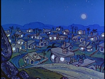
We now come to what appears to be a fall hiking focus: Sharieland, an area of Herman Park tagged with that label mid-May of this year. Basically speaking, this area consists of the immediate environs of Herman’s Mansion and then the whole valley extending below it to the southwest all the way to Head Lake, a distance of a bit less than 1 mile as the fly crows. All the peaks and ridges immediately rising up from this valley on its sides are also considered part of Sharieland. An initial map of the area where each part is identified with a particular planet, per a palmistry association implied by its central Heart Line or Heart Path, is found at the end of this follow-up May post. This map will most likely be updated and re-created in considerably more detail before October is over.

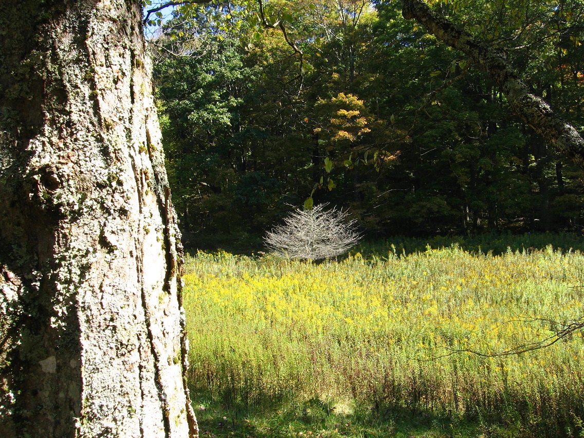
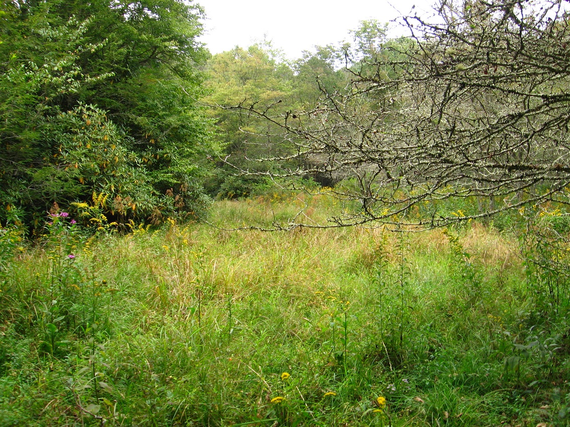
The meadow pictured below is the site of a newly discovered and very important path, which, after studying palmistry related images online, I’ve decided to call the *true* Heart Line, at the same time transforming the old Heart Line into Head Line. I think.

—–

There’s no doubt in my mind that Sharieland is directly connected to palmistry and its various lines and mounds, but I think the association can be flexed to make, for example, different lines attach to different Herman Park paths. After studying the matter for about 1/2 an hour presently, I’m going to call the new path the *Head* Path and keep the Heart Path as is (as I designated it this past May). The actual *shape* and *relationship* between Head Path and Heart Path more resembles that between *Heart* and *Life* lines of palmistry, as I’m examining the various pictures of hands and lines found in a Google image search on the subject. But keep in mind… well, let’s just leave it at that for now to continue moving the text forward. I’ll have more to say about all that soon enough in future posts here. NOTE: Head, Heart and Life are generally regarded as the 3 major hand lines of palmistry.

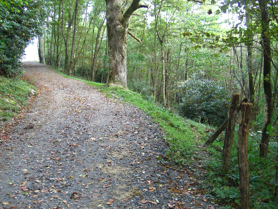
So the eastern edge of the meadow below represents the beginning of *Head* Path, which extends itself about a third to a fourth of a mile directly downhill from Herman’s Mansion, and runs in a general northeast direction from this meadow. Despite being situated on a steep slope, the path itself is basically level throughout its course, apparently following the line of an old road. The mansion would lie directly uphill from about its center.

IMG_0005smaller

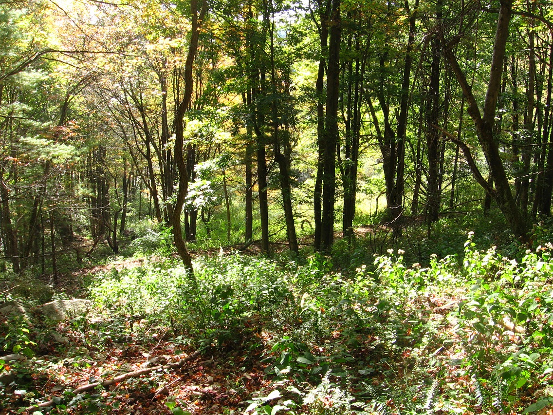
This is a view down from a point on Head Path to Heart Path below, at about this central point of the former. In the middle of the picture one can make out the very interesting arching branch that seems to act as a gateway to the meadow beyond. I believe this particular effect to be fairy induced.

IMG_0010smaller

Clash of red berry spotted bramble bush and fern. I think this particular thorn is a barberry variety, perhaps Japanese Barberry. If so, it seems to also be considered an invasive plant, avoided by deer and prone to ticks. Pretty, though. There are a considerable number of these bushes around Head Path, but not so much as to impede progress along it in any way.

IMG_0013smaller

Briar choked end of a trail splitting off from Head Path nearer its western terminus. I had a desire today to get to that rock pictured here but it was hard going, not only because of the briars but I also ran into a bit of poison ivy along the way. I made it, however (probably shouldn’t have tried?).

IMG_0022smaller

A rockier section of Head Path, in moving toward the center now. Again, this is not any officially recognized Herman Park path, but a traceable trail nonetheless, probably used by both deer and cows on occasion.

IMG_0030smallest

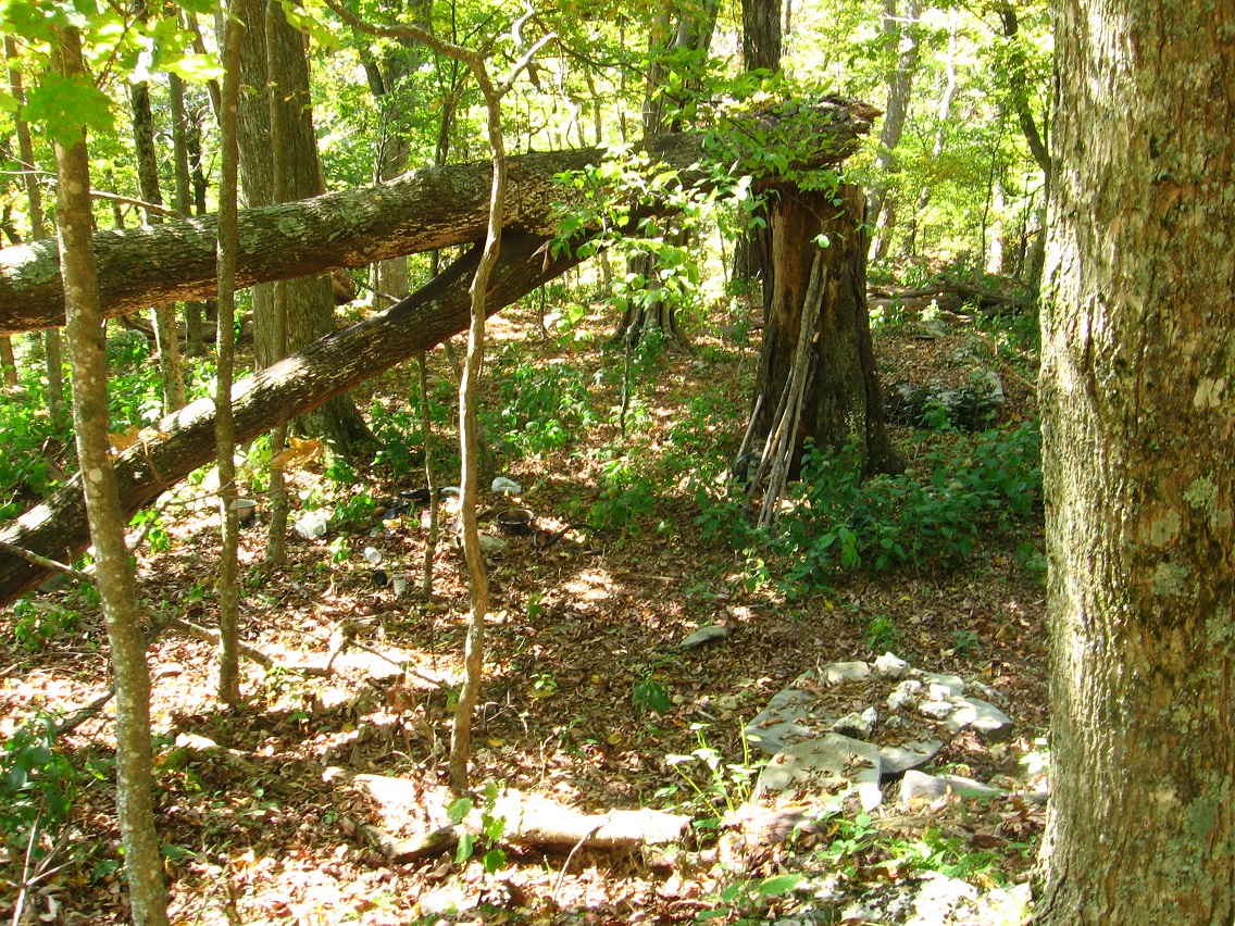
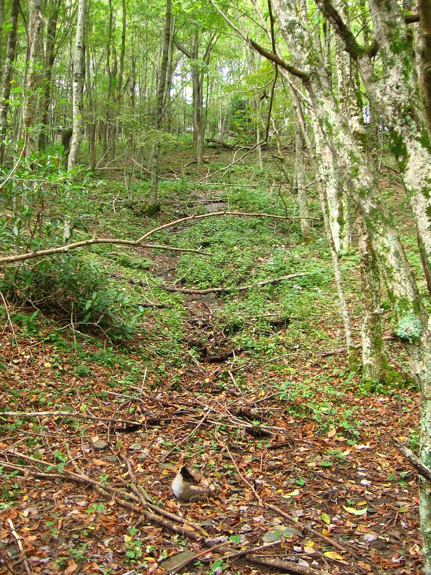
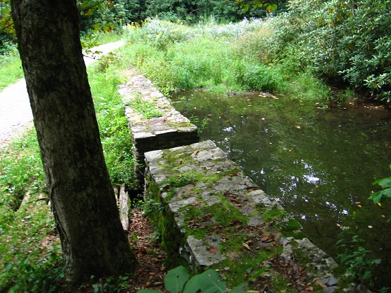
There are obvious signs of human activity from the past near the trail, like the remains of a rock wall here. But no humans besides me hang around here any more in all likelihood. It’s just Baker, cows, deer and other wildlife. 🙂 I will say that you can frequently hear the voices and sounds of walkers from a nearby, fairly heavily used path, however — just uphill.

IMG_0033smallest

A more impressive tree/bush that sprouts near the center of Head Path. I’m not sure what type it is yet, but the plant appears to be identical to the one found in Yellow Down (last photo from this September post). In my opinion the plant actually defines the center as much as any other object.

IMG_0035smaller

I thought I’d include this photo in the blog because of a somewhat interesting illusion caused by a yellow and green plant directly in front of one of the central trees, giving the appearance of a skeleton outfit almost.

IMG_0036smaller

Skeleton-Halloween-Costume-For-kids

Another shot of the fairy arch…

IMG_0046smaller

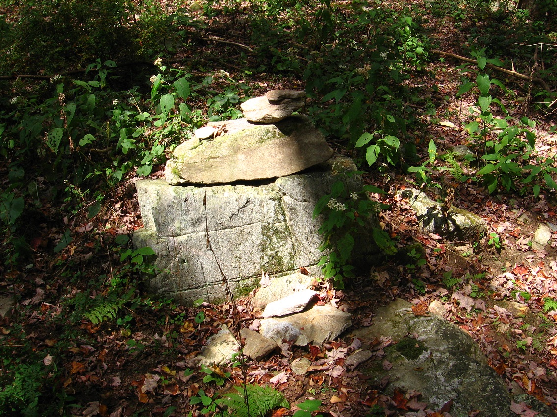
… and nearby fairy rock stacking. There is obviously considerable psychic energy in the area.

IMG_0054smaller

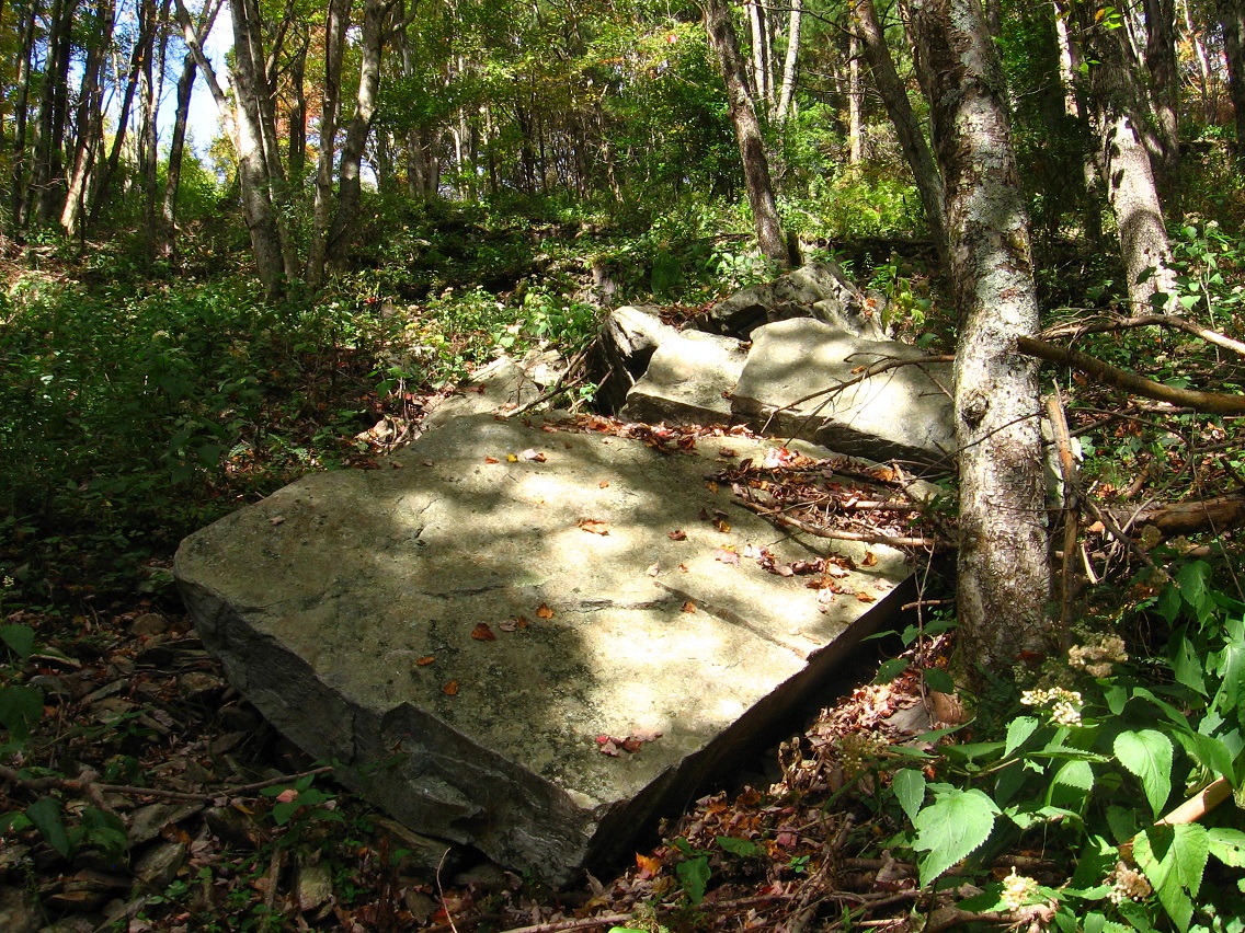
Larger, squarish rock of what I’m now perhaps calling Vale of Null or some approximation thereof.

IMG_0057smaller

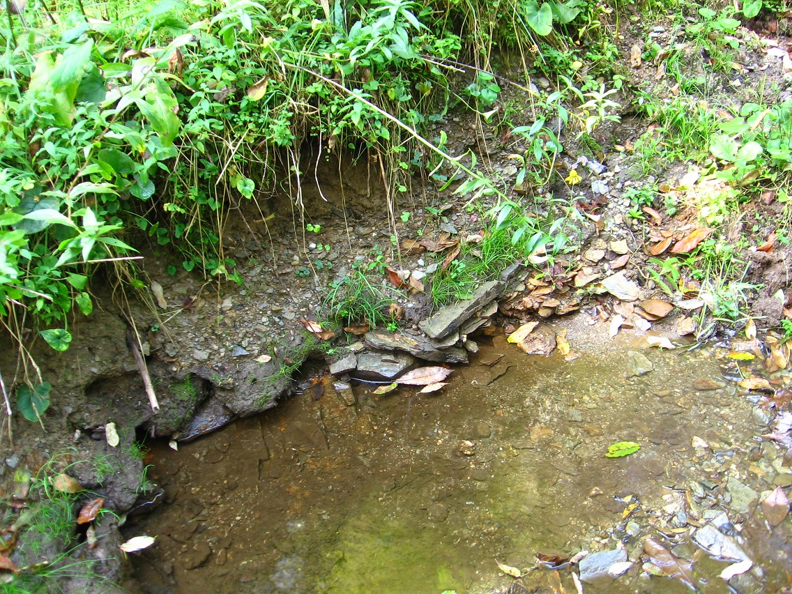
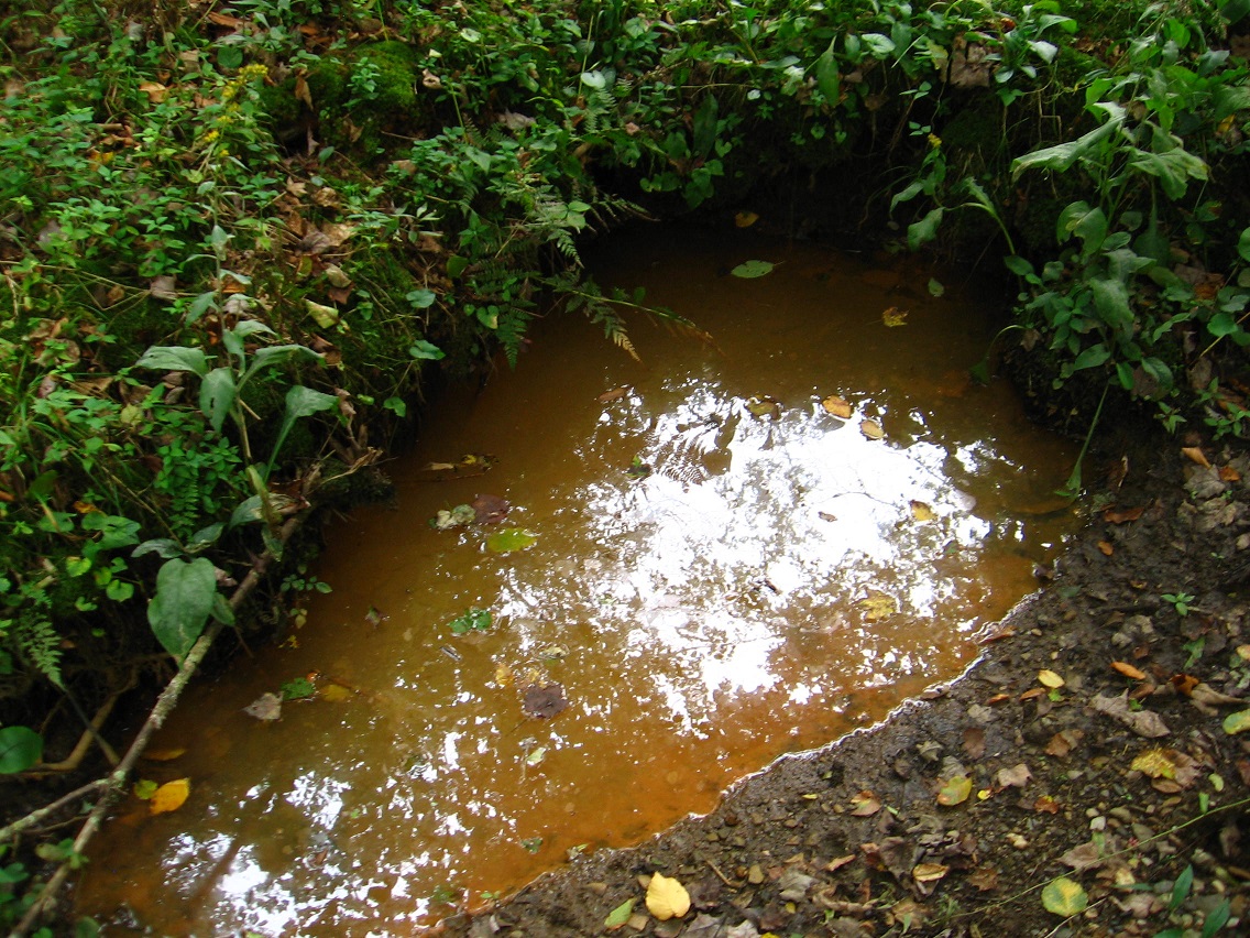
Amazing moss and lichen microcosm found in another valley leading to Heart Lake further down the hill. But the picture didn’t turn out too well. I’ll try again soon.

IMG_0058smaller

Nearby pile of rocks with a piece of plastic underneath the topmost one. Trying to take yet another cue from The Woods, I then wrapped this rock up in the plastic underneath it (perfectly covering it) and took it home for further examination. The wife said it gave the appearance of a piece of bread, or a scone-like pastry. Scone Rock is the name, then, since scones are often wrapped in plastic when bought.

IMG_0061smaller

On the same day of hiking, I visited Methril in Frank Park and found this end of a projecting log, which looks like a barking or snarling dog, just before hearing a group of wolves or coyotes eerily howling in unison nearby. I high tailed it out of there before dusk proceeded any further!

IMG_0064smallest

Leave a comment

Filed under Frank Park, Herman Park, Sharieland, Thrill

Wealthy Mtn. 01

Defender of The Depression (actually it’s an extremely rusty oil can).

IMG_0001smaller

Stones of Bedrock’s stream crossing.

IMG_0004smaller

Two identical guardian bushes of Bedrock, one light and one dark, like the pillars of Boaz and Jachin.

IMG_0009smaller

Platform area above Bedrock, once more.

IMG_0011smaller

Leafless tree across the goldenrod filled meadow from here.

IMG_0015smaller

Rusted out barrel in the meadow just above the center of Dark Space/Brownie.

IMG_0018smaller

Some scenes from the old Michael Too campground situated upon a ridge on the other side of the mountain, also visited on this same hike.

IMG_0040smaller

IMG_0041smaller

IMG_0042smaller

IMG_0043smaller

I’m counting 9 rocks now on Michael’s rock table, with Hucka Doobie’s impressive yellow quartz formation [LINK] still missing. Where did it go??

IMG_0045smaller

IMG_0050smaller

The central, dark object is just a piece of projecting bark, but doesn’t it look like some kind of unlit, foreboding spirit from this angle?

IMG_0060smaller

Rock below Michael Too giving the appearance of a log; in fact, I thought it was a log upon first glace. Log Rock it is, then. Might be connected with VWX Town’s Big Log pictured in the blog post below this. Big Log = BLog?

IMG_0062smaller

Leave a comment

Filed under Green Oz Creek, Herman Park, Wealthy Mountain

Bedrock Mystery

Bedrock

bedrock crackhttp://minecraft.gamepedia.com/Bedrock

http://bedrockorbust.blogspot.com/2010_09_01_archive.html

Pictured to the left is a spot that kept my interest high. This bedrock crack payed me 55 chunky pieces of gold in one pan within the area circled. That’s only about a foot in length. I chased the crack further toward mid-stream but it didn’t pay as well as it did within the circled area.

Bedrock_skyline_season1

Leave a comment

Filed under Green Oz Creek, Herman Park, MAPS, Tennessee, Wealthy Mountain

two in one, foreign one

wis

Drinking from the fount of pure synchronicity. W(e) IS renewed.

http://kdk12.tumblr.com/post/4879566957/the-shining-forwards-and-backwards

http://www.spectacletheater.com/the-shining-backwards-and-forwards-and-inwards-and-outwards-in-high-definition-anaglyph-3d/

http://vimeo.com/53766925

Leave a comment

Filed under Carrcass Artists, Green Oz Creek, Herman Park, Qbrick, Stanley, Shining, The, Wealthy Mountain

News, Notes

My ailing mother appears to be making a recovery. I know she is attempting to avoid a nursing home/assisted living situation as much as possible. She needs to take her vitamins so she won’t be so weak. She’s doing well, very well… for a 92 1/2 year old. This weekend I will be down with her again.

For lack of time, let’s go ahead and call in Hucka D. if he’s around. Hucka?

Hucka D.:

Hi baker. Good job with your mom. You got rewards points.

bb:

Thanks, Hucka D. Not out of the woods yet.

Hucka D.:

No, back *in* the woods. This weekend.

bb:

We’ll see. So, Green Oz Creek. That’s been the focus around this time of year 3 years in a row now, Hucka D., starting in 2011. And that initial focus was also the beginning of the obvious shift from Second Life to Real Life exploring for blog recording purposes. Each “passage” through Green Oz and Green Oz Creek as a whole bring more understand, more focus to the overall picture. It is a large story. Now, although Green Oz Creek has been a September focus the last several years, it’s also shifted, itself, into other stories during October and November. First we have, as I’m sure you’ll remember, the shift of Green Oz energy into norris or NORRIS or Norris.

Hucka D.:

My ex!

bb:

Yes… to the reader or readers, Hucka D. was actually married to this creek for a spell, according to him.

Hucka D.:

Truth!

bb:

That was 2011, when we were still working within the framework of the Baker Blinker Blog.

Hucka D.:

Yeah.

bb:

Then in 2012, and at the start of the current Frank and Herman Einstein blog, we shift an initial focus on Green Oz Creek into *Byng*, yet another stream. This involved the creation of the Lion’s Roar community and also the development of the Kentucky Platform and its Bee Line, etc.

Hucka D.:

Good times.

bb:

Now in 2013 we have the same situation: Green Oz Creek, in September, once again is in the blog spotlight, the blog crosshairs. Actually I don’t like that latter expression.

Hucka D.:

No.

bb:

What will it shift into *this* year? What will be my fall hiking focus, Hucka D.?

Hucka D.:

Opening the presents before Christmas are we?

bb:

Attempting to. Okay, you probably can’t tell me.

Hucka D.:

Green Oz Creek will continue to be the focus this time of year. Year after year after year. Tin Commandment: Love others as you love Yoself. Focus on Gold as original community of Tinsity area. Gold powder… Ark. Tinsity and Tin S. Man had it. The gold was buried, awaiting… (pause)

bb:

Harvest?

—-

bb:

GNIRPS, hehe, isn’t working tonight? What of GNIRPS?

Hucka D.:

Lisa the V. set up with her unlimited wallet, er, purse. Bottomless, I meant.

bb:

And this has to do with Carrcass-1.

Hucka D.:

Yes. Skillet. Skillet Swamp. Green Oz Creek. Wallace. Wallace3. Stares into hole. Greenup, but Yellow Down at the same time. Green Oz is bourne. Wallace.

bb:

Is Wallace an older community than Tinsity?

Hucka D.:

Two in one. Foreign one.

bb:

I’m sensing you cannot answer that quite yet.

Hucka D.:

You have a sign set up on the main path of the area: Tinsity that-a-way. Tinsity directly ahead, 0.2 miles. The sign will be created. At the tree. Sign Tree.

bb:

The Tinsity trail, from this direction, passes through Dark Space. What is the purpose of Dark Space?

Hucka D.:

Barrier. Is Tinsity aligned with Dark Space or not? We don’t know yet. Back to Gold…

—–

bb:

Tinsity is also going to be the name of the last Carrcass, Hucka D. Technically I suppose you would call this one Carrcass-10. But Carrcass-8, Carrcass-9, and Carrcass-10 make a triptych of audiovisual collages, much like the triptych ending the Latona series. Those were collages 8 9 and 10 as well.

Hucka D.:

Carrcasses, a blog term after all, will be seen as a set beginning in “0” and ending in “10”. 8, 9, and 10 will form a collage. The names will be Eight Ball, Number 9, and Tinsity. You start thinking of Tinsity collage as you are exploring Tinsity city in Herman Park at the same time. No chance.

—–

bb:

Do I keep VWX Town around this winter?

Hucka D.:

No.

—–

bb:

Communication between me and the co-worker will start to become limited now, Hucka D.

Hucka D.:

As it is.

bb:

He is Tin S. Man.

Hucka D.:

*You* are Tin S. Man. You both are.

bb:

So Tin S. Man… me as the boss of sorts, has his castle still, Hucka.

Hucka D.:

Not saying nothing.

bb:

I’ll have to get [another] student worker. I can’t work there alone.

Hucka D.:

No.

bb:

But back to Green Oz: I believe Wallace3, staring into the hole, saw Greenup and Yellow Down simultaneously. This is like playing a movie both forwards and backwards at once.

Hucka D.:

Yes (!)

Tinsity is about The Shining.

Hucka D.:

Yes.

bb:

A new Dark Side of the Rainbow has been created.

Hucka D.:

Yes.

bb:

Two in one. Foreign one.

Leave a comment

Filed under Green Oz Creek, Herman Park, Wealthy Mountain

Green Oz Creek Again 02

What will be called the traditional entrance to Tinsity according to Hucka D., who is able to peer into the future with his prescient bee vision. Is Tinsity that important? According to Hucka D.: Yes. The trail can be seen to veer off from the carriage road in the lower right corner, next to the barb wire fence. Presently this is only a secondary cow path, with the general public not knowing anything about its ultimate importance. Is it really that important? Yes, answers Hucka D. once more. I’ll just have to take his word for it for now.

The large tulip/poplar tree acts as a nice landmark for the trail’s beginning. Hucka D. further states that this positioning means that the trail will be pop(u)lar in the future. I’ve told him just to stop with the silly puns.

IMG_0131smaller

If you continue on the road you’ll soon come to a large meadow region with nice views to be had all around.

IMG_0133smaller

If you continue down the Tinsity Trail instead, you’ll soon come to an interesting landscape depression pictured below, of unknown importance or origin. I think Hucka D. wants to revisit this depression in the future. He’s stating something needs to be inserted there. The depression lies directly above one of the several seeps that run down to Green Oz Creek in Yellow Down, perhaps 5 or 6 in number. Will each one garner a separate name?

IMG_0137smaller

Holey moley! You can imagine my reaction when I spied this skull across perhaps the same seep lower down, suspiciously well positioned on a small, flat ridge just above. From this angle it certainly looks alien, or at least dinosaur-like. To my relieve (phew!), it’s actually a cow skull turned on its side. But what an illusion, given all else that’s happened in Yellow Down before it! I plan to make a separate posts reviewing photo oddities from this region in the coming days.

IMG_0139smaller

This same seep empties into Green Oz Creek very near the previously discussed Rib Rock, already associated with reptiles and dinosaurs through a Flintstone lineage. The ridge with the cow skull is inside the shaded area at the top of this photo.

IMG_0143smaller

Green Oz Creek shoreline nearby.

IMG_0147smaller

Moving a bit further downstream, we have a photo of 2 more interesting rocks near View Rock, itself perched just above Green Oz Creek below I. Rock. For the record, we presently have 3 named rocks in Yellow Down: View Rock, I. Rock, and Rib Rock. But with more appellations to come, I’m assuming.

IMG_0156smaller

Another seep in Yellow Down, this one with an old pot near its leafy source.

IMG_0160smaller

View Rock (foreground) and I. Rock (background) together.

IMG_0157smaller

Leave a comment

Filed under Green Oz Creek, Herman Park, Wealthy Mountain

Green Oz Creek Again 01

Stepping stones across Green Oz Creek leading to “Bedrock”, just off camera to the right here. Yd Falls can be seen in the background. More soon on this Bedrock, seemingly an ancient community of Yellow Down according to Hucka D. Isn’t that right Hucka D.? (Hucka D.: No. I mean, yes.) Anyway, this relates to finding Rib Rock in Yellow Down as well (another Flintstone image: see here), and also the reptilian or dinosaur-like face of I. Rock — along with the very queerly positioned “reptile” skull just up the hill from it. More on that very soon as well. My September experiences in Yellow Down are making for quite a story!

IMG_0103smallest

Lichen and moss decorated top of an as yet unnamed, larger rock in Yellow Down, demarking a lower edge of this Bedrock area. More comprehensive picture of this rock here.

IMG_0105smaller

Directly above this Bedrock is found an flat, open woodsy area, with several interesting characteristics. Like the below pictured rock with a pile of smaller rocks on top of it…

IMG_0117smaller

… and several old but still standing fence posts like this one.

IMG_0119smaller

The posts continue through a marshy stream bed below, whose flow then passes through a small grove of rhododendron and into Green Oz Creek about at that rock seen in photo no. 2 above.

IMG_0123smaller

Another fence post in the same row.

IMG_0125smallest

A huge, dead oak marks the lower corner of the open area; hollow in nature.

IMG_0126smallest

Another fence post on the upper end of the same area, laying on the ground near a moss covered stone just beyond the similar stone containing the rock pile mentioned before.

IMG_0127smallest

Interesting tree with prominent, downward projecting dead limb sighted across the goldenrod filled meadow from here.

IMG_0129smaller

Leave a comment

Filed under Green Oz Creek, Herman Park, Wealthy Mountain

S. Man

“Hucka D., I believe I’ll take my toys out to Wallace early Sat. morning, before the rain comes.”

Hucka D.:

Good idea. Who will be there. Carcassonne? Cardboard Derek Jones?

bb:

No that’s Second Life characters, Hucka D.

Hucka D.:

They can be there[ though]. What’s the relationship between VWX Town and Wallace? Just asking.

bb:

Unsure Hucka. What do you think it is?

Hucka D.:

Unsure as well. Wallace now seems more important than[ neighboring] Tinsity, at least…

bb:

At least temporarily.

Hucka D.:

Tin S. Man, the original, is still in the picture Hucka D. I have not yet fully become Tin S. Man, then. The original is still around.

bb:

Hucka, you seem to be channeling me again but more completely. Can we talk about Tin S. Man?

Hucka D.:

Tin S. Man has his castle, which is threatened. The co-worker doesn’t really care one way or the other. Go in Sunday and do some stats if you have to.

—–

I don’t think it’s going to be a train track happening. Maybe just take pictures of rocks and stuff there[ at Wallace].

Wallace:

I am alien. Dragon. Dragon eyes. Limited by circle. Schwa. Trying to communicate.

bb:

You are Wallace3?

Wallace3:

Maybe.

bb:

I need to make a map.

Wallace3:

Saturday.

Leave a comment

Filed under Green Oz Creek, Herman Park, Wealthy Mountain

wallace_mouse

wallace_mouse

Leave a comment

September 18, 2013 · 5:56 pm

Green Oz Creek 01

Dam on the lower part of Green Oz Creek, below the Green Oz region proper. To remind, Green Oz Creek passes through Green Oz proper during the middle part of its journey from the side of Wealthy Mtn. to Health Lake, a total distance of less than a mile. I believe this is the only dam on the creek as well to my knowledge.

IMG_0024smallest

Yet another photo from Green Oz now, looking from the northern meadow into the heart of the Yellow Down section of this region. Green Oz Creek can be glimpsed in the center of the picture.

IMG_0028smaller

Interesting, purple-ish triangular rock in Green Oz Creek at Yellow Down.

IMG_0039smallest

A nearby, orange-y seep emptying into Green Oz Creek from the opposite direction.

IMG_0042smaller

Skillet Swamp in Greenup, just west of Tinsity/Wallace.

IMG_0045smaller

Still unnamed muck pool at Wallace.

IMG_0047smaller

Wallace Beach, where I found the mysterious hole dug last weekend (LINK).

IMG_0052smaller

Closeups of the quite interesting double cone shaped end of a branch projecting over Green Oz Creek opposite Wallace Beach. Again, it, as yet, has no name.

IMG_0056smallest

IMG_0057smaller

IMG_0062smaller

Wallace Beach from the direction of Tinsity, muck pool to the left of it and double cone end of stick to right across the stream. The mystery hole is in the center of the beach, but hard to spot from this angle.

IMG_0066smaller

Interesting cluster of leaves apparently caught by a spider web in a tree growing on the western edge of Wallace, just past the entrance sinkholes. Unusual seeming (once more).

IMG_0071smaller

Leave a comment

Filed under Green Oz Creek, Herman Park, Wealthy Mountain