“Well, go ahead and read me my A B C’s or 1 2 3’s or whatever. We’ll head down to the station, then, and see who’s who and what’s not.”
“Break it off, Kevin,” spoke Jenny, out of her role as Heartsdale police officer Candy Candle Cane. Because she’s always on fire. “Big Black Smoke is out of room 03 again.”
“Uuhhh. I don’t care.”
“Shhhhh.”
—–
You have to go back, Jack. Blue is Pink and Pink is Blue. They’re calling for you.”
“Then I will take your name with me to remember you by, um, Precious. Jack Blue I am from now on.”
“Ingratiate yourself with Green, Brown. They will guide you. Leave Olive alone,” she warned.
They switched places and he ate her cake too.
—–
“Jack Blue, huh? You don’t *look* like a Jack. You’re certainly blue, though.”
“And you’re Green,” Jack Blue quickly followed.
“Pink is dead.” SEAN “Green” Penn’s head hung low, remembering the day he heard like it was yesterday even though it was 5 years ago. Now he was in Little Rock, Arkansas but certainly with a bit of the (New Orleans) blues left. And now a Blue itself shows up. Himself, herself. Something.
“I know,” Jack Blue tries to console, also thinking about Brown. Plans gone awry! “Let’s turn our attention back to the map and the next step.”
Green wipes his eyes and tries to focus. It all comes into place eventually. The Big Picture.
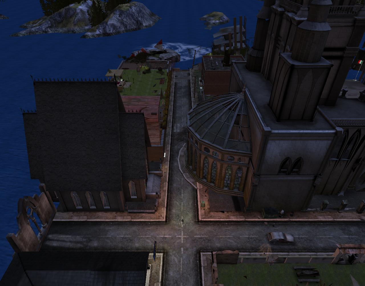
She stands at a crossroads outside the motel. David A.B. and Linda Halsey are still talking in the lighted patio outside the lobby. They would be doing this as long as the motel itself existed, she realized. She stares toward the mysteriously highlighted red-blue-green gate to the east (sky-sea-land). She’s *been* here before, she realizes while studying it and almost being hit by a right turning, beat up station wagon with Illinois license plates in the process. BDR529. Not quite all the numbers but getting there.
“Where there are churches there must be liquor stores,” she remarks confidently while walking between two. She goes in a direction no Yoko has ever gone before, messing with the patterns.
—–
“So this is what you do all the time, Baker B.?” asked observing Marty at Collagesity’s Blue Feather Table Room.
“Pretty much,” admitted the male baker version to the famous composer/musician variant.
“W-where is she going? She’s just heading off in a random direction.”
“Not random,” spoke Baker Bloch. “Hopefully.”
“What is this place?” Marty further queried.
“Heartsdale. It’s in title.” Baker looked over, confident in his randomness. “She’s been here before,” he added. “Or *I* have.”
“And this has — something to do with John.”
“Absolutely,” I crowed. “Bakersworks,” I said to end.
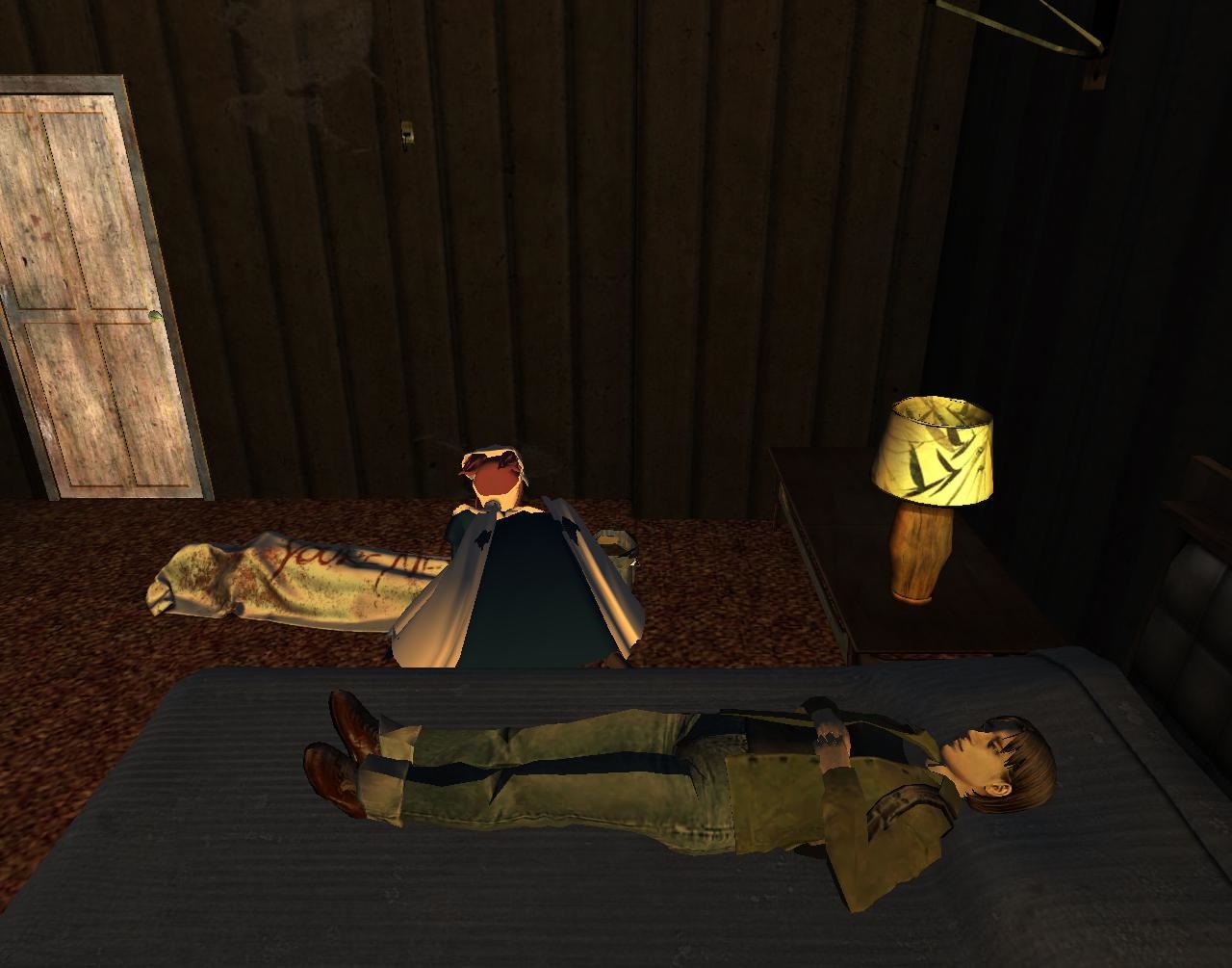
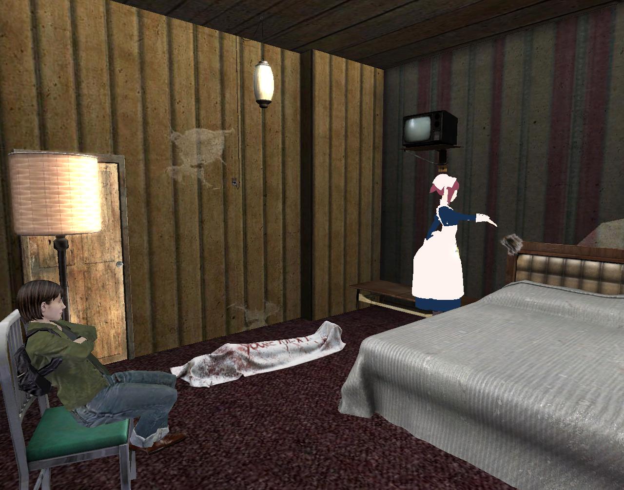
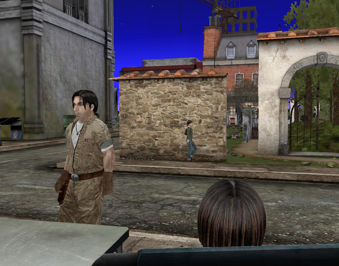
She woke up in the middle of the night with a realization. The maid was still trying to move the dead body out of the room to no avail. Perhaps she was attempting to be too quiet about it. I know who the motel receptionist is, Yoko Ona thought while staring up at the ceiling long crack in the ceiling: Cindy A.! This is where I met her and also started interacting with the others of the traitorous A.Team. Todd I believe. And Jim! Who could forget Jim and his maths. Figures began forming in her mind with this. All the numbers again (1 2 3 4 5 6 7 8 9 0). She decided she needed a middle of the night martini for further pondering. And so as not to disturb the maid and her duties, she tip toed out of the room, silently shutting the door behind her in search of a bar.
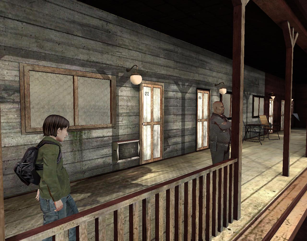
To move beyond 02 and especially 03, she knew she’d have to get by the security guard known locally as Big Black Smoke — learned that from the maid. She, in a whisper of a voice, had warned her about the corruption existing at the motel after dusting the bathroom for the 3rd time. 3 again. A.Team with three members. She’s getting closer! She runs smack into Big Black Smoke while spacing out about 3. “Morning misses,” he spoke, not fazed in the least. “Out for your morning walks again?” Plural, she realized. He thinks *I* am 3. And he’d been moved in front of motel door 03 with the collision for further emphasis. Heartsdale was certainly trying to talk to the famous widow of a woman! She walks further into the town proper and its beating Null Heart after affirming Big Black Smoke’s guess.
She decides to check into the motel she sits in front of with David and Linda. Why not? Too many mysteries to explore here in one sitting! Multiple me’s, she ponders while waiting for the desk clerk to respond to her presence. She never does, so Yoko Ona pipes up. “Excuse me miss… do you have any rooms available?”
“Rooms? What rooms?” Sarah McDooglehan then shakes her head and looks around the lobby, as if snapping out of a trance (true). “Oh… *these* rooms. Well,” — she puts her finger to her temple instead of checking any list she has, which seems odd. “Two is available. I’ll register it in triplicate. 222, then.”
“I’m *not* paying for three.” But then Yoko Ona reconsiders. *Is* she?
“One it is,” Sarah returned. “Not two, not three. Here’s the key.” She removed it from her pocket and not the wall with the others. Another oddity.
—–
She has to wait for the maid to finish dusting and removing that dead body before she can bring in the rest of her stuff.
“She finds a heart that is a yoyo in a hotel plaza, Hucka Doobie. Yoko is close to yoyo.”
“Listennn.”
—–
“I’m going to walk right over to that phone and make a call. I can’t find that girl of mine *anywhere* in this confounded town. Alleys go this way, pathways go that way. It’s like a maze!”
Amazing, thought Yoko Ona from the other side. This must be one of John’s friends!
“Oh. You using the booth?” he asked after spotting her.
No, I’ll fix that. She rewinds time.
Zach Black walks up to the phone with Yoko Ona on the other side. He doesn’t spot her, as if she’s invisible. He picks up the receiver. He can’t remember the exact number so he presses in all of ’em, in a row. 1 2 3 4 5 6 7 8 9 and 0 to end. That should do it, he thinks. It rings on the other side.
“Hello?” Feminine voice, good. No new jack-ass boyfriend to deal with, perhaps.
“Audrey?” he speaks into the receiver with his cool cat voice.
“Yes?” Cool cat back at him.
—–
In another part of town, David A.B. was talking to Linda Halsey about that failed transformation attempt over in Urqhart where she hails from. “Sorry about that,” he says to her in a conciliatory way. “We will try harder next time.”
What about *my* transformation, unobserved Yoko Ona thinks in a neighboring chair.
And then she spots *another* of herself walking against a rock textured wall across the street. How many are there??
“It’s possible here in Columbia for people to see surrealist masters like this in our own backyard,” Laverick said. “That’s what the Tiger Hotel has always been about, creating a place that would be at home in New York or Chicago, and this is the next level of that. These paintings would normally only be accessible in a big city but they’re right here.”
“Today Missouri. Tomorrow: Rosehaven.” Ruby Fantasie extends her arms and shrills in as nasal a voice as she can muster over the city. “Come fiind mee! I’m heeere!!”
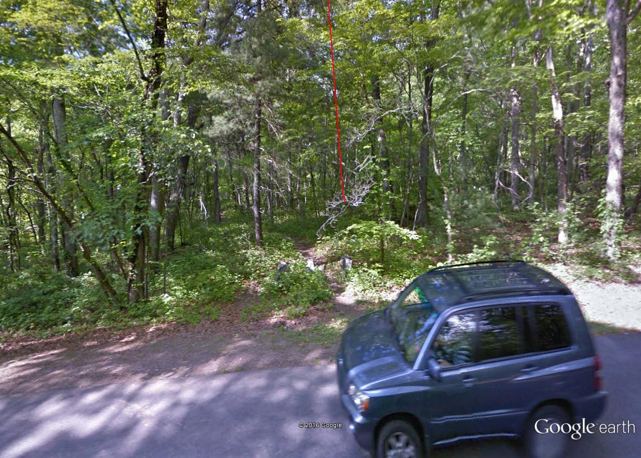
Bentmore-Future Home line passes directly over Greenway here where it intersects path leading to Prime/First Stream area via Grassy. In this location, Grassy and Greenway act like concentric circles. Future Home = center?
The Plutonians are two jagged-shaped aliens from the planet Pluto or beyond Pluto.
Contents[show]
CharactersEdit
Oglethorpe (voice of Andy Merrill), the leader, is the obese, orange-colored one who usually comes up with their “plans” for World Domination. Emory (voice of Mike Schatz), his tall green sidekick, who was explained to be partners since college, hooked up by a computer, is the tag-along of Oglethorpe, and usually the one to know when things have gone sour. In “The Last One,” Oglethorpe mentions that he went to high school with Ignignokt, mentioning some kind of incident on the bus. Despite this, the Mooninites think that “Plutonians are teh suck”, which started Spacecataz. The Plutonians’ ship is also, incidentally, Uglor’s ship from Space Ghost Coast to Coast. They can be seen in Master Shake’s pinball machine in Eggball.
TriviaEdit
They are named after the two universities in Atlanta, where Williams Street created Adult Swim.
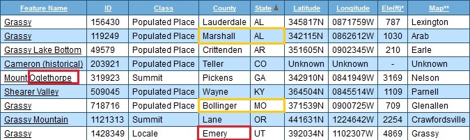
Mount Oglethorpe, the southernmost peak in the Blue Ridge Mountains,[2] is located in Pickens County, Georgia and was the southern terminus of the Appalachian Trail from when the trail was completed in 1937 until 1958. In 1958, as a result of over development around Mount Oglethorpe, the southern terminus of the Appalachian Trail was moved about 20 miles (32 km) to the northeast to Springer Mountain. Mount Oglethorpe is considered by some to be a more dramatic mountain than Springer Mountain, but the construction of a gravel logging road on the mountain and the development of a number of pungent chicken farms along the route, contributed to the move.
Until 1930, Mount Oglethorpe was called Grassy Knob, but the peak was renamed Mount Oglethorpe in honor of James Oglethorpe, the founder of Georgia.
Pluto was discovered by Clyde Tombaugh in 1930, and was originally considered the ninth planet from the Sun. After 1992, its status as a planet fell into question following the discovery of several objects of similar size in the Kuiper belt. In 2005, Eris, which is 27% more massive than Pluto, was discovered, which led the International Astronomical Union (IAU) to define the term “planet” formally for the first time the following year.[14] This definition excluded Pluto and reclassified it as a member of the new “dwarf planet” category.[15]
Bottom line: Both the (southern) terminus of the Appalachian Trail and our planetary Solar System were shortened by the exclusion of Mt. Oglethorpe and Pluto respectively. Mt. Oglethorpe changed its named from Grassy in 1930. Pluto was discovered in 1930. (Aqua Teen Hunger Force’s) Oglethorpe is a Plutonian. He’s recently been seen in Collagesity starting here, and directly replacing a grassy colored Karoz at the bottom of Confluence Pool who may realize the same here (?).
Arab:
Arab is a way to focus Grassy. Means “Foreign One” or perhaps “Alien”, like a Plutonian.
Grassy > Oglethorpe in 1930; Birth of Secondary Triad beyond [Prime/Primary]
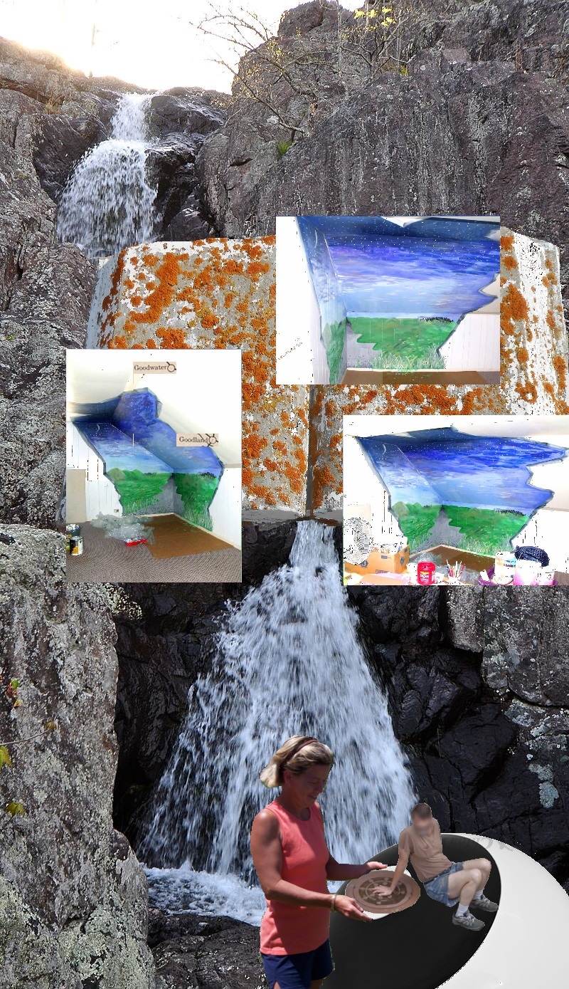
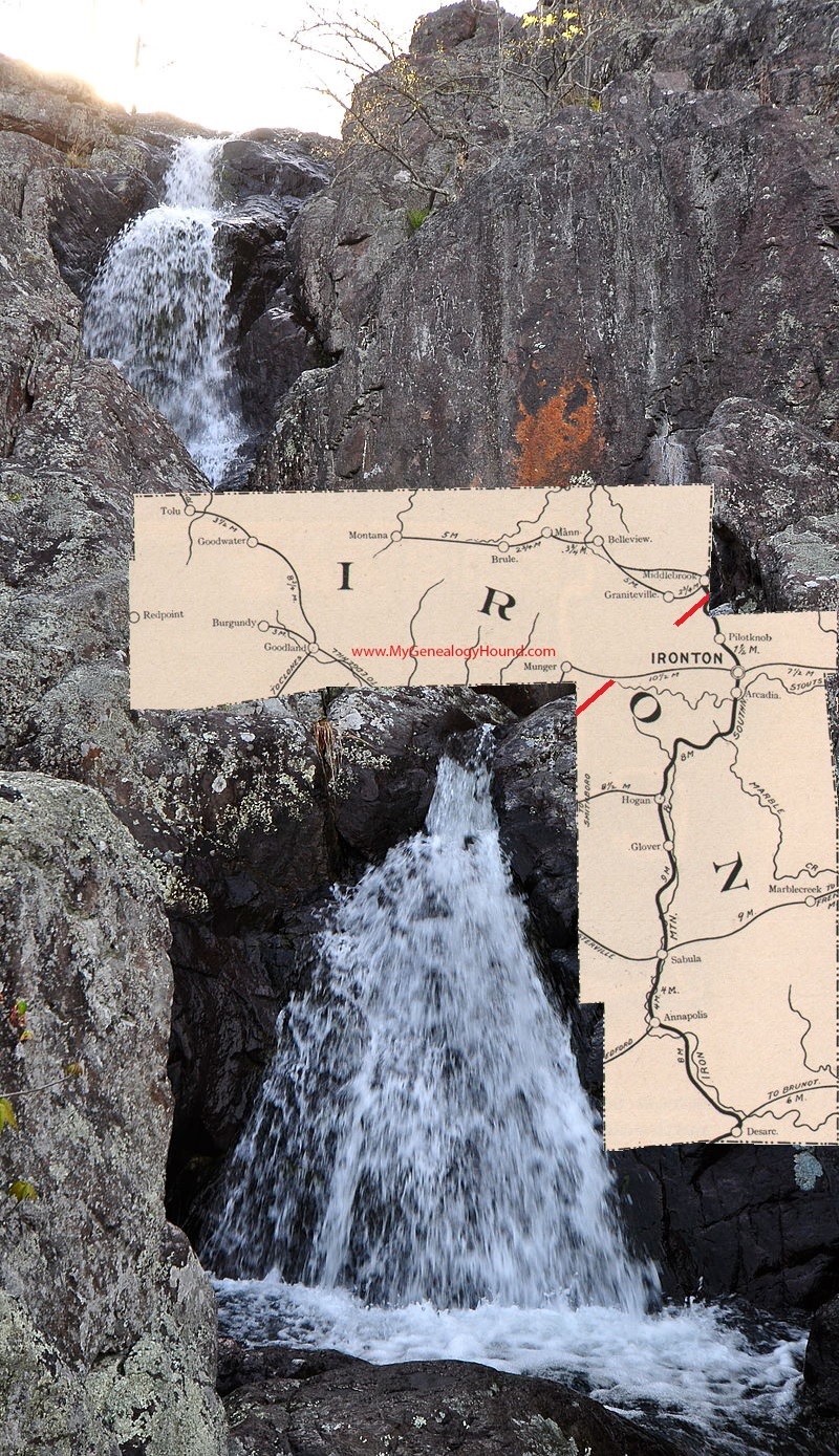
In the 9th collage of the Boos series, entitled “Goodwater Goodland 01”, we return to a Missouri setting, with the base photo being of Mina Sauk, highest waterfall in the state and located in Iron County. In an early draft for this collage, I simply superimposed a map of this county onto the 2 tiered falls, with the idea that both appear in two basic parts as you can see here…
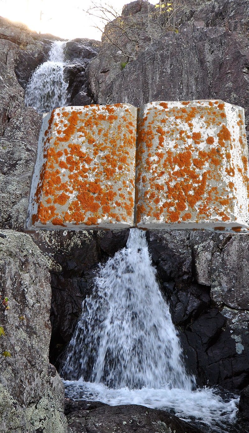
The rusty colored patch on the rocks of the falls just above the map acted as another tip to unite the two elements. Then in subsequent drafts the Iron County map was replaced by a “rusty” book I found in cemetery photos of Tungaske, Sask.: the two halves of the county become the two parts of the open book, which the falls pour into (edge) and then pour out of (spine).
The book is also notable as being the first image from Tungaske that I use in the Boos collage series, following by many more. The link which led me to this tiny, remote Canadian village? It’s the presence of population places named Goodwater and Goodland in the western part of Iron County, and in the same township (Dent) as the aforementioned Buick and Bixby communities there. Googling images through the conjoined “goodland goodwater” names quickly brought me to this Tungaske cemetery. Among the many pictures online the rust colored funerary book jumped out at me.
In the images I also found this one…
… and later learned that the name Tungaske itself means Goodwater according to some sources, thus its presence in the title of what is apparently the definitive history book for the community. But there’s more to the story than this. Check it out here.
The history book and the funerary book are now joined as one. I call the fictional synergy “The Big Book of Rust”. We may even quote passages from it later on.
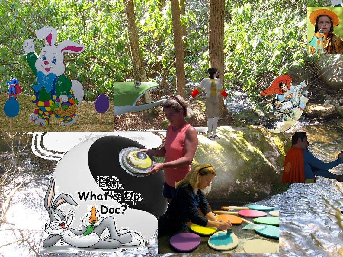
Now to the elements added just a bit beyond this in the lower part of “Goodwater Goodland 01”. We have the return of a woman artist from the 2nd collage of the Stonethrow series, the one coming before Boos.
In the present collage, she is again placing a round object into the white “eye” of a tajitu or yin-yang ball. I newly associated this with the Bigfoot art event, which took place in meantime. Namely it is the placement of the “iron smelting plant” to mark the center of the *yin* aspect of the marble race track, where it circles back around to head toward the spool table and complete its circuit. In the new collage, the sculpted eye she holds in the Stonethrow work is replaced by a similarly round sewer cover held down by a hand of Homeless Man (who himself appears in a subsequent Stonethrow collage).
If we look closely, we see the sewer cover, although the same “size” as the pictured white eye of the symbol, is turned in a way that will not fit this eye. The artist even seems to hold the eye more than the sewer cover. This could refer back to the “seed” of earlier collages, which appears in 2 forms perpendicular to each other (car and car’s license plate). There’s also a good chance that the woman artist of “Goodwater Goodland 01” stands in for another female artist from Tungaske, associated with the same tajitu sphere in a collage we’ll be examining soon. But for now, something doesn’t seem to quite fit yet.
And then the final elements of the “Goodwater Goodland 01” — 3 images of the same wall mural — also comes from Tungaske, being placed over on the other image (funerary memorial book) from the same town and partially obscuring it. This could represent differently angled illuminations from “The Big Book of Rust” itself.
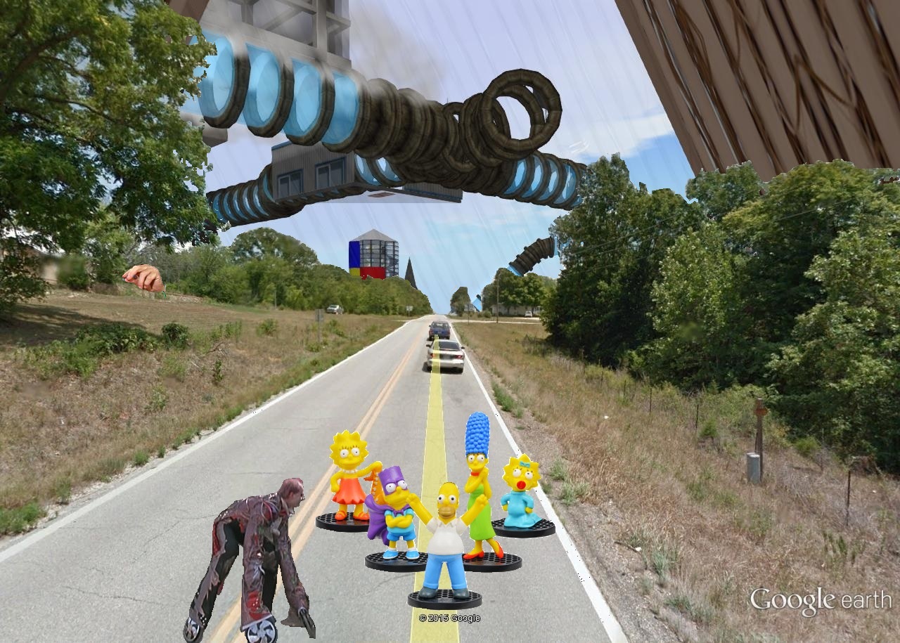
Collage 05, “Simpsons Road Bloch”, represented a small jump up in engagement for me with the developing art series. While the setting remains Boss, Missouri for this, in the air here we have the insertion of a portion of virtual Collagesity’s sky tube, still present in the Minoa sim as of this writing. While collage 03 now also contains Second Life images, that was actually created in the future, at the end of the series, and inserted into the past here to fill an important gap. Collage 05 hasn’t gone through phases like that. So this is really the first time that Second Life images enter the Boos works in chronological terms.
In a somewhat similar way, the Gilatona-Lis picks up speed early on when I start inserting Second Life images, especially with collage 04 (“Eclipsed Marge”) seen here:
Gilatona-Lis also begins with a number of Google Maps/Earth Streetview images employed as bases for collages, just like with Boos now. I believe that’s the first time I used such images in my work.
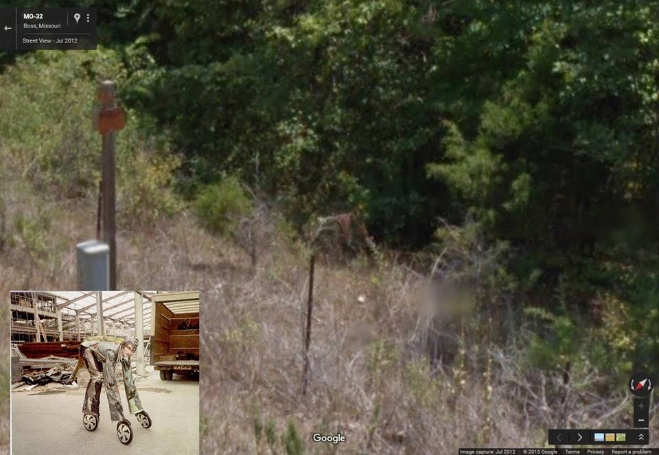
Specifically, collage 05 of the new series plays with the idea of a Google Streetview anomaly, coming in the form of an apparent “creature” seen beside the road in Boss, Missouri very near the rock house centering collages 01, 02, and 03 (which can still be seen to the left in the current collage). Resident blog spirit Hucka D. has claimed this is a sighting of an Oz Wheeler, a crazy hypothesis on the surface which made more sense when I compared online pictures with what we have here. So for collage 05, I simply juxtaposed the image of a “real” Oz Wheeler, culled from an online movie still of 1985’s “Return to Oz”, with the Google Maps “Wheeler”. I must admit it makes a nice match.
The “Wheeler anomaly” in Boss, MO
The culled or collaged-in Wheeler in the road seems to call toward his mate to the right, perhaps in recognition or perhaps in warning. Standing between them are the Simpsons toys, the “road block bloch” of the collage’s title. I now believe they represent another intrusion from the future, unconscious this time. “Go no further in this direction,” Homer Simpson seems to exclaim in his bumbling but good natured way. And so I didn’t. After this collage I left Boss, Missouri behind for good in the series. But a revisit to events surrounding this particular Streetview anomaly might be in order soon. We’ll see.
Note should also be made of the hand to the left side of collage 05, which is the same as Oliver Douglas’ from the previous collage. The hand still holds the seed, and hovers over the very spot of the parked car discussed in collages 01 and 02. We can now guess that the seed represents more the license plate of the car than the car, judging by its size here. The hand may be attempting to bring the license plate/seed “home” to the car, even, another cycle of completion.
And we’ve already talked about the next collage, “12 Oz Mouse Mound,” a bit in the Boos overview posts. The base location now is Second Life itself and not Earth (First Life), specifically Nautilus City, a prime Second life destination designed in a Phoenician style theme, and where I decided to locate my Boos Gallery for now holding the virtual rendition of the series. A meteor falls toward 12 Oz Mouse’s head from above, seemingly, while flying Baker Bloch looks on, perhaps unaware even of the meteor’s presence since it is above him a bit. Is his hand/arm also in danger of being hit? But certainly Fitz (12 Oz Mouse’s actual name) sees it judging from the expression of shock on his face. What happens when it lands? Fitz’s head becomes the meteor.
Similar to collage 05, collage 06 here presents a landscape anomaly. Hucka D. once again weighs in to claim that the terrain jut at Nautilus City’s main harbour area is actually suppose to represent Fitz, or at least his green oval torso. And specifically an image from the 12 Oz Mouse show where Fitz’s head gets hit by a meteor while he lays on the ground in a state of drunkenness. Well, he’s always drunk in the show. Hard to explain. But in the show the meteor really means nothing. It’s meaning translates to *this terrain jut* and even *this collage*, Hucka D. has more recently claimed. Once more, an image or event from “12 Oz Mouse” acts as a door into a parallel dimension; this has happened again and again now, and is especially vivid in the carrcasses. We’ll probably get back to that pattern soon enough.
Collage 07, “Head Brains”, is similar to collage 04 in that the base image is a still from a movie or tv show, in this case the 1968 movie “Head” featuring pop rock sensations The Monkees. This is, once again, audiovisual synchronicity related, a running theme for this section of the collage series apparently. In this case, an important juncture point in the synchronicity “Head Trip” is seen where Frank Zappa confronts lead Monkees singer Davy Jones, challenging him to spend more time on his music because the youth of America depends on him and his band members to “show the way”. Then the cow between them chips in by saying that “Monkees is the craziest people”.
An important statement, looking at it again, is Zappa saying that Davy’s song he just sang in the movie is “pretty white”, with Davy replying: “So am I, what can I tell you?” The audiovisual synchronicity “Head Trip” featuring this movie is all about the back and forth toggling between yin and yang forces, black and white, with the “Head half” (featuring Monkees’ *visuals*) being white and “Trip half” (featuring Zappa’s *music*) representing black. In collage 12 we’ll return to this concept. No Monkees music is heard in “Head Trip”. And this is the only time we see Zappa.


