Daily Archives: March 30, 2015

Red Head related names

2 Greenheads in US, both with an elevation of 144 feet (12 x 12). Synchronicity or chance?

greenhead01

Greenhead, FL, with nearby Red Head. This is only Red Head pp in US. A low summit of this name exists in another Washington County, in Maine.

greenhead02

I think here of Anne of Green Gables and her red hair, which she accidentally turned green just before she was accepted by Marilla to stay at Green Gables.

megan
Anne’s red hair

anne-dyed-hair
Anne’s temporarily green hair — misery!

Obviously when one’s hair turns white with age, you no longer have to worry about your original hair color unless you dye it. Accepting one’s [red] hair equals acceptance of oneself. Accepting one’s white hair equals acceptance of one’s *older* self. We are all figuratively white in the end, if we live long enough.

Whitehead in Da Woods.

Leave a comment

Filed under Allen Knob, Florida, Frank Park, Maryland, Whitehead Crossing

Thoughts

I probably need to give up Collagesity in Minoa in a couple of days, but can I manage it? I just talked to Carrcassonnee, who made a brief reappearance in the town’s temple. She said to remember her for who she is, and also that she would return. She recently had a baby — wonder what happened to it? But I suppose that might just be my keyboards (arriving Tuesday!). So what I need to do is save *all the town’s art*. I’m not going to worry about saving the altered Fal Mouth Moon structure. I’ll just re-create it as needed later on. My Sunklands site is up for renewal in August, and I want to make sure that will continue. I suppose.

Amazing new developments out in the *real* woods. Yesterday I found a whole new section of Whitehead Crossing which, quite peculiarly, seems to be blocked off from the main part. That’s why I hadn’t found it before. But Sunday was different. Now — perhaps even today — I have to figure out an easier way to get into it. I believe this to be the Mossman’s Red Head, mentioned here on this old map (top right)…

https://bakerbloch.wordpress.com/2014/04/30/new-whitehead-x-ing-map/

… but only hypothetically. Another name, then — looking at this map — could be Burnt Head, like on Monhegan Island along with its already employed Whitehead and Little Whitehead. I’m going to leave Blackhead alone, however.

monhe00x

RedDoor2
Now I know what’s behind the Red Door.

Leave a comment

Filed under **VIRTUAL SL, Frank Park, Heterocera, Maine, MAPS, Rubi^, Sunklands^, Whitehead Crossing

Carr. Returns

Carr.:

I only came back to tell you that the city should probably be destroyed. The Temple is unsafe now. I must leave to go back to the skybox.

bb (through Baker Bloch):

That’s it for Collagesity? Just like that? What does Spongeberg say?

Carr.:

Why don’t you ask him.

Spongeberg (in the air around them):

I can’t speak.

bb:

Well tell me a plan, Carr.

Carr.:

You must remember who I am and what I did here. I will return. I am you.

Snapshot1155_001

bb:

So Norubi is a concept that must end now. Collagesity as well.

Carr.:

The Red Umbrella will continue. Everything else can go[ for now]. Yes, Collagesity has made its run. (pause)

bb:

Sunklands. I must focus on Sunklands.

Snapshot1155_002

Leave a comment

Filed under **VIRTUAL SL, Heterocera, Rubi^

March 29 2015 photos

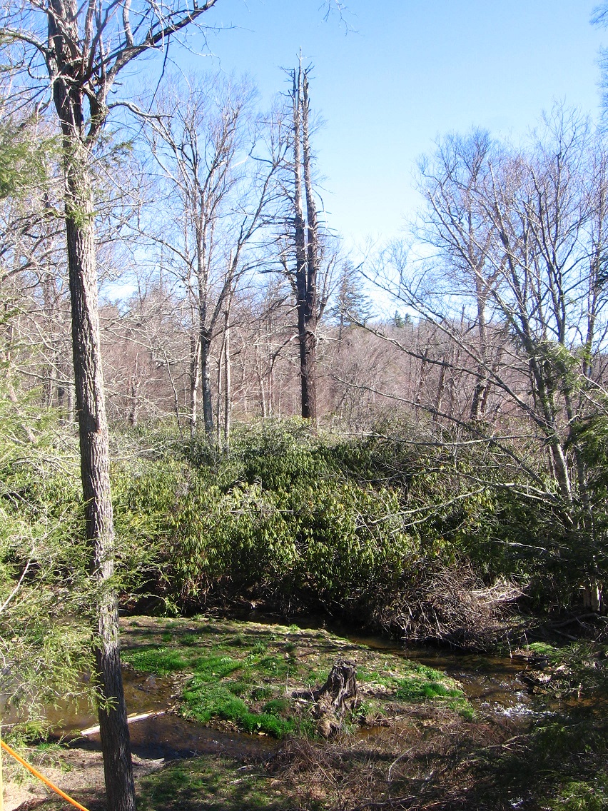
New territory discovered not once but twice yesterday (Sunday). We start in Boulder — or more precisely on the edge between Boulder and Herman Park — where for the first time I poked around the mouth of TILE Creek as it empties into a fork of the Old River (ironically one of the newest rivers in not only the United States but the world). The mouth is found just off the short driveway down to the Boulder Water Treatment Plant from the main highway. Plant employees have apparently created steps down to the stream juncture; a kind of miniature park. Perhaps they go there to eat and relax at lunch and on breaks.

This is the small gorge that the Old River fork runs through just before encountering TILE Creek. Possibilities exist here for future toy happenings. I was happy to find it. Civilization lies all around this pocket of gorge-ous wilderness. 🙂

IMG_0011smaller

A small but very sandy beach just downstream from the TILE-Old conjunction.

IMG_0019smaller

This hemlock towers over it — obvious ruler. This is yet another spot that could serve as a toy happening.

IMG_0020smallest

A green-ing island at the Mouth of TILE. Green Isle I suppose is as good a name as any.

IMG_0027smaller

Then I decided to hike in neighboring Frank Park this same day and found another new and most likely more important discovery: a whole *’nother section of Whitehead Crossing*, effectively blocked off from the main part. That’s why I didn’t find it until yesterday. I will definitely be heading back to this area sometime during the next handful of days. For now I’ll say that Green Stream, Whitehead X-ing’s largest water flow, cascades through the western edge of the open area. This region has also been called Red Head in the past, and supposedly where Mossman settled in ancient times after finding the Korean Channel through the old Spoon Fork Portal System. But Red Head remained only conjecture until yesterday.

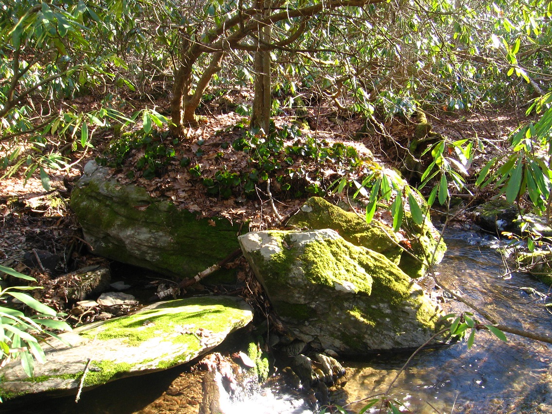
Interesting rocks at the top of one of the several Red Head cascades. I’ll most likely create a map of Red Head sometime this spring, when I gather more information. First off, I have to figure out an *easier way into it* (!).

IMG_0032smaller

This seems to represent a very important rock toward the northern limit of the cascade series. Additional info soon (once more).

IMG_0034smaller

Many interesting features in the cascades region.

IMG_0045smaller

And this is a shallow pool of water found nearby which I also hadn’t known about before. Most likely it will garner a name soon as well. But as hard as I tried, all paths heading toward the main part of Whitehead Crossing evaporated from this direction. I could *see* the main part through the trees and rhododendron — just couldn’t reach it.

IMG_0058smaller

Rotted tree near the pool.

IMG_0061smallest

Another nifty Red Head rock on Green Stream, this one toward the southern end of the blocked off region. South Rock?

IMG_0062smallest

Leave a comment

Filed under Allen Knob, Boulder, Frank Park, Herman Park, Tile Creek, Whitehead Crossing