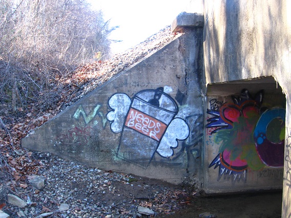
Category Archives: MAPS

Twinned Swannanoas

http://www.newsleader.com/story/life/2014/09/27/swannanoa-mysterious-mountaintop-marble-mansion/16242299/

The Dooleys called the palace Swannanoa because Sallie dearly loved the graceful white birds and the fact that they mated for life. It is possible that the name had a dual meaning as there is a river in North Carolina called Swannanoa — the Cherokee word for beautiful trail. A carving over the entrance to the mansion contains a swan and a paddle and would seem to support the theory that the word came from that region and was connected to the river there.

Then a third Swannanoa, a variant name of Petersburg, NJ according to GNIRPs. It was the site of a mansion built by one of the Ringling Brothers brothers famous for the circus. Circus animals drank the water of Lake Swannanoa Ringling created from 2 natural ponds. Another 2-n-1.

http://en.wikipedia.org/wiki/Lake_Swannanoa,_New_Jersey

The name Swannanoa is reported to be “derived from the Cherokee word Suwali-Nunna, meaning ‘trail of the Suwali tribe,'”[3] however the name was used in this case under the impression that the translation is actually “the beautiful trail.” The street names within the development are all named after Native American tribes.

And then a bit down the same article we have this:

Weird Swannanoa

Due to the Ringling Brothers Circus connection, the elusive Midgetville has been rumored to be located here,[4] in addition to several other New Jersey towns. There are local legends about the ghosts of circus animals haunting the area. A human ghost is also said to haunt the retirement home located on the lake.

I was curious about this, because the 2003 independent film Station Agent was shot just in the next valley over, and starred Peter Dinkage, born with dwarfism. Again, Station Agent plays an important role in the carrcasses, namely Carrcass+6. Station Agent is centrally fused with Beatles songs from Revolver and Rubber Bullet Soul within. The song Norwegian Wood acts as a center for the 5 used songs here, itself lying in the center of 3 likewise Rubber Soul tracks (the 2 Revolver tracks as a frame for these). Norwegian Wood is now the name of a mistified Middletown neighborhood. In the synch/carrcass, Norwegian Wood highlights a possible relationship between Dinkage’s character Finbar McBride and Olivia Harris, played by Patricia Clarkson. But just as in the song, a sexual relationship is not consummated, but the two remain friends, which is more important in the end.

See here for more about Midgetville:

Small Wonders of Midgetville

Midgetville-House-1

The most credible reports of Midgetville that we’ve investigated are probably the ones that center around a remote enclave of houses in the woods of Jefferson Township in northern Morris County. Though the houses are quite small, it is this community’s close proximity to the old Ringling Brothers’ Estate which really made us wonder whether we had at last found the true Midgetville we had so long sought.

Leave a comment

Filed under MAPS, New Jersey

Goth Hill

Another successful and satisfying time spent in Middletown/Ashville this past Saturday. Now I wish I would have gone one more day during this long holiday weekend. The primary objective was a place I’ve renamed (“mystified as”) Goth Hill, formerly Richmond Hill. I’ll let fans of the IT Crowd figure that one out. Hint: You can most easily reach the park by following Red Door Road. It’s fairly hard to find — you have to know exactly where to look. I missed the mark not once not twice but 3 times. The park is close to downtown, but seems quite isolated still.*

Speaking of which, here’s an isolated lemon yellow colored rock discovered along the railroad forming the northern border of the park. Could it be related to the yellow skull found on Google Earth at Alexfin just the day before? Close to 1/2 of the park is now in private hands, perhaps soon to become a housing development. The yellow rock belongs to that side of the park. Is it a resonant “death skull”, then?

IMG_0002smaller

Red berried vine found nearby.

IMG_0006smallest

Isolated river rock; photo taken once more from the railroad bed.

IMG_0007smallest

Yet another picture of rocks along the rr, this one including an old hornet’s nest.

IMG_0011smaller

Yet another. I like the isolated “Y” remaining from the mostly erased graffiti.

IMG_0014smaller

Prison spied from across the river. This is not the Alexfin prison mentioned before containing the northern point of the Middletown Pyramid (Alexfin-Future Home-Bentmore), but the older one further south which it replaced starting in 1989. It now serves as a prison laundry.

IMG_0033smaller

But the most interesting spot along the railroad was probably this double underpass allowing Rich Smith Creek to reach the Middle River from the south. This stream is also the largest in the park by far, and just the small part I explored at the mouth contains a number of interesting features.

IMG_0039smallest

More Rich Smith underpass graffiti. Notice the “Cold Feet..” on the angled part.

IMG_0047smaller

Cap that has merged with brown muck at bottom of Rich Creek next to the underpass. Pretty cool shot, actually.

IMG_0044smaller

Tire found in Rich Smith as it approaches underpass.

IMG_0050smaller

Another tire in seeming better shape lies nearby.

IMG_0049smallest

A bit furhter upstream I found this unusual rock, appearing almost like a broken off top of a table. I’ll be examining this again sometime soon.

IMG_0053smaller

couch-200-exam-table
examination table

Still on the Middle River, the final photograph of this post is from a small riverside park called Walnut Island just below the northern border of Center County.

IMG_0058smaller

—–

* About the only other “Goth Hill” I could find is a former location for the Algonquin Radio Observatory.

1 Comment

Filed under Canada/Tungaska, Middletown

Hand, Heart

245e07a19f6f98868a4a4e1edc76efe2612b6f07c4026bafd874f8eb2ed13043

French (1 of 4) and Heart (1 of 1) in Fulton County, AR along with Elizabeth and nearby Hand, inundated by Norfolk Reservoir. Obviously points to above caption meme: Fred Sanford’s trademark fake heart attack where he puts his hand over his heart and calls to deceased wife Elizabeth that he’s coming to join her. But the just discovered presence of French adds a new twist. It seems it has something to do with Center County and its Middletown and Heart Circle and centering river which still doesn’t possess a mythological name. Part of the real name, however, includes the word French, and since French is so near Heart in already highlighted Fulton County, I think this points to middle/center/heart again in full. Is the mythological name, then, the Heart River? Or is this just another indication of middle, as in Middletown and Center County? Many Islands is also in Fulton County, and the “Heart River” contains many islands as it runs past the heart of Alexfin and the old dump area there.

I also recall that in August Baker Block “died” of a heart attack when Head of Perch merged with a painting in his room composed of many eyes, or many “i’s”.

https://bakerbloch.wordpress.com/2014/07/26/baker-bloch-is-dead/

Check out who owns the Elizabeth post office.

http://en.wikipedia.org/wiki/Elizabeth,_Arkansas

Elizabeth is an unincorporated community in Fulton County, Arkansas, United States. Elizabeth is located along Arkansas Highway 87, 8 miles (13 km) southwest of Viola. Elizabeth has a post office with ZIP code 72531, owned by Jackie and Stephen Hart.[2]

Leave a comment

Filed under **VIRTUAL SL, Arkansas, Jeogeot, MAPS, Middletown, Noru

Middle: River + Way + 40 + Weak

Of course the main thing connecting Blue Mountain mythos and Middletown mythos (formerly Ashville mythos) is The Way. Perhaps spelled The Wey, but I think the former now. It’s another, er, way to define Centre County as a whole along with the Central River (official name still pending). Art River? (like Art Bears?), since the road runs ne to sw and defines a nice, full diagonal in the process. Although The Way also passes through the county Blue Mountain is the seat of, there it’s along the southern boundary. That’s actually another plus about the location of Future Home: very close proximity to this Way, and the ability to travel up and down it easily to hiking possibilities — such as Bentmore, the center of which is bisected by it, in essence. So I believe The Way is how toy avatars or whatever travel from Blue Mountain to Middletown and visa versa. In this way they can act as a kind of balance to each other. And of course The Way also bisects contiguous Frank and Herman Park, splitting them both in two, to the initial protest of Herman[ Munster]’s widow Lilly in the the 1940’s.

Speaking of 40’s, Superhighway 40 also bisects Centre County, running basically east to west across the county and also lying quite close to Future Home. In fact, The Way and SH 40 intersect only about 1 1/2 miles from FH. Another way to get to places quick, then. Blue Mountain has no superhighways, in contrast. Travel must be slower there in general. And yet another way Ashville is truly Middletown.

To summarize:

Central River: bisects Centre County north to south.
The Way: bisects Centre County northeast to southwest.
Superhigh 40 (?): bisects Centre County east to west.

The Pyramid is probably another way to link all of these together. We can also assume a 2nd diagonal running nw to se across the county, which would represent the weakest, 4th line defining the county. We might also be able to assign some color qualities.:

River: Blue
Way: Green
Superhigh: Red
Weak: Yellow

middletown01

The Pyramid is based on exact measurements directly assoc. with the n-s passage of River through the county. The other defining lines of the county — Way, Superhigh, Weak, are not exactly defined as yet, and perhaps never will be.

So a focus for my remaining (?) time in Blue Mountain is to understand The Way, seemingly the only thing connecting the two mythologies, or most closely connecting them.

All of these line pass into other counties in both directions. So their story extends in the same essential directions on either side.

Here’s some further thoughts:

River is Number 1, and colored the highest value hue of blue. Way is Number 2, and colored green. Superhigh(way) is actually Interstate 30 now, and represents Number 3, then (30 = 3+0 = 3) and the color red. The weak line becomes the 4th line, which seems to have no physical attachment to a particular highway or road or stream or anything else. Appropriately it is then assigned the lowest value color of yellow.

middletown02

(1) is defined mainly by The Pyramid now composed of points Alexfin (north), Bentmore (south) and Future Home (east or top or apex), and also its two 5.85 mile long arms connecting Alexfin to the place where The River crosses the northern county line and Bentmore to the place where The River intersects the *southern* county line. As stated, the line of The River across Centre County is the one most defined now. So let’s look at the larger picture of The River. Where does it start and where does it end? We’ll be asking this question for all bisecting county lines except the Weak Line, which doesn’t correspond with a physical object.

http://en.wikipedia.org/wiki/French_Broad_River

French_Broad_Watershed1254
213 miles

http://en.wikipedia.org/wiki/Blue_Ridge_Parkway

22tgbluejpg-eeed4b9a7e74b5d1
469 miles

http://en.wikipedia.org/wiki/Interstate_40

usa-interstate40-map
2555 miles

Leave a comment

Filed under Blue Mountain, MAPS, Middletown, North Carolina

Bentmore 01

Proposed new mythological zone of the Middletown area. Will hopefully check out more this weekend. May act as a new balance to Otanoa, replacing Alexfin developed in the early 90’s to the north (and also on the same “Bent” river). Map soon.

Bentmore center may be a type of Dead Center *Hole* (or Holl), to balance Dead Center Hill and perhaps a Dead Center Hall (center of Middletown Circle?). Must keep in mind that county to north of where these are located is a Magic Square of Mars situation, and, so, pointing to Jack County, Texas through the Wizard Cube. Middletown is the birthing place of Mythopolis and its created planet Mythos, also directly related to the Wizard Cube (green Wazob on 1 side and red Ur on the other). Like Ur, Alexfin built around dump, which is no more. Replaced by prison in effect — imprisoned. Center no longer present but maybe can be approximated still. Look back at 1990-1993 notes to find out more about Alexfin mythos which may now become obsolete or lose its center to Bentmore. Otanoa, in the meantime, has gained in strength since that will be the site of Future Home. Even the home will garner a name most likely. Gradually, gradually, it is filling out.

bentmore02

Also seeming to be defined in the Bentmore-Alexfin relationship is the dimensions of the county itself as framed by The River. There is no parallel big river for my present county with Blue Mountain. I don’t think this is the Bent River but am not totally sure of that. It is both the Bentmore River and the Alexfin River somehow.

bentmore04

Hucka D.:

Centre County is between Far North/Hi and Far South/Lo. There is no need to go further except to look for colonies. Even Blue Mountain and its Frank and Herman Park will serve this middle soon. Dead Center Hill is center or middle, yes. Middletown Circle is middle. Future Home is middle. All these are middle. Alexfin marks the location between middle and north — middle north. Bentmore marks the location of middle south. There will be more added to this. It is not Dead Center Hole (in Bentmore), then, but just a Bentmore Hole. And there is no Dead Center Hall except in Fun Fun Town, USA.

bb:

Brazil, then.

Hucka D.:

Yes.

—–

Additional note: Forest Home (AL) directly related to Future Home? Saucer? Fake Herbert? Cardinal Roads’ beginnings and ends?

http://www.cleavebooks.co.uk/scol/calpyr.htm

Measurements in miles of Centre County Pyramid composed of Alexfin (center), Bentmore (center) and Future Home, then.

pyramid01

Length of pyramid base: 11.14. Length of each slant height: 8.68.

Notice the calculated 6.66 distance between Future Home apex and middle of pyramid base, which has also been identified with a particular home, current in that case and not past or future exclusively. I’ve visited the home in Google Earth Streetview not surprisingly, and found nothing to note as yet.

To complete, then, the length of both Alexfin-Hi and Bentmore-Lo is 5.57 miles. This is the pyramid fitted into Centre County.

(to be continued?)

2 Comments

Filed under Alabama, Blue Mountain, MAPS, Middletown, North Carolina

Next Step

Carrcasses:

Carrcasses will obviously continue, and probably for the rest of my life. I’m in a steady state era for these kind of creations, with the length consistently between 45 and 70 minutes for almost all of ’em. Carrcasses are still the axis of my creativity, even though I don’t devote the time to them that I use to, especially during the early to mid-2000’s. At some point I’m looking to notch it up again with the possibilities of computer editing on both the audio and video sides. Recent clues about how this might come about could be here…*

https://bakerbloch.wordpress.com/2014/12/01/map-sinking-feeling-02/

In 2014 I created only 1 carrcass (C-11), after making 4 in 2013 (C-7.5, C-8, C-9, C-10), a banner year along with even higher peaks in 2006 and 2007. I haven’t even taped the last one — rectification soon.

Collages:

Obviously these will continue as well, and have become the creative focus above and beyond carrcasses (although I still see the latter as the fundamental note). I’ve created over 100 collages in the past 2 years, matching the total for the 9 years before that, which includes the Art 10×10. Although these are already born digital, I seem to be edging more into hard core animation, starting with the recent “Story Room” animation involving the first 6 collages of the Falmouth series. This series overall was quite the surprise — who knew that I would create a 61 piece effort that fast? Not me (until it was over). Another development has been the 2, 3, and 4 part pieces, or diptychs, triptychs, and tetraptychs. These complement the natural 2-4 part animations I first developed in the Art 10×10. How far down the animation road I’ll travel and away from the stand alone pieces I don’t know yet.

So more collages than ever created in 2014: over 70 adding in September’s Sam Parr series of 10 to the 61 from the earlier Falmouth series. It appears I’m in a flow.

Preservation:

As collages are born digitally, I’m not as concerned about preservation issues for them. Audiovisual synchs are still created using old fashion analog techniques. I have a rough table of all the “tiles”, which includes info about cue points and involved media, but more is needed in this area. More digital copies of analog creations need to be created. A 2015 resolution.

Sunklands:

This year I’ve also gathered together my collage series, along with the interpretations I share with others on my blog, in a new website using a freshly coined domain name, sunklands.com. Also here are descriptions and slurl links to virtual towns where the artwork is displayed (example: Collagesity, Noru and now Minoa). Another interesting category developed on the Sunklands site is the idea of hybrid works straddling defined areas, like “6 Weeks of Shining” from this year, or “Baker Bloch in England” from 2010. Carrcasses have a place in sunklands.com too, and I plan to create an abbreviated “Table” listing tiles from The Rainbow Sphere to SID’s 1st Oz at least. Hidden behind this will be the larger, full table of tiles (Rainbow Sphere to present, Carrcass-11 most recently). I’ve fitted Paradox I and its larger, fictional followup Paradox II (latter still in progress) into Sunklands as well.

Blog:

Apart from the Sunklands site, I’m still working daily on my personal blog, Frank and Herman, Einstein!, since 2012 (supplanting my original one, the Baker Blinker Blog from 2008-2012). Hybrids spring from this, along with collage interpretations and descriptions and working file stuff. Toward the end of this year map synch material has been developed more, resulting in yet another kind of collage (7-part “Map Stuff” from Nov. and early Dec.). This is my bread and butter.

Local Hiking/Myth Making:

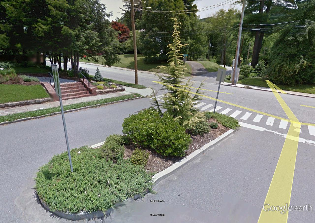
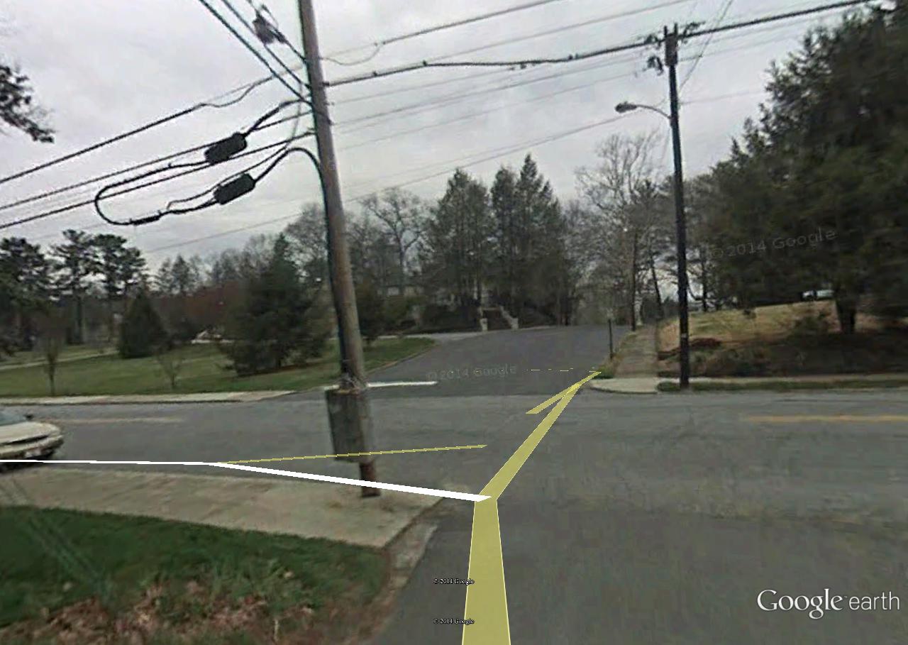
The title of the Frank and Herman, Einstein! blog refers to the 2 large, contiguous parks I live near, and which I assumed at the time of its birth in August 2008 would be a lifetime focus above and beyond, for example, Second Life or other pursuits. But this year I decided that Blue Mountain will in all likelihood probably *not* be the place we spend our retirement years in the main. Instead that burden will fall on Ashville. As part of this big shift, I’ve decided to rename the latter Middletown to indicate its more central role. The recently uncovered Ashville Circle built around Cherry Avenue and parallel Linden Creek will turn into the Middletown Circle — a further mystification device, then.

But in saying this I’ve also decided to see Blue Mountain for its great plus: the proximity to these parks and the outdoors overall and to take full advantage of this while remaining here for probably the next 6-10 years. Another 2015 resolution, then — to be happy in the place I’m at more than in 2014. But the die has been cast for the future nonetheless, seemingly.

Second Life:

Yes, my involvement in this virtual, fake world has continued. 🙂 Big story was the development of Noru’s Collagesity in July and Aug and Sep after a battle between Noru and Rubi for town ownership in June. Then at the end of November, Noru land was given up in favor of same sized area at se corner of fabled Rubi Woods, very near where VWX Town existed toward the end of 2013. Just at the end of the year, I consolidated my land holdings in Minoa next the woods better, and it looks like my presence there will continued into 2015 a bit. Centerpieces remain the Power Tower and Falmouth galleries, along with the new Sam Parr State College building holding its namesake series. Falmouth gallery (an old castle) developed in Philudoria during Feb-April.

So the big news for SL in 2014 is the development of 2 new galleries holding the 2 newest collage series (Falmouth and Sam Parr), and also a new town to put them in: Collagesity, replacing 2013’s VWX Town as a virtual center.

Work work:

Most likely 6 or at tops 7 years to slave away before retirement. Must get a solid foundation for dealing with present and future issues. It’s not going to be an easy ride, but I’m certain the challenge will reap benefits. Better than working as a restaurant manager or the like. I’m very lucky to possess the position I do, and the support group I have.

—–

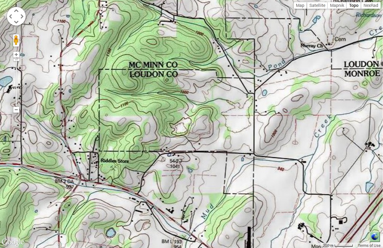
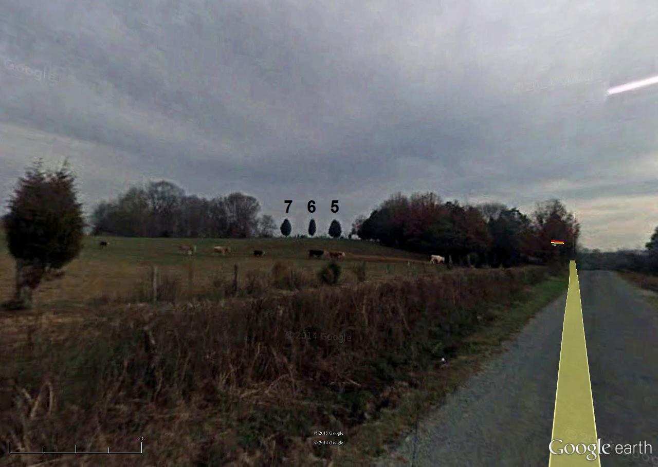
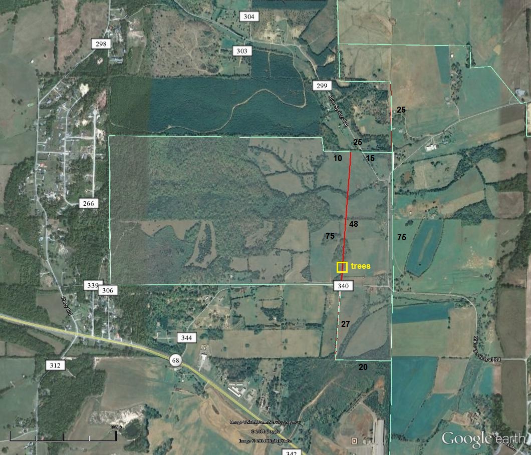
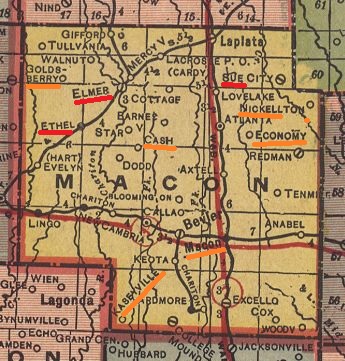
* Note1: In looking up riddle/ again just now, saw that Riddle’s Store lies in sw corner of small part of Loudon County, Tennessee separate from rest of county. Corr. to this, also this morning I rearranged my Minoa virtual holdings but accidentally left a 128 sq meter parcel separate from the rest in the process, representing 1/68th of my land. Is this simultaneous synchronicity? Does it represent me as separate from the rest of my team? A riddle for certain.

loudon01

Further, Riddles Store is coupled with Curry or Currys Store in Alabama, making a direct overlap between old and new. These are probably only 2 Riddles Store pop places.

loudon06
7-6-5 trees

loudon05
100 = 1 mile

This split off part of Loudon County, TN lies directly west of the Ashville Circle concocted just before, and newly deemed, in this post, the Middletown Circle. Seems to reinforce the middle aspect (!). I also think back to the larger but still similar quite Forest Home Circle in Alabama discovered to be on the same latitude as Baker’s Creek, Miss. in 2013, and also in a neighboring state to the west.

Leave a comment

Filed under **VIRTUAL SL, Alabama, Jeogeot, MAPS, Middletown, Mississippi, North Carolina, Noru, Rubi, Tennessee

we know more

Baker *Beach*…

http://en.wikipedia.org/wiki/Burning_Man#1986_to_1989

One of the roots of the annual event now known as Burning Man began as a bonfire ritual on the summer solstice in 1986 when Larry Harvey, Jerry James, and a few friends met on Baker Beach in San Francisco[8] and burned a 9-foot (2.7-meter) wooden man as well as a smaller wooden dog. Harvey has described his inspiration for burning these effigies as a spontaneous act of “radical self-expression”.[9] …. In 1987, the effigy grew to almost 15 feet (4.6 meters) tall, and by 1988, it had grown to around 40 feet (12 meters). Burning Man attendees informally called it “The Man,” and this name was given to each successive effigy, every year since Burning Man began.

Harvey stated that he did not see the movie The Wicker Man until many years later, so it played no part in his inspiration.

https://bakerbloch.wordpress.com/2014/11/14/more-map-stuff-01/

tumblr_neqbp7CXaB1sozjhxo1_1280

Returning to Lock Ness and Cherry Island:

http://en.wikipedia.org/wiki/Cherry_Island_%28Loch_Ness%29

A castle stood on the island during the 15th century; this was constructed of stone and oak wood and was probably used as a fortified refuge. It has been suggested that Eilean Muireach may have been a hunting lodge, with Eilean Nan Con the home for the hunting dogs.[1]

Cherry Island = (residence of) man.

Dog Island = (residence of) dog.

Dog was forgotten about or submerged in time (after 1986 apparently). Man remained, sans smaller companion. Burning Man is bourne.

Burning Man is also a primary inspiration for Linden Labs’ Second Life, also in San Francisco like Baker Beach. An inworld event called Burn2 (originally Burning Life) has virtually attempted to recreate the excitement of Real Life’s Burning Man since 2003.

—–

More Burning Man:

Cacophony Society connection, c1989:

http://ljmichel.com/burningman/burningman.html

From the mouth of those involved, including more cacophonists (interesting, for example, that The Man may have started out as The Woman):

http://www.outsideonline.com/outdoor-adventure/events/Hot-Mess.html

A pivotal year was 1996. Burning Man could become Woodstock or Altamont. The safer route was picked, which was inevitable. Else the whole event would be nuked.

$_57

Philip Linden Says Second Life Must Evolve Beyond Burning Man Era

http://nwn.blogs.com/nwn/2009/09/burning-man.html

When Philip Linden resigned as CEO last year, I asserted that “The Burning Man era of Second Life is over.” But it is one thing for me to say that, and quite another for Philip himself to compare Second Life to Burning Man, and not just in the positive sense of a place that fosters freeform creation in an egalitarian community, as he always has — but tellingly, also in its most limiting connotation:

Presently, Second Life still isn’t very accessible – most people still don’t have the time to get over the steep learning curve and get to the amazing stuff inside. Similarly, the total number of people willing to drive 3 hours from Reno into the middle of a barren desert carrying a week’s worth of drinking water and food is limited.

At the moment, as Philip notes (having just returned from another Black Rock jaunt himself), Burning Man has reached a plateau of about 50,000 attendees. (As it happens, that’s roughly the number of Second Life users in-world at any given time.) This, he says, must change:

Try not to cling too tightly to what we have now. The design, the UI, the orientation experience, the tools – all these need to change, a LOT, for Second Life to become accessible to hundreds of millions. Those changes are sometimes going to be disruptive and painful… But a bigger part of my heart wants to see it reach everyone, and so we must evolve.

Background:

http://usatoday30.usatoday.com/printedition/money/20070205/secondlife_cover.art.htm

(continued in: tale wag)

Leave a comment

Filed under **VIRTUAL SL, Burning Life, California, Middletown, United Kingdom

and/or

baker02

baker01

Click to access how%20did%20baker.pdf

Baker has appeared before here:

https://bakerbloch.wordpress.com/2014/11/23/up-with-maps-01/

baker02

And “Caledonia” also appears in a second F&H,E! post.

https://bakerbloch.wordpress.com/2014/12/10/murdochs-islands/

Cherry Island (Scottish Gaelic: Eilean Muireach, meaning Murdoch’s Island) is the only island in Loch Ness, Highland, Scotland, and is an example of a crannog.[1] The island is about 150 yards (140 m) from the shore near the southern end of the loch. The island was originally 160 feet (49 m) by 168 feet (51 m) across, but is now smaller as the level of the loch was raised when it became part of the Caledonian Canal.[1] The increase in the level of the loch caused a smaller natural island nearby Eilean Nan Con[2] (also known in its Anglicised form of “Dog Island”), to be totally submerged.

“Caledonia” submerges Dog I. and makes Cherry Island or “Murdoch’s Island” smaller. But Cherry Island is artificial in nature and wouldn’t be there atall without man. Smaller Eilean Nan Con or Dog I. is natural in contrast.

The name Baker is similarly submerged beneath Martel in Ohio near Caledonia (latter with Harding-Anderson overlap from past), but a twinned Baker, as it is, remains next to Caledonia in New York state. Not submerged or lost in the seas of history.

Caledonia (OH plus NY) represents the levels of Lock Ness and its Cherry and Dog isles. It follows that Baker equals past Lock Ness, pre-Caledonian Canal connected, with its Cherry Island and Dog Island both intact. Martel represents the present Caledonia Canal situation for the lock, with Cherry Island made smaller (now 51m x 49m) and Dog Island having completely disappeared.

(continued in: we know more)

Leave a comment

Filed under California, MAPS, Middletown, New York, Ohio, United Kingdom

Ashville Circle 01

“The Ashville Circle was where it was all heading, Hucka D.”

Hucka D.:

Put up your map and let’s examine.

ashvillecircle03

A.

bb:

This is the head, Hucka D. The man, John Lynndon as we’ve come to call him, puts his hand in the middle of the sewer top to indicate the circle. This is point A on the map above, 0.32 miles from the Hart. The radius of the [Ashville Circle] in other words, is 0.32 miles. Cherry Avenue, the spinal diameter of the circle, also tilts from true north at about a 32 degree angle. Worth noting.

Hucka D.:

Indeed.

bb:

Do you think John is a homeless person?

Hucka D.:

Nope.

bb:

Do you think the hand indicates more than it seems?

Hucka D.:

Yup.

bb:

Clock[ hand]? [no answer]

https://bakerbloch.wordpress.com/2014/12/17/norwegian-wood-02/

ashville950

B.

Hucka D. has gone back to bed. In concocting the circle yesterday, I was aided by the fact that several more intersections apart from those involving Cherry Avenue seem to be highlighted, including this one to the west. The intersection appears to be on the outer edge of a neighborhood we’ve dubbed Apricot-Bone. Not sure if that name will stick, however. The east-west road involved here is Banana Street again, famous for the Ingleboort and Flaarph invested house next to Linden Creek. That particular house lies more toward the E, or center, of the A’ville Circle, with Banana Street peeling off (sorry) from Cherry Avenue near there as well.

In visiting the intersection via Google Earth Street View, I was very surprised to find something more unusual going on. The conjunction of Banana Street and the side road we’ll call Cone was calm itself.

ashville951

But one Street View camera shot down Cone manifests a figure sitting in the middle of the road, which turns out to be a teenager.

ashville952

The girl appears to see or hear the Google Earth car approaching, and moves out of the way. We get a good look at her…

ashville953

… and also glimpse the person sitting on the front stairs of a home across the road she is interacting with in some fashion. Wish Hucka D. was still around to possibly tell us more about the story. Ohl well.

ashville954

—–

“It’s not Cone. It’s *Bone*. Now leave me alone so I can get some shuteye before my big meeting next year!”

—–

So Hucka D. says the side street is named Bone, hence the latter part of the neighborhood appellation Apricot-Bone. Makes sense. Or maybe it’s Pineapple. Better keep that to myself. But then there’s this: Fred Cone from Pine Apple, Alabama, as talked about by comedian Jerry Clower on his 1974 Country Ham album.

Also here:

http://www.jsonline.com/sports/packers/fred-cone-was-the-leading-scorer-during-lean-years-b9988029z1-222292051.html

“I didn’t play high school football because we didn’t have enough kids to field a team,” he said.

C.

This intersection is near the south end of Cherry Avenue…

https://bakerbloch.wordpress.com/2014/12/11/found-art-event-02/

… first highlighted here. The two sets of walkers are shoulder to shoulder at this intersection of Cherry and [insert: Apricot] when we enter the former in Street View from the south.

ashville300

[Apricot]-Cherry intersection. Pinball machine traffic islands dead ahead.

ashville957

D.

Also helping delineate the Asheville Circle is this intersection to the east, involving the oddly coined Hartichoke and a larger artery named Berry Avenue, running parallel to Cherry appropriately enough.

No, I’ve woken up Hucka D. again in my stupidity and he’s indicated that Hartichoke is actually named Salad. He says not to bother him now until February. So I suppose — have to be careful here — that Salad is named after Salad Bar Jack, the famous Mmmmmm actor. I hear Hucka D.’s little hard feet hitting the floor next to the bed so I suppose I’m wrong again. “What’s that Hucka D.?” I shout toward the bedroom as he roars his disaproval again. Then I hear the window shatter and he’s gone — flown away to a better resting place, I suppose. So with him gone I’m going to leave it that Salad Place was named after Salad Bar Jack.

But anyway… there’s an island present at the meeting of Salad and Berry. Not sure what it means yet, if anything. But it probably does.

ashville956

Since the traffic island isn’t present in the below Street View snapshot from 2008 and is in the 2012 snapshot above, we can deduce it was created between 2008 and 2012, obviously.

ashville955

E.

This point marks the Hart or center of our circle, corresponding with the meeting of Salad and Cherry this time. This is no mere Thomas Benton we’re talking about here.

evelyn01

macon02

winona1898

My uneducated guess is that this is Salad Bar Jack’s retirement home in Ashville, bought with hard earned film royalty money. His “place” as it were.

IMG_0056smaller

Could be wrong of course.

3 Comments

Filed under Middletown, Minnesota, Missouri

Pineapple + Island

pineappleisland02
easy as 123

Last_of_El_Nido_Manila_Xmas_in_Puerto_Galera_and_early_Bangkok_118

http://www.aliexpress.com/pineapple-island_reviews.html

2-Pcs-SpongeBob-font-b-Pineapple-b-font-House-Squidward-Easter-font-b-Island-b-font

2-Pcs-SpongeBob-font-b-Pineapple-b-font-House-Squidward-Easter-font-b-Island-b-fontb

Free-Shipping-2-Pcs-SpongeBob-font-b-Pineapple-b-font-House-Squidward-Easter-font-b-Island

New-2PC-SET-SpongeBob-font-b-Pineapple-b-font-House-Squidward-Easter-font-b-Island-bd

See below for similar flags (!).

Leave a comment

December 20, 2014 · 1:26 pm