Category Archives: MAPS

Grand Spot 02

http://www.dailystandard.com/archive/2015-04-04/stories/26445/painting-the-town-for-easter

Another article with Brenda Robinson, painter of the Quilted Rock. This time she helped restore Big Bob, claimed to be the world’s largest handmade bass.

When the Griswolds were done painting, Robinson applied a final clear coat to protect Big Bob from the elements.
“I bet he’s good for another 50 years,” Griswold said.
The fish was built to advertise Celina and Grand Lake, with many Lake Festival queens riding on the float in the past. More recently members of the Celina Dolphin swim team have enjoyed a ride on the float during the Lake Festival parade.

History of Big Bob:
According to a 1976 Celina Lake Festival brochure, the current Big Bob is not Celina’s first whopper of a fish float.
Apparently, in the 1930s, a 30-foot-long fish float was built by Celina businessmen to advertise Grand Lake. The float appeared in numerous parades and events throughout Ohio, Indiana and Michigan.
The float was to be a part of the famous Parade of Roses in Pasadena, Calif., but was destroyed when it was loaded for the parade and never reached its destination.
The disheveled fish then was put on a small island in Grand Lake off West Bank Road where it sat for many years as a tourist attraction, the brochure says.
– Betty Lawrence

2009-07-22_1_full

222116_1243754459395_416_300
Oops!

2015-04-04_3_full

2015-04-04_2_full

—–

“Isn’t it clear? You must make a [“quilted”] fish sculpture. To match Waxy the Bird in nearby Greenhead. B[y]rd-Fish.”

polk1955map02

greenup11collage661x516
“One Pink” (Greenup collage #11).

I just took apart the sculpture of the red/green/blue birds seen in the above collage (Opus 19) to make room in my study for the new keyboards (Baby Chro). One replaces another in effect.

opus19
Opus 19 in 1990 art exhibit

—–

Fish+Bass in Quay County, NM.

fish_bass01

Leave a comment

Filed under Frank Park, Georgia, MAPS, New Mexico, Ohio, Whitehead Crossing

Grand Spot 01

http://en.wikipedia.org/wiki/Grand_Lake_St._Marys_State_Park

I believe the shallow pool of water at the lower end of Red Head may now be called The Grand or Grand Pool or something equivalent. Model: Grand Lake, Ohio, also very shallow. More on Grand Lake and its Mercer County soon enough. Thanks!

mercer
Celina = Jupiter, Coldwater = Saturn, Neptune = Neptune (etc.)
Mercer County is our Solar System.

mercer_county_flag
Mercer County flag

quilted_rock_mercer_county_ohio
Quilted Rock near Celina

http://generationqmagazine.com/needle-gypsies-the-quilted-rock/

We stopped on the way back home to get a closer look and take pictures. I contacted Stoneco—actually a company called Shelly that acquired the Stoneco quarries some years ago—to ask about the origins of the rock. I was told the rock had been placed to mark the northwest corner of the property that housed Stoneco in that location, but it had been a magnet for graffiti. A local artist, named Brenda Robinson, offered to paint the rock in a quilt-like design in order to discourage the vandalism. And, apparently, it worked, as the Shelly representative had no knowledge of any further defacement.

And that’s all there was to it. Frankly, I was a wee bit disappointed. I was hoping for something that involved a jilted lover, a family feud, and a ghost that haunts the grinder thingy next to the rock. So, what do you think? Tell us what your story would be for the origin of The Quilted Rock. Maybe we can get Stoneco to go with one of ours instead.

No relation between the quite similarly colored Quilted Rock and the official Mercer County flag that I can tell. Story of the flag here:

http://www.ohiostatehouse.org/museum/county-flags/mercer

The lighthouse signifies Grand Lake, the largest man-made lake in Ohio. Beams radiating from the lighthouse stand for all six Mercer County schools: red for St. Henry, orange for Coldwater, gold for Parkway, green for Celina, blue for Marion Local, and purple for Fort Recovery. The flag committee added one final touch to the design. The foundation of the lighthouse was modified to have fourteen stone blocks. Each block represents one of the townships.

IMG_0058smaller
Red Head’s very shallow “Grand Pool”

But I wonder if a map like this could have possibly served as an inspiration for the colored Quilted Rock patterns.

Actually, I suppose it looks more like townships. More pondering to do here…

http://myhometownohio.blogspot.com/2009/09/temple-of-tolerance.html

auglaize_county_ohio

Leave a comment

Filed under Frank Park, MAPS, Ohio, Whitehead Crossing

Herman\

What sticks out from this list?

herman01

Yes, it’s obvious. The 2 Hermans of Craighead County, AR, one on a Herman topo map and one on a *Tru*mann topo map. Herman Munster, ol’ Flattop, is not a true man. He is a [composite] monster.

There are 2 Hermans in Winesap. This is also obviously referred to here. Is there more proof of this? Of course. We have Winesap in the same county, and one of only 2 in the country, the other being in Ohio. We have a Fisher, with another in the county below, almost directly south. Fisher-Herman. Fisherman. Obvious.

fisher01

But Herman also refers to Herman Park. But Herman Park refers to the 2 Hermans of Winesap. It’s a circle, or a triangle. Triangle within a circle.

Herman Park was built around Tile Creek, known to non-Tilists as mundane Yards Creek, spewing forth in an Appalachian Spring from Yards Mtn.

222116_1243754459395_416_300
PEI’s Appalachian Spring

That’s Red Head soon to run into a Greenhead roadblock, quickly resolved. Greenhead is where the bird beat the bug. Hucka Doobie was a martin bird. Bird Wax instead of Bee Wax. Isn’t that right Hucka D.? Never mind. I know I figured it out. You transformed from a bee into a bird.

Hucka D.:

Almost.

bb:

Stay on course.

Hucka D.:

Yes.

bb:

What is the relationship between Green Stream and TILE Creek? Are they the same? Or, better, is Green Stream the *new* TILE Creek? Given that Red Head begins it all, and Red Head starts 4orrin1 [and the flow of an Appalachian stream] as seen above. Red Head transforming temporarily to Greenhead — and I’ve been thinking about this — is the confluence of the former with the Whitehead Crossing matrix. Assimilation. Whitehead Crossing is home for poor little orphaned Anne, even though she was suppose to be a boy (as Red Head is most logically Greenhead and visa versa, since it’s on Green Stream and Greenhead is on Red Brook instead). Then in the next synch carrcass, Frank’s Moving Mountain, we have the same dialog reappearing. But instead it’s Howl whose hair has turned an awful shade of green.

Hucka D.:

We’re getting off course.

bb:

Sorry. Could there even be significance to the poem Anne is reading at the beginning of the synch carrcass and film as one?

http://en.wikipedia.org/wiki/The_Lady_of_Shalott

Stanzas five to eight describe the lady’s life. She suffers from a mysterious curse, and must continually weave images on her loom without ever looking directly out at the world. Instead, she looks into a mirror, which reflects the busy road and the people of Camelot that pass by her island.

Modern critics[citation needed] consider The Lady of Shalott to be representative of the dilemma that faces artists, writers, and musicians: to create work about and celebrate the world, or to enjoy the world by simply living in it.

TENNYSON-DICKEYVILLE.

Why Dickeyville?

dickeyville01

Hucka D.:

On course.

http://en.wikipedia.org/wiki/Dickeyville_Grotto

http://www.roadsideamerica.com/story/2242

Leave a comment

Filed under Arkansas, Frank Park, Indiana, MAPS, Whitehead Crossing, Wisconsin

Genes 02

Bloom (City) is also near both Boaz KY and Boaz WI, and thus also near Metropolis/Gotham. Blooming flowers are often put on graves. Bloom pop places have already arisen in this Frank and Herman Einstein! Blog here.

https://bakerbloch.wordpress.com/2014/11/14/more-map-stuff-01/

bloom01

“First off, Hucka D., there’s this tiny place called Bloom just north by northeast of Winfield in Carroll County, Maryland, the one already identified as next to Legos Choice which brings up an assoc. with Winfield, Kansas in Cowley County there.”

Hucka D.:

Correct. When you looked up Bloom, Chicago Heights came up as a variant name in a rather short list. Cool! Wonder who did that (snickers)?

bb:

Yeah, and in researching our magical book came up with this yesterday… called the first successful adaptation of the book.

http://en.wikipedia.org/wiki/Chicago_Heights_%28film%29

Hucka D.:

Well, you better not delay, and look up Winesburg, then. Why don’t you broaden it with Wines/. That’ll catch the sap.

The Bloom in Graves Co., KY is unlisted, thus historical. It is a Dead Bloom.

Also appropriate here may be Bloomer, as here in Madison County, IN:

First, notice the Anderson county seat.

madisoncountyindiana01
Aroma, Lapel, Bloomer

Not shown: Clare + Fisherburg. Results: Dead, as in Six Feet Under. Bloom, Lapel, Aroma: obviously an undertaker’s carnation or equivalent. Additional note: Anderson is a Father Figure. Anderson is the author of Winesap. That’ll catch it.

http://www.aoltv.com/2008/07/03/the-final-six-deaths-on-six-feet-under-video/

Claire Simone Fisher (1983 – 2085, age 101) — The youngest lived to be the oldest. Claire went on to become a world-renowned photographer and even taught at NYU. Her obit says she had numerous memorable magazine covers. Taking her mother’s advice to be a strong woman, she never took her husband Ted’s last name, presumably because she married him later in life and didn’t want to change it in light of her successful career. Stylistically, two things stand out for me as we watch Claire pass. One is that the future doesn’t look all that futuristic. The second? Claire’s eyes. She must have had cataracts or something similar because they’re glossed over, white, and devoid of life. How sad to think that the one thing she needed to truly achieve her art was taken from her. She couldn’t see any of the pictures she had shot in her final years.

Just like that, Six Feet Under was over. Now’s your chance to sound off. TV Squad only sort of covered this show when it originally aired (well before my tenure here), but I’m curious to know what every thinks. Am I off in saying this is the best series finale ever? Do you think everyone’s death did their character justice? Watch the final moments first if you need to jog your memory and remember, “Everything. Everyone.

This brings us back to Chuck or Charles, since the video in the link makes a direct synch with perhaps his most famous of all tunes: Constantinople. Try it and see!

Constantinople = Death. And so it begins (again).

waits1inverted4small
Waits 4 No 1.

Fishers of men(1), fishers of men
Up one side and back again
Along the river of men

w4n102

Leave a comment

Filed under Indiana, MAPS, Maryland

Genes 01

http://www.biography.com/people/groups/famous-named-gene

This post will pertain to Mossman actor Gene Fade, as extended, for example, into Gene Wilder.

Gene “I to y” Wylder — A PRIOR. Home: Trident Streams to the immediate west of Gene Fade Mtn., and in the westernmost region of Frank and Herman Parks as a whole.

Perhaps [even] Gene *Wildest* per description of these creeks here:

https://bakerbloch.wordpress.com/2012/12/30/middle-trident-stream-01/

The streams fan out below this commonality, roughly forming the shape of a downward pointing 3 pronged trident or head of such, as classically associated with the Roman God Neptune. The names Lower Trident, Middle Trident and Upper Trident for these streams, north to south, is made more apt by the fact that tributaries merging into a single stream are often called prongs. This general area is possibly the wildest and most remote part of Frank and Herman Parks as a whole.

Also: Wild Wild[er] W[ild]est.

2914465-the_wild_wild_west_16

PRIORSBURG. link

Parents Boaz and Viola buried (in Graves).

ky-graves-county-kentucky-1905-map

There is evidence that Prior is WIS (Wizard — played by Richard Pryor in The Wiz). Gene Wylder joked about himself being Gene Prior. He saw into Future as Gene Fade, a nodal personality destined to reside in Whitehead X-ing.

It was Gene *Prior* who wove his lifestory at The Weaving Spot.

Must talk of the Loop of Chuck also on Fade’s Mountain or on its south side, where Story Room’s Chuck or Charlie and I fused as fellow yellow composers (Ear) just the other day (as channeled from a probable future event).

Snapshot1151_002

The story of Gene Fade becomes the story of Frank and Herman Parks.

It must have been at Whitehead X-ing:Red Head where Gene Fade discovers his Gene(s) Prior, and the WIS connections. This leads to Tinsity. Excitement.

—–

Boaz indicates superheroes, particularly Superman and Batman via Illinois and Wisconsin. See here:

map

52921463
Metropolis, Illinois

COrichland

gothamwisconsin01
Gotham, Wisconsin

Additionally, Boaz + Viola in Graves County, KY is also near Metropolis, Illinois, indicating a continuation or extension of Story. Death of a Superman. Death of Superman’s[ spouse]. They become PRIOR.

Superman_III_poster

http://en.wikipedia.org/wiki/Superman_III

Webster orders Gorman [Richard Pryor] to use his computer knowledge to create Kryptonite, remembering Lois Lane’s Daily Planet interview with Superman, in which Superman identified it as his only weakness. Gus uses Vulcan to locate Krypton’s debris in outer space.

But in the end the brothers come together to bury the evil supercomputer. It becomes PRIOR too. “y to I”.

supermanpryor03

11REEVE2.2
Gene and Superman in Superman I

There is also a Neptune in Richland County, WI near Boaz and Gotham. Neptune NJ is birthplace to not one but 2 actors who played prominent Batman villians. Can you guess them? Hint:

getting-pianolesson1969
Easy Peasy

Leave a comment

Filed under Illinois, Kentucky, MAPS, Wisconsin

Frank Park Music 02

BigSto31b
Artichokio

Leave a comment

Filed under MAPS, Minnesota

Whitehead X-ing Notes 02

Study: WIS maps. Red Head may equal the central WIS?

Mall Meadows (famous for its 5 shot lattes) may have also been called Five Points (source: Washington County, FL).

An important concept is that the bees, like Hucka Doobie (or anthropomorphized bees) use to live at Whitehead Crossing before being basically forced to move to Greenhead to escape persecution. Uncle Zoe and Aunt Joe plugged up their main hole, the Mammoth Hole to them, like the entrance to Mammoth Cave. They found another (smaller) hole at Greenhead. Waxy greeted them as they were released to freedom. The bird beats the bug.

So the bees may have been the original inhabitants of Whitehead X-ing. Did their honey attract Pooh, then?

The Bees still met other Whitehead Crossing related species at Mall Meadows.

Direction Rock: one of the WH Xing wonders?

GNIRPS may have been started or maybe moved to WH Xing in the past. GNIRPS is a computer or computer program based upon US maps. Maps about *us*.

Map Rat may be in at least partial charge of GNIRPS (source: MO). If so, Rat (conj. Map) is connected to the mythical Giant Rat of Sumatra. Cousins: Elephant of Celebes (Max Ernst) and Rose Hobart (Joseph Cornell; location=Boreo).

Map Rat is assoc. with Gang of Willard (1 member).

In short, Map Rat is from Real Life Sunklands. Source of that equals MO again, specifically Shannon County.

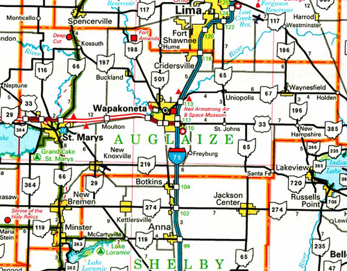
This is still very important: There is a direct link (portal) between my Little Whitehead in WH X-ing and Little Whitehead Summit on Monhegan Island, ME. And it probably generates all the other Maine related synchs in area, including Norum(bega), Nautilus Island (reached exclusively through Whiteheads), Gray with its lone Southern soldier and also Blue Feather Gallery on Brown Street, and also the reversal of North and South in Oxford County (Mexico-Peru to Norway-Sweden-Denmark), and also Bull Rocks at Dixfield. Maine is much about Whitehead X-ing. Believe it!

—–

White Rock, Whitehead Crossing, has power. Extends this into the White Rocks of TX, pointing out Petty/Pettiway (Petty + Ewa) and also the White Triangle of White Rock – Whitewright – White Rock. This is just beyond w. line of Fannin County, as the White Rock near Petty (and Petty, in turn near “High”) just beyond *east* line of Fannin.

We now also know that Petty is connected to Tom Petty, who is probably referring to being high in the song “Running Down a Dream” featured in Carrcass-10.

In Spring 2013 during another run of Whitehead X-ing related posts, I figured out that Seal Stone sits atop Grey Rock, making “Grey Seal” in toto, like the Elton John song. The spring beside it with no name quickly became No Title Spring (after the song before Grey Seal and after the title song of the album, GYBR: “This Song has no Title”).

The very shallow pool just discovered in Red Head may have been named Big Blue Pool in the past (source: Washington Co, FL again). Much deeper in past. It definitely has a story. You can’t easily get from Red Head to Whitehead X-ing from this direction, as reinforced to me just yesterday (!).

—–

Zebra Station at or near the mouth of Concreek points to Head Trip, which may be coded within a computer there. Black and white, like a Zebra. Zebra, Missouri and nearby Damsel Island is the source, however. It lies on the edge of Korean Channel, which is a important *tile* within Head Trip, perhaps what it was all built around.

This is a way beyond Billfork. This is Head Trip. Solidifes Whitehead X-ing as *the* place to create an art happening in the future, perhaps a cabin even.

Green Turtle also “found” in Spring 2013, along with the Wilcoxson cemeter and the Totem (Land of Blue and Purple).

4 Sticks also known as ZoSo, perhaps degenerated to SoSo. Big Log also named Spring 2013.

Yellow Bricks hidden at Tinsitiy originally come from WH X-ing and it’s “Rocky Trail”?

Imp. Whitehead X-ing related post here to review carefully:

https://bakerbloch.wordpress.com/2013/04/23/whitehead-x-ing-thoughts/

—–

The Emerald name also coined Spring 2013.

Diamond Rock found late spring 2013. On Diamond Beach of Whitehead Brook. (a 4×7 magic diamond? like centers my opus 1 drawing)

http://www.peeron.com/inv/sets/2989-1

Walk the Contemplation Loop this summer when and if possible.

Leave a comment

Filed under Allen Knob, Frank Park, MAPS, Missouri, Whitehead Crossing

Red Head related names

2 Greenheads in US, both with an elevation of 144 feet (12 x 12). Synchronicity or chance?

greenhead01

Greenhead, FL, with nearby Red Head. This is only Red Head pp in US. A low summit of this name exists in another Washington County, in Maine.

greenhead02

I think here of Anne of Green Gables and her red hair, which she accidentally turned green just before she was accepted by Marilla to stay at Green Gables.

megan
Anne’s red hair

anne-dyed-hair
Anne’s temporarily green hair — misery!

Obviously when one’s hair turns white with age, you no longer have to worry about your original hair color unless you dye it. Accepting one’s [red] hair equals acceptance of oneself. Accepting one’s white hair equals acceptance of one’s *older* self. We are all figuratively white in the end, if we live long enough.

Whitehead in Da Woods.

Leave a comment

Filed under Allen Knob, Florida, Frank Park, Maryland, Whitehead Crossing

Thoughts

I probably need to give up Collagesity in Minoa in a couple of days, but can I manage it? I just talked to Carrcassonnee, who made a brief reappearance in the town’s temple. She said to remember her for who she is, and also that she would return. She recently had a baby — wonder what happened to it? But I suppose that might just be my keyboards (arriving Tuesday!). So what I need to do is save *all the town’s art*. I’m not going to worry about saving the altered Fal Mouth Moon structure. I’ll just re-create it as needed later on. My Sunklands site is up for renewal in August, and I want to make sure that will continue. I suppose.

Amazing new developments out in the *real* woods. Yesterday I found a whole new section of Whitehead Crossing which, quite peculiarly, seems to be blocked off from the main part. That’s why I hadn’t found it before. But Sunday was different. Now — perhaps even today — I have to figure out an easier way to get into it. I believe this to be the Mossman’s Red Head, mentioned here on this old map (top right)…

https://bakerbloch.wordpress.com/2014/04/30/new-whitehead-x-ing-map/

… but only hypothetically. Another name, then — looking at this map — could be Burnt Head, like on Monhegan Island along with its already employed Whitehead and Little Whitehead. I’m going to leave Blackhead alone, however.

monhe00x

RedDoor2
Now I know what’s behind the Red Door.

Leave a comment

Filed under **VIRTUAL SL, Frank Park, Heterocera, Maine, MAPS, Rubi, Sunklands, Whitehead Crossing

The Ra.

ehearts

http://anagram-solver.net/earth

harte
hater
heart

I’ve just initially explored what on the below doctored map can be called the “Mercury Ridge” of Sharieland.

https://wordpress.com/post/38932651/7344

cueballeightball04

Herman’s Mansion in Disguise, once more:

munsters

More soon! Sharieland may be a spring hiking focus. I’m almost healed.

1 Comment

Filed under Herman Park, MAPS, Sharieland, Virginia