
One word: Synchpatch!
Monthly Archives: December 2014
we know more
Baker *Beach*…
http://en.wikipedia.org/wiki/Burning_Man#1986_to_1989
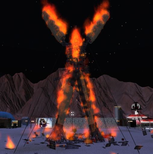
One of the roots of the annual event now known as Burning Man began as a bonfire ritual on the summer solstice in 1986 when Larry Harvey, Jerry James, and a few friends met on Baker Beach in San Francisco[8] and burned a 9-foot (2.7-meter) wooden man as well as a smaller wooden dog. Harvey has described his inspiration for burning these effigies as a spontaneous act of “radical self-expression”.[9] …. In 1987, the effigy grew to almost 15 feet (4.6 meters) tall, and by 1988, it had grown to around 40 feet (12 meters). Burning Man attendees informally called it “The Man,” and this name was given to each successive effigy, every year since Burning Man began.
Harvey stated that he did not see the movie The Wicker Man until many years later, so it played no part in his inspiration.
https://bakerbloch.wordpress.com/2014/11/14/more-map-stuff-01/
Returning to Lock Ness and Cherry Island:
http://en.wikipedia.org/wiki/Cherry_Island_%28Loch_Ness%29
A castle stood on the island during the 15th century; this was constructed of stone and oak wood and was probably used as a fortified refuge. It has been suggested that Eilean Muireach may have been a hunting lodge, with Eilean Nan Con the home for the hunting dogs.[1]
Cherry Island = (residence of) man.
Dog Island = (residence of) dog.
Dog was forgotten about or submerged in time (after 1986 apparently). Man remained, sans smaller companion. Burning Man is bourne.
Burning Man is also a primary inspiration for Linden Labs’ Second Life, also in San Francisco like Baker Beach. An inworld event called Burn2 (originally Burning Life) has virtually attempted to recreate the excitement of Real Life’s Burning Man since 2003.
—–
More Burning Man:
Cacophony Society connection, c1989:
http://ljmichel.com/burningman/burningman.html
From the mouth of those involved, including more cacophonists (interesting, for example, that The Man may have started out as The Woman):
http://www.outsideonline.com/outdoor-adventure/events/Hot-Mess.html
A pivotal year was 1996. Burning Man could become Woodstock or Altamont. The safer route was picked, which was inevitable. Else the whole event would be nuked.

Philip Linden Says Second Life Must Evolve Beyond Burning Man Era
http://nwn.blogs.com/nwn/2009/09/burning-man.html
When Philip Linden resigned as CEO last year, I asserted that “The Burning Man era of Second Life is over.” But it is one thing for me to say that, and quite another for Philip himself to compare Second Life to Burning Man, and not just in the positive sense of a place that fosters freeform creation in an egalitarian community, as he always has — but tellingly, also in its most limiting connotation:
Presently, Second Life still isn’t very accessible – most people still don’t have the time to get over the steep learning curve and get to the amazing stuff inside. Similarly, the total number of people willing to drive 3 hours from Reno into the middle of a barren desert carrying a week’s worth of drinking water and food is limited.
At the moment, as Philip notes (having just returned from another Black Rock jaunt himself), Burning Man has reached a plateau of about 50,000 attendees. (As it happens, that’s roughly the number of Second Life users in-world at any given time.) This, he says, must change:
Try not to cling too tightly to what we have now. The design, the UI, the orientation experience, the tools – all these need to change, a LOT, for Second Life to become accessible to hundreds of millions. Those changes are sometimes going to be disruptive and painful… But a bigger part of my heart wants to see it reach everyone, and so we must evolve.
Background:
http://usatoday30.usatoday.com/printedition/money/20070205/secondlife_cover.art.htm
(continued in: tale wag)
Filed under **VIRTUAL SL, Burning Life, California, Middletown, United Kingdom
and/or

Click to access how%20did%20baker.pdf
Baker has appeared before here:
https://bakerbloch.wordpress.com/2014/11/23/up-with-maps-01/
![]()
And “Caledonia” also appears in a second F&H,E! post.
https://bakerbloch.wordpress.com/2014/12/10/murdochs-islands/
Cherry Island (Scottish Gaelic: Eilean Muireach, meaning Murdoch’s Island) is the only island in Loch Ness, Highland, Scotland, and is an example of a crannog.[1] The island is about 150 yards (140 m) from the shore near the southern end of the loch. The island was originally 160 feet (49 m) by 168 feet (51 m) across, but is now smaller as the level of the loch was raised when it became part of the Caledonian Canal.[1] The increase in the level of the loch caused a smaller natural island nearby Eilean Nan Con[2] (also known in its Anglicised form of “Dog Island”), to be totally submerged.
“Caledonia” submerges Dog I. and makes Cherry Island or “Murdoch’s Island” smaller. But Cherry Island is artificial in nature and wouldn’t be there atall without man. Smaller Eilean Nan Con or Dog I. is natural in contrast.
The name Baker is similarly submerged beneath Martel in Ohio near Caledonia (latter with Harding-Anderson overlap from past), but a twinned Baker, as it is, remains next to Caledonia in New York state. Not submerged or lost in the seas of history.
Caledonia (OH plus NY) represents the levels of Lock Ness and its Cherry and Dog isles. It follows that Baker equals past Lock Ness, pre-Caledonian Canal connected, with its Cherry Island and Dog Island both intact. Martel represents the present Caledonia Canal situation for the lock, with Cherry Island made smaller (now 51m x 49m) and Dog Island having completely disappeared.
(continued in: we know more)
Filed under California, MAPS, Middletown, New York, Ohio, United Kingdom
Probably exiting land ownership in Second Life
Thought I’d write this post before heading to the coast for the holidays. I’ve been caught heavily encroaching on a neighbor’s property in Minoa, and I believe I’ll just set the land for sale when I return. I have until maybe Tuesday to think about it. I haven’t done anything with the land except build on it and then ignore it. Could go back to renting from Lama Estates. It seems I need just a bit more than an 8704 to be happy. Have to “encroach” in other words, to keep my tier from bumping up into the unreasonable again. So that’s probably what I’ll do. There’s a nice chance that collage creating could resume in January, so I’ll have a new gallery to deal with soon enough.
So it looks like Minoa is *not* my permanent stop in SL. What I need is more room, and I can’t afford it. Probably can’t really afford the 8704. I’ll have to read some of my old SL related blog entries on my break before making a final decision. This could be *it*.
Filed under **VIRTUAL SL, Heterocera, Rubi
Ashville Circle 01
“The Ashville Circle was where it was all heading, Hucka D.”
Hucka D.:
Put up your map and let’s examine.

A.
bb:
This is the head, Hucka D. The man, John Lynndon as we’ve come to call him, puts his hand in the middle of the sewer top to indicate the circle. This is point A on the map above, 0.32 miles from the Hart. The radius of the [Ashville Circle] in other words, is 0.32 miles. Cherry Avenue, the spinal diameter of the circle, also tilts from true north at about a 32 degree angle. Worth noting.
Hucka D.:
Indeed.
bb:
Do you think John is a homeless person?
Hucka D.:
Nope.
bb:
Do you think the hand indicates more than it seems?
Hucka D.:
Yup.
bb:
Clock[ hand]? [no answer]
https://bakerbloch.wordpress.com/2014/12/17/norwegian-wood-02/

B.
Hucka D. has gone back to bed. In concocting the circle yesterday, I was aided by the fact that several more intersections apart from those involving Cherry Avenue seem to be highlighted, including this one to the west. The intersection appears to be on the outer edge of a neighborhood we’ve dubbed Apricot-Bone. Not sure if that name will stick, however. The east-west road involved here is Banana Street again, famous for the Ingleboort and Flaarph invested house next to Linden Creek. That particular house lies more toward the E, or center, of the A’ville Circle, with Banana Street peeling off (sorry) from Cherry Avenue near there as well.
In visiting the intersection via Google Earth Street View, I was very surprised to find something more unusual going on. The conjunction of Banana Street and the side road we’ll call Cone was calm itself.
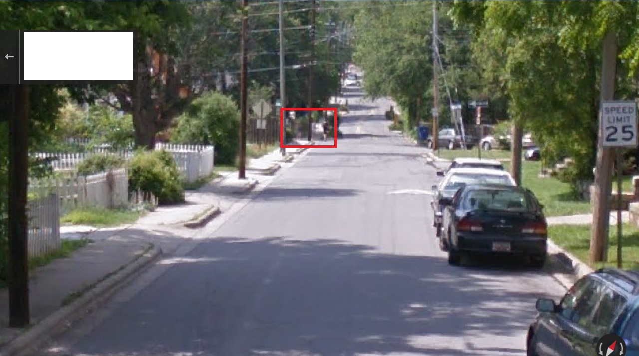
But one Street View camera shot down Cone manifests a figure sitting in the middle of the road, which turns out to be a teenager.
The girl appears to see or hear the Google Earth car approaching, and moves out of the way. We get a good look at her…

… and also glimpse the person sitting on the front stairs of a home across the road she is interacting with in some fashion. Wish Hucka D. was still around to possibly tell us more about the story. Ohl well.

—–
“It’s not Cone. It’s *Bone*. Now leave me alone so I can get some shuteye before my big meeting next year!”
—–
So Hucka D. says the side street is named Bone, hence the latter part of the neighborhood appellation Apricot-Bone. Makes sense. Or maybe it’s Pineapple. Better keep that to myself. But then there’s this: Fred Cone from Pine Apple, Alabama, as talked about by comedian Jerry Clower on his 1974 Country Ham album.
Also here:
“I didn’t play high school football because we didn’t have enough kids to field a team,” he said.
C.
This intersection is near the south end of Cherry Avenue…
https://bakerbloch.wordpress.com/2014/12/11/found-art-event-02/
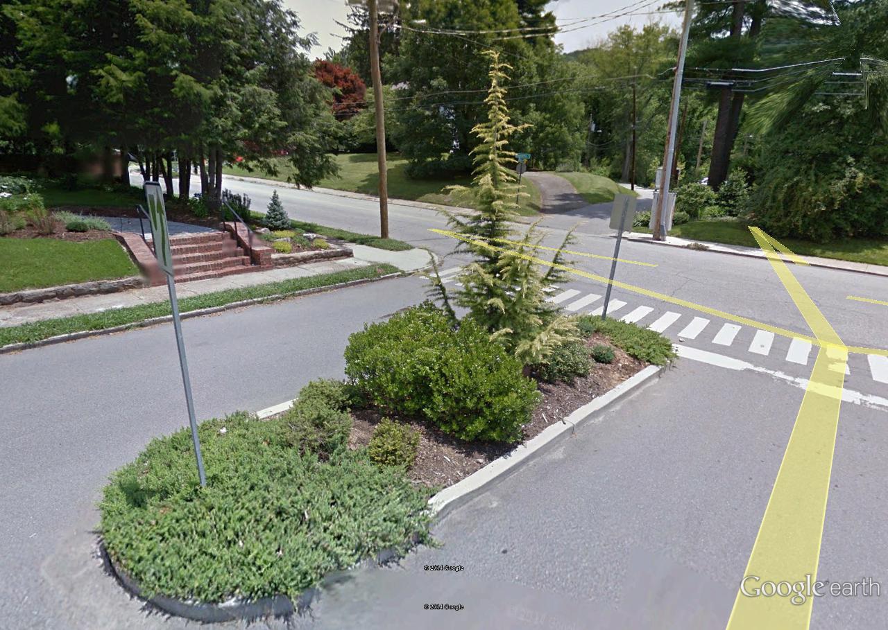
… first highlighted here. The two sets of walkers are shoulder to shoulder at this intersection of Cherry and [insert: Apricot] when we enter the former in Street View from the south.
[Apricot]-Cherry intersection. Pinball machine traffic islands dead ahead.

D.
Also helping delineate the Asheville Circle is this intersection to the east, involving the oddly coined Hartichoke and a larger artery named Berry Avenue, running parallel to Cherry appropriately enough.
No, I’ve woken up Hucka D. again in my stupidity and he’s indicated that Hartichoke is actually named Salad. He says not to bother him now until February. So I suppose — have to be careful here — that Salad is named after Salad Bar Jack, the famous Mmmmmm actor. I hear Hucka D.’s little hard feet hitting the floor next to the bed so I suppose I’m wrong again. “What’s that Hucka D.?” I shout toward the bedroom as he roars his disaproval again. Then I hear the window shatter and he’s gone — flown away to a better resting place, I suppose. So with him gone I’m going to leave it that Salad Place was named after Salad Bar Jack.
But anyway… there’s an island present at the meeting of Salad and Berry. Not sure what it means yet, if anything. But it probably does.
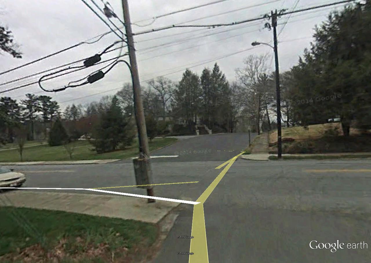
Since the traffic island isn’t present in the below Street View snapshot from 2008 and is in the 2012 snapshot above, we can deduce it was created between 2008 and 2012, obviously.
E.
This point marks the Hart or center of our circle, corresponding with the meeting of Salad and Cherry this time. This is no mere Thomas Benton we’re talking about here.


My uneducated guess is that this is Salad Bar Jack’s retirement home in Ashville, bought with hard earned film royalty money. His “place” as it were.

Could be wrong of course.
Filed under Middletown, Minnesota, Missouri
Ashville Revisited
It was a cool and overcast day yesterday when I decided to head to Ashville to check out more recent Google Maps based oddities. Nothing earthshaking found, but I’m starting to fill in a larger picture. I continue to believe a lot of it, a lot of what the energy is channeled through, has to do with that stream I call Linden Creek running between Cherry and Lime streets.
Below we have a conjunction of Linden Creek (top) with Read Creek (left) at the southern edge of Earl Weaver Park. As I’ve stated before, the 2 flows are about equal here, perhaps opening a debate over which creek name should have yielded to which. Read Creek won out in this reality. In another it may have been a different outcome.

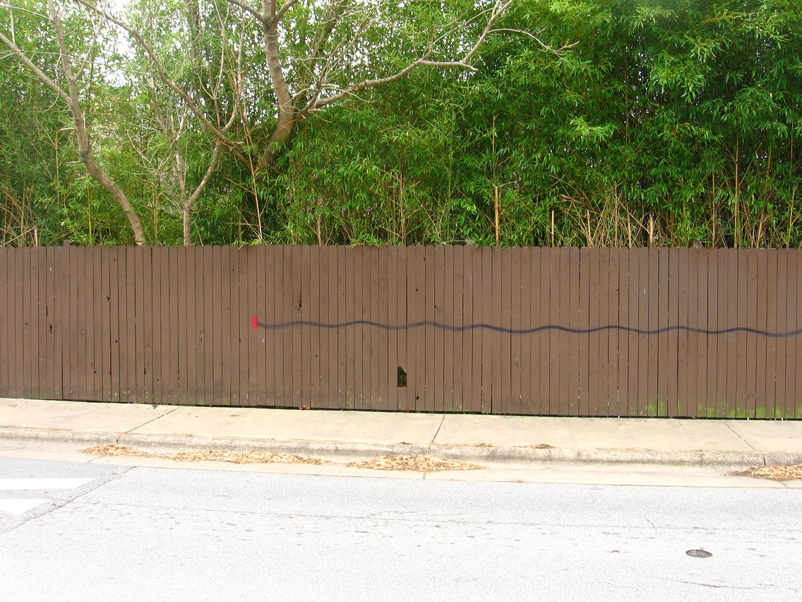
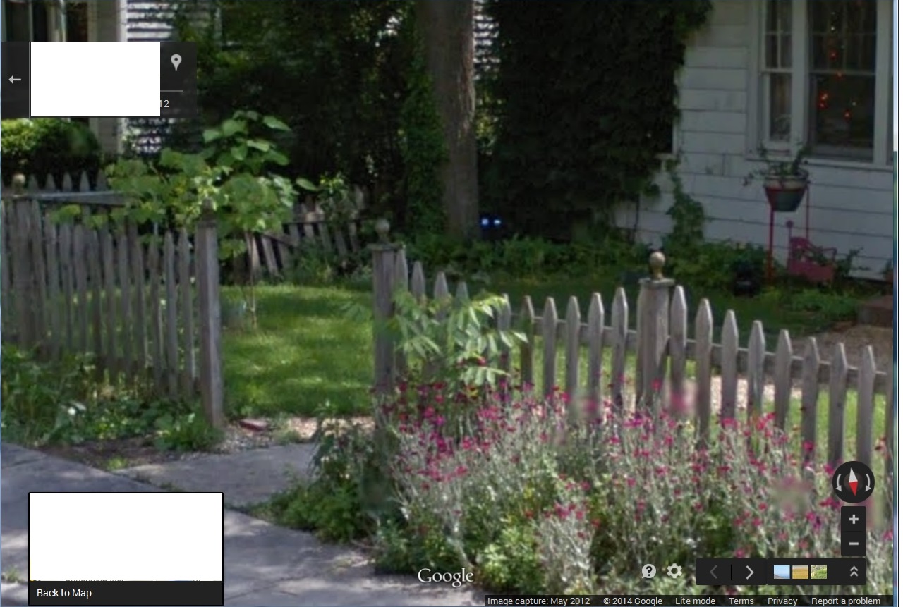
Bamboo and fence bordering Cherry Ave. not far from Linden’s mouth.

A perhaps peculiar design has been painted on the fence. Is is a map of the stream existing not far behind it. Do the joined red spots to the left indicate a mouth for the stream creature? Do the 2 dots indicate 2 different choices that the name of the combined stream could take, even? Things to be asking.
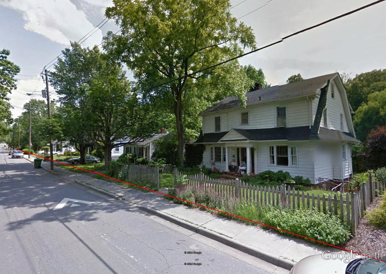
Linden Creek from Banana Street, just as it passes the house formerly (presently?) inhabited by Ingleboort and Flaarph’s friends George and Harriet. Another strange thing about this house I found out yesterday: a hiding fence has been erected all along its north and back side, and a cement patio has been built right next to the creek to the north. Is this where G and H commune with the creek and learn more of its secrets? Is this where I and F first appeared to them? Did I and F at some point tell them they should pose for Google Earth Street View when the camera topped car drove by at a specific time in May 2012? “Sit on the porch just like this,” they might have said, perhaps telepathically. “We’ll sit in the yard just below you.” “It should look like we are 2 sets of twins, one mirroring the other,” they might have additionally thought only to themselves. And so it came to pass.

Colors of TILE on Lime Street not far from George and Harriet’s once more. Perhaps the site of a TILE Temple in the past, Linden Creek style. A past marker as it were.
Linden Creek looking in the other direction away from G and H’s on Banana Street, or toward its juncture with Read Creek only about 30 yards distant from here.

More interesting bamboo enclosed house on Cherry Avenue. I believe there’s a good chance the inhabitants know the secret of Linden Creek as well and the power it holds.
At least 5 of the 7 dwarves from Snow White pose beside rocks in front of this house. I’m not sure what they have to do with the Linden Creek avatars like I and F, but perhaps something (!). And there’s another Japanese torii fronting the place; could be a secret totem indicating knowledge of the creek’s power for others in the know to see and understand. Maybe they even have meet-ups(?).
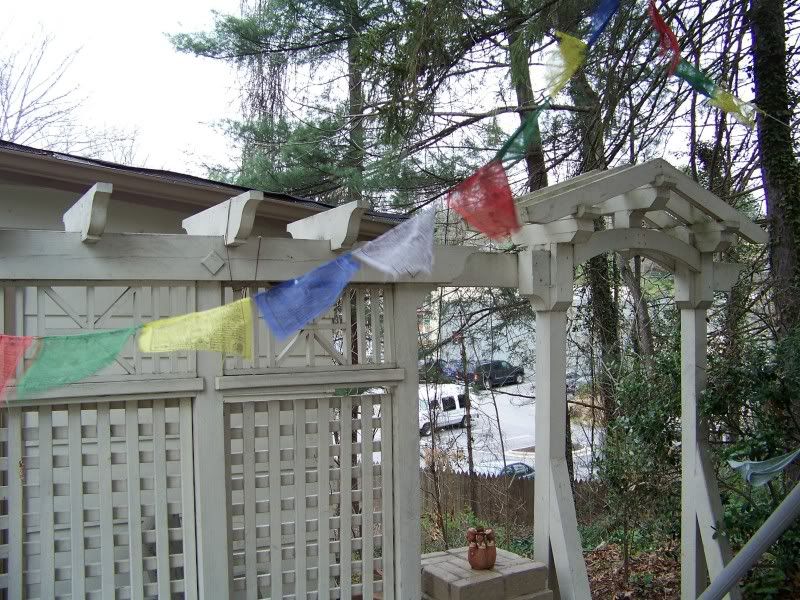
And perhaps that colorful flag bunting is another secret indicator of wisdom.

Further upstream, we catch a good glimpse of Linden Creek through a fence on [fill in the blank] street. I was quite surprised how large the creek is here. No tiny affair we’re dealing with.

Cherry Avenue’s southern set of traffic isles, once more. Said to, “look like something you’d find in a pinball machine” by one critic.

Bamboo bordering Linden Creek or marking its flow appears in ample amounts behind Cherry Avenue and Lime Street houses.

Still on Cherry Avenue: interesting house mural. Again I must ask: does it secretly tell the story of the creek’s native inhabitants? I’ll have to get a better picture of the mural soon.
Bamboo backed fence again, looking toward the Norwegian Wood neighborhood. Although I visited the latter as well this day, I didn’t snap any pictures. Again: rectification soon enough! Ashville is not that far away.

Filed under Middletown
Pineapple + Island

easy as 123

http://www.aliexpress.com/pineapple-island_reviews.html


See below for similar flags (!).
December 20, 2014 · 1:26 pm
tile one on again
TILE colored flag bunting fronting a Norwegian Wood house…

… also highlighted in this blog…
http://forum.skyscraperpage.com/showthread.php?t=167694
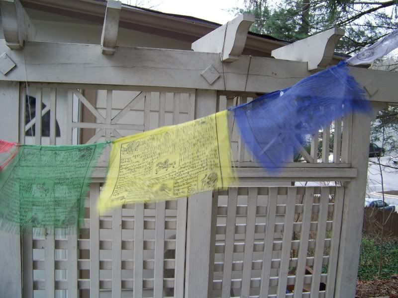
… and quite similar to what was found at “TILE Falls” on Bull Creek in October.

Such flag bunting may be an indication of secret knowledge and power.
Filed under Middletown
Basketballheads
GNIRPS:
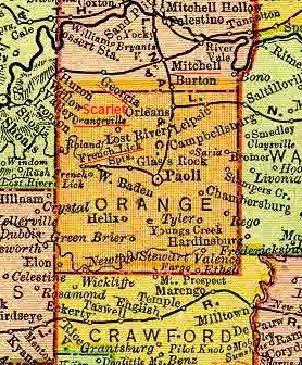
When you get a Scarlet in Orange County next to Georgia and Mitchell, you think of O’hara. Not the airport. Don’t say I don’t know nothing about birthing no map synchs!
bb:
I won’t GNIRPS. And thank you again for your contributions to the Frank and Herman, Einstein! blog.
GNIRPS:
Glad to be of service.
https://bakerbloch.wordpress.com/2014/01/20/graysonsadler-02/
—–
Orangeville points out Orange County, Indiana home of basketballhead legend Larry Bird. Scarlet in northwest corner of same county. Near Scarlet, WV is Bias, like Lenny Bias. Larry Bird and Lenny Bias: twins. Orange basketballhead twins, highlighted in scarlet. Third Scarlet (GA) near Seals(ton). This is, once again, the Scarlet Triangle.
Georgia was also Larry’s mother’s given name.
![]()
Sealston here before:
https://bakerbloch.wordpress.com/2014/07/18/olive/

Cherry Ave. Creature?
Two worlds; oblivious to the “danger” (far future humans?).

This one’s from Google Earth. You can just make out one of the southern traffic islands down the road, I believe. I might call this creature Saucer Eyes, or just Saucer or Saucey for short.
—–
100,000 years: The human face will have evolved to be proportioned to the ‘golden ratio,’ with unnervingly large eyes featuring a sideways blink

Filed under Middletown
