
… finally gone.

August VWX Town Meeting…
… finally adjourned.
… finally gone.
August VWX Town Meeting…
… finally adjourned.
Filed under **VIRTUAL SL, Heterocera, Jeogeot
(continued from “Byng 01”)
Rock Island about 50 yards or so upstream from Lion’s Roar. One could certainly make an argument that it’s not an island per se, but just an interior conglomeration of rocks more often than not protruding above Byng’s water level.

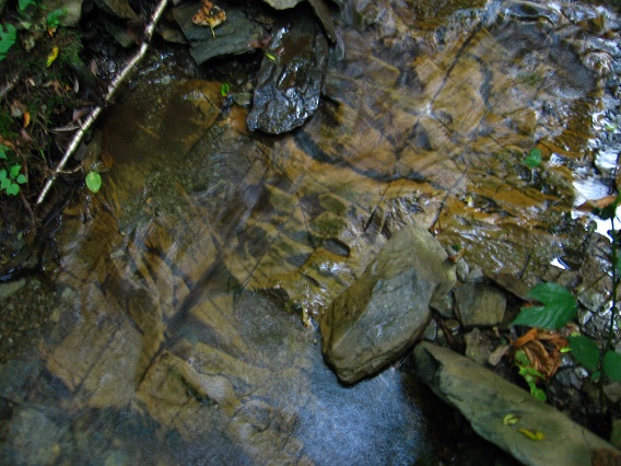
Interesting orange tinted rock patterns within an unnamed, small cascade just above Rock Island.
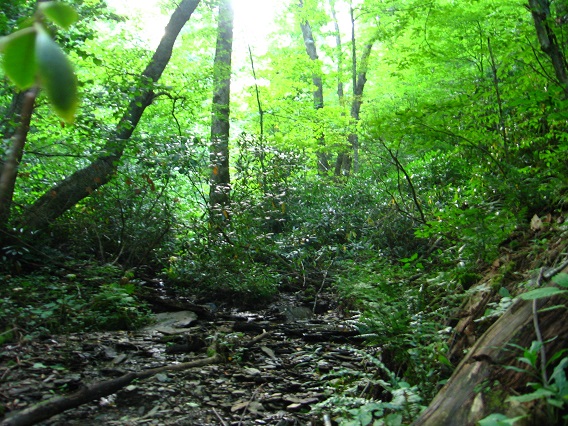
Shots into the upper reaches of Byng’s Kansas region, which has taken on added significance in the meantime:

I’ve found a path linking Missouri on the ridge to the west (same ridge with the Kentucky platform further up, once more) to this rock filled and more spread out, circle shaped part of Byng I am standing in for the below picture. Just downstream from here, we can spy the dark silhouette of a large, dead tree that perhaps represents the center of 6 Minute Hill. More on that soon as well.

Larger, square-ish rock from the same area.


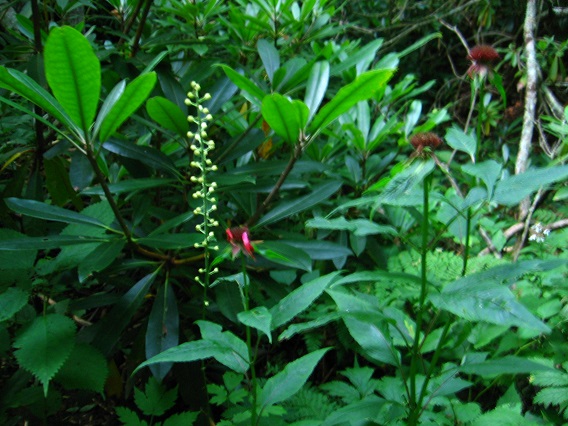
Upper Kansas flora.
Interesting crisscross of tree trunks above Byng… again taken within the same circular Byng location that the Missouri Trail leads to from the western ridge.

Interesting trunk spanning a more marshy part of 6 Minute Hill.

The central dead tree mentioned before, viewed from the opposite direction.

Filed under Byng, Herman Park
A greenish mushroom that has partially collapsed since I first spied it at the beginning of the Missouri Trail of Byng several days ago. I barely recognized it, in fact. The surface aspect of mushrooms seem to have a short span of existence. That’s something I look forward to studying closer when I retired in *7 1/2* years, barring illness. And even with illness (not going to happen) it will still be 7 1/2 total years, since I have bunches of sick leave accumulated. Not that I don’t like my job, but I have things to do… besides keeping up with this blog, which I intend to continue until I can’t. Frank and Herman, Einstein! is long term. Maybe beyond 7 1/2 years. 🙂
Since the below spot marks the point where you can enter Kansas (middle Byng Creek) or Missouri (ridge west of Byng), some might call it Kansas City. I’m not sure I’m ready to run with that particular pack yet.

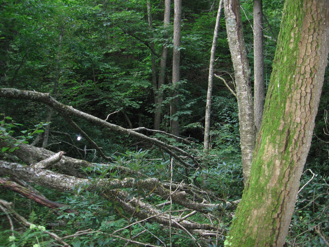
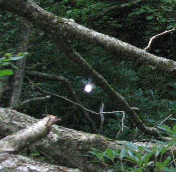
Holey Moley! Is that a wood fairy I took a picture of yesterday?!? This was a bit up the Missouri Trail, where you can see Lion’s Roar (central dark patch) in the background. I believe I took the picture with a flash (automatically set to adjust for lighting), but still I don’t see how it could illuminate a whole object like that. Could be wrong. Didn’t see anything like a fairy (or big bug) when taking the picture.
Close-up of the “fairy”. You can definitely see the wings here, and it appears to be flying at a goodly rate, or at least the wings, if that’s what they are, appear to be vibrating at such.
A short hike uphill brings us to the flatter platform of Missouri, not nearly as big as the Kentucky platform further up the same ridge but its only other identifiable platform area nonetheless that I can tell. The name Missouri comes from its proximity to both Kentucky to the west and Kansas to the east. Illinois and Iowa may figure into this as well, and it’s rumored (so far in Byng story) that Kansas’ Rock Island, which I’ll get to in a moment in this photo series, actually comes from a hidden mystery land of Illinois or Iowa or both, perhaps originally issuing from the area of The Impass above Kansas on Byng. Now factor into this seed mythology the Missouri platform situated not far above Rock Island.

Details from Missouri.

This photos depicts a tree seeming to grow almost horizontally out of the ground, but on second glance appears to be dead. Unusual.

Now we come to another oddity of the day. As I was shuffling around the Missouri platform taking pictures, I noticed not one but two unusual sounds. One sounded like somewhat garbled or muffled gunshot from a distance hill, and at a peculiarly regular rate. The second at first seem to come from the other direction, and sounded like a benign chirp from some exotic bird. It took a while to understand that the two sounds actually came from one source: a raccoon perched perhaps 50-60 feet above me in a tree. The sounds were directed toward *me*!

When I returned home last night, I looked up raccoon sounds on the Internet, and discovered they can make an astonishingly wide variety of such. I never found an audio match for the more threatening of the two sounds, however. I didn’t feel like I was in immediate danger, but I also knew that to continue up to Kentucky, my original plan, would have me passing through this very spot on the way back. I didn’t like the idea of encountering this raccoon again, and so I decided to instead descend back down the ridge and head over to Kansas and Byng instead. Below we have a pic from the still extant pots neatly tucked into an inner pocket of Lion’s Roar’s large, overhanging rock.

Byng’s Periwinkle Falls, just above Lion’s Roar.

(continued in “Byng 02”)
Filed under Byng, Herman Park
