Monthly Archives: July 2016

Bigfoot Map 02

(continued from)

bigfootmap01d
click to enlarge

Paths:

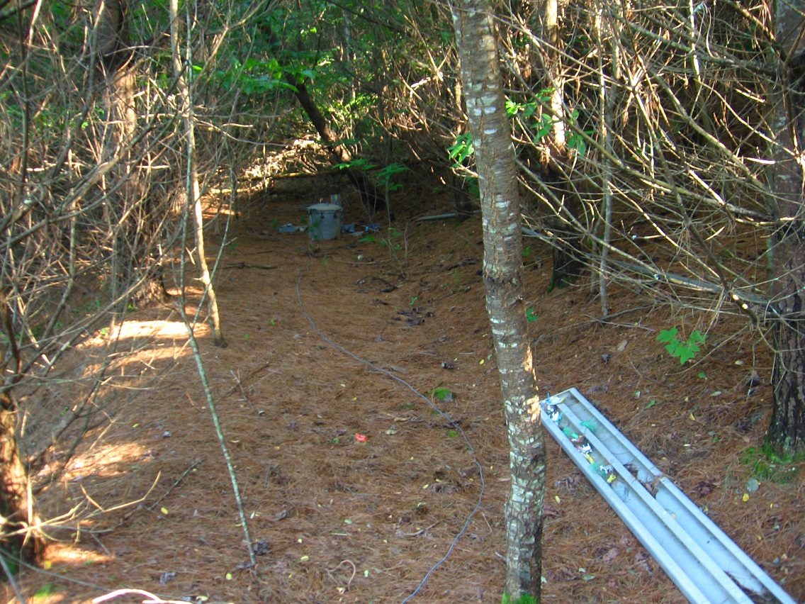
There are several paths that lead into and out of Bigfoot. Let’s start with the main path in, which is the one I mostly use in the summer. It’s really cool — you park your car quite legally at a lot just to the west of the Plateau of Raw Art and then walk above and to the south of it on one of those old logging roads that are multitudinous within the area. The path crests about 1/2way between the parking lot and Bigfoot. At that time the walker may be close to 200 feet above the level of the plateau, so quite a bit up from it. Rare is the day when I use this path that skateboarders aren’t present at the old high school tennis courts below, along with their constant slapping and rolling sounds. But it doesn’t bother me that much, despite my condition…

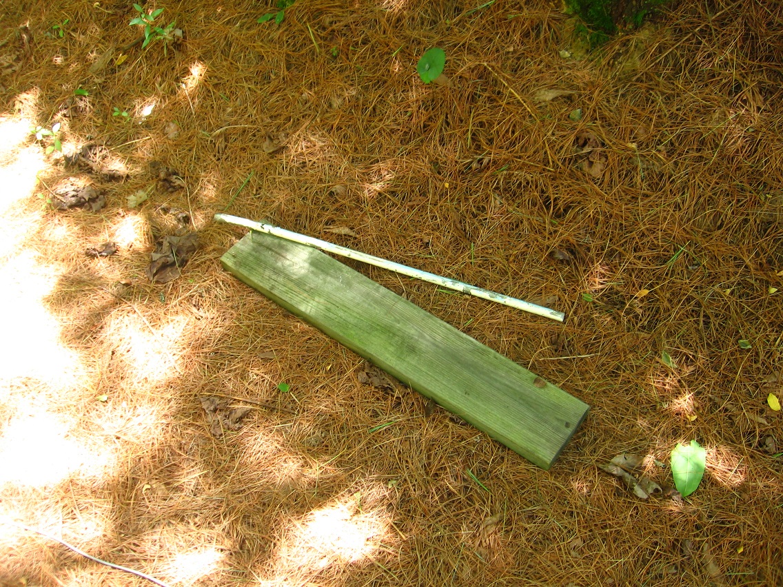
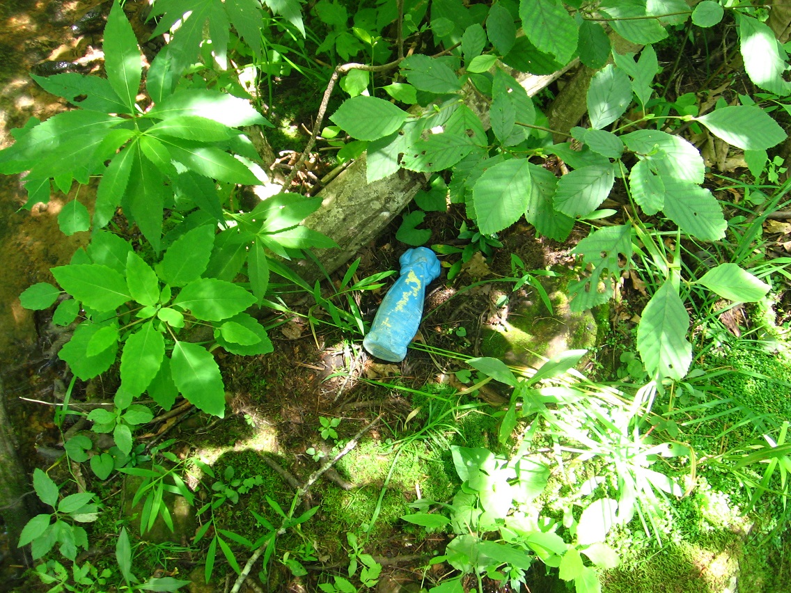
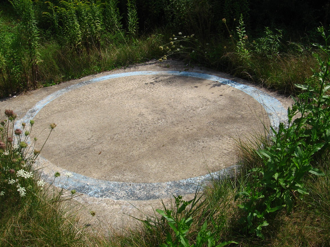
At the upper right of the map you can see where this Main Path intersects Bigfoot at its southwest corner, or at the southern end of 4th Road. Just into the field to the left as you enter, you find this mysterious blue circle adorning a cement slab. LINK

At this point one has a choice to follow either 4th Road or South Path down into the heart of Bigfoot. South Path represents a much steeper descent directly to the Bigfeet Swamp past the southern edges of 4th, 3rd, 2nd, and then 1st Road to end. You can use 1st Road to access Bigfoot Proper now, following either an eastern or western navigation around the swamp. I do not generally go down to Leola Creek from 1st Road through the set of stairs on the southeastern side of Bigfeet Swamp when I first arrive at Bigfoot, but you also have that option here.

If one instead uses 4th Road to access Bigfoot Proper, you head north until close to its end near the old school track and then turn right on what I’m also terming a “Main Path” on the above map. Maybe I should change the first such named path I’ve mentioned to *Crest Path*. Anyway, once again you cross 3rd, 2nd, and 1st roads to reach Bigfoot Proper, except when you reach 1st Road from this direction, you’re already basically on the edge of Bigfoot Proper according to present definitions. Again, BP is the yellow highlighted area in the lower central part of the above map.

And more recently formed and still fainter paths can take you from 4th Road down to Chesterton on Second Road (yellow highlighted square more in the upper central part of the map) and ultimately to Vincente on First Road.

Before the poison ivy comes out in the spring (and after it retreats in the fall), one can also access Bigfoot from the nearest of two old baseball fields, following a path that runs behind the scoreboard and drops into the area north of the swamp. This is the path I’ve marked with “closed for summer” on the right hand side of the map.

From the north and south directions, there are no easy ways into Bigfoot — no paths to mention. This certainly helps protect the area from visitors. Practically speaking, to access Bigfoot you have to use paths coming down from the Plateau of Raw Area to the west or those coming across Leola Creek to the east.

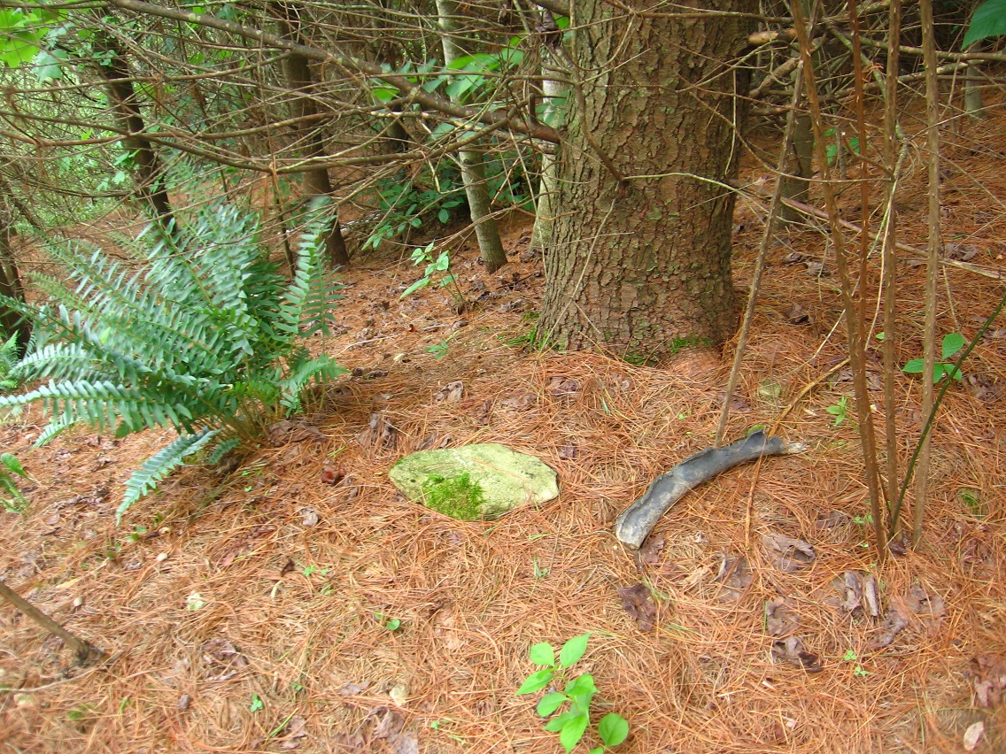
So let’s deal with those eastern accesses. When the water of Leola Creek reaches a certain low level, you can cross the creek into Bigfoot through stepping stones at specific places. Not many, but I at least know one fording place of this nature, which would come in the area I’ve labelled “Safe Zone” in the lower center of the Bigfoot map. I applied this name to a small span of Leola here because it is out of a direct viewing line of house and apt. dwellers to the north and south. I can hop and play on the numerous rocks in this zone knowing that my silliness is probably not going to be observed.

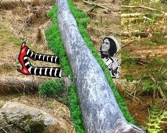
Another, longer way you can access Bigfoot from the east is across a log or fallen tree bridge seen on the extreme lower right of the map. First you have to reach the island we only see the southern tip of at this bridge, an easy hike from apartments on that side. The island doesn’t have a name yet, but it’s the only legitimate geographic feature of its kind within Greater Bigfoot; all other “islands” in the creek are basically just moss and plant bedecked rocks that I’m recalling.

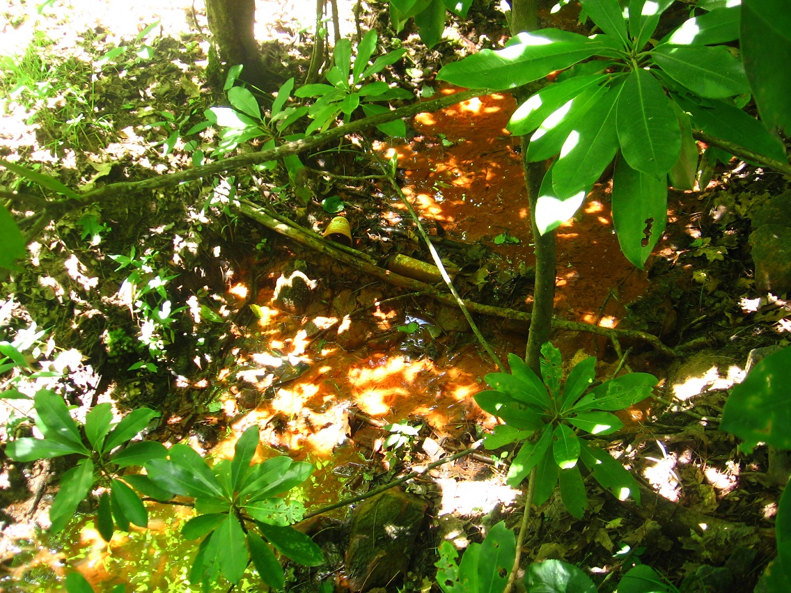
So you carefully walk across the log, hop the stream I’m calling Cheetah 2 times, and then while continuing to head south you have to also leap across Orangie Stream (rename this Tiger Stream?) to reach the swamp, once more. Coming from the direction of Bigfoot, you can also use this bridge to access the whole Blue Mtn. Urban Landscape which lies just to the east. Nifty.

(continued in)

2 Comments

Filed under BIGFOOT, Blue Mountain

Bigfoot Map 01

bigfootmap01d
click to enlarge

Classic seeming map of Bigfoot above. Future maps, when they come, will perhaps be of similar proportions in terms of an overall cropping. Both Chesterton and Bigfoot Proper (yellowed on map) will deserve more detailed looks. Interesting tension forming between the two. Reminds me of rivalry between my self created virtual towns of Pietmond and Teepot in 2010-2012. What community gets what object? What toys are more identified with one or the other? How do the marble races — actualized for Bigfoot Proper and hypothesized for Chesterton (more on that very soon) — differ between the two? Although both are on old forest roads, the communities contrast in other ways. It’s good to have this tension through natural rivalry. Helps each grow and define itself better. Bigfoot Proper will never go away as long as Bigfoot is around. Nor will Chesterton. And what of little Vincente between them now? Will a beach form there, accessible to both bergs?

To present details of the map [enlarge]:

Well, let’s start with those communities. You can spot yellow outlined Bigfoot Proper next to Bigfeet Swamp in the lower center of the map. The two shapes within, circle and square, stand for its spool table and metal chair respectively, both heavily featured in the Bigfoot Art Happening last fall. LINK Notice on the map that north is to the right instead of at the top. This means that Bigfoot Proper lies on the north side of the swamp. Again, Bigfeet Swamp got its name through an influential 1998 survey, which determined it is about 100 feet long, which became a “big number of feet” and then just “bigfeet”. The name Bigfoot for the overall area stems from Bigfeet, then. Before this, Bigfoot Proper was called Middle Game (and before that Iron or Irontown or Ironton).

Vincente (on west side of Bigfeet Swamp, or upper side on the above map), lies between Bigfoot Proper and Chesterton, forming almost a right angle with the two. It may be older than Bigfoot Proper. Then again, Chesterton may be older than either Vincente or Bigfoot Proper. But in hypertime, it doesn’t really matter at the bottom. All form “at once”. Vincente remains the smallest of the three by a considerable margin. The name comes from painter Vincent van Gogh in a convoluted way involving a resident of Utah’s Brian Head that I befriended at a temporary job in Middletown about 25 years ago. Unfortunately, we haven’t kept up with each other. Like Ironton Missouri, Brian Head Utah lies within an Iron County, one of four such named counties in the U.S. (Michigan, Missouri, Utah, Wisconsin). Iron is associated with Bigfoot Proper especially because of the presence of a full golfing iron there when I first visited it in September of last year. From this grew the legend that BP was originally known for its iron smelting, hence its original names.

Vincente may have been the site of the Middle Game high school. Did kids from both Bigfoot Proper and Chesterton attend? Or did these larger communities have their own schools? I’m guessing the former, at least for a time. The Middle Game name also refers to the middle position of Vincente between the two, then.

Chesterton is highlighted in yellow above Vincente, in the upper central part of the map. The pressure cooker seeming pot is symbolized as a circle within. The top of the pressure cooker originally appeared in Bigfoot Proper, built when it was known as one of the “Irons”. A second iron, only a head this time, was moved into Bigfoot Proper at one point, procured from the Plateau of Raw Art (far upper part of above map). Only the very lower part of this plateau is shown on the map. It is not part of Bigfoot but remains separate. It is essentially a less visited community park of Blue Mountain now, skateboarders being the most frequent guests. Some people also walk their dogs there, or lob baseballs around in the old fields or run around the track and stadium stairs for replenishing exercise. I’d say 10-15 people visit a day.

The four forest roads of Bigfoot are also marked. First Road comes close to surrounding the swamp, with a gap between Bigfoot Proper and Vincente where the intake stream’s pipe comes down from Plateau of Raw Art. BigFoot Proper lies on First Road, at the northern edge of the swamp as stated. 2nd Road lies above (elevation-wise) and west of First Road. Chesterton is on this road. For this and other reasons Bigfoot Proper is sometimes dubbed First Town and Chesterton Second Town. But this is mainly done by those from Bigfoot Proper, who are biased about the importance of their town relative to a primary rival. Bigfoot Proper as a whole is still seething that Chesterton stole (and enlarged) their smelting plant. “You have the spool table still,” counters Chesterton as a whole, in turn. Bigfoot Proper scowls and starts its usual spiel about its advantages, blah blah blah. Chesterton shoots back that it is more long term and naturally evolving. It also touts itself as more hidden and also more central. Little Vincente tries to speak but cannot be heard above the shouting of its “parents”. “Blah blah blah”. Well, “blah blah blah!”. That’s what it all sounds to Vincente’s peewee ears; makes him want to hack ’em off, or at least the one turned in their direction. The other is listening to reason.

394e767f4a82c49ba9fb1034f841b96c

(continued in)

1 Comment

Filed under BIGFOOT, Blue Mountain

Bigfoot Early Mid July 01

We had a terrible wind storm the other day here in Blue Mtn., with many trees knocked down. Yet when I returned to Bigfoot the next day, I believe, my two little tiger figurines I had set on a small rock were still standing! I was amazed; I thought they’d be blown clear across Leola Creek to parts unknown. The forest and also plateau above them must have acted as a buffer. But even then the wind couldn’t have been that severe here… the storm must have largely passed Chesterton over somehow. And, in fact, I didn’t see any fallen branches in Bigfoot either that I noticed. Hmm…

IMG_2491smaller

Two new objects I imported into Chesterton this same day.

IMG_2492smaller

Down at Bigfeet Swamp now, I’d been meaning to take a picture of this broken cement slab near the southeast corner of 1st Road for a while now. Obviously use to be square shaped. Now broken fairly cleanly down a central diagonal. Like a broken locket?

IMG_2493smaller

Bigfoot Proper: I simply could not choose what objects needed to be moved up to Chesterton and what needed to stay here. So I made no large decisions this day on that matter. But we definitely have two sides of a balance in terms of Chesterton vs. Bigfoot Proper. Like black and white rocks. Like a marriage of some kind. Yin and yang, perhaps.

IMG_2500smaller

More Bigfoot Proper objects… for now. Speaking of yin/yang, one thing I believe that definitely belonged in Chesterton from Bigfoot Proper was that old “iron smelting plant” which actually was the top of a pressure cooker, it seems. I’ll tell more of its story down the line. I’m not sure exactly *how* the 3 main parts of the pressure cooker got back together (!). More broken pieces, that have been reunited in this case: bottom, sides, top.

IMG_2502smaller

A continuing theme for this post: broken or fractured rock found near Orangie Creek north of the swamp.

IMG_2515smaller

Another unusual “rock” nearby. I’ll have to take a closer look at this one soon.

IMG_2524smaller

A plastic cup and some kind of spray can embedded in the banks of Orangie. They partially inherited its color.

IMG_2533smaller

We move to the extreme west of Bigfoot for these next 3 pictures, including a cement decoration that I could barely budge. No way I could get it back to the swamp, let alone Chesterton uphill.

IMG_2565smaller

Unusual rock path along Leola Creek wedged between what I’m defining as Bigfoot and the Blue Mtn. Urban Landscape. I want to talk to the creator! But, then again, I don’t want to attract attention to myself via Bigfoot in any way, beyond the cloaking mythology of this blog.

IMG_2590smaller

Another object found near the cement decoration mentioned just above. This would be next to the northern edge of The Island, which I’ll have to take more pictures of soon as well. This Snow White shaped dispenser *did* make it back to Chesterton. Probably contained a fabric whitening product originally.

IMG_2603smaller

Snow White, eh? And I even found a kind of two staired platform for her to stand on at another part of The Island. During windier times, she can fit into that hole between the two stairs for protection.

IMG_2606smaller

The Chesterton “downtown” is also developing as well. I’m sure at least a handful of toy avatars will call it home soon. I’m thinking Lisa the Vegetarian should number among ’em. We’ll see. I rolled that tire in the background down from the Plateau of Raw Art this same day. It was just waiting there for me on the old high school track when I arrived; not present before. I’m seeing it as maybe a sports stadium for Chesterton. What will the attached sports mascots be? Tigers? Cheetas? (Goldfish?)

IMG_2626smaller

A small “forest” of plants more in northern Chesterton. I think it should be deemed a park. You can see Wireway 61 on the lower right of the picture.

IMG_2629smaller

1 Comment

Filed under BIGFOOT, Blue Mountain, Toy Avatars

Thoughts: Chesterton Etc. 03

Possible next steps:

Simply to *camp* at Chesterton overnight. I could keep entertained by my phone, and I could take books. I could bring in white noise to drown out any neighborhood commotions. I could go down to the swamp. I could head up to the Plateau of Raw Art to hang out a bit. It might be fun. But I probably won’t do it anytime soon.

In 1983 I camped out for about a month at the Leola Creek watering hole just across the ridge. In the same year I created a makeshift teepee, also near this watering hole (what I’ve called Rediscovery more recently), and at the same place that people are *still* camping at, 25 years later almost. Yes, at some point I will camp out at Bigfoot, if it remains intact and the land isn’t developed. Because the land *will* be developed. Bigfoot is not protected property, like Whitehead Crossing, like Billfork and other places in Frank and Herman Parks. It is not within a park. It is simply land, very near town, that for one reason or another remains a void that progress has skipped over so far.

My theory, and perhaps I should have Carrcassonnee voice this instead of myself, is that Bigfoot is a *gift* to me at this point in my life. “We’ll give him some place that is safe so he won’t get into trouble,” is what the providers are thinking. “Let him stretch his imagination still, but in a protected microcosm.” I haven’t gotten tired of Bigfoot yet, despite many visits. And I dont’ see my interest in it waning much until the leaves go away again, when the rest of the local woods really open up to me once more. How many years will I have Bigfoot? I’m hoping quite a number. But realistically I’m shooting for 5 or 6. And I’m serious about it being created for me. For you, the reader, as well through me, but mainly for me on a physical level. How could this be?

Reverse engineered, Bigfoot doesn’t totally belong in the present. It is seeded in a more recent past. When I camped out at Rediscovery those 20-25 years ago, Bigfoot as I’m presenting it in this blog didn’t really exist. It was born out of an expansion project taking place at what is now the mainly vacant Plateau of Raw Art, namely the creating of a new playing field for the local high school. The Bigfoot forest roads and the swamp were made in the mid-90s sometime. It took them this long to become mature with vegetation. Open at the beginning, Bigfoot protects and nurtures now. The small pine forest hides. The lush swamp has been basically forgotten, although steps on one side indicate a more visited past. But at the bottom of it, I believe Bigfoot exists outside of time — that’s my point, I think. It exists in coordination with all else that surrounds it: the skateboarders up at the Plateau that come daily, the apartment dwellers to the north and east, the beautiful and almost certainly sentient Leola Creek marking a protecting eastern border for it. All these create a coordinated tension that Bigfoot slots into the middle of perfectly. It is a round peg in a round hole. But this perfect balance of tensions is temporary.

It is a nest. I am the egg. What will I become when hatched? The art happenings progress. They could not do so in Frank and Herman Parks. Those spaces belong to others, perhaps other artists, and of a much more advanced nature. True Bigfoot we are possibly talking about here, along with accompanying aliens. My art does not really complement or slot in easily with their art. These other artists might not understand the nature of the marbles and the toy avatars. They may be protective of their junk which is potentially used in a happening. Toy/junk happenings, the way I see them, are a *delicate* matter. I, we, are interacting with nature in a very intimate and creative manner. I am not constructing a building or school. I am not inflicting mass damage on the environment like an expansion project of a high school would do, or creating an apartment complex relatively unsensitive to the plants, the trees, the landscape that has to be sacrificed as a result. I am attempting to *blend* with an already established environment. The happening has many sides and angles. As stated, it coordinates with other art and habitation of a given region. The skateboarders of the Plateau of Raw Art, developing and refining their own work, are *unconsciously* aware of Bigfoot. I now sometimes walk quite close to them when returning to my car. “I am one of you,” I want to communicate. “We are working in a similar direction.”

The apartment dwellers across the creek unconsciously know of me and my Bigfoot involvement. They provide space; this is my space and that is theirs, just like the skateboarders. I do not like to expose myself to their viewings. The skateboarders, as well, must be kept at a certain arm’s length, despite some cool symmetries of artistic endeavors. It is good enough that all of these people create unconscious space for me and my own creative impulses. And the swamp and attached stream are certainly sentient in a way, also. What is it saying? Does it see or remember its beginning, its end? Who am I to it?

Leave a comment

Filed under BIGFOOT, Blue Mountain

Thoughts: Chesterton Etc. 02

lions_tigerville

“… reversed in Louisiana, with Lions the plural instead of Tigers. Instead it’s Tigerville, singular. In Chesterton yesterday there were 2 tigers on opposite sides of Wireway 61 from a lion. But at any rate, Wireway 61 resonates with Highway 61 which is, in turn, the Mighty Mississippi River itself.”

LOOK UP: How Miss. divides Lion and Tiger from each other, formerly joined at the hip. This separation also spells end of Oz rulership. Real Life begins. Birth.

Breaking of First Hoop in Chesterton at some point in the moving in of these wireways also parallels this end and new beginning.

U.S. Route 61:

https://en.wikipedia.org/wiki/U.S._Route_61

U.S. Route 49:

https://en.wikipedia.org/wiki/U.S._Route_49

At Jackson, U.S. Highway 49 shares an alignment with segments of Interstates 20 and 220 before turning northwest to Yazoo City. A split in the highway, rare in the U.S. system, begins here, with both routes heading into the Mississippi Delta, U.S. 49W serving the towns of Belzoni and Indianola, where it junctions U.S. Route 82 and its four-lane segment ends, while two-laned 49E serves Tchula before encountering U.S. 82 at Greenwood. Both routes continue north from 82 and are linked again at Tutwiler, Mississippi. Continuing northwest, the highway passes through an interchange with U.S. Route 61 as it enters Clarksdale. It is at Clarksdale that Highway 49 encounters “The Crossroads”, the legendary junction with State Street (an old alignment of U.S. 61) where the great blues musician Robert Johnson is reputed to have sold his soul to the devil.[6]

From Clarksdale, Highway 49 continues north toward its crossing of the Mississippi River, where it enters Arkansas near the town of Helena.

NOTE: Robert Johnson has come up in 2 separate ways recently in this blog. First, the Crossroads legend focusing on the 49-61 junction in Clarksdale has resurfaced through the crossed wireways of Chesterton, which have been identified with the 2 highways. Second, in Second Life, Quito has surfaced as a keyword in BoB (Birth of Bogato) LINK, and the Mississippi town of the same name (origin: unknown) was found to be one of 3 sites in Leflore County where Robert Johnson of 49×61 fame was reportedly buried in an unmarked grave.

Leave a comment

Filed under BIGFOOT, Blue Mountain, Louisiana, Mississippi

Thoughts: Chesterton, Etc.

lions_tigerville

“It’s obvious that the Chesterton happening would take root when we were watching “6 Feet Under”, Carrcassonnee.”

Carr.:

I am here. Yes, the second Chesterton in Indiana, and the only remaining one in the US as a whole. Hole? Anyway, it indicates this yes. Good.

bb:

I watched the synch featuring “6 Feet Under” today, Carrcassonnee. Do you know the one?

Carr.:

Yes. I am Carrcassonnee.

bb:

Great. I enjoyed it, as usual. Probably watched it 30-40 times now. It’s one of the most complicated I’ve been able to tape. Over 90 tiles within.

Carr.:

I am here.

bb:

But looking from the outside, without prior knowledge and understanding of the structure, it could be confusing.

Carr.:

Yes. Don’t blame others.

bb:

Is Bigfoot around in Bigfoot? Had to ask.

Carr.:

They are keeping a [certain] distance.

bb:

Where’s Hucka D. in all this?

Carr.:

Hucka D. is more behind the scenes[ now]. (pause)

bb:

Is it because of the establishment of Collagesity as a permanent installation?

Carr.:

In part. We need for you to talk to someone a little more solid. Me.

bb:

Claire Fisher is at the beginning and the end of the synch. Alpha and omega. And it’s one tile, broken in two. The first shows her death at age 101, I believe. The second continues the journey to the city where she can truly begin her career as an artist, a photographer perhaps. She is the frame. The construction barrels above Chesterton are her.

Carr.:

Fishers, yes. Clare Fisherburg. I dig it, as Chester would say.

Chester:

Dig it!

bb:

Then there’s one several tile[s] within the synch that shows her mother, Ruth Fisher. She has just allowed Bill Murray to enter her house in the tile before, and then in the next she takes the place of Murray, stating she doesn’t need to come in — Arthur’s room. She’s rented a video. She doesn’t have [Murray’s] flowers in her hand any longer. Flowers to video. It’s “Silent Running” which stars Bruce Dern, featured in a recent carrcass Carrcassonnee.

Carr.:

Carr-11. I know.

bb:

[About] Nebraska. Then we have Ruth again in 2 other tiles just after this. It’s kind of a weak spot of the sync as a whole.

Carr.:

We’re talking about Waits 4 No 1. Not Carr-11.

bb:

Yes. Anyway, she and Arthur watch the film, and we tune in, in the synch, when they are almost done and are watching the ending credits. This cuts to a porn film after we return to Whose Line is it Anyway, with Ryan attempting to demonstrate how a Sperm Bank ATM works to Colin.

Carr.:

Funny. But, yes, it is cut.

bb:

Both Arthur and Ruth are very embarrassed that the porn thing is on TV when the video is cut off. Then we head to Dune.

Carr.:

I am Dune.

bb:

I wonder if a new synch could feature Silent Running?

Carr.:

2010.

1 Comment

Filed under BIGFOOT, Blue Mountain, Carrcass Artists

Chesterton Early July 03

Daily visits continue to Chesterton in this kind of slow developing toy/junk happening. Today I bought 2 batches of cheap animal figurines from the local Wal Mart and Dollar Store. Nice stuff for the cost (5 dollars total). 2 tigers were within, although I didn’t plan this twinning with what I’m now calling The Tigers (conjoined construction barrels) just above and west of Chesterton. It’s something that just happened.

The longest wire of Chesterton separates the two tigers and a lion in the below photo. I believe this reinforces the idea of the wire representing the number 61, specifically connected to the famous Highway 61 and the mighty Mississippi River it parallels for the great majority of its north-south length. This is reinforced in several different ways. Check here LINK for an example.

And this is also Oz related. Have we found Oz in the center of Chesterton, as Carrcassonnee suggested we do?

IMG_2459smaller

There were also several plastic plants and trees included in the toy packages I bought today.

IMG_2460smallest

More of the toys.

IMG_2463smaller

Even more.

IMG_2464smaller

A very important melding also occurred this day of the Chesterton happening. The bottom of what appears to be a pressure cooker, already present in Chesterton, was reunited with its top coming from Bigfoot Proper down at the swamp, a key element in the happening from last fall and what I deemed an “iron smelting plant” there. More on this soon; it’s kind of, again, one of those mysterious things about the happening, about the swamp and area itself. But with this “marriage”, Chesterton appears to have truly become the dominating center of all of Bigfoot now, supplanting the swamp location.

IMG_2469smaller

The 61 “Wireway” passing through the cluster of new toys.

IMG_2475smaller

The giraffe’s head is illuminated by the evening sun.

IMG_2476smaller

Experiments with washer and nut sliders on the wireway.

IMG_2482smaller

Having finished snapping my pictures for the day, I put up my new toys all except for the 2 tigers (lower center), which remain on their rock.

IMG_2486smaller

Closeup of the broken First Hoop. It can also be seen at the bottom of the above photo. Wireway 61 doesn’t pass through it currently, but it did in the past and perhaps the future as well.

IMG_2489smaller

1 Comment

Filed under BIGFOOT, Blue Mountain, Toy Avatars

Tigers

tiger01

Clare. Fisher. Fishers.

https://en.wikipedia.org/wiki/Fishers,_Indiana

Fishers is a city located in Fall Creek and Delaware Townships, Hamilton County, Indiana, United States, with a population of 76,794, according to the 2010 census. A suburb of Indianapolis, Fishers has grown rapidly in recent decades: about 350 people lived there in 1963, 2,000 in 1980, and only 7,200 as recently as 1990. In 2011, Fishers was named the number one city for families by The Learning Channel and was selected as a Green Community by the Indiana Association of Cities and Towns.[6] The city was named the safest in the nation by CQ Press for 2011-2012[7] and 2012-2013.[8] In 2010, Fishers was ranked eighth in the best places to live according to Money magazine,[9] America’s best affordable suburb by BusinessWeek,[10] and the eleventh best place to move in the country by Forbes.[6] Fishers was also ranked the 24th best place to live in America by Money magazine in 2005,[11] 33rd in 2006,[12] 10th in 2008, and 12th in 2012.[13]

The 2000 census reported the population of Fishers at almost 38,000.[25] With the town’s affordable homes, growing economy, and proximity to the booming city of Indianapolis and Interstate 69 the growth in Fishers was tremendous. In 2003 the town of Fishers requested a special census from the U.S. Census Bureau to accurately measure the rapid population growth since 2000.[18] This census would put the town’s population at 52,390, which is a 38 percent increase from the 2000 census.[18] Since then much of the government’s resources have been devoted to building parks, maintaining roads, and managing the rapid growth of the town.

https://en.wikipedia.org/wiki/Six_Feet_Under_(TV_series)

Six Feet Under is an American drama television series created and produced by Alan Ball. It premiered on the premium cable network HBO in the United States on June 3, 2001 and ended on August 21, 2005, spanning five seasons and 63 episodes. The show was produced by Actual Size Films and The Greenblatt/Janollari Studio, and was shot on location in Los Angeles and in Hollywood studios. The show depicts members of the Fisher family, who run their funeral home in Los Angeles, and their friends and lovers. The series traces these characters’ lives over the course of five years. The ensemble drama stars Peter Krause, Michael C. Hall, Frances Conroy, Lauren Ambrose, Freddy Rodriguez, Mathew St. Patrick, and Rachel Griffiths as the show’s seven central characters.

Six Feet Under received widespread critical acclaim, particularly for its writing and acting, and consistently drew high ratings for the HBO network. Regarded by many as one of the greatest TV series of all time, it has since been included on TIME magazine’s “All-TIME 100 TV Shows”,[1] as well as Empire magazine’s “50 Greatest TV Shows of All Time” list.[2] It has also been described as having one of the finest series finales in the history of television.[3] It won numerous awards, including nine Emmy Awards, three Screen Actors Guild Awards, three Golden Globe Awards, and a Peabody Award.

Leave a comment

Filed under BIGFOOT, Blue Mountain, Carrcass Artists

This is 61?

“That’s enough of the picture anyway, Baker Bloch. You have noticed that part 2 exactly begins at the wall anyway. We have 2 and 3 within my gazebo. First is outside. First is always outside. What is this? Is it Chesterton? No. But it may be Chesterton-like. Do you see a possible hoop?”

Snapshot2602_002

BBloch:

I think I do Carrcassonnee. Could it be the Ray Davies figure trapped by the log, with ruby slippered feet extended?

Carr.:

What do you think Chester? It’s your town[ after all].

Chester:

I, of course, dig it. Dig that picture. 2 and 3, eh? Cool-ie. Cool-i-o. Dig it.

Carr.:

What do you think of it?

Chester:

Its so cool there’s so much to dig. Cool-ie.

BBloch (adding thoughts):

The log is the 61 wire. I think I, as baker b., originally put the wire through the hoop, and then thought otherwise.

Carr. (speculating as well):

It [ the wire] is a passage of a marble through time. Silver.

Chester:

Nice dadd-i-o.

Carr.:

Thank you.

BBloch:

It is a woman, plain and simple. Pure. 61.

Carr.:

Er.

BBloch:

Wait. The wire *crushes* the hoop if not literally, then figuratively. I tripped over the hoop and broke it while moving in the wire. This is the Fall of Man. Inevitable. Rain comes. Rain *did* come just as the hoop was broken.

Carr.:

Better.

BBloch:

Mann’s Choice. Rain. Riddle, Puzzle, Cypher. Point. Point to Line to Sphere. Um, Cube.

Carr.:

49×61. 2989. We better end. Study Lego.

collage61excerpt

BBloch:

Oz erased from the center of Chesterton. Hoop broken. Event seen as wicked [witch].

Carr.:

Bed.

Leave a comment

Filed under **VIRTUAL SL, BIGFOOT, Blue Mountain, Heterocera, Rubi^

Bigfoot Early July 02

Picture of the still central object of Chesterton, which appears to be a pot of some kind, perhaps the remains of a pressure cooker. If so, the missing *top* of the pot may be the same as the “Smelting Plant” of the original Bigfoot happening last fall. In this symbolic way, Chesterton may extend and complete the first happening of the area. It is more long term and slower to unfold.

Note should also be made of the briar growing up from the edge of the pot, whose stem was accidentally broken this day while moving in additional objects. I’m not sure the plant will live. And that wasn’t the only thing I “broke” this second day of the new happening. Oh no.

IMG_2456smaller

A second, smaller root hoop was discovered in Chesterton to complement the one already found the day before. Good thing, because I *broke* the first hoop. I was so mad, but in fairness to myself, it was probably a thing that was doomed to happen, since the first and larger root hoop was right on the main path I continually use in pacing back and forth through the area.

IMG_2459smaller

“Second Hoop” from above.

IMG_2460smaller

Perhaps mysterious yellow flowers laid out near the center of Chesterton. Where did they blow in from? Is it yet another message concerning the new event? I must keep notes on possible oddities like this, for that is certainly part of the happening as well.

IMG_2463smaller

See through leaf. Not as mysterious seeming but making for an interesting blog picture nonetheless.

IMG_2467smaller

First hoop before I tripped over it and broke the root. Dag Gonnit! Big clumsy foot.

IMG_2477smaller

A more interesting rock I bumped my knee upon while setting up railroad track the day before. Has a red mark on it in the shape of a half circle. Does it represent pain itself?

IMG_2482smaller

Four pieces of wire were moved from Third Road down the slope to Chesterton and Second Road. Two pieces were more or less straight (and longer), two pieces were amorphous shaped, and akin to the wire art thingie employed in the Bigfoot fall happening. LINK One of the amorphous wire pieces, pictured below, seems to trap a “native” golf ball in one of its reinforced angles.

IMG_2485smaller

I took this picture of fern/rock/rubber object on Third Road while gathering the wire.

IMG_2491smaller

Across Third Road from that cluster of objects is the landmark Construction Barrels, also known as The Tigers (I think).

IMG_2493smaller

The two straighter and longer wire pieces eventually formed a natural crossroads near that central pot. I believe this should be connected to the 49×61 crossroads mentioned in Whitehead Crossing lore. LINK Tomorrow, supposedly a somewhat drier day here in Blue Mountain, I may found out more information about this and other Chesterton developments.

IMG_2494smaller

IMG_2495smallest
The longest bit of wire extends from one side of Chesterton to the other. This is 61?

1 Comment

Filed under BIGFOOT, Blue Mountain, Toy Avatars