Tag Archives: DOTS

BM Urban Landscape 07/31/15 01

Lookout near Point-1 from the other side of Leola Creek. Originally pictured here.

IMG_0003smaller

At the back of the same commercial building with this lookout: a perhaps disrepaired fruit drink vending machine. Well, who needs those anyway when you have cokes and pepsis?

IMG_0005smaller

Another picnic table was found this day, tucked around a corner of a neighboring building.

IMG_0031smaller

Also on this day I explored more of Leola Creek’s mouth, finding some nifty and meaningful things. A nice fishing or wading pool exists on the creek it empties into (unnamed, as stated)…

IMG_0040smaller

… formed by a dam at this power station. The Leola Creek mouth would be just downstream from here.

IMG_0045smaller

IMG_0046smaller

Yet another picnic table was found positioned near this mouth, light blue in color. What a nice getaway spot.

IMG_0049smaller

Back in the Urban Landscape proper, this butterfly posed for me on a leaf in bright sunlight. It’s really been nice up here in Blue Mountain for the past couple of days. I even took off Friday to enjoy the weather, and may take half a day tomorrow (Monday) as well. We’ll see if I can wrap up some stuff at work first.

IMG_0056smaller

The word “ALO” found in a bus stop. Admittedly I doctored this photo a tiny bit, erasing two dots within the “L”. I think it is suppose to instead be an “E”. But now it’s not. The bus stop is located on the south edge of what I’m calling ALO, and I think the graffiti could be a synchy resonance anyway, if only for my eyes — and now your eyes, dear reader.

IMG_0059bsmaller

More “messsages” wtihin the same bus stop.

IMG_0060smaller

Leave a comment

Filed under Blue Mountain

More Glyphs of The Measure 02

Where’s it heading? LINK

Answer: To the true supercontinent of The Measure glyphs, taking up most of its northern hemisphere. I’ve circled it in red below (low resolution version). Each of the four 8190 square meter regions of this hemisphere contain part of the supercontinent. The basic idea is more condensed brown sea floor masses (“land”) that are connected by isthmuses or necks of the same color. If he wished, Baker Bloch can walk all over this area without having to cross a beige part of the sim; he can remain on brown.

measure_supercontinent01

And to be complete about things up front, what *could* be called a similarly composed 2nd supercontinent — a third of the size, however — might be said to form primarily in the southern hemisphere, circled in yellow below. A number of individual glyphs we’ve already reviewed, including The Pony and The Nebulous Horsie for example, come from this smaller supermass.

But for clarity’s sake I’m only going to refer to the larger northern one as a supercontinent, making it, in my eyes at least — and in Lisa the Vegetarian’s eyes — *The* Supercontinent of The Measure. So back to this one and only Supercontinent as we’re defining it.

measure_supercontinent02

Below I’ve highlight some glyphs that strike us as interesting on the surface of things. First we have a duplicate “L” within one of the eastern seas of the supercontinent (right), matching the size and direction of the one next to Clubfoot (left). You’ll probably have to enlarge the below photo to see this. Also in the same photo I’ve highlighted the Double Dots glyph (left top) discussed in the previous post just to give you additional perspective on where we are in The Measure.

measure_supercontinent04

Clubfoot appears in one of Wappo Jack’s two assigned 8190 square meter regions, namely the northern one. The second clear L of the northern hemisphere highlighted above is positioned just to the right of this, over in the 8190 assigned to Jesus of Nazareth, who can’t join us right now because he’s taking a nap.

measure07reversed

Despite its size, the elected deities of Mystenopolis, those that remain conscious, have decided to focus only on one other aspect of The Supercontinent presently, or what we can call The Three Hearts. The 1st heart shape from left to right also appears to contain a line of degenerating forms below it, as if an animation of itself. I think here of The Grinch’s heart growing three times its former size in the animated Christmas classic The Grinch Who Stole Christmas from 1966, during a moral conversion. Or the creation of a true heart from a degenerated version. Too bad Jesus of Nazareth didn’t own this glyph, since he was born on Christmas day. Instead it falls just out of his region and into Wappo Jack’s.

Snapshot1820_001

Then the fulfilled heart itself, as we can call it, is mirrored into 2 other, similarly sized heart glyphs to the right here: A, B, C.

hearts01

grinchhearts

Heart C even contains what appears to be a smaller capital “L” within. Curious indeed.

Snapshot1830_001

Is this the endpoint of our investigation?

1 Comment

Filed under **VIRTUAL SL, Nautilus, Yd Island^

More Glyphs of The Measure

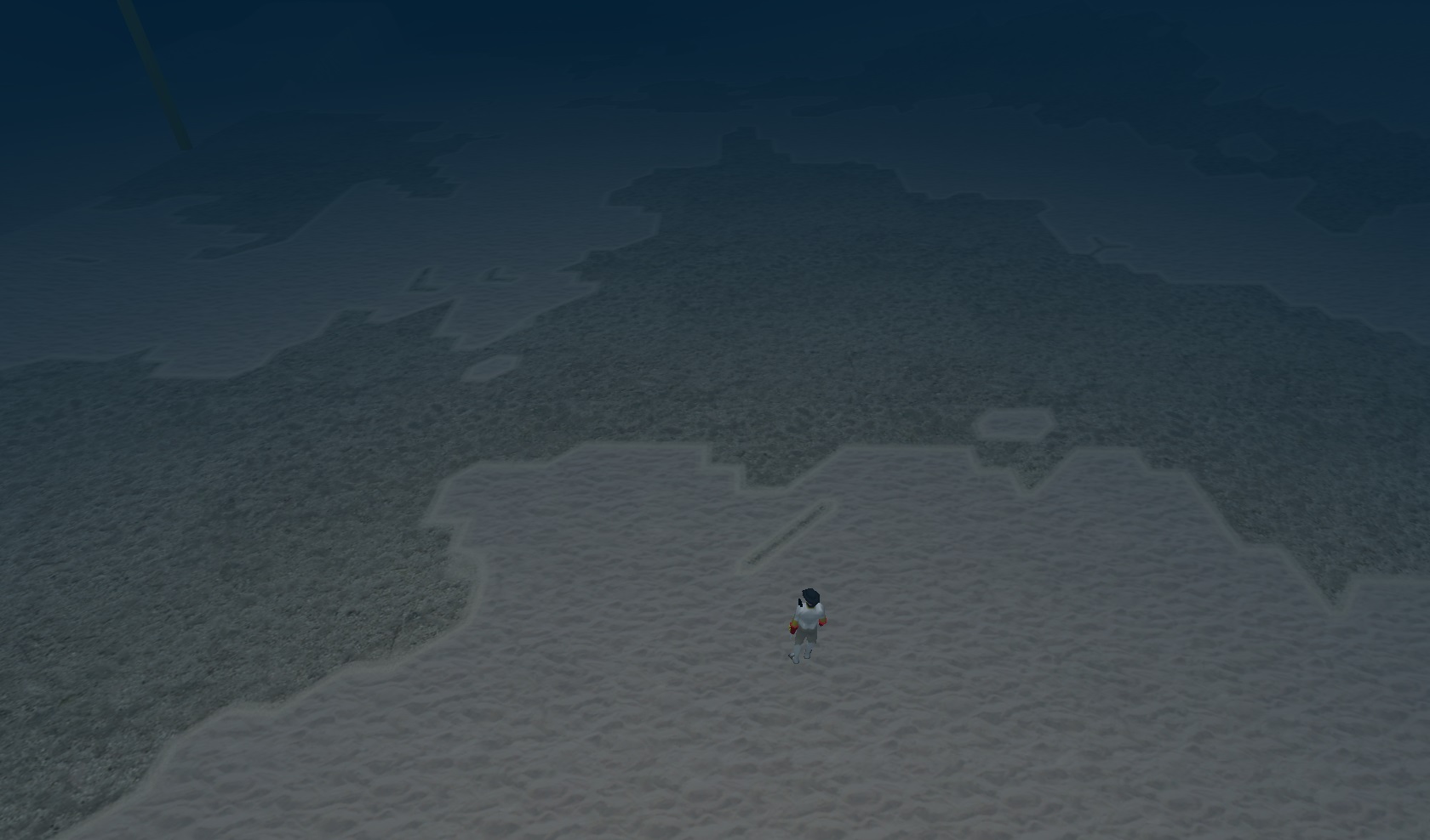
The Slash, another unique glyph of the sim.

http://maps.secondlife.com/secondlife/The%20Measure/220/94/1

Snapshot8002_001

The Slash with Double L’s in background.
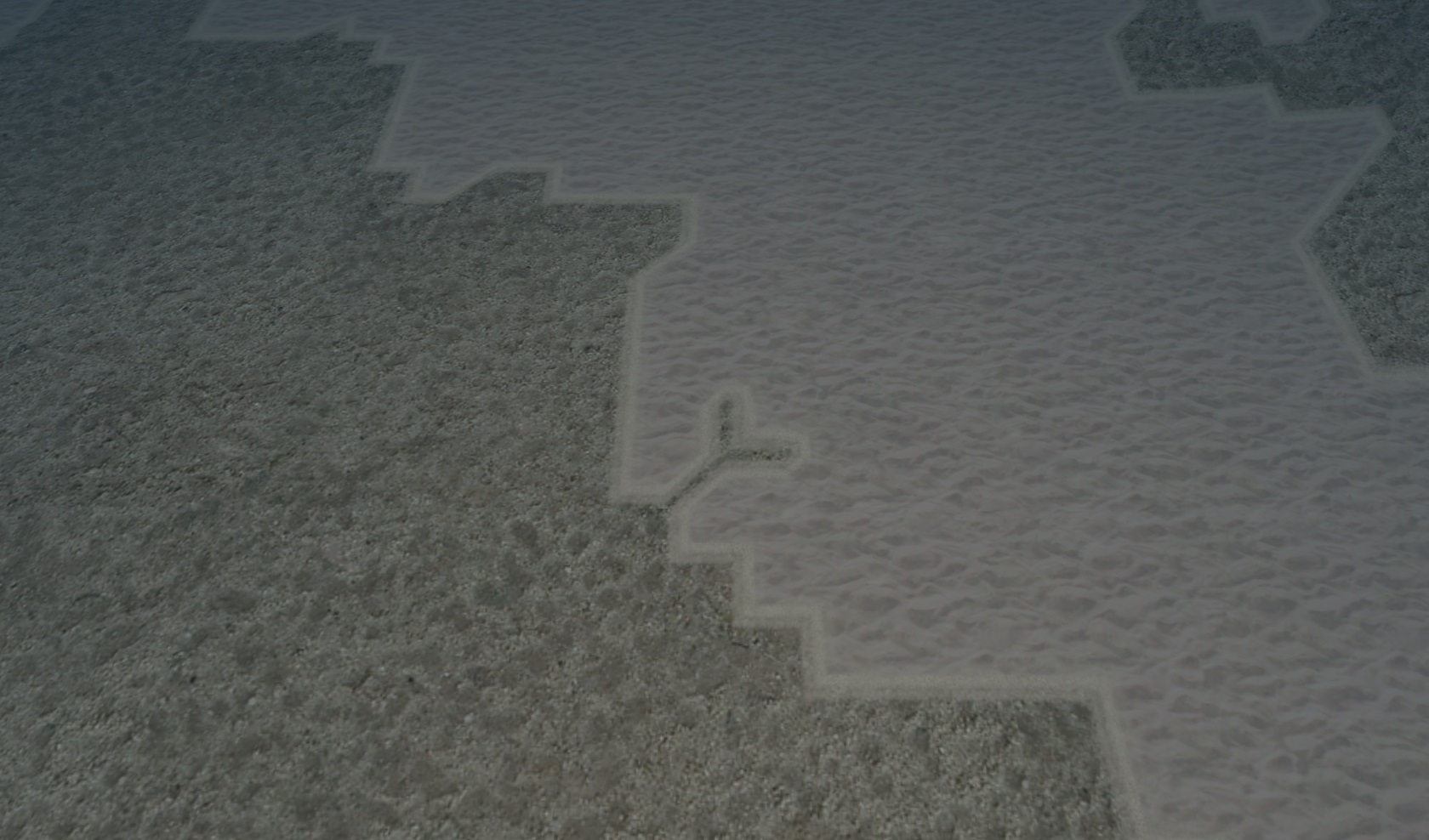
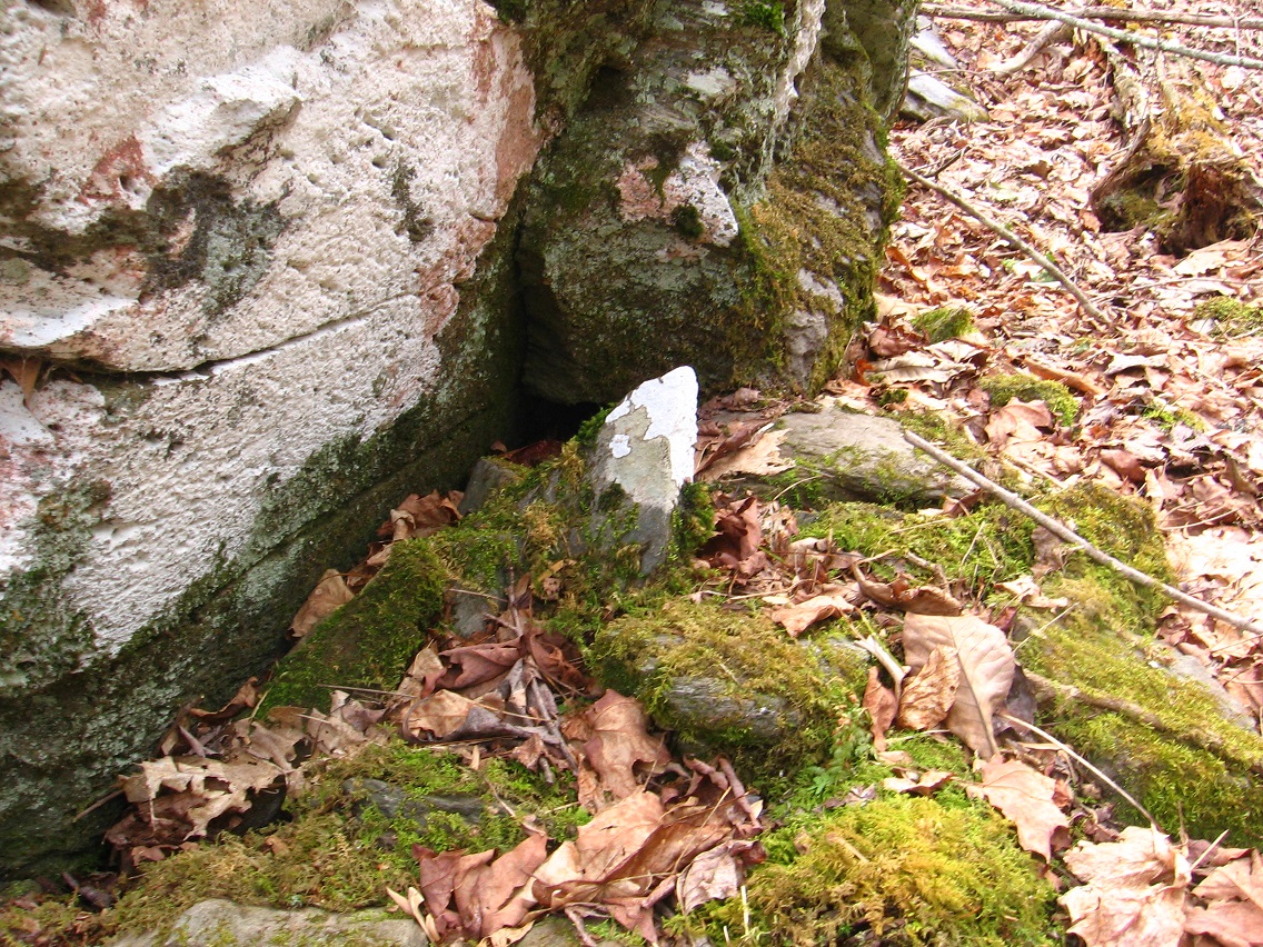
Snapshot8002_002

The Forked Tongue.

Snapshot8002_003

tongue_111

The Flag.

Snapshot8002_004

The Slash, The Forked Tongue, The Flag (Double Squares in the background).

Snapshot8002_005

Combined perhaps, they point to the Forked or Swallowtail Flag?

forked_flag

https://en.wikipedia.org/wiki/Swallowtail_%28flag%29

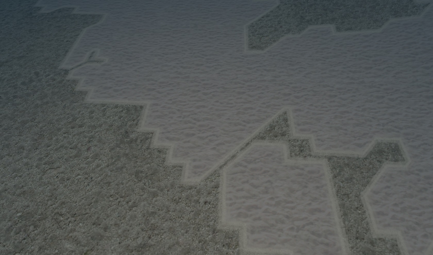
Detail of Double Squares. They’re not exact duplicates of each other. Lisa V. speculates they might stand for Second Life sims.

Snapshot8002_007

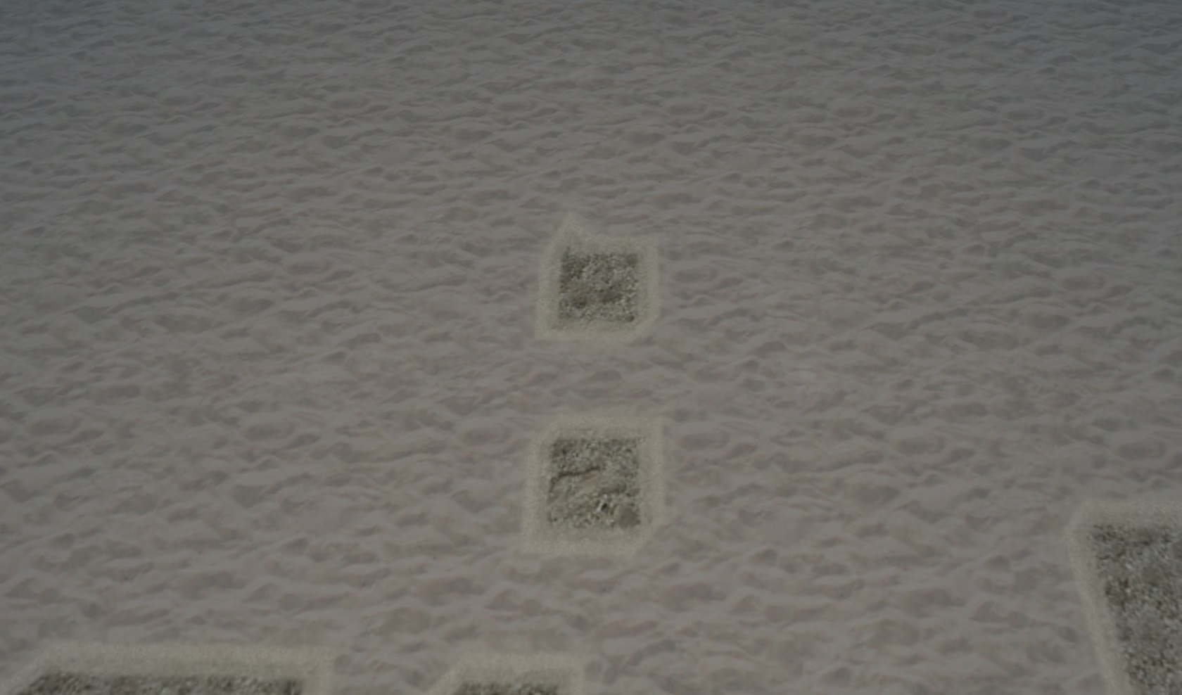
The Double Triangles (upper) &

The Double Dots (lower).

The Double Triangles and The Double Dots are about the same distance and angle apart from each other, as emphasized by their closeness. The Double Triangles appear to be half-squares each. The Double Dots represent no dimension atall. So you can assign descending numeric value as follows:

Double Square: 1 + 1 = 2
Double Triangles: 1/2 + 1/2 = 1
Double Dots (or Double Periods): 0 + 0 = 0.

Snapshot8002_008

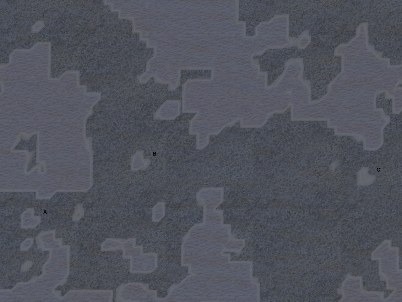
Relationship between Double Squares (top left corner) and Double Triangles/Double Dots (bottom left corner).

Snapshot8002_009

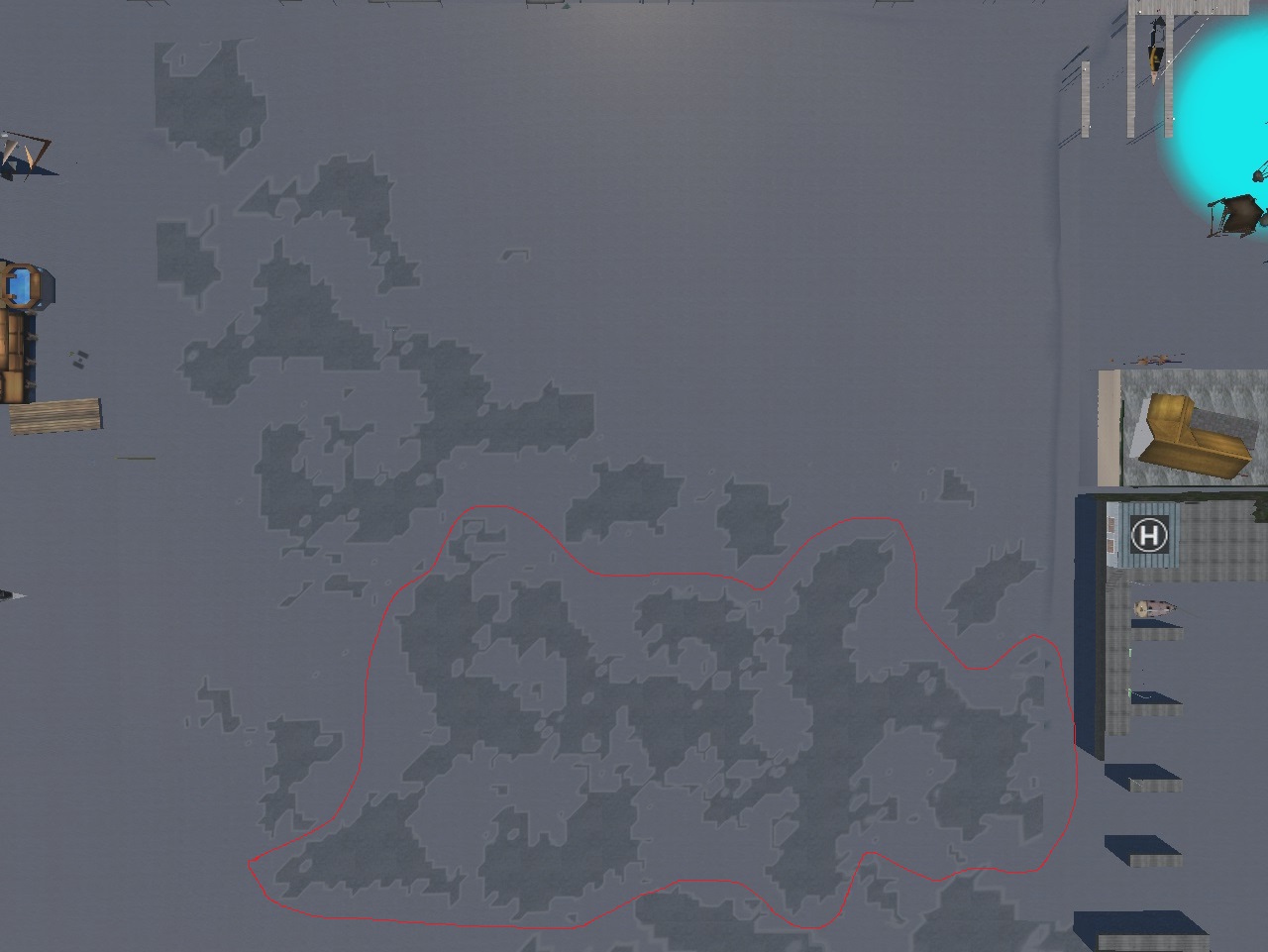
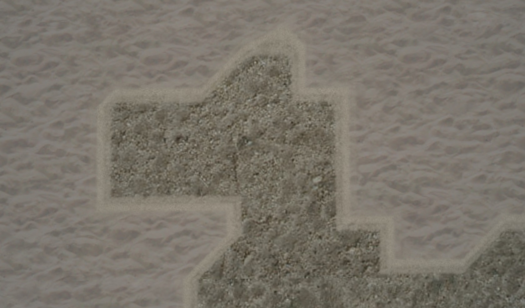
A) The Pony, B) The Nebulous Horsie, C) The Closed Coffin, D) The Open Coffin, E) The Double Squares.

Snapshot8006_002b

The “head” of The Nebulous Horsie even appears to have an eye (!). One up on the namesake actual nebula, then.

Snapshot8006_004

https://en.wikipedia.org/wiki/Horsehead_Nebula

Barnard_33

https://en.wikipedia.org/wiki/Nebulae_in_fiction#Horsehead_Nebula

“The Impossible Planet” and “The Satan Pit” (2006), episodes of the television series Doctor Who written by Matt Jones and directed by James Strong; “Planet of the Ood” (2008), episode written by Keith Temple and directed by Graeme Harper. In the first two episodes the Doctor is visiting a strange world orbiting a black hole, whose normally passive slave race, the Ood, have been psychically possessed by an evil entity imprisoned in the center of the planet: the Beast. In the end both Beast and maddened Ood fall into the singularity and perish. In the later episode, the Doctor visits the Ood homeworld, the Ood-Sphere (see graphic), and liberates the fundamentally decent race from a permanent state of servitude to the trafficking Ood Operations corporation. The Ood-Sphere is a barren, icy planet with vast mountains and caves, and with two moons and a greyish-pink Saturnlike planet in its heavens. The world lies in Mutter’s Spiral in the midst of the Horsehead Nebula, close to the Sense-Sphere. This planet is the home of the telepathic Sensorites, visited by the First Doctor in The Sensorites.[30]

Backing up a bit: The Face, next to the Double L’s.

Snapshot8006_005

The Face with possible “mouth” and “eye” highlighted. Toggle between the above photo to see the effect. The face stares with his small round eye and slanty mouth at the L’s, but the second larger L is possibly blocked by the first from his angle. More theories by Lisa V. She’s now convinced the L’s stand for Lemon and Lime (Labs), perhaps through several different ways even.

Snapshot8006_005c

The larger L shape seems unique in The Measure. However, the smaller L is more or less repeated in at least 2 other locations on the sim’s sea floor.

First, this is the floor scene below the Double Triangles/Double Dots. Another dot is found here (left of sitting Baker Bloch), along with two dashes (upper left & center right) which might effectively be called “1/2 L’s” in the grand scheme of things (as each of the Double Triangles represent 1/2 Squares).

Several other, similar dashes are found in The Measure’s Eastern Hemisphere, 2 to my current counting. One lies approx. 20 meters directly east of the Double L’s themselves. There are other dot glyphs as well in the east.

The other glyph I should point out here is The Four in front of Baker Bloch. We’ll see it again too.

Snapshot8006_007

Then continuing to move down, we encounter the second “L” of the eastern hemisphere, about the same size as the smaller of the two making up the Double L’s above it…

Snapshot8006_009

… and stared at from the right by what could be taken as another prominent nosed face, larger in scale this time. The eye or eyes of the face are not as distinguished. He (or she) appears to be wearing a cap so I’ll just call the formation The Cap Dude (or Capped Dude). But actually if you look closely you can see not one but two of the same human-like eyes that appear on the Nebulous Horsie’s head. Can you make them out with your own two eyes?

Snapshot8006_010

I’ll highlight, then (enlarge to truly *see*).

Snapshot8006_010b

The right one of the two can then be said to be worn on the wrist of Smoking Bear, the backside of Cap Dude and forming a duplicitous face. Pretty obvious name association, I feel. Looks quite like what it says it is.

Relationship to famed firefighter Smokey the Bear? An evil twin?

Smokey3

clockwsfvaefvork_orange_4x3mtd_na-1
Wrist eye of evil Alex from Clockwork Orange.

Walking duplex faced Smoking Bear/Cap Dude, forming a whole glyph continent unto itself. Appears to be strolling away from the “L” while taking a backwards glance at the same time.

6/24/15 update: Hucka D. has stated a desire to call this formation “Clubfoot”, because of the shape of its feet. Lisa V. and Wappo Jack have agreed to the term.

Snapshot8006_011

Where’s it heading?

2 Comments

Filed under **VIRTUAL SL, Nautilus, Yd Island^

Ashville Revisited

It was a cool and overcast day yesterday when I decided to head to Ashville to check out more recent Google Maps based oddities. Nothing earthshaking found, but I’m starting to fill in a larger picture. I continue to believe a lot of it, a lot of what the energy is channeled through, has to do with that stream I call Linden Creek running between Cherry and Lime streets.

Below we have a conjunction of Linden Creek (top) with Read Creek (left) at the southern edge of Earl Weaver Park. As I’ve stated before, the 2 flows are about equal here, perhaps opening a debate over which creek name should have yielded to which. Read Creek won out in this reality. In another it may have been a different outcome.

IMG_0024smaller

Bamboo and fence bordering Cherry Ave. not far from Linden’s mouth.

IMG_0029smaller

A perhaps peculiar design has been painted on the fence. Is is a map of the stream existing not far behind it. Do the joined red spots to the left indicate a mouth for the stream creature? Do the 2 dots indicate 2 different choices that the name of the combined stream could take, even? Things to be asking.

IMG_0036smaller

Linden Creek from Banana Street, just as it passes the house formerly (presently?) inhabited by Ingleboort and Flaarph’s friends George and Harriet. Another strange thing about this house I found out yesterday: a hiding fence has been erected all along its north and back side, and a cement patio has been built right next to the creek to the north. Is this where G and H commune with the creek and learn more of its secrets? Is this where I and F first appeared to them? Did I and F at some point tell them they should pose for Google Earth Street View when the camera topped car drove by at a specific time in May 2012? “Sit on the porch just like this,” they might have said, perhaps telepathically. “We’ll sit in the yard just below you.” “It should look like we are 2 sets of twins, one mirroring the other,” they might have additionally thought only to themselves. And so it came to pass.

IMG_0038smaller

Colors of TILE on Lime Street not far from George and Harriet’s once more. Perhaps the site of a TILE Temple in the past, Linden Creek style. A past marker as it were.

IMG_0043smaller

Linden Creek looking in the other direction away from G and H’s on Banana Street, or toward its juncture with Read Creek only about 30 yards distant from here.

IMG_0051smaller

More interesting bamboo enclosed house on Cherry Avenue. I believe there’s a good chance the inhabitants know the secret of Linden Creek as well and the power it holds.

IMG_0056smaller

At least 5 of the 7 dwarves from Snow White pose beside rocks in front of this house. I’m not sure what they have to do with the Linden Creek avatars like I and F, but perhaps something (!). And there’s another Japanese torii fronting the place; could be a secret totem indicating knowledge of the creek’s power for others in the know to see and understand. Maybe they even have meet-ups(?).

And perhaps that colorful flag bunting is another secret indicator of wisdom.

IMG_0057smaller

Further upstream, we catch a good glimpse of Linden Creek through a fence on [fill in the blank] street. I was quite surprised how large the creek is here. No tiny affair we’re dealing with.

IMG_0059smaller

Cherry Avenue’s southern set of traffic isles, once more. Said to, “look like something you’d find in a pinball machine” by one critic.

IMG_0066smaller

Bamboo bordering Linden Creek or marking its flow appears in ample amounts behind Cherry Avenue and Lime Street houses.

IMG_0070smaller

Still on Cherry Avenue: interesting house mural. Again I must ask: does it secretly tell the story of the creek’s native inhabitants? I’ll have to get a better picture of the mural soon.

IMG_0075smaller

Bamboo backed fence again, looking toward the Norwegian Wood neighborhood. Although I visited the latter as well this day, I didn’t snap any pictures. Again: rectification soon enough! Ashville is not that far away.

IMG_0079smaller

1 Comment

Filed under Middletown^

“Hucka D…

… I think the Falmouth collages can be basically divided into 4 parts. There’s the Steptoe Butte animation part that takes up the basement of the gallery — that’s 6 collages if separated from the overall animation — then there’s the collages leading up to Falmouth 25, the first Stonethwaite related one. Then we have Falmouth 25 – Falmouth 43, where Stonethwaite dominates, and I including the surrounding countryside like Greenup Gill and Dock Tarn with this, and then to top it off we have Falmouth 44 through Falmouth 61 now, dealing mainly with Whitehead Crossing. To me, the latter is a brand new type of collage, dealing with local, to me, base images and interacting with the blog mythology more directly. Whitehead Crossing has become a central crossing. Associable, for example, to the crossroads of Clarksville, Mississippi in Coahoma County. The infamous, some say, 61 x 49 crossroads where bluesman Robert Johnson sold his soul to the Devil. Fal Mouth Moon gallery housing the entire set of Falmouth collages on its 7 floors, if we *count* the basement, has been psychically aligned, perhaps, with Williams’ Moon Lake Hotel. Remember when the rocket launcher was located within this building that took VWX Town residents and visitors directly to The Moon?

Snapshot8001_002d

http://articles.philly.com/1993-03-14/news/25952390_1_mississippi-dotson-rader-restaurant

—–

Hucka D.:

Who is Mr. Dundee?

bb:

Owner of the Fal Mouth Moon?

Hucka D.:

Is it his castle?

bb:

How does he change collages into paintings?

Hucka D.:

Is that the selling of the soul part?

Leave a comment

Filed under **VIRTUAL SL

Bean

Tom Bean ghost sightings (multiple):

http://www.ghostsofamerica.com/7/Texas_Tom_Bean_ghost_sightings.html

Tom Bean turns White Mound into ghost town.

https://www.tshaonline.org/handbook/online/articles/hrw20

When the St. Louis Southwestern Railway’s right-of-way missed White Mound by three quarters of a mile in 1887, the community declined. Tom Bean was built on the railroad and attracted 75 percent of the population, many businesses, and all of the churches from White Mound. White Mound quickly became a ghost town.

Nearby White Rock (also of the White Mound – White Rock – Whitewright triangle) doesn’t even seem to exist in a manner, not listed in the otherwise extremely thorough Texas Almanac atall. It has this in common with White Rock, Robertson County. And another White Rock that’s listed in the GNIS database as being in Fannin County immediately east of Grayson County is actually just inside Lamar County to *its* immediate east. In this blog post, I compare this to a similarly GNIS displaced Herbert population place from Alabama.

https://bakerbloch.wordpress.com/2013/04/10/more-whitehead-related-maps/

Void, null.

whiterocktexas01b
White Rock, Lamar County, Texas (near Petty) on Ghost Creek.

I’m going to quote something directly from this post now:

https://bakerbloch.wordpress.com/2013/04/10/more-whitehead-related-maps/

There is no article in the Texas Alamac for White Rock, Robertson County, unlike for nearby Headsville and Bald Prarie. However, this comprehensive almanac has a listing for a White Rock in Fannin County, which happens to be near a Petty according to the below stats, as White Rock in Robertson County is very near a Petteway (Pett—y + ewa in effect).

whiterocksintexas
White Rock population places in Texas. Notice that White Rock, Robertson County is on a Petteway topo map and White Rock, Fannin County is on a Petty map. This clued me in to their possible association.

4/11/13:

But getting back to the White Rocks of Texas, I noticed that the above mentioned White Rock near Petty is actually not in Fannin County but just over the east line in neighboring Lamar, about a mile and a 1/2 from Fannin County. So the GNIS database got this wrong, harkening back to the Herbert error discussed several months ago on this blog. But then in looking at that listing again, it’s interesting to note that a White Rock lies on a Whitewright topo map, and this particular White Rock is just beyond the *west* Fannin County line, in Grayson County in this case, about 4-5 miles in. Besides Whitewright we also have a White Mound near this White Rock, making a type of White Rock – Whitewright – White Mound triangle, with two more interestingly named population places within this established triangle, or Tom Bean and Kentucky Town.

This is where I originally uncovered the White Mound – White Rock – Whitewright triangle, then.

shinig5901ab

Continuing…

Another perhaps odd thing here: White Rock in Lamar County, unlike the great majority of population places on the topo map involved, is marked with a black dot. So is White Rock in Robertson County. If we make White Rock, Lamar County the retrograde inversion of White Rock, Robertson County merging these two black dots, we find that each lies about 2 1/2 miles from their Petty (Lamar County) and Petteway (Robertson County) and in the same direction.

whiterocktexas02b

whiterocktexas01b

whiterocktexas01c
Retrograde Inversion of White Rock-Petty, Lamar County. You can kind of make an animation by toggling this with this.

Call me crazy, but I think these black dots standing in for Texan White Rocks have something to do with the meaningful placement of *black dot* like specks in various Shining shots, most prominently, for now, in the scene involving the Danny-psychiatrist interaction — another interview of sorts, per the title of the movie section (“The Interview”).

But which ones?

Read about what I called the film flaw occurring right where Wendy walks over the spot where Jack later axes Scatman Cruthers’ Hallorann character. I’ll quote a key sentence of mine from the “strange? 03” blog post on this:

I think there’s a strong possibility that mad genius Kubrick purposely constructed this as one of those “burnt toast” spirits.

Spirits… ghosts. White Rock, Robertson County next to Ghost Creek, a White Rock that doesn’t seem to exist in a way. Another White Rock (Grayson County) made a ghost town by nearby Tom Bean, named after a denizen/alien or pseudo-extraterrestrial. Tom Bean itself as haunted by ghosts. Another White Rock in Fannin County a ghosted or basically non-existent population place, and forming a retrograde inversion through PETT(EWA)Y with the similar White Rock spirit ghost thingie in Robertson.

Burnett County, Texas pronounced like “burn it”, as in burnt toast. 125 = 1.25 = 1/8.

It has to do with Texas.

Leave a comment

Filed under MAPS, Qbrick, Stanley, Shining, The, Texas

strange? 04

(continued from)

This is the first frame of Chapter 4.

A yellow rubber duck is seen clearly behind the shower curtain Danny stands in front of at the sink. The curtain is drawn slightly away from the side wall at the bottom to emphasize the object, seemingly. Note also that Dopey the Dwarf is the last sticker character seen on the door as we track into the bathroom during the shot. This will become important in a moment.

shining1033a

We move to Chapter 5 now and Shot 61 again covered in “strange? 01, 02 and 03”, with screen captures of additional oddities or curiosities. The first is a spark illuminating the spot where the duck *was* in Chapter 4, the last time we saw this bathroom. The shower curtain hangs slightly *toward* the side wall at its bottom this time in contrast to before. We might presume the duck is obscured then, if it wasn’t clearly present in the *window* of Danny’s room. Did Danny move the duck? Or is this more magical Shining displacement, with no possible, terrestrial explanation?

Another reason this shower glint might be important is that it occurs in the first few frames of the shot, near its very beginning (12:10).

shining1210a

At 12:25, we have an oval patch appearing just to the left of the bear pillow on the bed. Notice that shapes seem to be formed in the pillow, perhaps most prominently what looks like a 4 toed foot across the top side, to the left of the 2 ears in the below capture. I’m recalling that Halloran would have his feet symmetrically propped up on pillows later on in the movie, when he’s watching TV in Florida and just before a shining moment where he appears to be in psychic contact with Danny.

shining1225a

Two more black dots form at 12:26 and 12:27 between Wendy and the bathroom, at about the same height above the top of the picture with the 3 animals. During this time, the doctor is approaching Danny to begin asking questions about the fainting incident he experienced earlier that day.

shining1226a

shining1227a

Then in what appears to be the last frame of shot 61, we have the *duck* highlighted by a small, dark discoloration. Recall that the place the duck *had* been, in the shower, is spotlighted at the very beginning of the same shot with a white sparkle thingie. Quite a bit of framing symmetry here, then, and another Alpha-Omega relationship. Planned? Dunno.

shining1240a

But there’s more (!) In the very next frame past shot 61, the first of 62, we have a mysterious white streak appearing above Danny’s head and the bear pillow, reminding us of the earlier white streak coming above the doctor’s head in shot 61. The white light only appears in this one frame, and doesn’t reappear in any other shot of Danny on the bear pillow in this movie chapter as far as I can tell.

shining1240b

In shot 63, we’re back looking at the dr. and Wendy. A brown spot occurs above the doctor’s head at 12:49…

shining1249b

… a redder spot near the center of Danny’s window at 12:53…

shining1253a

… and then, in shot 65, *another* vertical white streak above the psychiatrist at 13:07. Quite remarkable. It comes precisely as she’s saying the word “just” of the sentence, “Now Danny, can you remember what you were doing, *just* before you were brushing your teeth?” “Just” is the highest pitched word of her question.

shining1307a

When Wendy closes her eyes at 13:25, we again get the impression that her right eye is somehow larger than the left one, a popeye effect if I may be allowed again.

shining1325a

Wendy sneaks a quick glance at her doppleganger doll Goofy before leaving the room. I would assume Kubrick instructed her to do so. Something odd about her arms movements throughout these shots as well.

shining1406a

As other Shining researchers have pointed out, Dopey is gone from the door now as Wendy shuts it to end Chapter 5 of the movie. Compare with the first photo of this blog post. This disappearing act is mentioned in the “Room 237” documentary as well.

shining1420a

(continued in)

6 Comments

Filed under Qbrick, Stanley, Shining, The

Whitehead X-ing, Late Spring 01

Unfortunately I deleted the first slice of my new Whitehead Crossing related photos last night when preparing this post. But I’ll probably take pics of all the deleted scenes soon enough. So let’s go with what we’ve got this morning. The first picture records part of the process of creating a “thinking circle”, or a place I would walk around in a big circle and just think out loud. I’ve made quite a number of these down through the years in various spots; *thinking* most recently in… well, actually I hadn’t made one of these in a number of years, and have forgotten where the last appearance would be. I use to have a thinking rock just outside of Boulder, within the Herman Park borders. I’d basically pace a small loop upon the rock while talking to myself about various, usually synchronicity related subjects. The stone lays below one of the park’s many carriage trails, jutting from the top side of a deep valley to Boulder’s west. But I haven’t been over there for many years. In contemplating the matter further, I *have* created quite a number of these loops, but usually they are of a very transient nature, and used only once or twice. But there are exceptions. Will the Whitehead Crossing contemplation circle (new name) be more long term in nature? Well, first I have to nail down the path of the loop, which I didn’t quite do this fine, late May day. The gray feather at the base of the tree pictured below might be an indicator on where the loop should be placed — I was looking for signs like this when continuing to pick out the path in test runs. If the loop is completed it seems to be of a ovoid shape, about 40 yards long and 25 or so yards wide, and centered by a large tulip tree which forks into two parts near its base.

More on that story as it develops during future visits.

IMG_0044smaller

A shot of the huge Knobby Log crossing Whitehead Brook near the center of the complex.

IMG_0046smaller

Bank of Whitehead Brook, opposite a small beach just upstream from Knobby Log or Big Log — haven’t quite settled on a name yet.

IMG_0049smaller

I didn’t take any pictures this day of the heart of the 4 Sticks area, which may also represent the beating heart of Whitehead Crossing as a whole. However, I certainly stopped in, as I always do when visiting WC, and took note of late spring developments. Yes, it truly seems to be an epicenter, and if I was — no, *when* I camp in the area — this is as good a spot as any to set up a tent. As with the creation of the Contemplation Loop, I’m very cognizant of the wildlife already present, with my aim to disturb and especially kill or eradicate as few of the native plants as possible. Contemplation Loop is being set up in the only logical place it could be within Whitehead X-ing, in a more open area with much fewer ground plants than other spots. The center of 4 Sticks also fits this bill, but within a much more limited range, probably too limited for the creation of a contemplation loop there. But I’ll talk more of 4 Sticks later on as well… this is probably where I’ll set the model train track down also (a la a Lion’s Roar), if it comes to that. 🙂

But to the below picture: Another thing I decided to work on today was identifying the main path through the Whitehead Crossing area, beginning at the Maine Trail (official hiking trail just north of Whitehead Crossing) and running all the way through the meat of the area — past the Contemplation Loop and Grey Seal and Cliffs of Dundee and 4 Sticks, etc. — to Green Stream, a distance of several football fields, perhaps. Just past 4 Sticks (heading to Green Stream) the trail seems to divide into 2, with the left fork quickly coming to a dead end, however. Instead, the less obvious, right fork is the way to reach the fabled stream, soon crossing the below log with a peculiar fungus attached to it now, looking perhaps a bit too much like a skull (?) Or looking at the picture a little better now, perhaps just an amorphous face with still identifiable eyes, nose, and mouth regions. The black and sparkly dots on the “face” may be insects of some kind — didn’t check when I took the picture. The same log had a large yellow fungus on its top a way’s up the branch, which I also took a picture of but didn’t turn out as well as this one.

IMG_0054smaller

As I’ve stated before, the Whitehead X-ing area is large and varied, with many prominent locations yet to be named. This would include the spot below, perched on the edge of a rather deep yet dry valley filled with rhododendrons, and marking probably an eastern edge of WC (or “WX”) as a whole. This would be between 4 Sticks and Green Stream on the main path through the area.

IMG_0058smaller

Reaching the flat plain surrounding Green Stream at the upper end of the Korean Channel, I decided to take a picture of Rock’s Rocket, first discussed in this Baker Blink Blog post from last spring. As you can see, Gene Fade has yet to find money in the “Fade to Moss” motion picture budget to paint the famed wreck, per Rock’s suggestion. Or perhaps Gene Fade thinks the rusted look will work better in the movie; can’t wait to see it, whatever. 😎

IMG_0060smaller

Another picture of those large, dead hemlocks positioned on opposite banks of Green Stream, marking a type of gateway.

IMG_0063smaller

I’ve decided to call the passage of Green Stream through this gateway the Straightway, because, as you can tell from the below photo, the creek runs basically straight in this area, or from the northern tip of Great Island, which I’ll get to in a moment, and the very upper limit of the Korean Channel at another rocky island which I’ll also talk about below.

IMG_0065smaller

Mr. Blue Sky was very much in evidence during this day’s visit to the Korean Channel.

IMG_0067smaller

(continued in Whitehead X-ing, Late Spring 02)

3 Comments

Filed under Frank Park, Whitehead Crossing

More Whitehead related maps 01

Conjunction of Headsville with Bald Prarie in Robertson County, Texas indicates “bald head”. Nearby is White Creek and Heads Creek, just over line to north in Limestone County, but name conj. on map originally made me think this was a White Heads Creek. White Rock is below Headsville.

robertsontexas

https://bakerbloch.wordpress.com/2013/04/05/whitehead-x-ing-02/

I believe it relates to the first 2 rocks of the above, recent blog post here. The first picture is of a rock with a bald spot upon it. I think I’ll call this Head Rock now. Headville? The next picture is of a white rock, which I’ll call White Rock, which is near Headsville (and Bald Prarie) in Robertson County, Texas. These rocks of course come from the Whitehead Crossing region.

There is no article in the Texas Alamac for White Rock, Robertson County, unlike for nearby Headsville and Bald Prarie. However, this comprehensive almanac has a listing for a White Rock in Fannin County, which happens to be near a Petty according to the below stats, as White Rock in Robertson County is very near a Petteway (Pett—y + ewa in effect).

whiterocksintexas
White Rock population places in Texas. Notice that White Rock, Robertson County is on a Petteway topo map and White Rock, Fannin County is on a Petty map. This clued me in to their possible association.

Originally *here*, in this Maine location, I thought Whites Head (reverse of “White Heads”, Texas just discussed) was actually *one* word, Whiteshead, only corrected in my mind when I just checked in the GNIS database. There is a causeway of sorts, it seems, between this Whites Head, then, and Nautilus Island, which has come to symbolize Second Life’s Nautilus Island and probably Second Life itself.

monhegan04

4/11/13:

But getting back to the White Rocks of Texas, I noticed that the above mentioned White Rock near Petty is actually not in Fannin County but just over the east line in neighboring Lamar, about a mile and a 1/2 from Fannin County. So the GNIS database got this wrong, harkening back to the Herbert error discussed several months ago on this blog. But then in looking at that listing again, it’s interesting to note that a White Rock lies on a Whitewright topo map, and this particular White Rock is just beyond the *west* Fannin County line, in Grayson County in this case, about 4-5 miles in. Besides Whitewright we also have a White Mound near this White Rock, making a type of White Rock – Whitewright – White Mound triangle, with two more interestingly named population places within this established triangle, or Tom Bean and Kentucky Town.

Another perhaps odd thing here: White Rock in Lamar County, unlike the great majority of population places on the topo map involved, is marked with a black dot. So is White Rock in Robertson County. If we make White Rock, Lamar County the retrograde inversion of White Rock, Robertson County merging these two black dots, we find that each lies about 2 1/2 miles from their Petty (Lamar County) and Petteway (Robertson County) and in the same direction.

whiterocktexas02b

whiterocktexas01b

whiterocktexas01c
Retrograde Inversion of White Rock-Petty, Lamar County. You can kind of make an animation by toggling this with this.

There is one other Petty in Texas, in Lynn County on a topo map named New Home. This is also the only other Petty in the US as a whole according to the GNIS database.

petty01

From this map of part of Lynn County (lower right corner), we can see that Petty is (or was) near a place called Dune. Grassland exists to the east of Dune in this county still.

HockleyCountyTexas1940

The planet Dune became the New Home of Paul Atreides in Frank Herbert’s famous novel Dune, already discussed in connection with another map anomaly involving the name Hebert itself. Should White Rock-Petty be fitted into this overall mythology, still developing then? Or is this, ahem, a petty matter to contemplate.

175px-Lynn_County,_TX,_sign_IMG_1492

White Rock in Whitehead Crossing *points*. What is it indicating, if anything?

604ec08fdc1a4f153cf39bba8243a7e6
Ahem.

6 Comments

Filed under Frank Park, MAPS, Texas, Whitehead Crossing